
After a few isolated thunderstorms graced our area on Wednesday, yet another surface high will settle over our area tonight to provide clear conditions, calm wind, and widespread late-season frost. The surface high will provide ample sunshine for Friday.
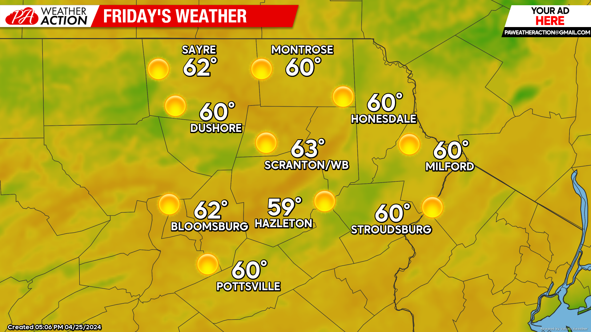
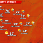
FRIDAY
After a frosty start to the day, ample sunshine and light wind will allow temperatures to recover to a reasonably mild day.
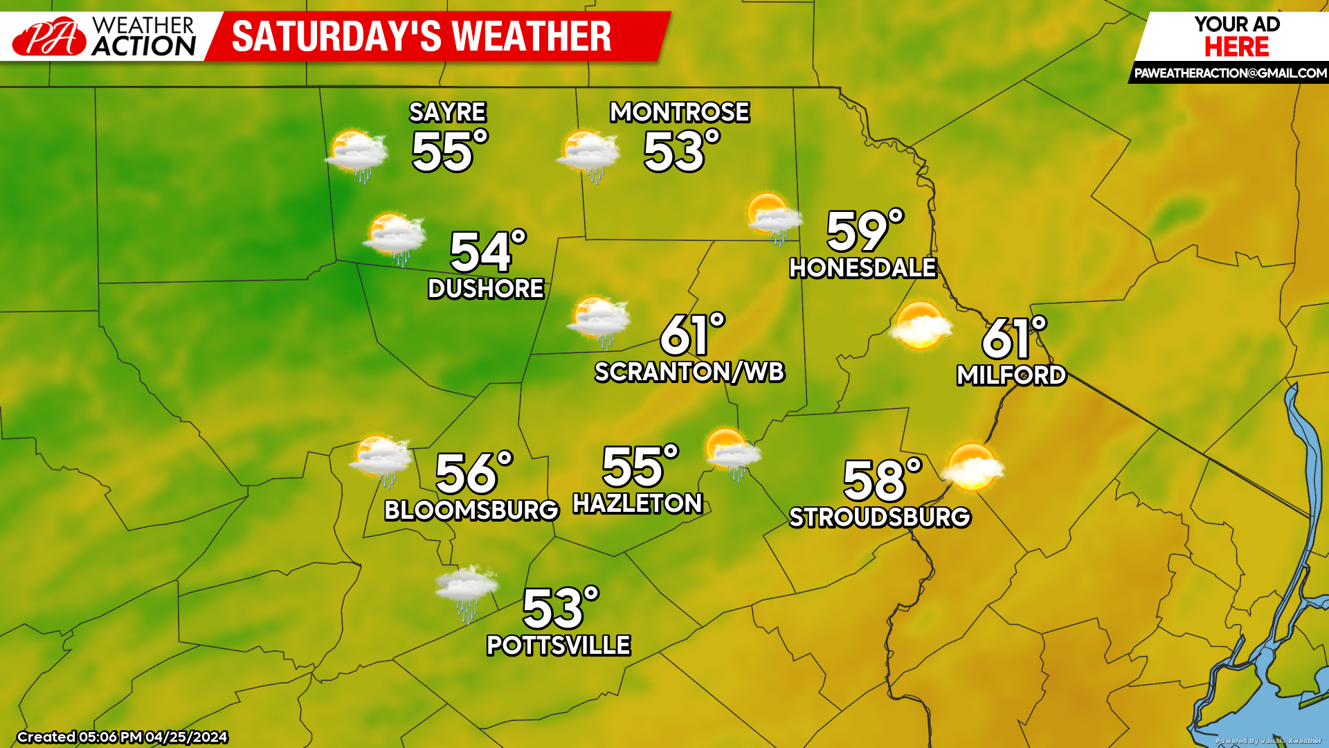
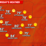
SATURDAY
An area of low pressure moving northward through the Great Lakes will push a warm front through our area late Saturday / Saturday night. The day will feature increasing clouds, with an area of light rain pushing eastward through our area during the afternoon and evening.
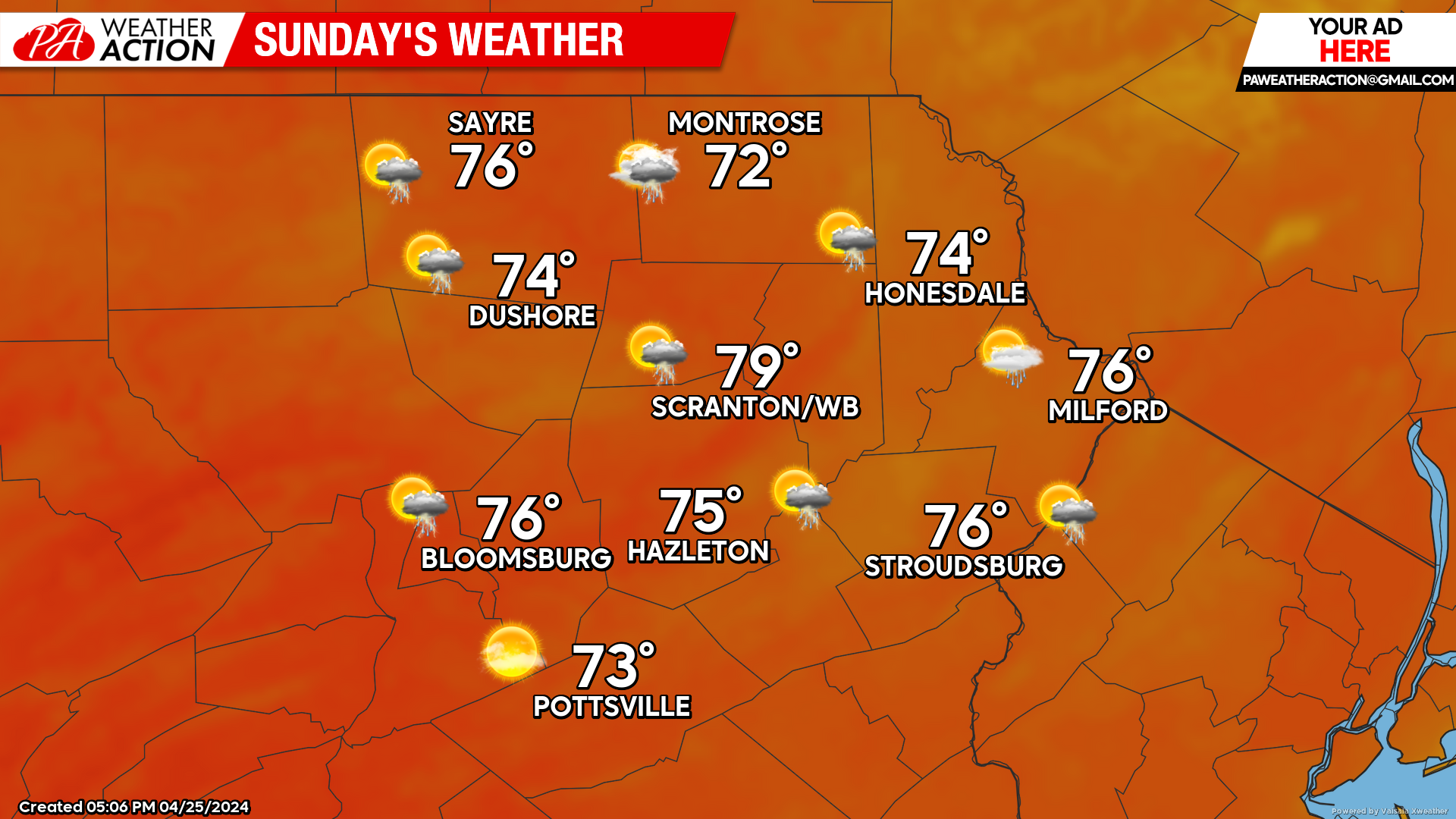
SUNDAY
The warm front will be north of our area, allowing warmer and even slightly humid air to overrun our area. There could be an isolated shower or thunderstorm.
BEYOND SUNDAY (Mon-Fri April 29 – May 3)
Most of next week will be dominated by a sprawling surface high over the Southeastern United States, which will keep our area quite warm and even somewhat humid through at least Wednesday, when a cold front will attempt to deliver cooler weather to finish the week. The warmest day will likely be Monday, when the lower valley areas could soar above 80! There will also be opportunity for some thunderstorms Monday-Wednesday, with the best opportunity for thunderstorms on Tuesday.
You must be logged in to post a comment.