
With an early summer feel out there today, it’s only natural we’re talking about thunderstorms. With the peak of severe storm season still about two months away, this is only the beginning. And an active start to the season it has been!
After storms push through Western PA this evening, the threat will push east Saturday as a low pressure sits to our west. While a severe threat exists Saturday in areas, there will also be widespread rainfall over the next few days.
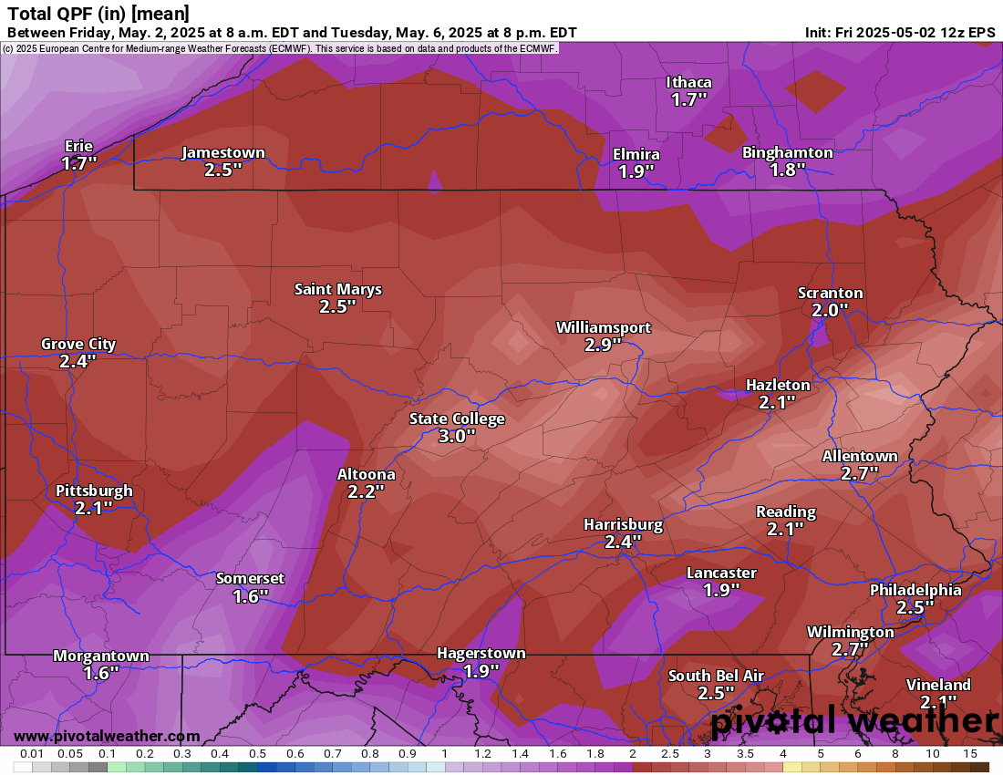
Here is the European model showing total rainfall through Tuesday.
THUNDERSTORM TIMING
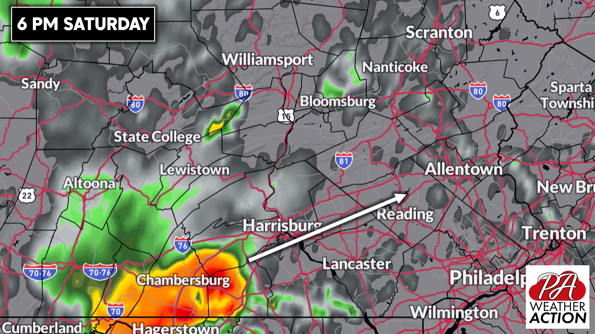
Strong thunderstorms will develop in WV’s eastern panhandle Saturday afternoon and push northeast. By dinner time, they will be in South Central PA. Below is Hi-Res NAM Future Radar for 6:00 PM Saturday.
As we head into the mid-evening, storms will push into the Lower Susquehanna Valley. Damaging winds and hail will be possible in stronger parts of these cells.
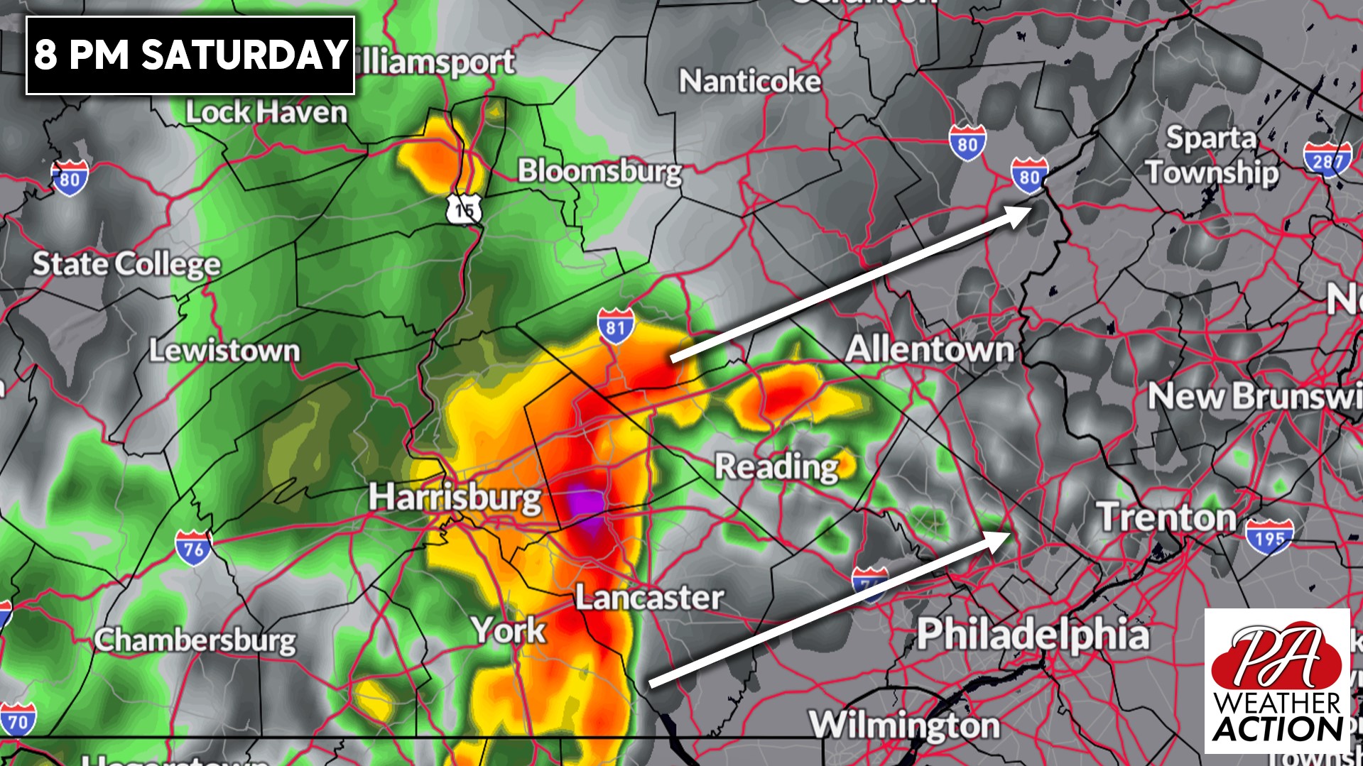
And by the late evening, we expect strong to severe thunderstorms to push across the Lehigh Valley and far North Philadelphia suburbs.
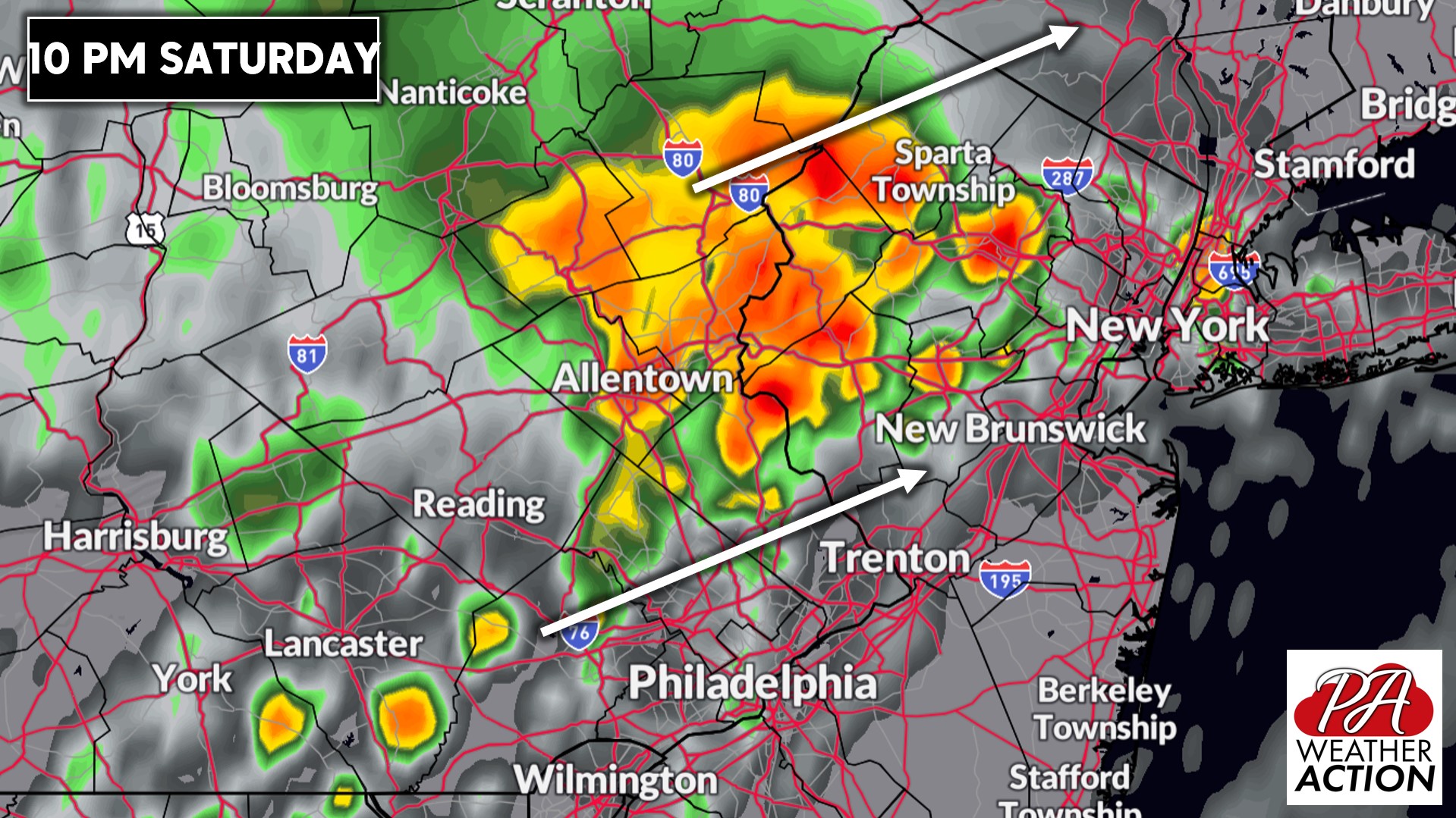
Philadelphia itself will likely see scattered thunderstorms instead of this more predictable line. Here is future radar for 10:00 PM Saturday.
FIRST CALL FORECAST FOR SATURDAY’S SEVERE THUNDERSTORMS
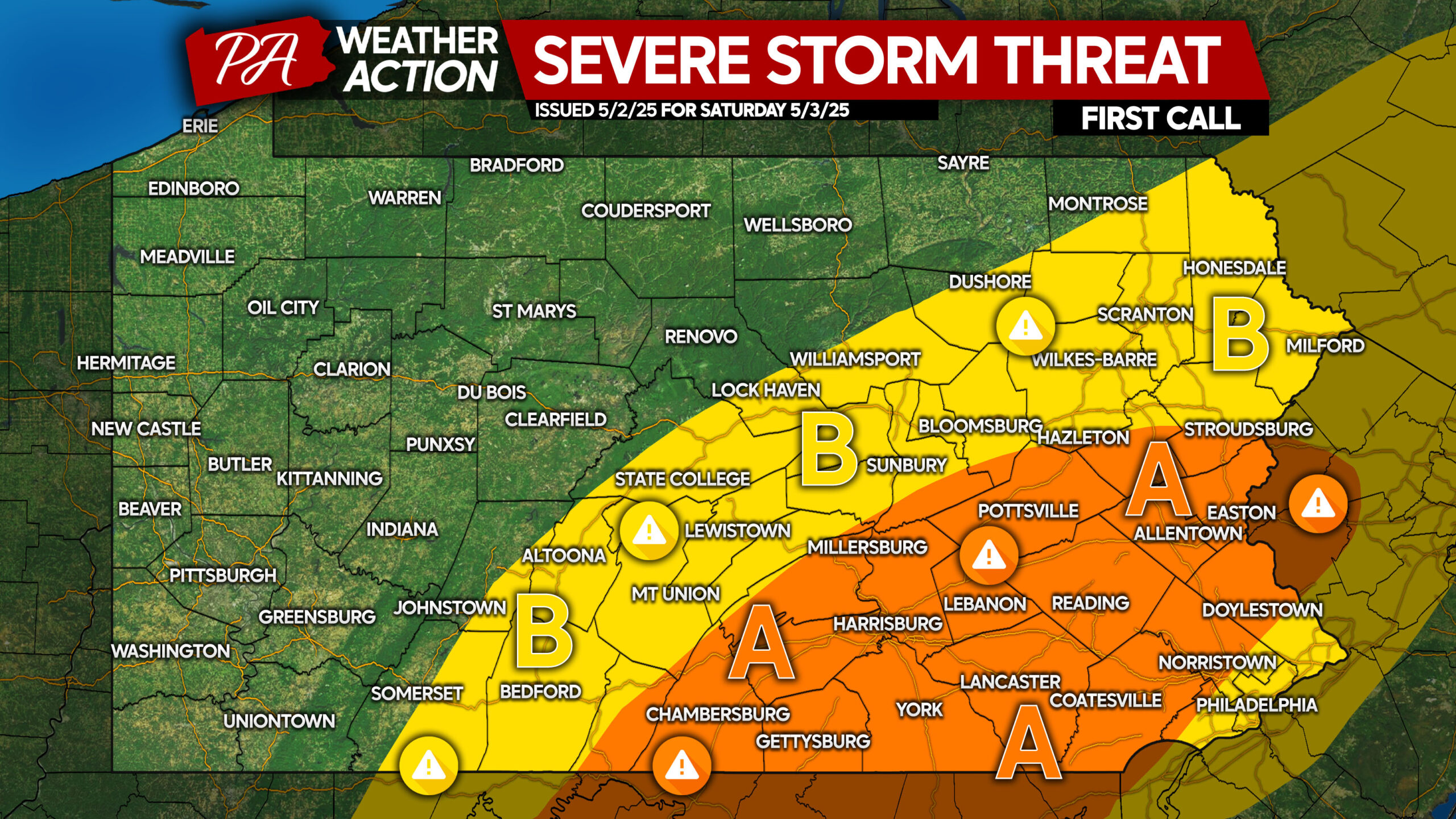
Area A: Scattered strong to severe thunderstorms are expected. Damaging winds of 50-70 MPH and large hail will be possible within severe cells.
Area B: Isolated strong to severe thunderstorms are possible. Gusty winds of 30-50 MPH and small hail are the main risks in strongest storms.
Be sure to share this forecast with friends and family in affected areas. Have a great weekend!
You must be logged in to post a comment.