
A significant winter storm is taking aim at Pennsylvania Wednesday, delivering with it a period of heavy snow, sleet, freezing rain as well as plain rain as the system is wrapping up. Winter Storm Watches have been issued by the National Weather Service for the Laurel Highlands, South-Central and Southeastern PA, where the impacts between the snow and ice look to be the greatest.
Timing remains fairly similar to what we posted yesterday. The snow will move in from the southwest Wednesday morning, impacting southwest counties by 5 – 7:00 AM Wednesday morning. We expect all areas will start off as a period of moderate to heavy snow. Snowfall rates could be as high as 1 to 2 inches per hour, leading to very poor visibility. When the snow starts, we highly recommend to avoid driving. Snowfall rates of 1 to 2 inches per hour has the potential to produce whiteout conditions at times. Here is the Hi-Res NAM model for 8:00 AM Wednesday:

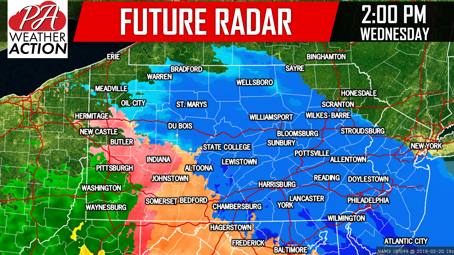
The snow will continue to expand northeastward throughout the morning hours. Below is a look at 11:00 AM Wednesday morning: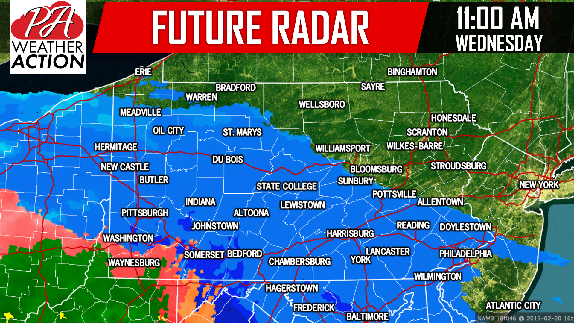 By 2:00 PM the snow will push into most of Eastern PA, with the exception of far Northeast PA. Northeast PA will see limited snowfall totals due to the lack of heavy precipitation making it into the area. On the other hand, Southwest PA has turned over to a wintry mix and even plain rain by 2:00 PM which will limit the snow totals in these areas as well:
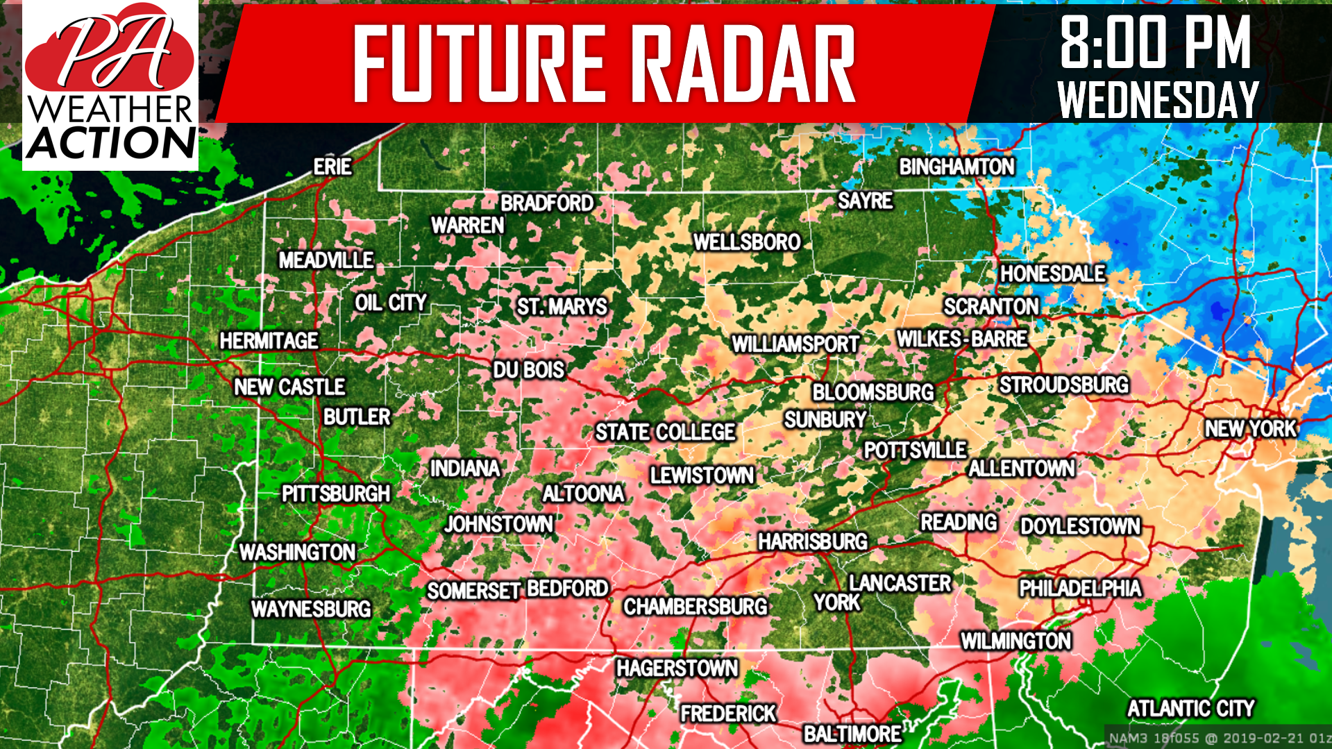
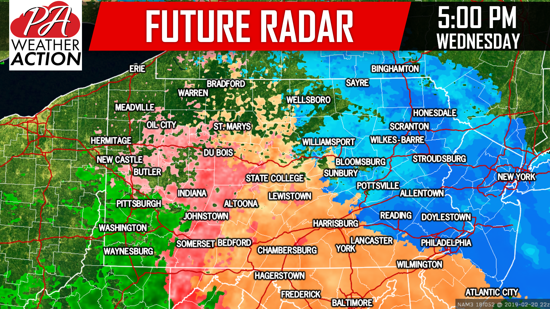 By 8:00 PM Wednesday evening, the storm will begin to taper off. Not before ending as a period of sleet and freezing rain for all locations of Central and Eastern Pennsylvania. For some areas, significant sleet and ice accumulations are possible on top of the snow:
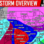
FIRST CALL SNOWFALL FORECAST FOR WEDNESDAY
 Be sure to view our ice forecast below this.
Area A: Snowfall of 5 – 8″ expected. Visibility of a quarter mile and snow-covered roadways will make travel dangerous to near-impossible by late morning Wednesday, through Wednesday Night.
Area B: Snowfall of 3 – 5″ expected. Visibility of a quarter to a half mile and snow-covered roadways will make travel dangerous in the late morning through Wednesday Night.
Area C: Snowfall of 2 – 3″ expected. Visibility of a quarter to a half mile and snow-covered roadways will make travel dangerous in the late morning through Wednesday Night.
Area D: Snowfall of 1 – 2″ expected.
Area E: Snowfall of < 1″ expected.
While amounts may not seem high, intense snowfall rates will give this storm higher impact-characteristics for the several hour period.
FIRST CALL ICE FORECAST FOR WEDNESDAY
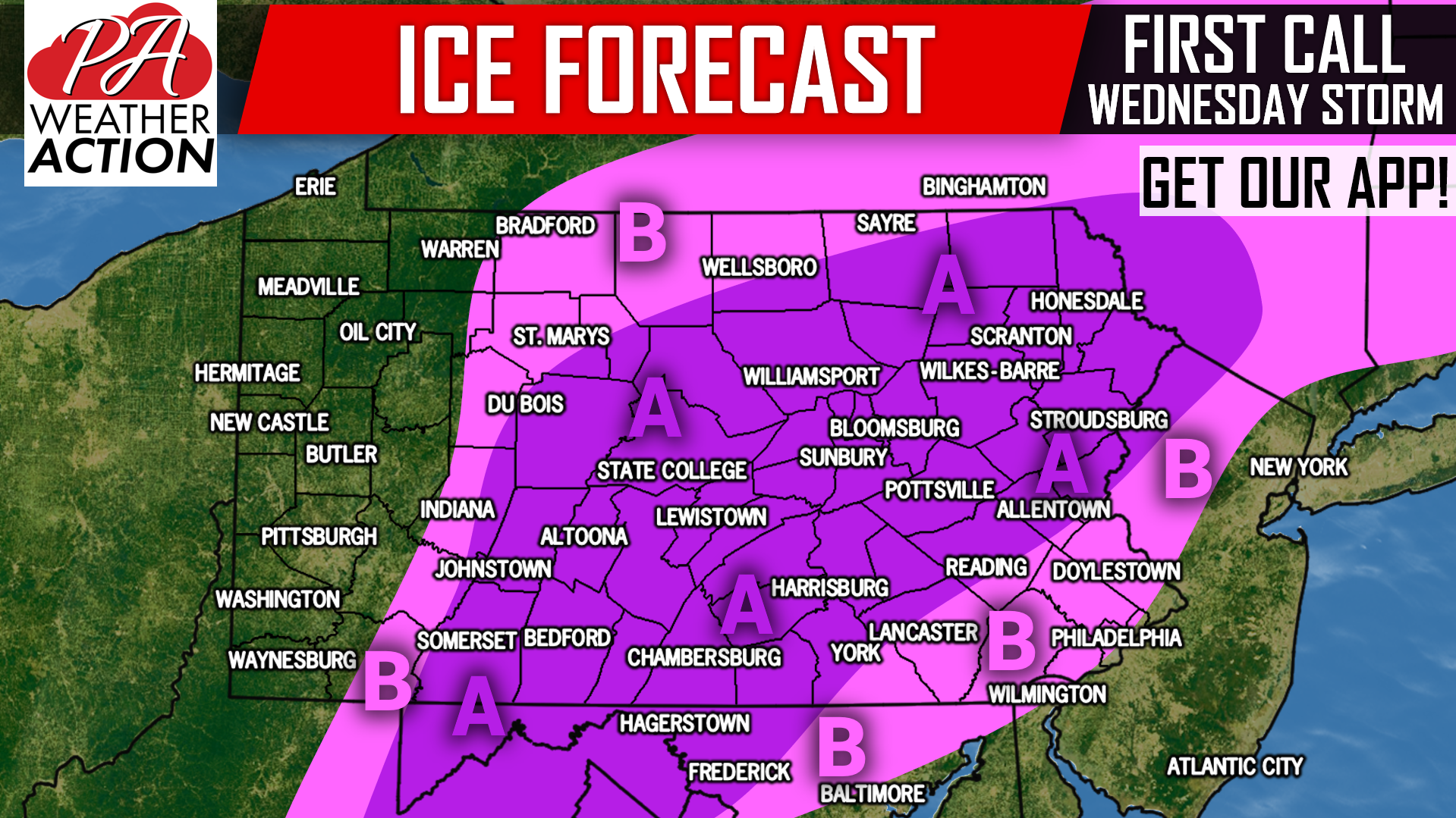
Area A: Ice accumulation of .10 – .25″ expected. Scattered power outages possible.
Area B: Ice accumulation of .01 – .10″ expected. Isolated power outages possible.
We will have our Final Call Snow & Ice Forecast out Tuesday Evening, with more details on amounts and timing. To receive that as well as your local hourly & daily forecast, radar and more, download our free app >>> PA Weather App!
Be sure to share the forecast with your friends and family using the button below, stay tuned!
You must be logged in to post a comment.