
FORECAST UPDATED, CLICK THUMBNAIL BELOW FOR 2ND CALL FORECAST ~>
Second Call Snowfall Forecast for Early Weekend Snowstorm Across Parts of Pennsylvania (2/16-17)
Winter weather has the tendency this season to come in with double shots of snow and then disappear for a few weeks. That looks to be the case this time around as well, with another snow event likely late Friday evening into Saturday morning. This round of winter weather will be less impressive than what we just experienced, and will be all snow. We also don’t expect the forecasting insanity like the previous storm, as the ceiling with this is lower and it’s a less complex setup.
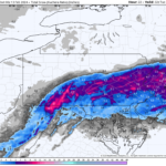
A weak low pressure system will form out west, before sweeping into the Ohio Valley and then Virginia. As a result of the track, Southern PA will be the focal point for snow and we expect the mix line to stay well south. Snowfall rates with this one will be under a half inch per hour, except briefly up to an inch an hour south of I-76. However the ceiling is low because this will be a six hour storm near and south of I-76, and even less farther north. The whole thing will be out of here by sunrise Saturday, leaving behind snow that can cleared without much strain unlike what we just endured.
SNOW TIME TABLES
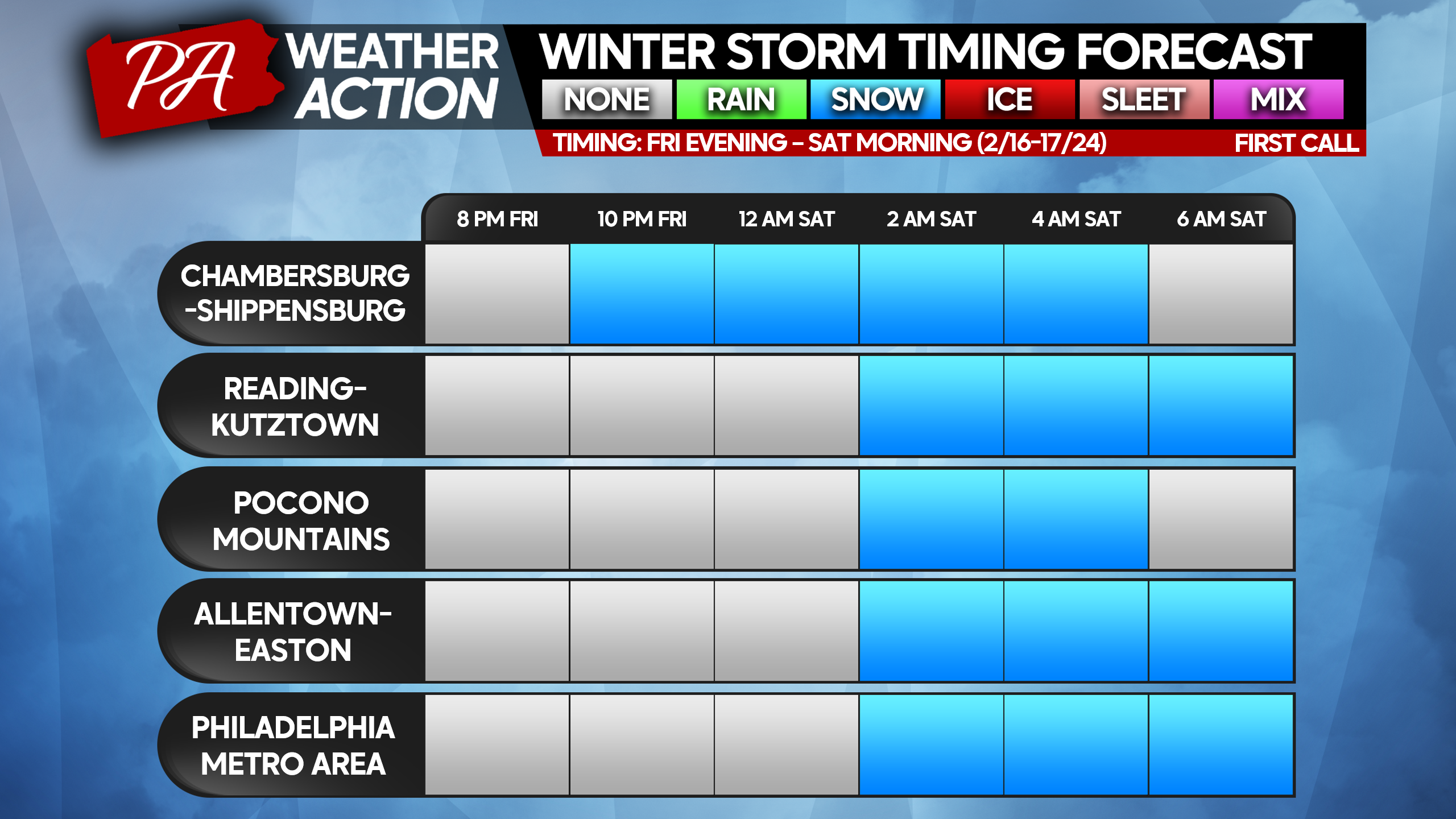
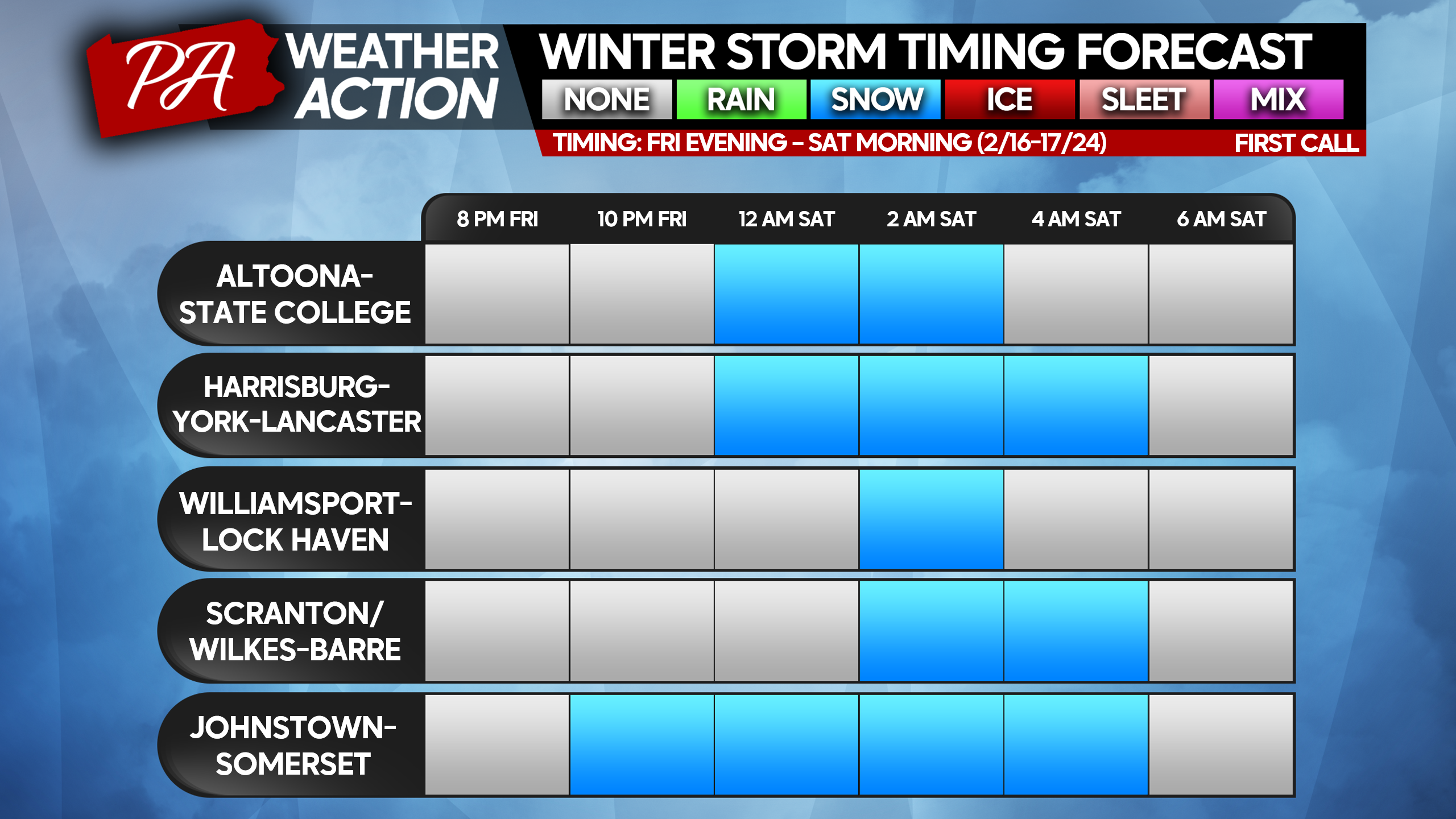
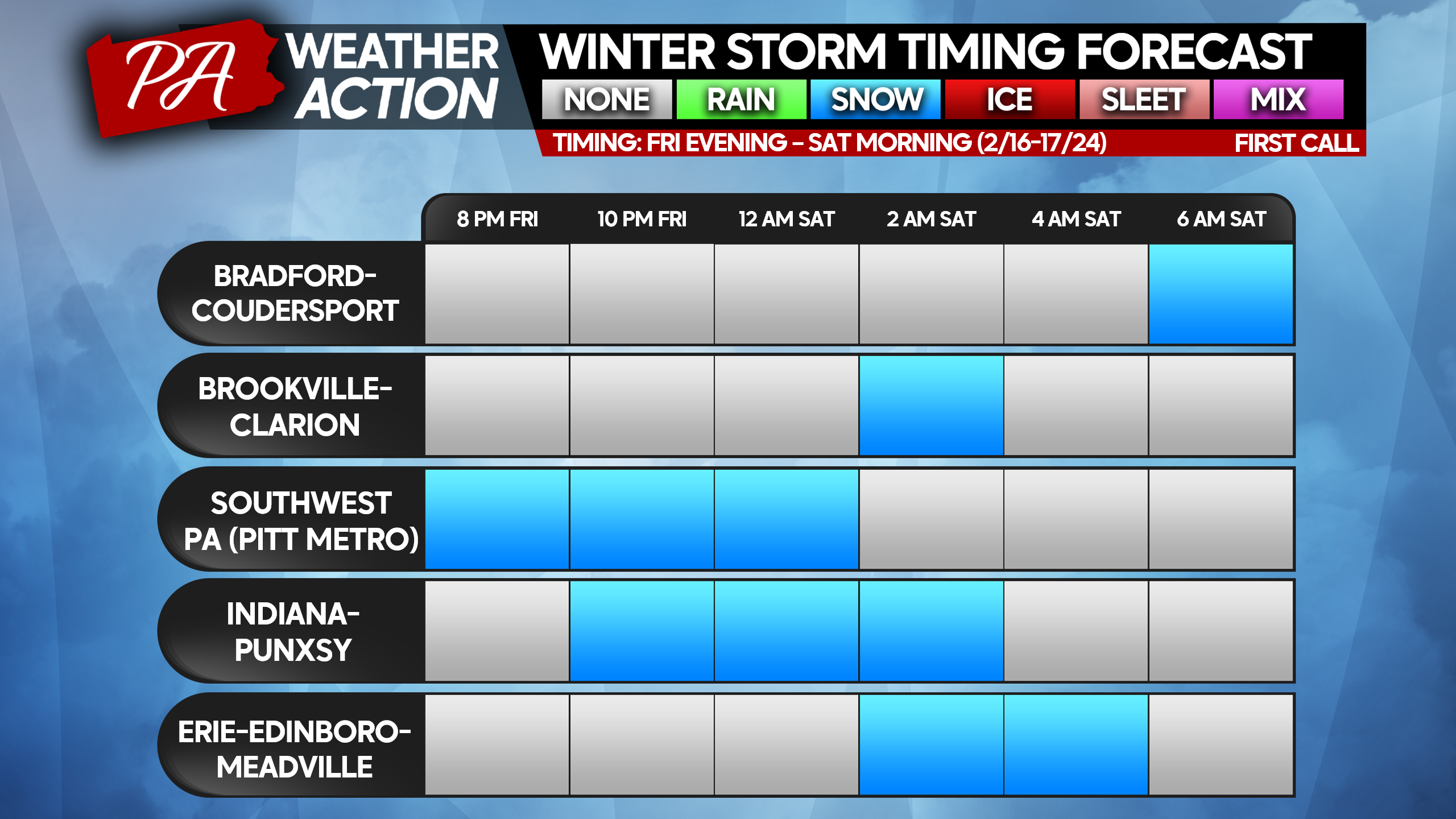
FIRST CALL SNOWFALL FORECAST FOR FRI EVENING – SAT MORNING
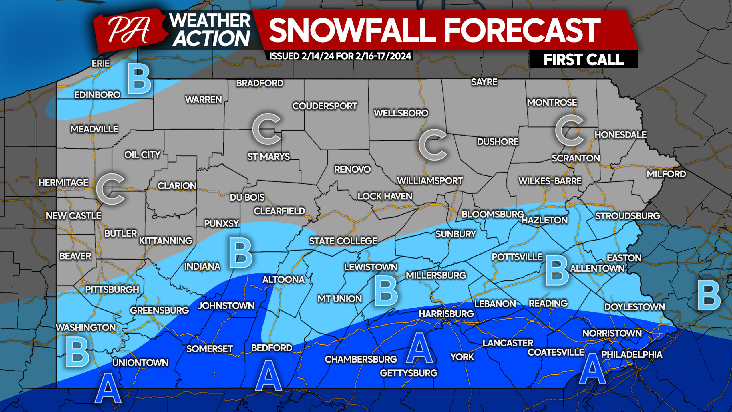
Area A: Snowfall accumulation of 2 – 4” expected. Snow-covered roadways expected, resulting in difficult roadway conditions. Travel not encouraged during snowfall.
Area B: Snowfall accumulation of 1 – 2” expected. Snow-coated roadways expected, resulting in slippery roadway conditions. Travel not encouraged during snowfall, which will be brief.
Area C: Snowfall accumulation of less than 1” expected. Untreated roadways may be slippery.
Saturday morning plans may be a little more complicated! Fortunately, this snow will be very easy to shovel!
If you’re in an area expecting a few inches of snow, share this forecast with family and friends below!
You must be logged in to post a comment.