
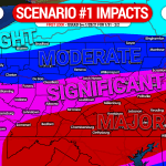
Tracking this storm has certainly been a roller coaster ride. As of Thursday morning, it seemed there was a consensus that most of the state would see a major snowstorm. Then as the day went on, models began to trend south with the heavy snow axis. This morning, questions still remained with most models in agreement except the European as the southern outlier. Now, we think a real consensus is coming together. With that said, this forecast is not locked in, and there may still be some smaller shifts as we head into the weekend. Definitely stay tuned for the latest forecast.
This will be a long duration event, and most of us won’t see rapid snow accumulation. The best chance for moderate to locally heavy snow will be Monday in southern and eastern PA.
STORM TIMING
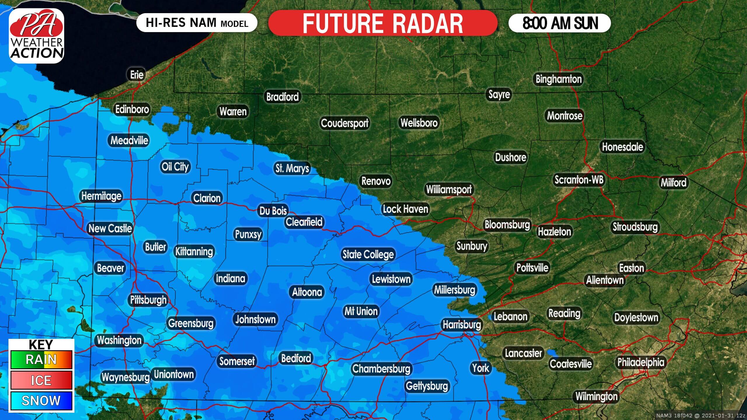
Light snow is expected to move into southwestern and south-central PA by Sunday morning. With temperatures in the 20s, it will have no problem accumulating immediately. With that said, only about quarter-inch per hour rates are likely at the onset. Below is Hi-Res NAM future radar for 8:00 AM Sunday.
More widespread snowfall will make its way into the region as we head into the late afternoon on Sunday. Light snow is modeled to overspread much of western and central PA before sunset. Here is future radar for 4:00 PM Sunday.

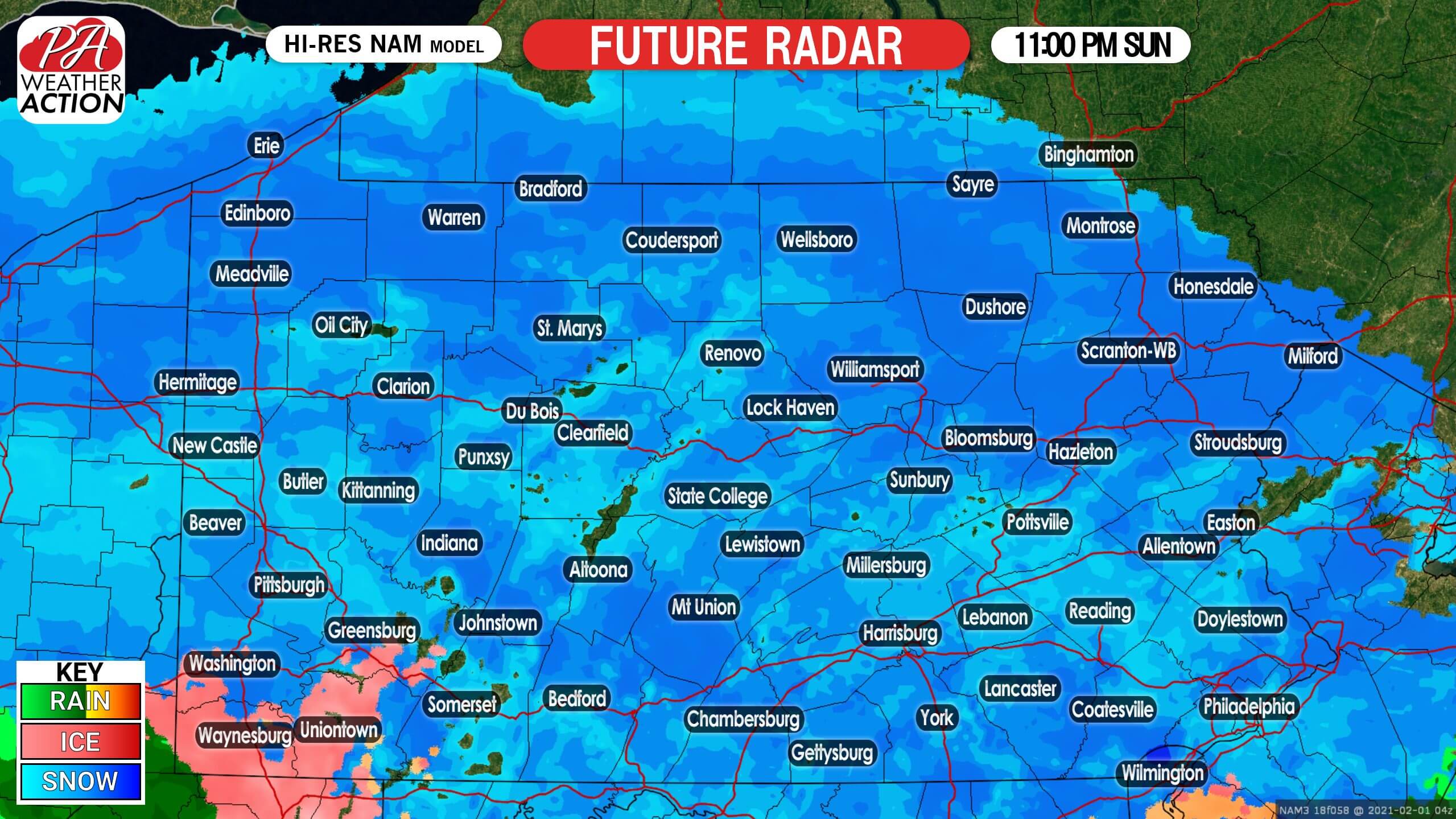
By late Sunday evening, nearly the entire state is anticipated to be under light snowfall. Below is future radar for 11:00 PM Sunday.
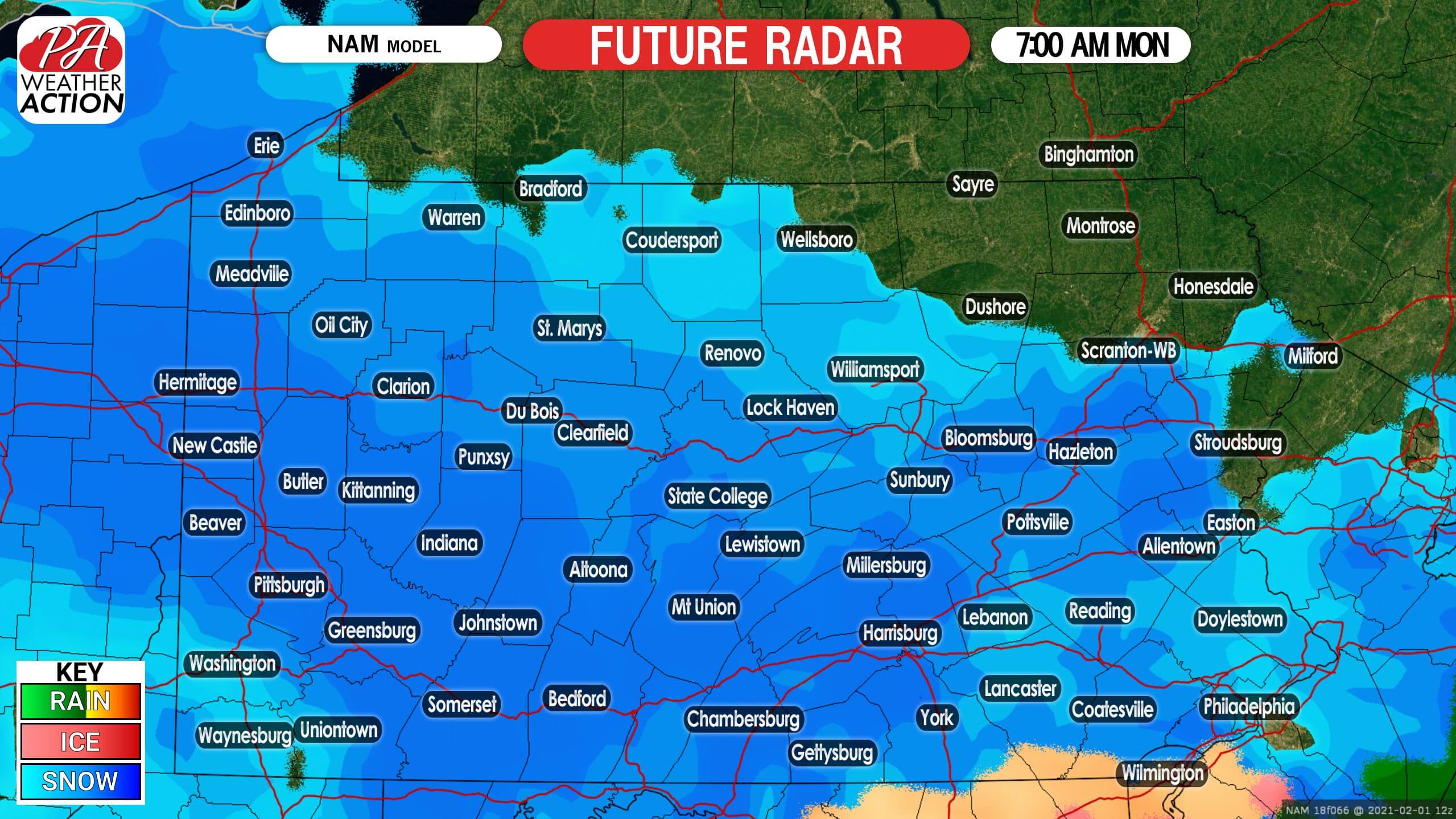
There may be a short lull in precipitation early Monday morning in south-central PA right before the coastal low pressure system gets going. By mid-Monday morning, snow should fill back in across most of southern PA. We believe this model has the precipitation shield too far west, and it will be more concentrated on central and eastern PA. Here is future radar for 7:00 AM Monday.
Light to moderate snow is expected to continue through much of the day Monday, before moving east by the evening. As this is still three days out, short range models aren’t the best at this range. We will have more images in our second and final call. Below is future radar for 7:00 PM Monday.
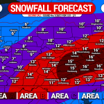
FIRST CALL SNOWFALL FORECAST FOR SUNDAY – MONDAY SIGNIFICANT SNOWSTORM
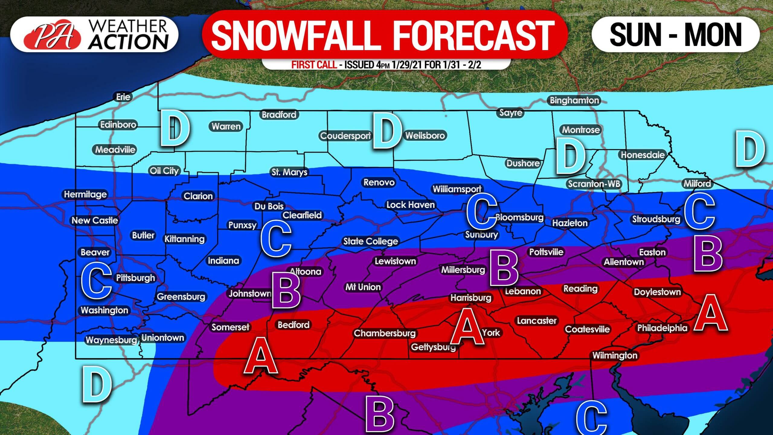
Area A: Total snowfall accumulation of 8 – 12″ expected. Light to moderate snow is expected to fall over a long duration, with some locally heavy snow Monday. Travel will be hazardous late Sunday into Monday, as roads will become snow-covered.
Area B: Total snowfall accumulation of 5 – 8″ expected. Light to moderate snow is expected to fall over a long duration, with some locally heavy snow Monday. Travel will be difficult late Sunday into Monday, as roads will become snow-covered.
Area C: Total snowfall accumulation of 3 – 5″ expected. Mainly light snow will accumulate over a long duration, giving road crews the ability to keep at least main roads clear. Secondary roads may become snow covered.
Area D: Total snow accumulation of 1 – 3″ expected. Secondary roads will become slippery if untreated.
This continues to be an evolving forecast, and right now the trend is north. There is the potential that this forecast may be bumped north, with slightly higher numbers. Be sure to view our second and final call calls. You can easily do so with our app >>> Weather Action App
Be sure to pass this forecast along to your family and friends using the blue button. Stay safe and stay tuned!
You must be logged in to post a comment.