
We are now three to four days out from early next week’s potential major storm, meaning it’s time for scenario maps. Model guidance at this range has given us a few different scenarios. Trends today have been to keep the low pressure off the coast near Ocean City, quieting sleet worries in southern PA. However, this solution may cut down on snow totals somewhat especially in the northern half of Pennsylvania, as well as inland locations. Trends may change in the coming days, which may benefit interior PA given climatology and previous systems this winter.
There are no snow totals specified on these maps for a reason. Confidence is not yet high enough to make a snowfall forecast with amounts, and will not be until Friday afternoon when we make our first call. For now, stay updated with all the latest info and be prepared for possible impacts.
SCENARIO #1: 40% PROBABILITY
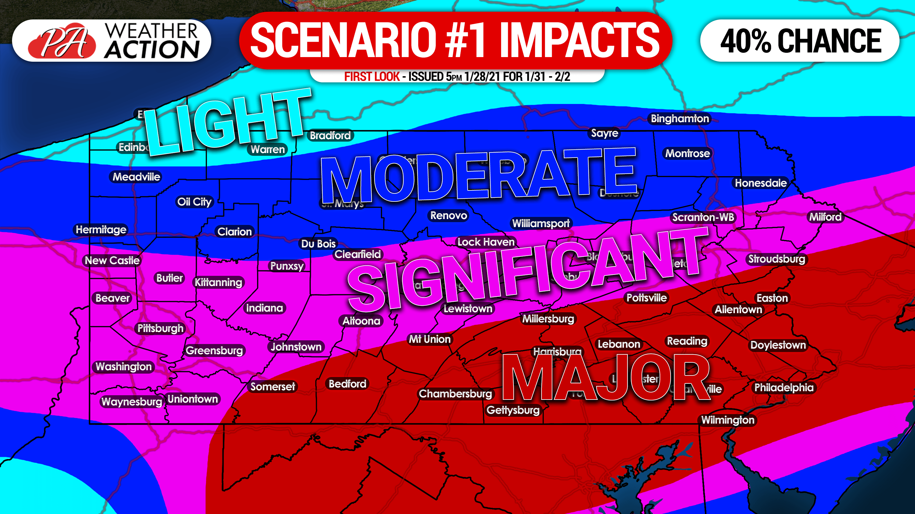
SCENARIO 1: This scenario is based on moderate snow for many on Sunday followed by a low pressure about 100 miles off the coast of OC,MD Sunday night into Monday, sending moderate snow back into much of PA south of I-80. Areas in southern PA would likely benefit the most from both systems, resulting in major impacts mainly south of I-78 in eastern PA and I-76 in central PA. The threat of sleet reducing snow amounts with this scenario is low.
SCENARIO #2: 30% PROBABILITY
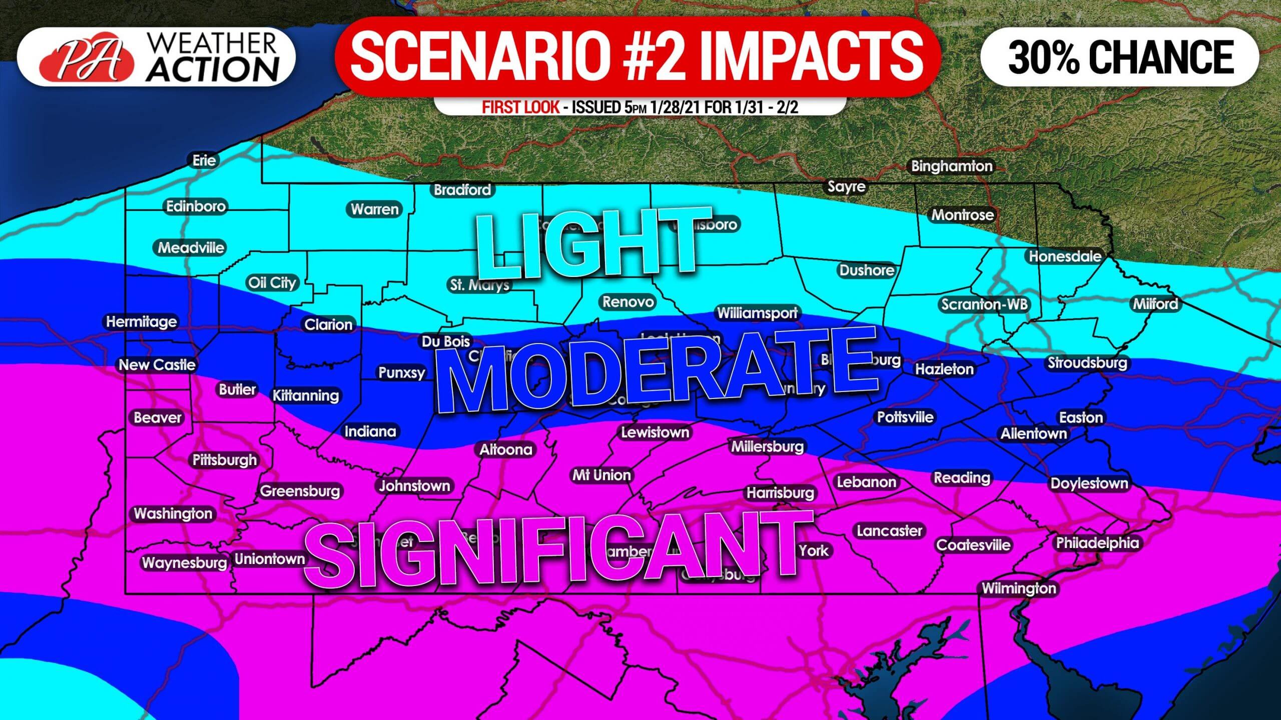
SCENARIO #2: This scenario also relies on a wave of light to moderate snow on Sunday mainly in southern PA. The coastal low pressure in this scenario is slightly more south and still about 100 miles off the coast, sending a consistent period of light to moderate snow into the southern half of PA Sunday night into Monday. Significant impacts would occur in much of southern PA. The threat of sleet reducing snow amounts with this scenario is low.
SCENARIO #3: 30% PROBABILITY
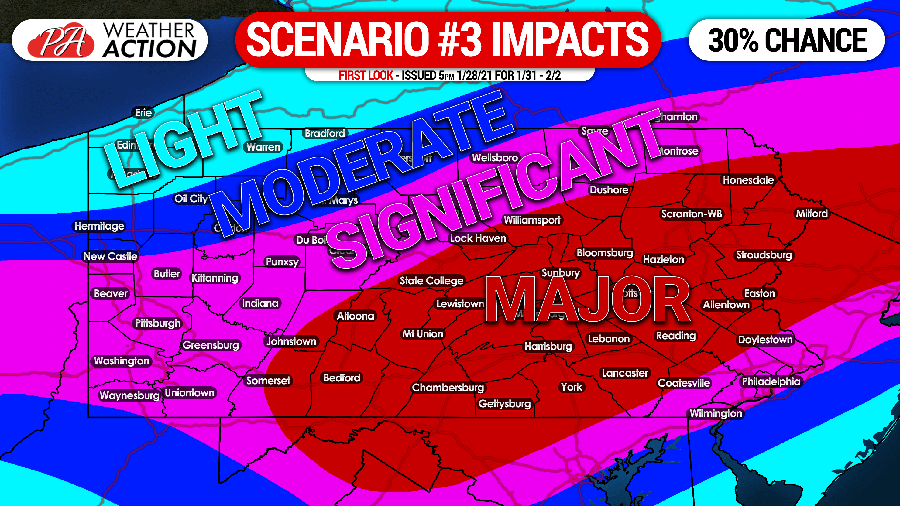
SCENARIO #3: This scenario is based on a period of moderate snow for most of us on Sunday, followed by a strong coastal low pressure that moves directly over OC,MD on Sunday night into Monday. That would throw moderate to locally heavy snow snow into much of central and eastern Pennsylvania, resulting in widespread major impacts. The threat of sleet reducing totals in southern PA is highest with this scenario, but still minor.
Don’t forget to share this important update with family and friends using the blue button.
Stay tuned for our first call snowfall forecast, which will be posted early Friday evening.
Get all of our updates as soon as they’re posted with our app! Get it on Apple and Google Play here >>> Weather Action App

You must be logged in to post a comment.