
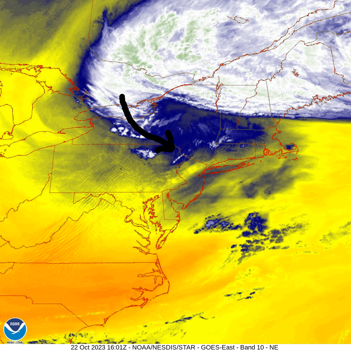
A large surface low located over the Canadian Maritimes is driving colder air into our region on gusty NW wind today. Meanwhile, an area of precipitation wrapping around the back side of that storm system will push southward through New York state and eventually eastward into the Catskills, clipping our area late this afternoon and evening.

Most areas will remain too warm at the surface and will suffer through chilly rain showers. However, temperatures in the highest elevations will fall into the upper 30s by this evening, which will be marginally cold enough that they could enjoy actual snowflakes mixing in with the showers. And those of you yearning to see some white ground might want to make the short trip to the Catskills as I would not be surprised if the higher peaks get an early-season whitening (coating to an inch of snow possible above 3000 feet).
Meanwhile, those of you in the lower elevations of the southern Poconos will struggle to even get the rain showers as you will be in the shadow of the Pocono Plateau.
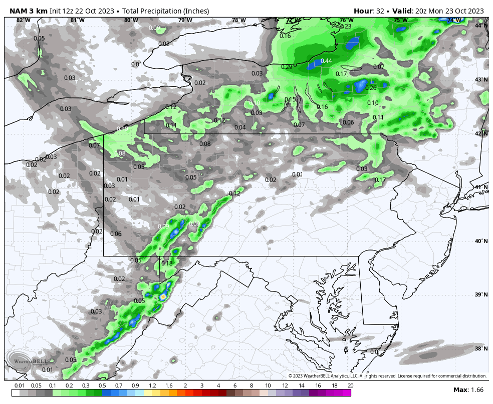
Here is this morning’s NAM model projection of precipitation totals this afternoon and evening:

You must be logged in to post a comment.