
Good morning! Happy Friday, another week is already done with in October. Time is surely flying! After a rather calm week (despite the cloud cover), we will be ending the week on a rather active note. An incoming cold front will help spawn showers and thunderstorms across the region today, which may put a damper on your afternoon and evening plans. If you are planning to be outdoors today, make sure to bring your umbrella and rain coat just in case you are impacted by precipitation. Lets dig in!
TODAY’S SETUP:
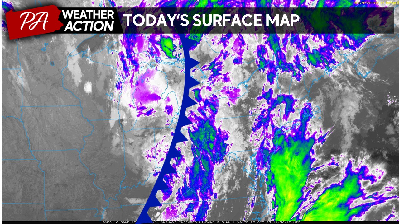
After a few drier days with high pressure dominating the weather map, we will have changes coming to our forecast this afternoon and evening. A strong cold front will begin to approach the region from the west, which will allow for showers and potentially a few thunderstorms to develop in and across the region.
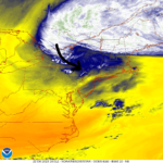
FUTURE RADAR:
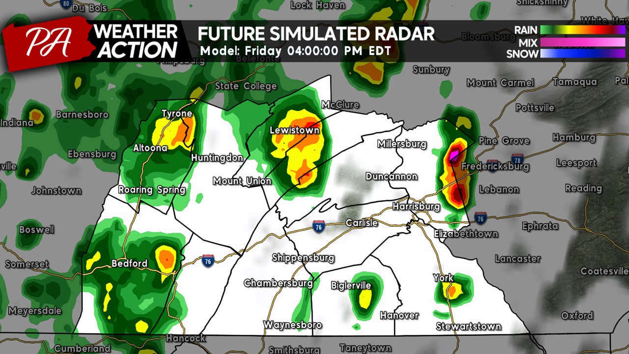
As the cold front approaches our region, expect an increase in rain showers across the western zones by the lunch hour. A few showers may be in moderate-to-heavy in intensity, denoted by the warmer colors.
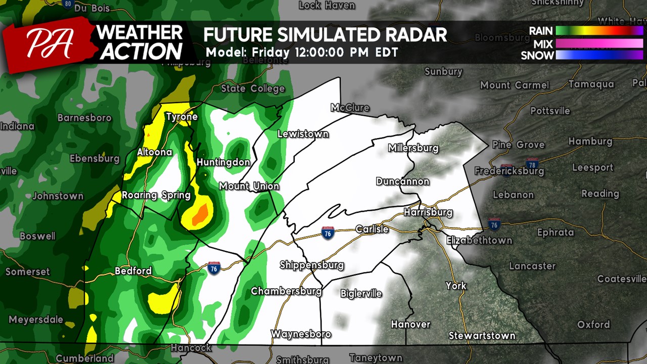 These showers will continue to progress further east into the early afternoon hours, beginning to affect portions of the central counties. The eastern counties will still remain fairly dry, although showers and thunderstorms will likely fire in and around the Harrisburg region by the mid-to-late afternoon hours.
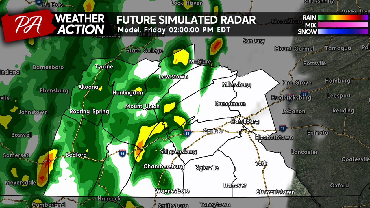
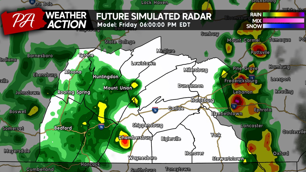
By mid-afternoon hours, expect scattered showers with a few thunderstorms across the area. If any thunderstorms develop, they are expected to remain sub-severe due to the lack of instability and overall atmospheric ingredients. However, for those who see thunderstorms may see torrential downpours, gusty winds, and the potential for a few flashes of winter. As said in the summer months, “when thunder roars, head indoors!”.
By the late-afternoon hours, expect much of the thunderstorm activity to shift further east of Harrisburg, although a few isolated storms may still remain in the area. Heading further west, another batch of showers will begin to move into the region. Unfortunately, if you have any outdoor evening plans, including Friday Night Lights, those plans will likely be impacted so make sure to bring the rain gear and umbrella before heading out this evening!
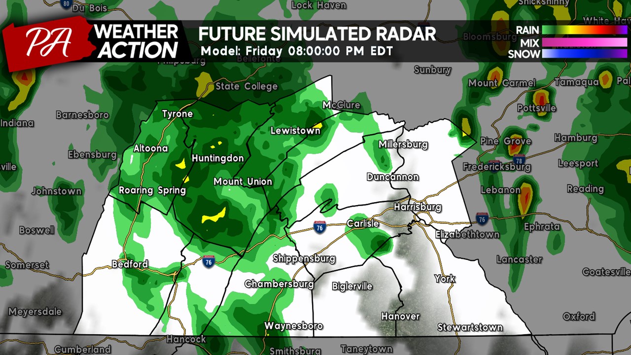
By the evening hours light rain showers will continue to spread across the region. These rain showers will be rather light but they will be a nuisance if you are outdoors. These showers will slowly dissipate as we head closer to the midnight hour.
THUNDERSTORM OUTLOOK:
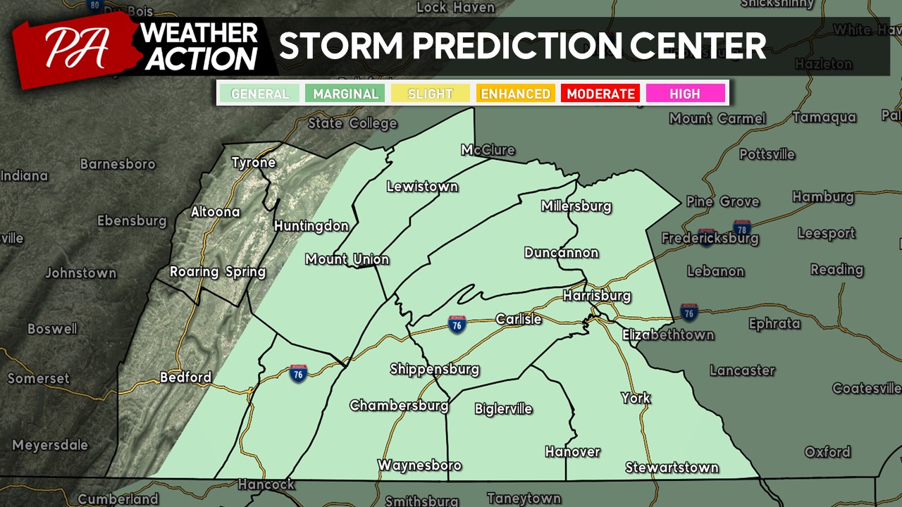
Although not a severe weather risk, the Storm Prediction Center has placed much of the region under a non-severe general risk of potential thunderstorms. These thunderstorms may produce gusty winds, torrential downpours, and for a few flashes of lightning .
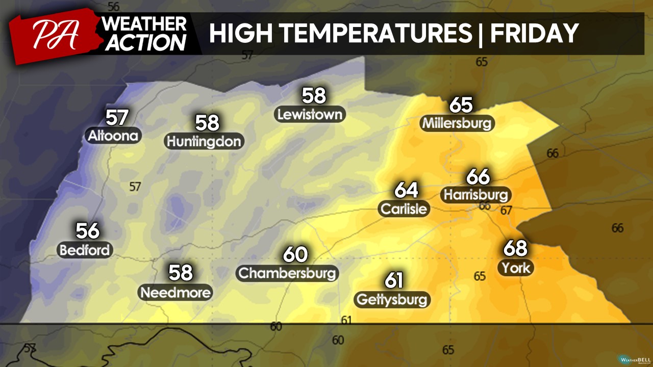
 HIGH TEMPERATURES:
High temperatures will be split across the region. The further west you are located, the lower your high temperature will be. The highest temperatures will be centered across the far eastern counties for cities such as Harrisburg and York, where some sun may peek out during the afternoon hours.
 I hope you have a great Friday despite the potential rain showers and thunderstorms! Just remember to bring the rain gear and/or umbrella before you head out- you will most likely need it this afternoon and evening. As the cold front moves through this evening, much cooler conditions will usher in with gusty winds. Feel free to read yesterday’s blog post for more details on that front. If you have any questions regarding the forecast, feel f
Denys

You must be logged in to post a comment.