
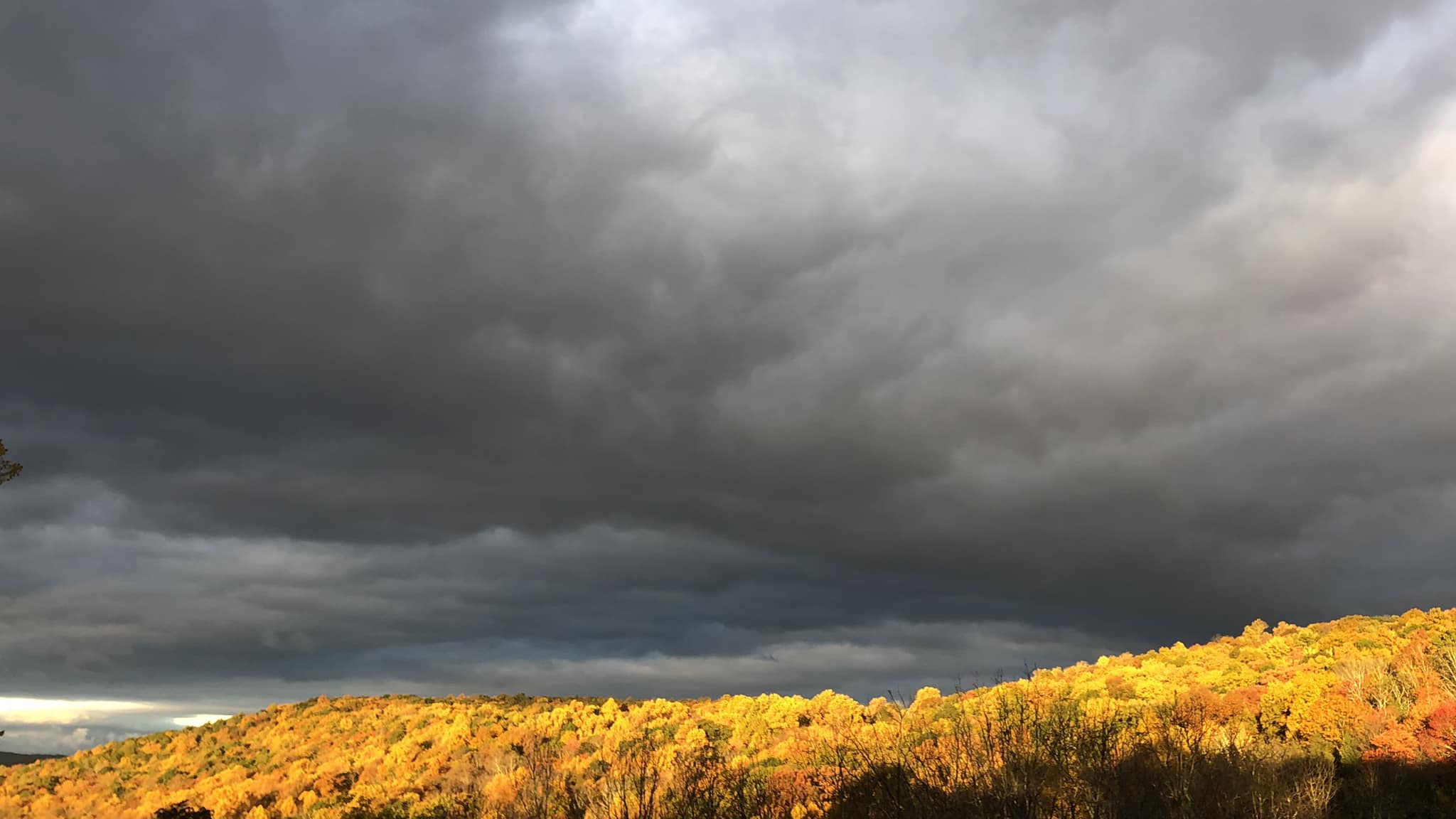
Temperatures across the region today soared well into the 70s – and even into the 80s in some of the valley locations! I hope everyone has been able to enjoy this incredible summery weather, as it will fade into distant memory with a dramatic pattern shift this weekend…
A strong cold front currently separates colder-than normal temperatures and downright wintry conditions over the northern Rockies and northern Plains from the summery weather currently being enjoyed by much of the southern and eastern US. The weather will be quite wintry across the northern Plains, with several inches of snow and high temperatures remaining below freezing into early next week! This frontal zone will push eastward, affecting our area this weekend and ending our warmth.
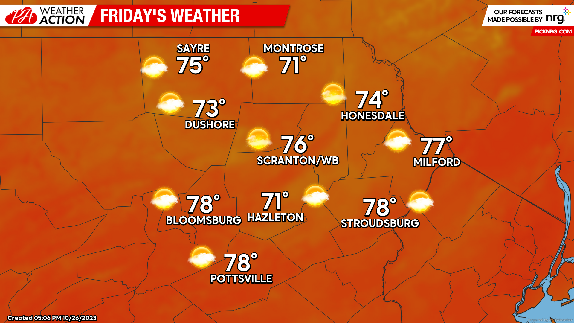
FRIDAY
Friday will be the last pure Indian Summer day as it will dawn with temperatures near 60, followed by sunshine that will propel temperatures into the 70s during the afternoon… and some locations in the lower valleys could approach 80!
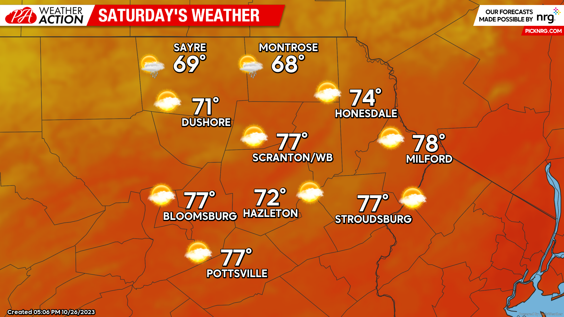
SATURDAY
Saturday will start with widespread upper 50s and lower 60s across the region, which is the normal max temperature for this time of year! Temperatures will quickly climb into the 70s. However, that aforementioned cold front will be pushing through our area during the afternoon, reaching the New York border early afternoon, and finally clearing the southeastern zones of Carbon and Monroe counties shortly after sunset. Clouds and some scattered light showers will accompany the frontal passage, with temperatures plunging into the 5os behind the front, possibly into the 40s in the higher elevations. On a more-celestial note, there will be a lunar eclipse Saturday evening with the full moon, but our area would only be able to glimpse the final minutes if it were clear, which it likely won’t be.
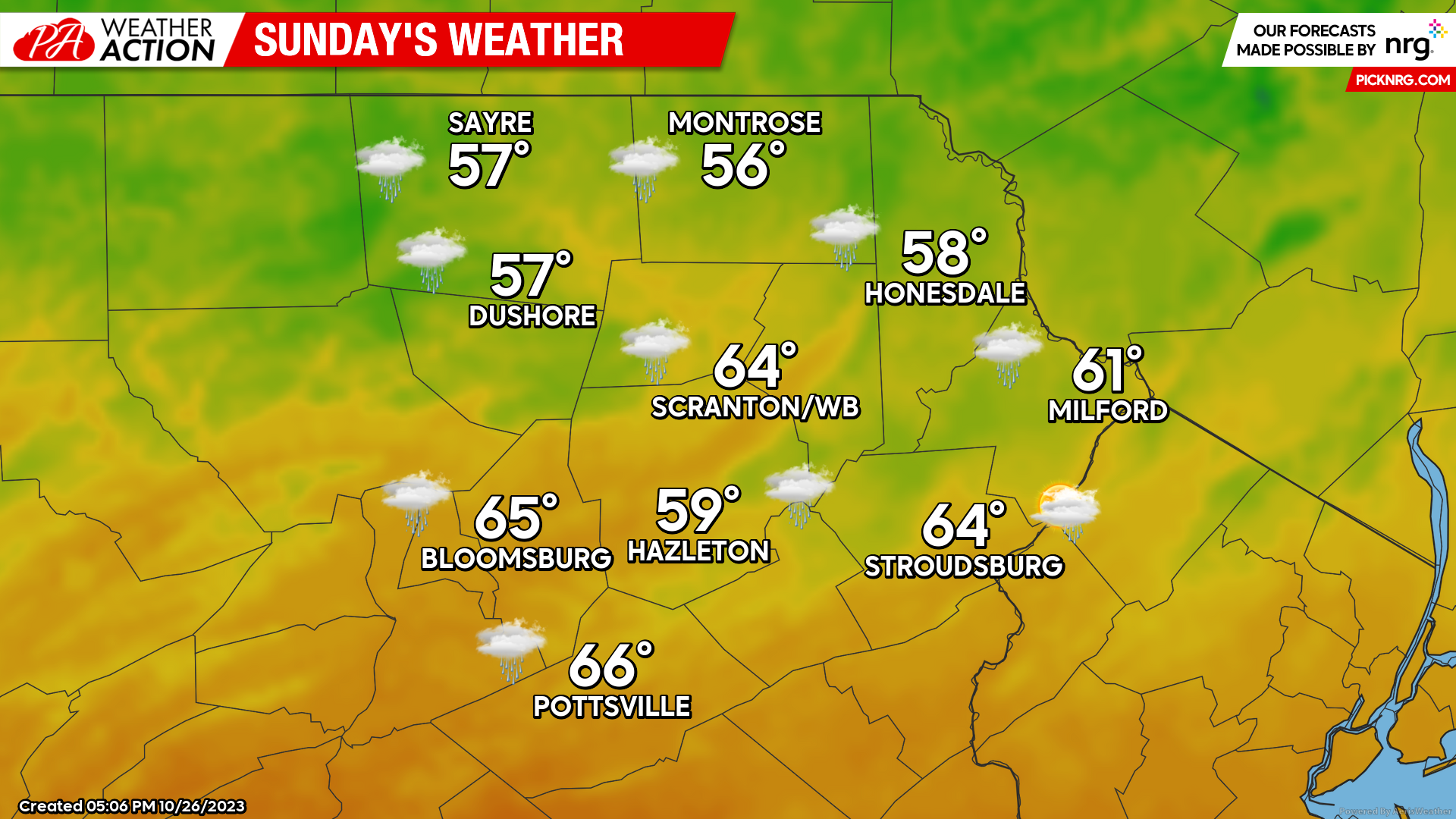
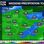
SUNDAY
The cold front will straddle Pennsylvania, with our area being on the cold side. A disturbance will ripple along the front and deliver showers to our area. Depending on the extent of the showers, temperatures could remain several degrees lower than the currently-predicted temperatures, possibly remaining steady in the low-mid 50s. Either way, it will be a chilly damp day compared to this week’s final gasp of summer!
Colder than normal weather will persist throughout of next week, along with unsettled conditions and opportunity for showers lingering into early next week. Enjoy!

You must be logged in to post a comment.