

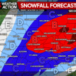
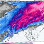
An area of low pressure will pass to the south on Saturday, bringing the chance for some areas to see the first measurable snowfall event of the winter. Models are still showing inconsistencies, however the overall impact to the region appears to be significantly less than what was originally anticipated earlier in the week.
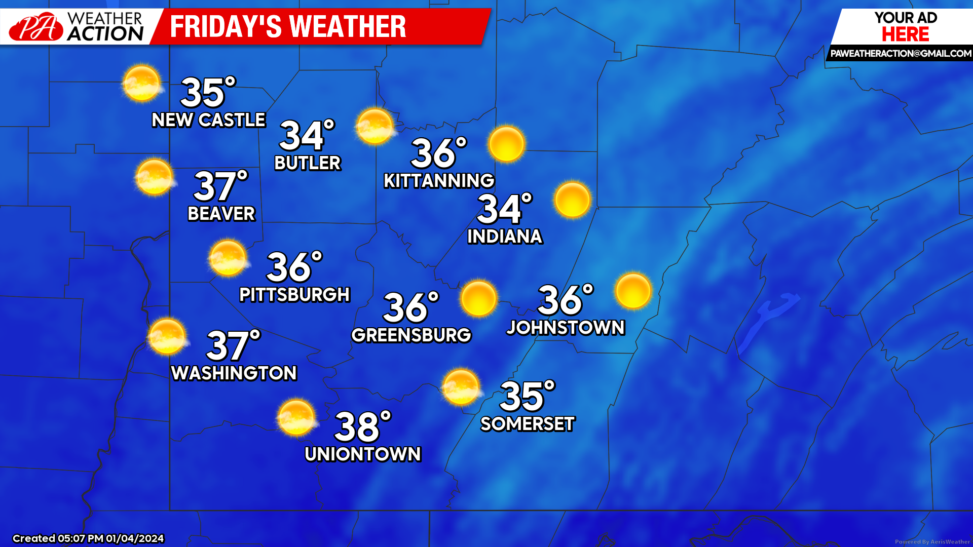
Friday
Mostly sunny conditions can be expected with clouds increasing in the overnight hours. Highs will be in the mid 30s. Lows will be in mid 20s.
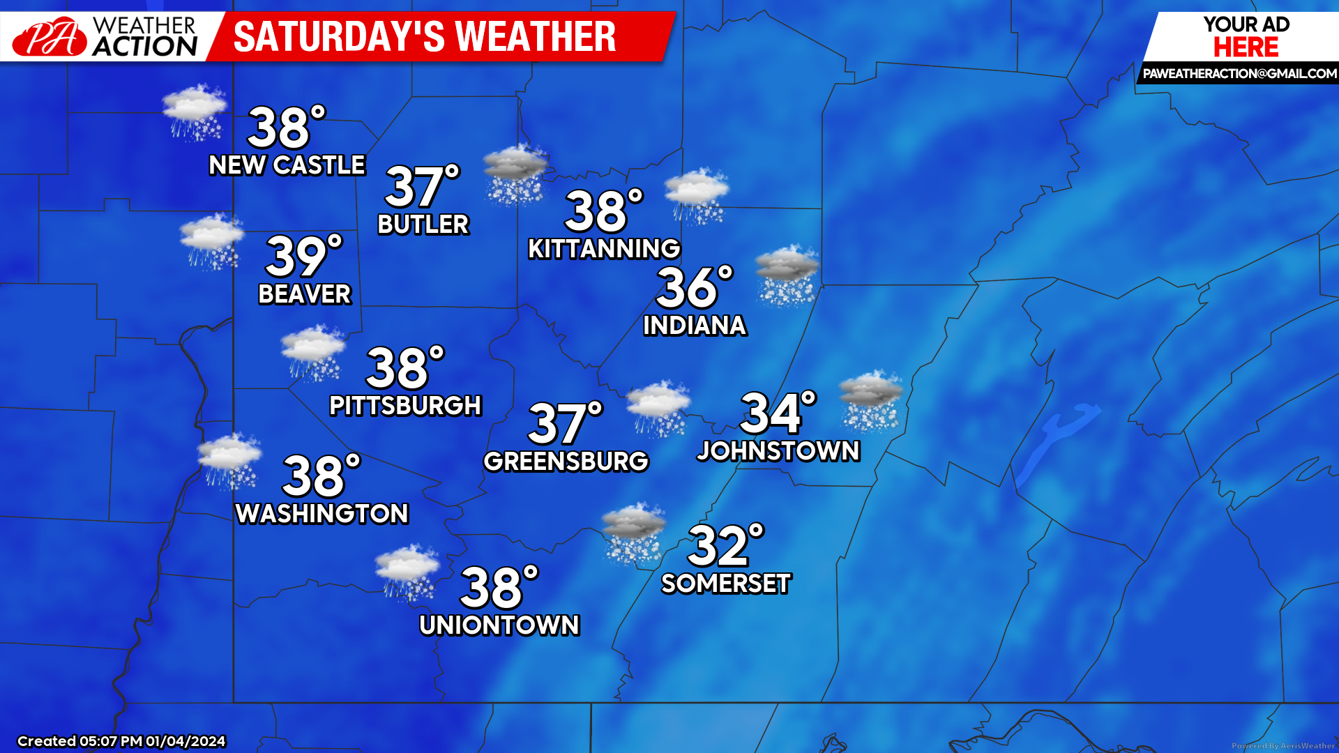
Saturday
Periods of snow will impact the region throughout the day on Saturday, some areas could see a rain/snow mix at times. Highs will span in the 30s. Winds will be out of the east-southeast ranging between 5 to 15 mph. Lows will be low 30s to mid 20s. Higher elevations could see higher snow accumulations compared to the rest of the region.
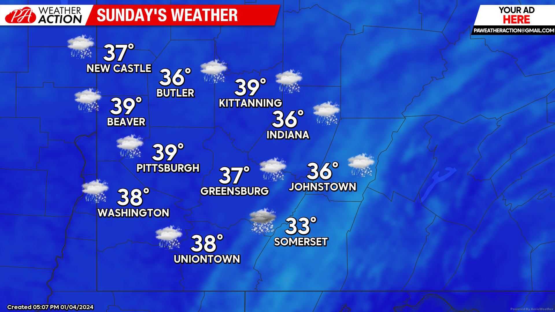
Sunday
Snow showers are likely to continue throughout the day with the chance for snowfall dropping after mid-day and into the overnight hours. Highs will be in the mid to low 30. Winds will be out of the west-southwest at 7-15 mph, increasing as the day goes on, wind gusts approaching 30 mph could occur in the overnight hours. Lows will be in the mid 30s to high 20s.
PA Weather Action will continue to release statewide reports on the weekend’s winter storm, providing potential snowfall totals for all of Pennsylvania. Be sure to follow PA Weather Action for updates over the weekend.
You must be logged in to post a comment.