
FINAL CALL HAS BEEN POSTED AS OF 5:00 PM FRIDAY 1/5:
Final Call Snowfall Forecast for Saturday’s Significant Snowstorm in Pennsylvania
Confidence that a significant winter storm will bring up to a foot of snow to the state has increased over the last day, and for once it seems, expected snow has not shifted northwest. The only trend over the last 24 hours since our first call has been to extend the duration of light to moderate snow at the end of the storm in Eastern PA. Mixing with rain and sleet remains a likelihood across parts of the Lower Susquehanna Valley and Delaware Valley. One thing is for certain – you will not want to be out and about while heavy snow is moving through. View timing for your area below.
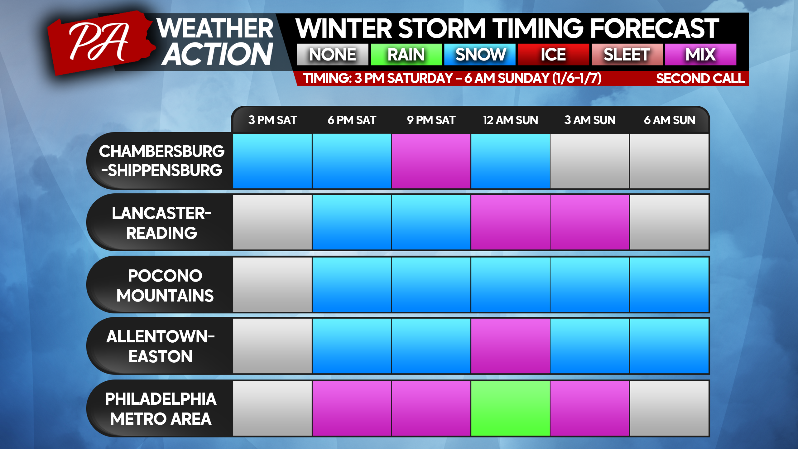
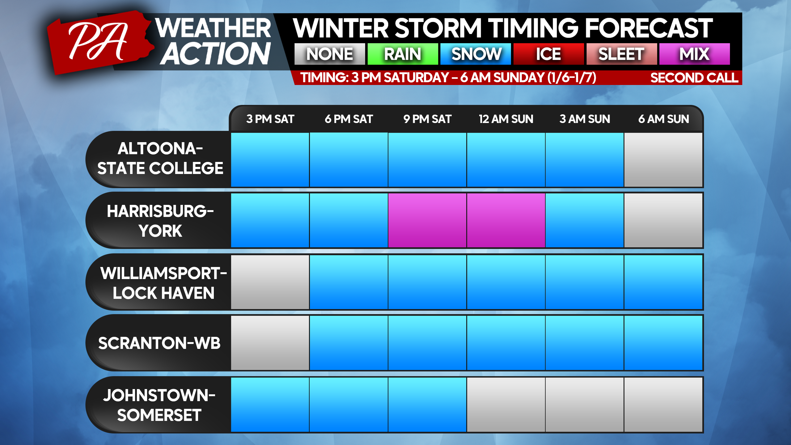
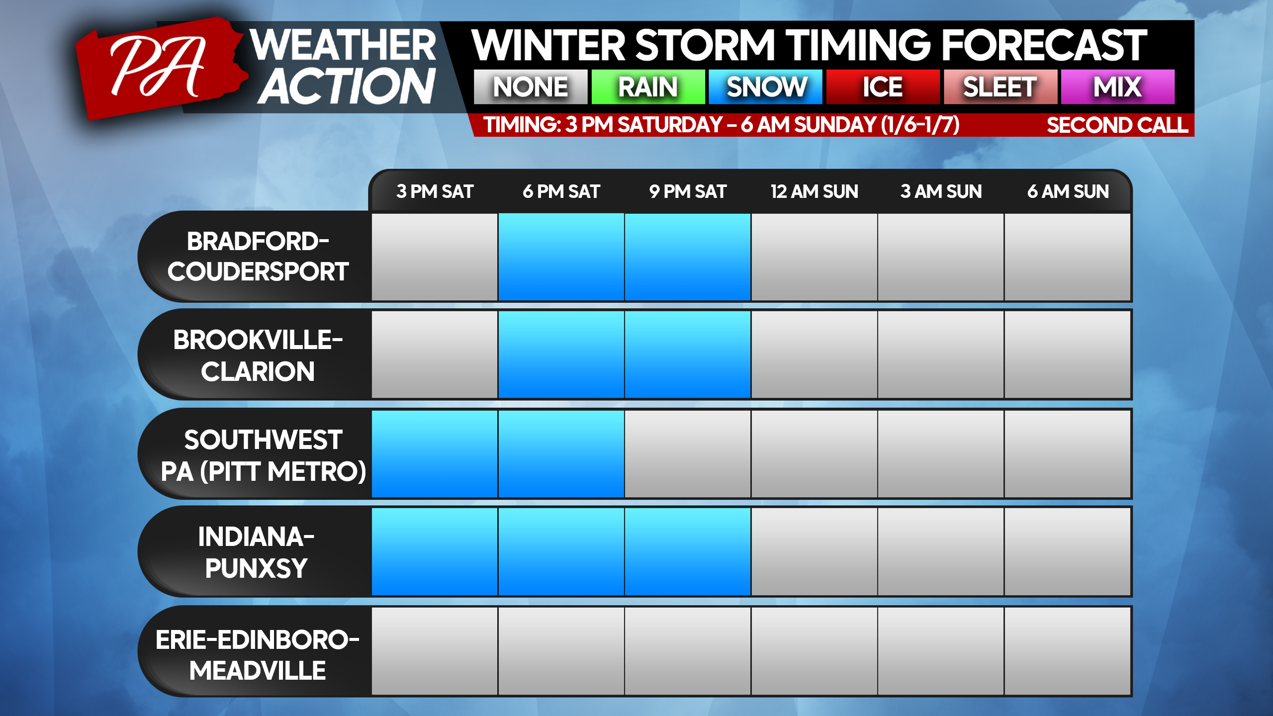
STORM TIMING FORECAST CHARTS
SECOND CALL SNOWFALL FORECAST FOR SATURDAY AFTERNOON – SUNDAY MORNING
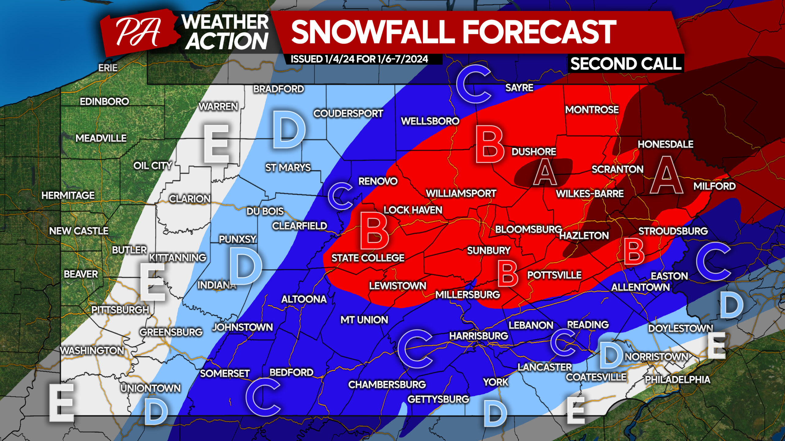
Very poor travel conditions are certain. View time tables above, find nearest area to you or region of interest.
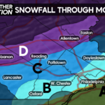
Area A: Snowfall accumulation of 8 – 12″ expected. All snow expected, heavy at times.
Area B: Snowfall accumulation of 6 – 8″ expected. All snow expected, heavy at times.
Area C: Snowfall accumulation of 4 – 6″ expected. Southern areas near I-81 and I-78 will begin as snow, followed by a brief wintry mix before ending as snow.
Area D: Snowfall accumulation of 2 – 4″ expected. Southern areas will begin as snow before changing to a long period of wintry mix and rain.
Area E: Snowfall accumulation of 1 – 2″ expected. Southern areas will briefly begin as snow before changing to rain.
Many people may have Saturday Evening plans, be sure to share this forecast with family and friends below!

You must be logged in to post a comment.