
December 19, 2022 Morning Update
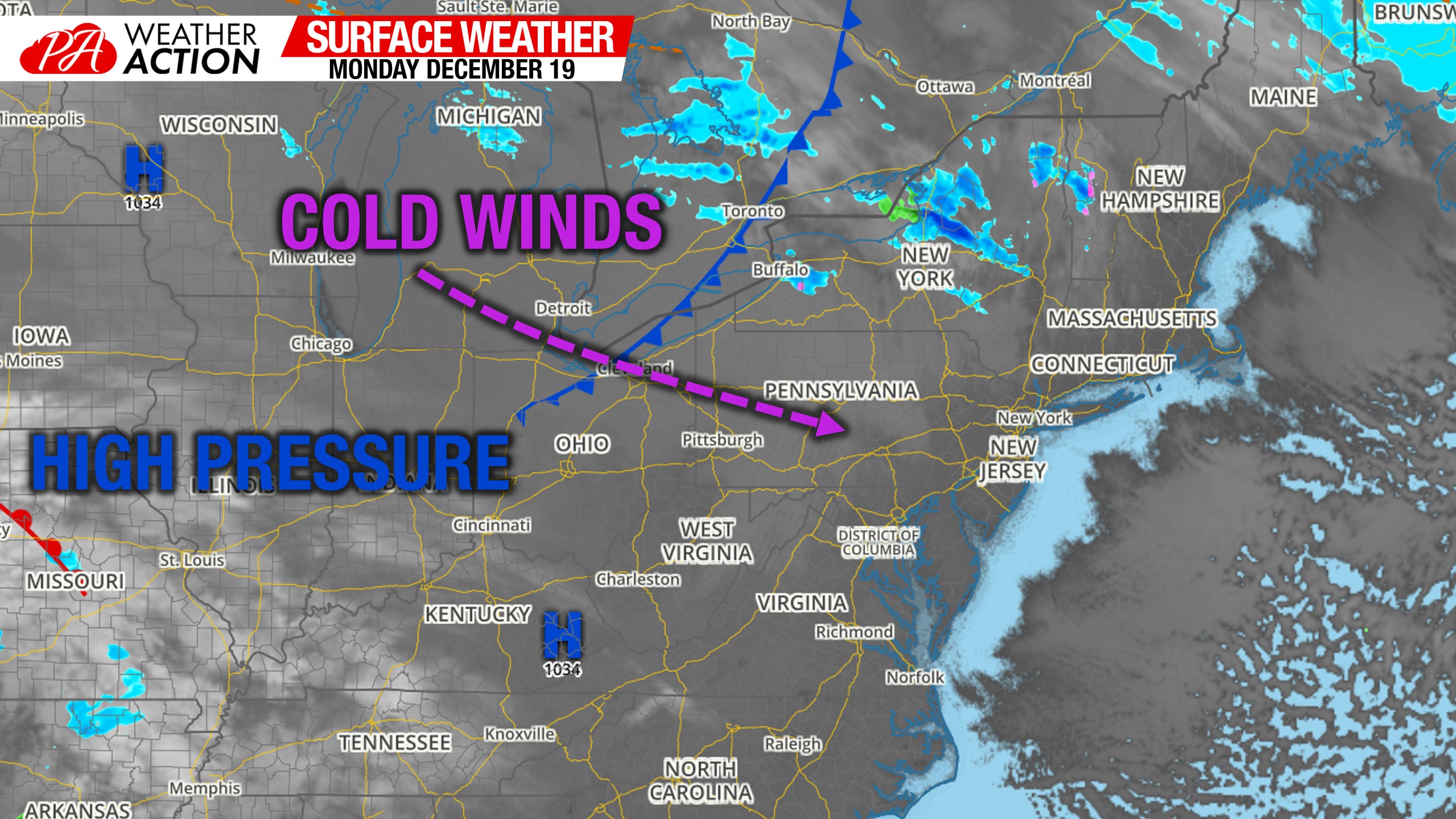
Morning Surface Weather Map
Mostly clear skies this morning with a westerly wind making wind chills in the single digits and teens. High pressure is in place, centered to our west, and will dominate the first half of this week.
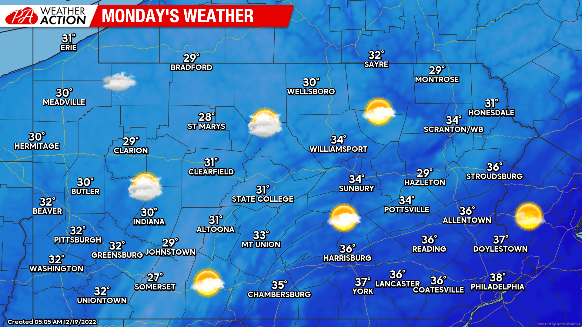
Monday’s Weather Map
A nice winter blue sky today, with a few clouds here and there more so in Western PA. Temperatures, combined with winds, will not be pleasant.
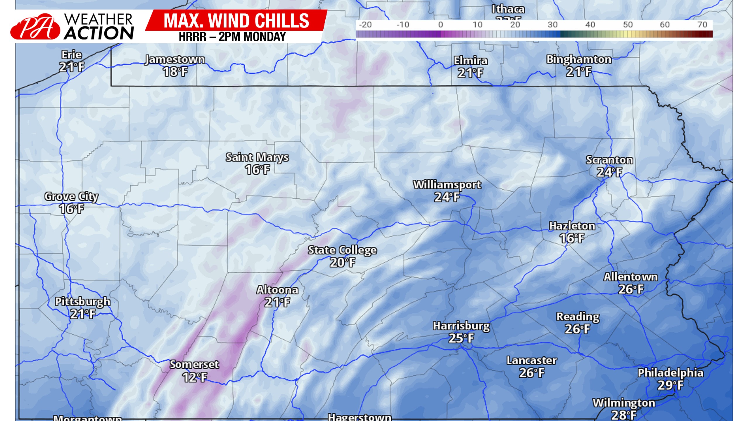
Monday’s Maximum Wind Chills
The “warmest” wind chills we will see today will be in the teens and 20s, yikes! Definitely a good day for a heavy winter coat, and just a taste of what’s to come around Christmas.
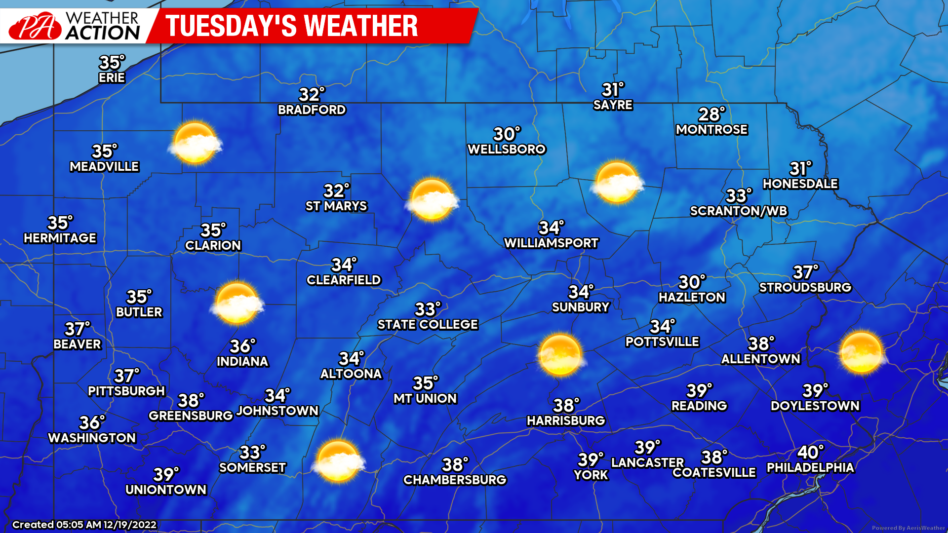
Tuesday’s Weather Map
High temperatures will be a bit warmer in most areas tomorrow, with continued sunshine. Wind won’t be much of a factor, so it won’t feel as cold.
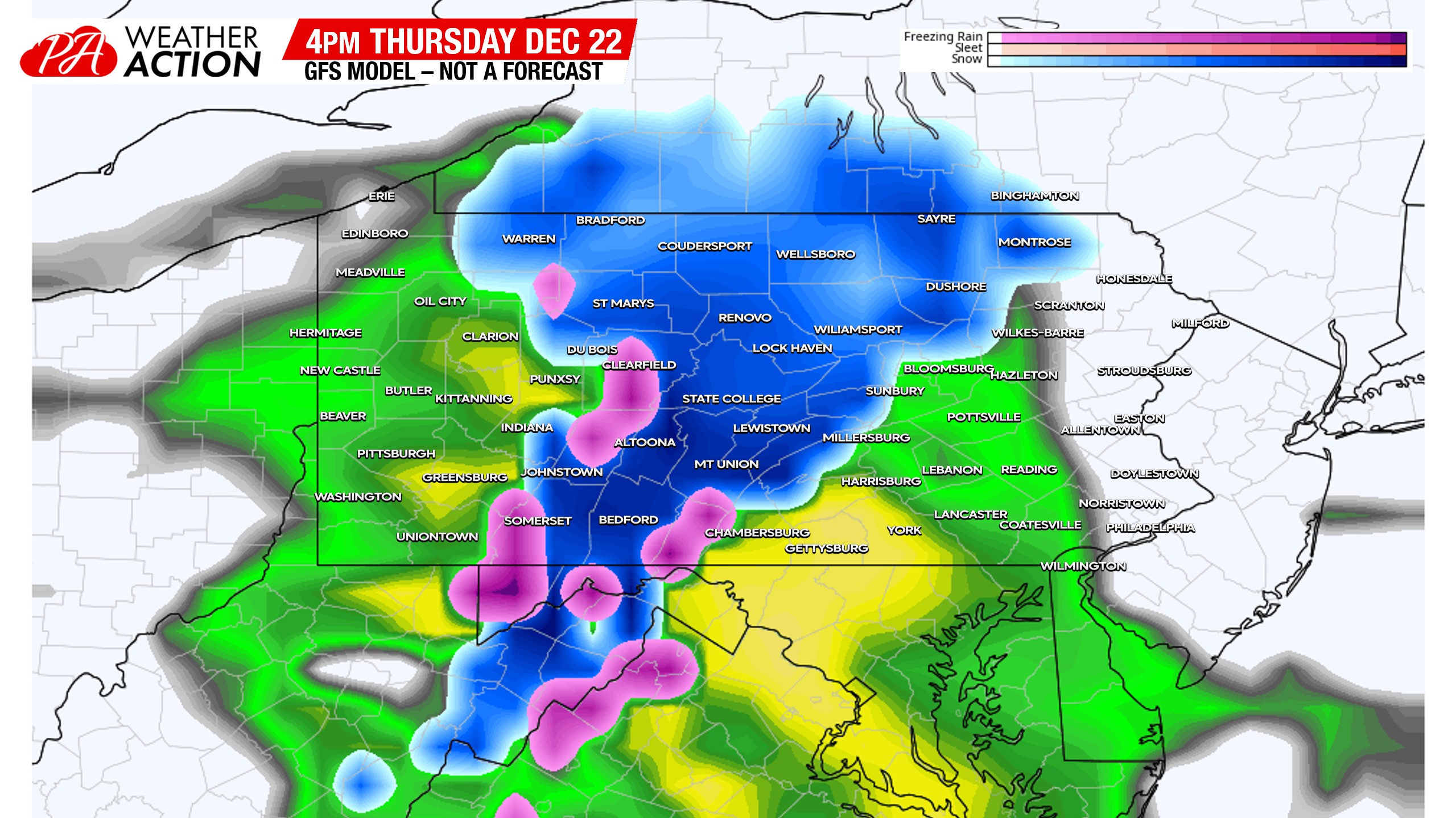
Thursday – Friday Storm Update
Shockingly, models have drastically changed course on this storm over the weekend. Actually, it’s not shocking at all. It’s what models do, and it’s why we don’t post model snow maps a week out. I would say it’s a lesson learned for those that do post said maps, but they never seem to learn their lesson, and neither do the people that believe them.
So, this storm will begin as rain for most of us on Thursday afternoon. A three to six hour period of snow is possible before rain along the spine of the Appalachians Thursday afternoon and evening, which may create some travel issues in those areas. For the rest of the state, a cold rain. Below is the GFS for 4pm Thursday, showing that snow in places like Bedford, Altoona, State College, and Wellsboro.
There is some hope for a white Christmas, especially in Western and Central PA. I’m as skeptical of backend snow as anyone, but this is an ideal setup for it. I think the Allegheny Mountains are guaranteed a white Christmas, with Western PA and Northern PA at a good 60% chance of a white Christmas. East of the mountains is where greatest uncertainty remains, and will remain until Wednesday or even Thursday. This is a mesoscale feature, and not something global models can handle too well.
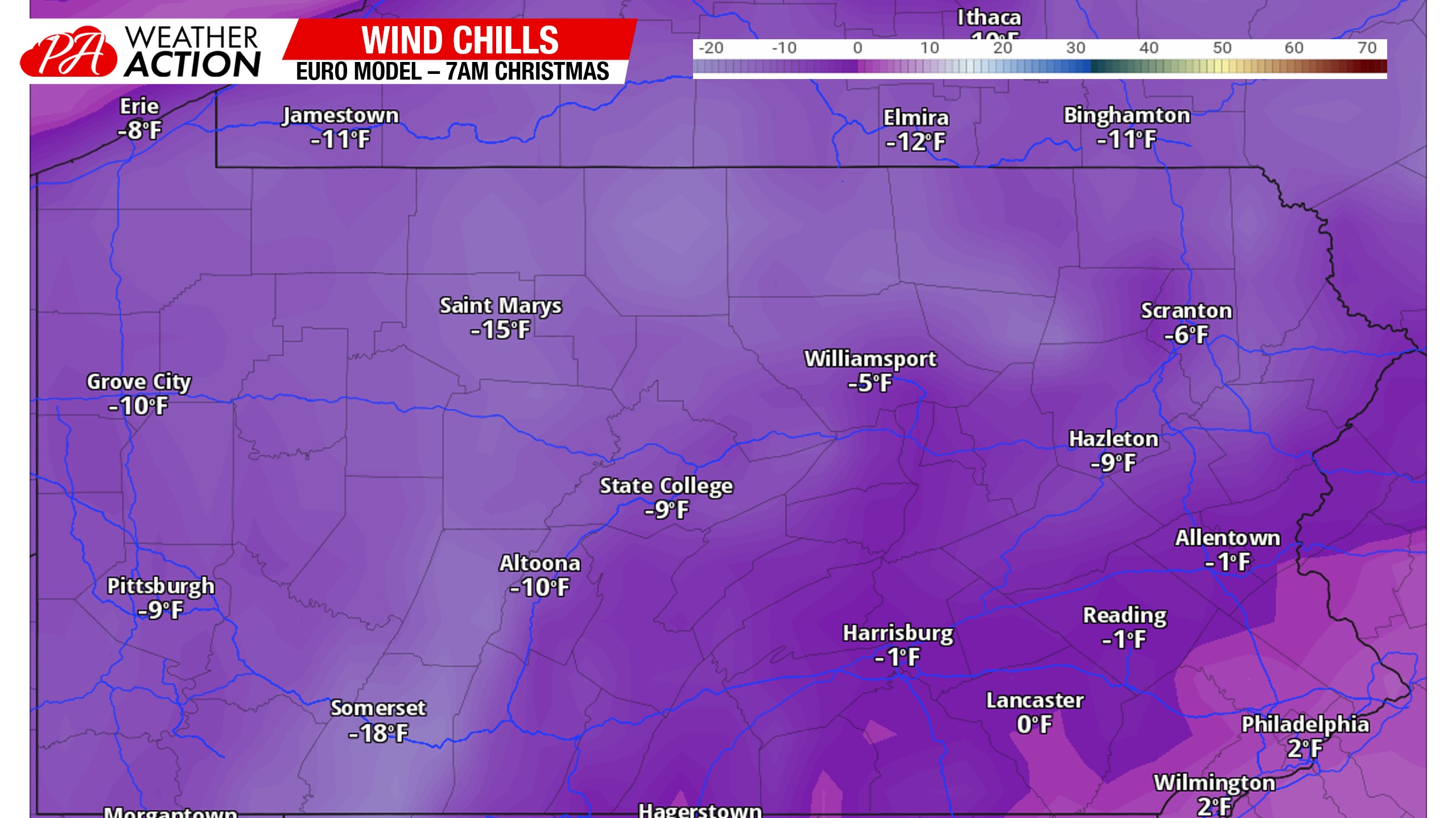
Christmas Eve & Christmas Day Wind Chills
In short, this will be a very comfortable time to be inside, perhaps by a fire with hot chocolate in hand, enjoying time with family. It’s going to feel below 0 in most areas not just in the mornings, but in some areas, all day on Christmas Eve and Christmas Day. Frostbite will even be a risk in the coldest areas like the Alleghenies. Here are wind chills for Christmas morning, and these aren’t even the coldest!
We will have model updates twice daily in our app, and you can find an elegant design with your local NWS forecast and all our handwritten updates there as well! Download it by tapping the banner below!

You must be logged in to post a comment.