
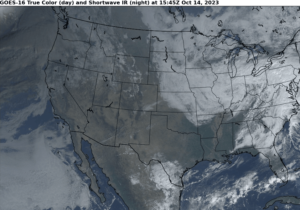
A complex system will deliver yet another wet weekend to our area. However, this time, there could be a tease of snow showers in the higher elevations of the Catskill Mountains…
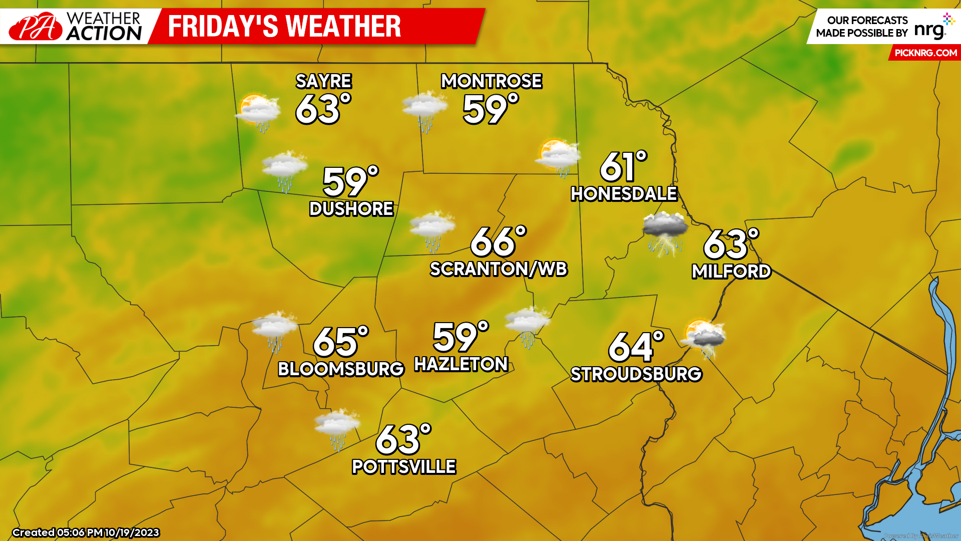
FRIDAY
A storm system approaching our area will draw showers and even some thunderstorms northward along and east of the Delaware River, possibly providing downpours to Monroe, Pike, and Wayne counties. There will be a lull in the precipitation during the late afternoon and evening. Another round of showers showers will move into the area from the west overnight Friday night.
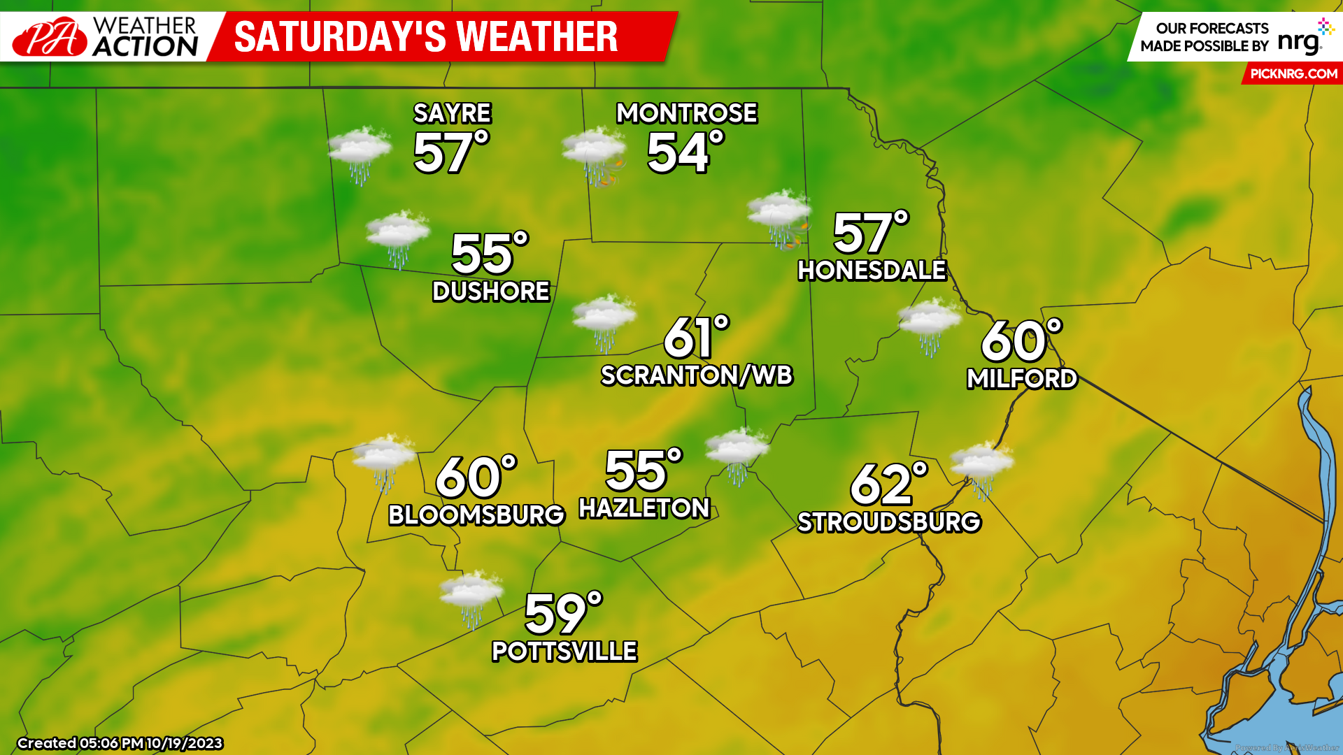
SATURDAY
Rain will continue through the morning hours as a surface low intensifies to our east and moves over Cape Cod late in the day. The morning rain will taper to scattered showers during the afternoon with gusty WNW wind.
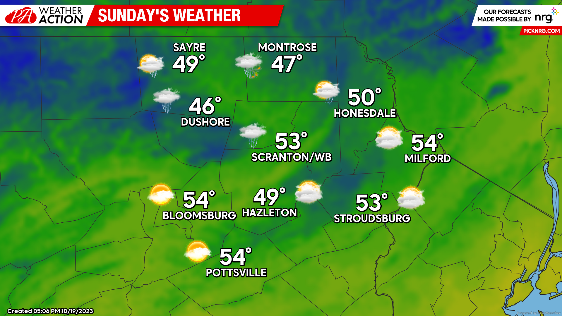
SUNDAY
As that surface low moves into eastern Maine, gusty NW wind will drive colder air into our region. The max temperatures shown on the map will occur pre-dawn, with temperatures steady or slowly falling throughout the day. The highest elevations could fall into the 30s by sunset! There could be a few scattered showers, but they should not be of much consequence. However, late Sunday and Sunday night there could be snow showers nearby in the Catskill Mountains!
After an unsettled weekend and that almost-wintry tease in the highest elevations late Sunday, high pressure will move into the region to provide a mostly dry week next week with temperatures near to above normal, making it perfect weather for some foliage gawking!
Finally, please enjoy a satellite loop of the annular eclipse that crossed the southern US on October 14th:

You must be logged in to post a comment.