
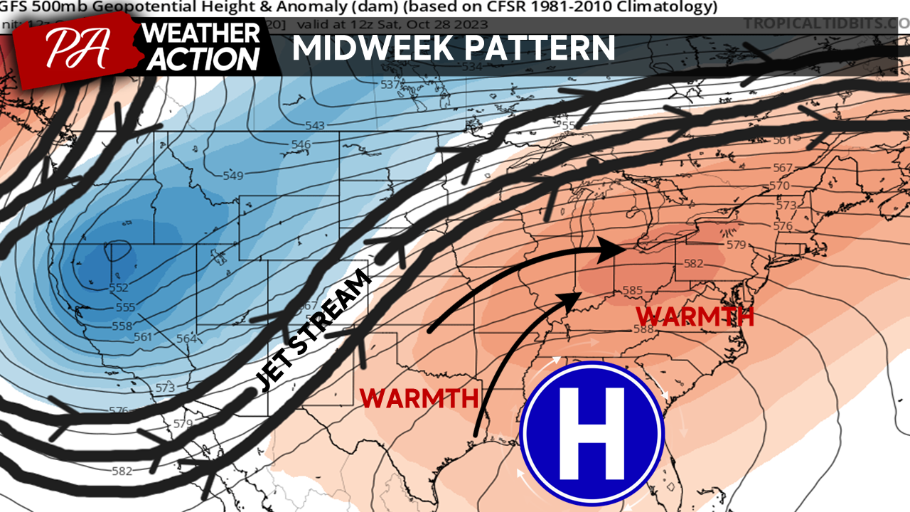
Good Afternoon Everyone! After a cool and unsettled weekend, a pattern change is coming for the region. A ridge of high pressure is expected to build into the region as we head mid-late week. This ridge will push our jet stream well to the north, allowing warm air from the South to surge in around our high pressure. Expect a dramatic increase in temperatures with highs more representative of late summer possible later this week. Highs may reach 10-20 degrees above average later this week, with an uptick in humidity.
Tuesday
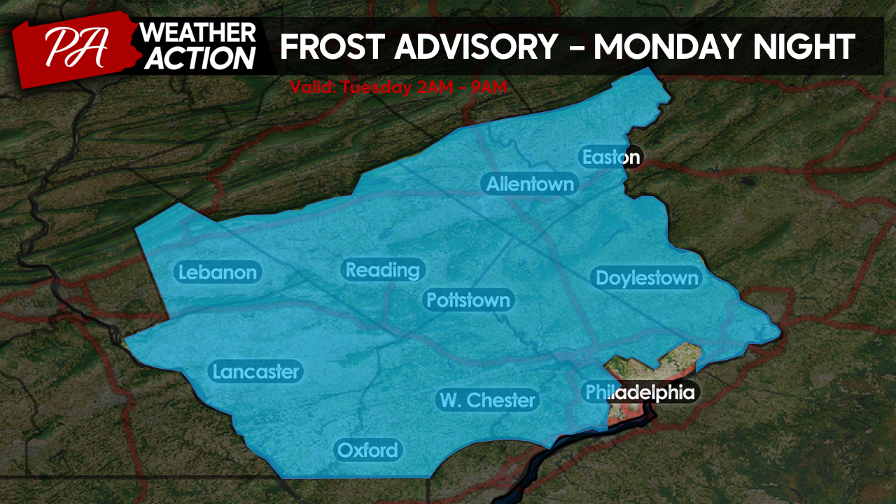
Ahead of our ridge development, calm winds, and clear skies overnight tonight will allow for quite a chilly start to Tuesday morning. Lows tonight will range generally in the mid-30s for suburban and rural areas. Philadelphia will see lows only dip into the low-40s due to the urban heat island. For this reason, the National Weather Service has issued frost advisories for all counties in our region except Philadelphia. If you have any frost-sensitive plants left outdoors, best to bring them inside this evening!
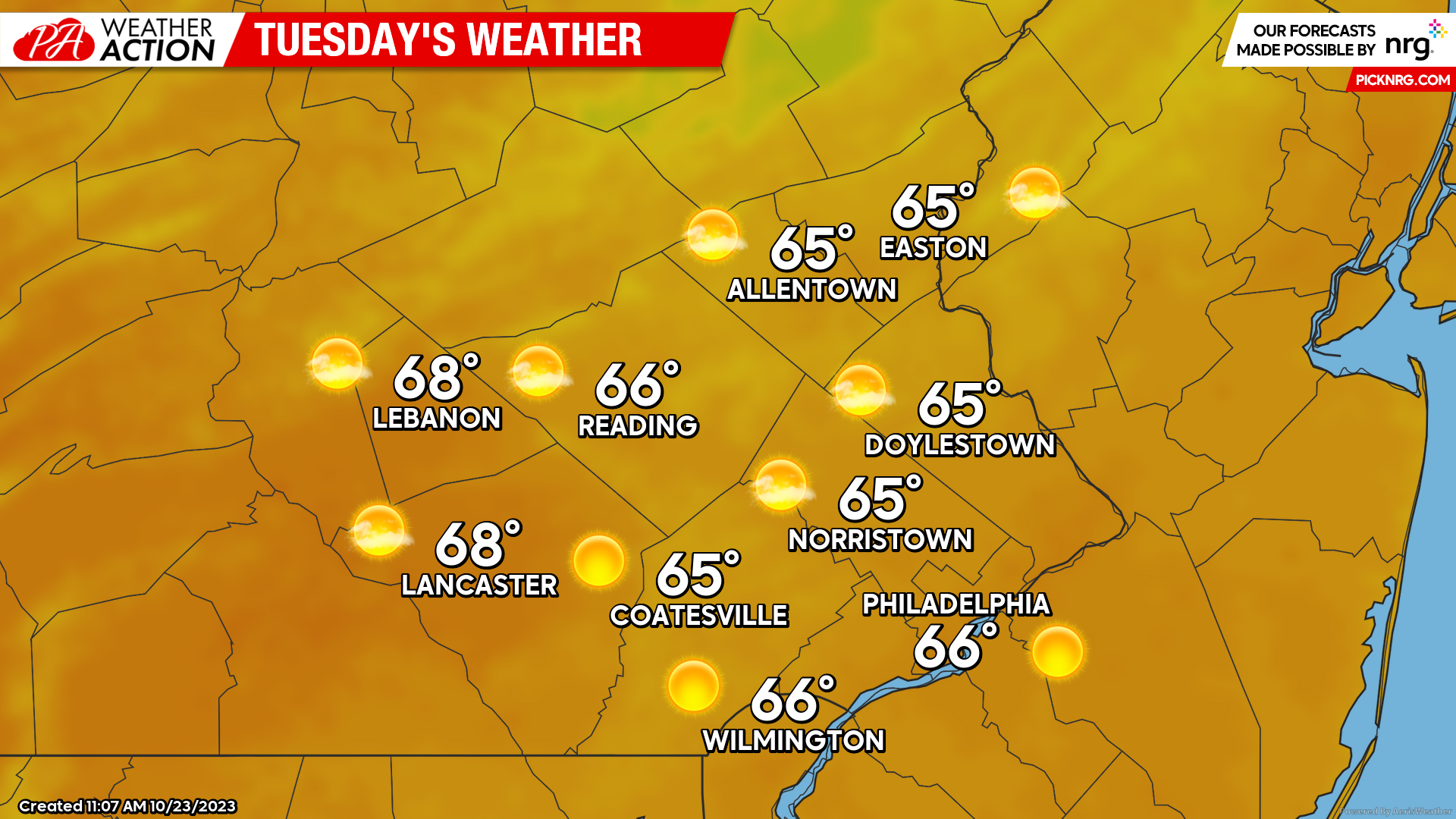
After a chilly morning, abundant sunshine will prevail throughout Tuesday, allowing temperatures to warm steadily throughout the day. Expect highs to top out in the mid-upper 60s Tuesday afternoon. Winds will be light, out of the S at 5-10mph. Overall, Tuesday is shaping up to be a beautiful late October day.
Wednesday
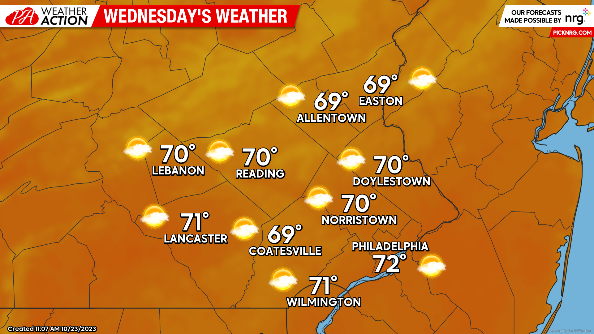
A warm front on the leading edge of our developing ridge will move through the region early Wednesday morning. Lows Wednesday morning will start in the low-upper 40s under partly cloudy skies. Behind the warm front, a mix of sun and clouds will settle over the region, lingering throughout the day. As the ridge builds into the region highs on Wednesday will top out 5-10 degrees above average. Expect high temperatures in the upper 60s to lower 70s Wednesday afternoon.
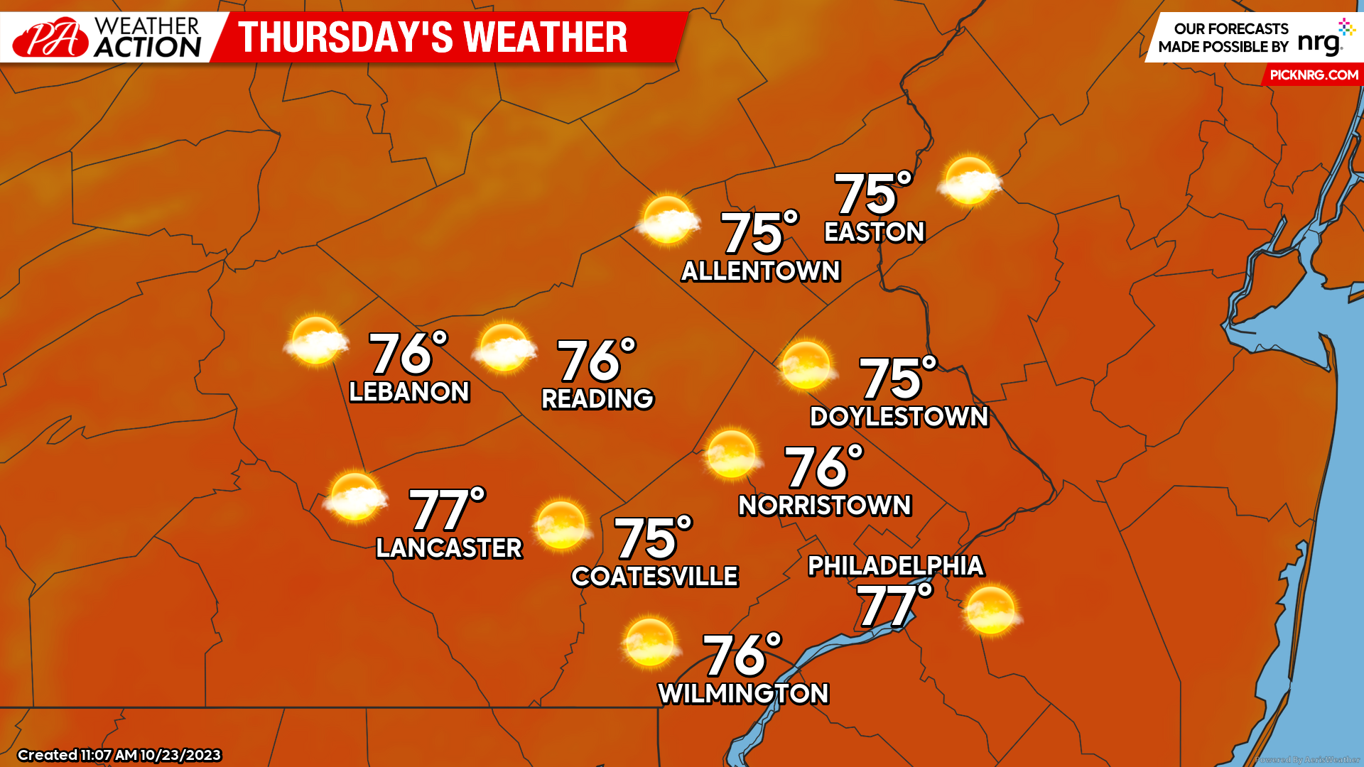
Thursday
Lows Thursday morning will start off relatively mild from the upper 40s to mid-50s. Our ridge will continue to build stronger into the day on Thursday allowing temperatures to warm 10-20 degrees above average. Expect highs Thursday afternoon to feel more like early September than late October with highs reaching the mid-70s for most. Mainly Sunny skies should continue to remain in place throughout the day with calm winds.
Beyond Thursday, expect warm weather to continue throughout the weekend. However, a slow-moving cold front will bring the chance for showers back into the picture Saturday and Sunday. While a few showers are possible, this weekend will be a marked improvement from previous weekends as rain should remain light and scattered in nature. Looking ahead to next week, another pattern change is expected with more precipitation chances and much cooler temperatures. Until then, I hope you all enjoy the sunshine and warmth this week, if that’s your thing! If you have any questions or comments regarding the forecast, feel free to let me know.
-Michael Woytowiez


You must be logged in to post a comment.