
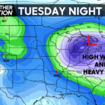
An intense storm system will push into the Lower Great Lakes on Tuesday, bringing heavy snow to places throughout the Midwest. For those in Pennsylvania looking for snow, unfortunately we will be on the warm, southeast side of the low pressure, which means heavy rain and strong winds. However, there will be a short period of heavy snow at the onset in the higher elevations of mainly Central PA.
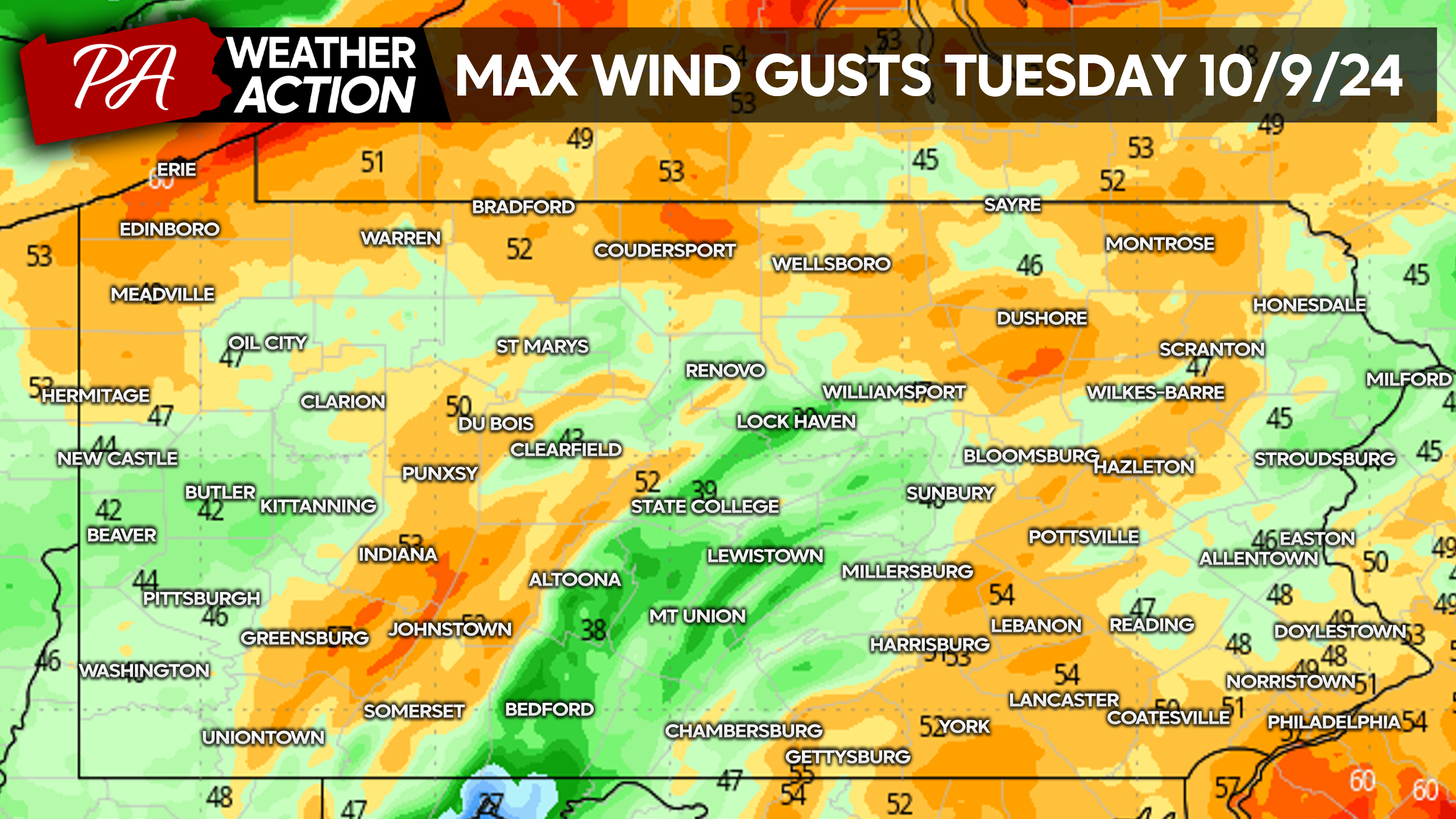
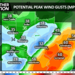
Winds accompanying this storm will be no joke, with widespread wind gusts of 45-55 MPH expected. Sustained winds will be more on the order of 20-30 MPH. View maximum expected wind gusts on Tuesday below.
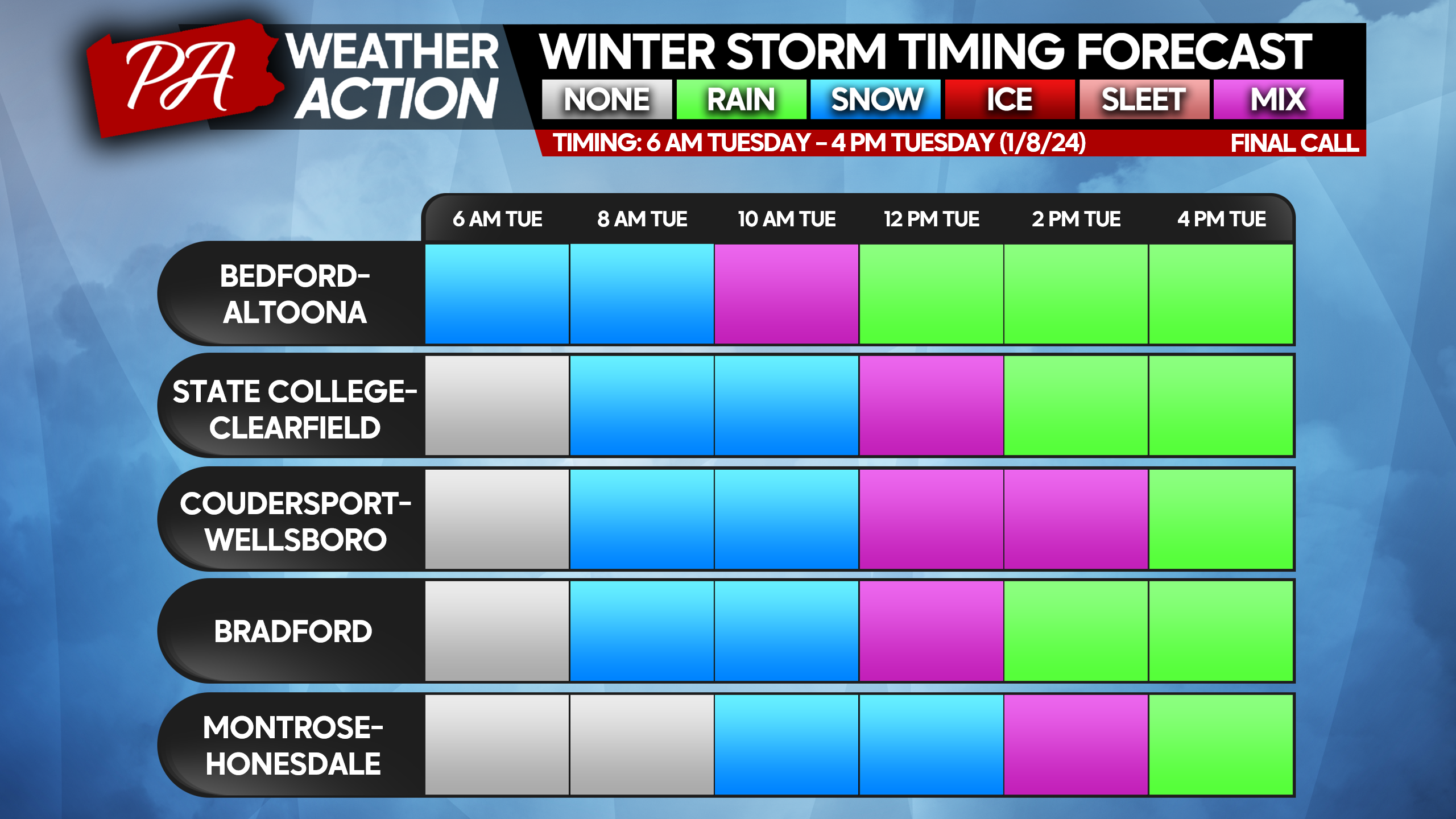
Snow is expected mainly Tuesday morning near the spine of the Appalachians, where most cold air damming is in place. The select few towns on the graphic below are the only larger towns expected to receive snowfall Tuesday. We have an app with localized timing for everywhere in the state if you’d like to check that out. Tap here for the PWA App!
FINAL CALL SNOWFALL FORECAST FOR TUESDAY 1/9/24
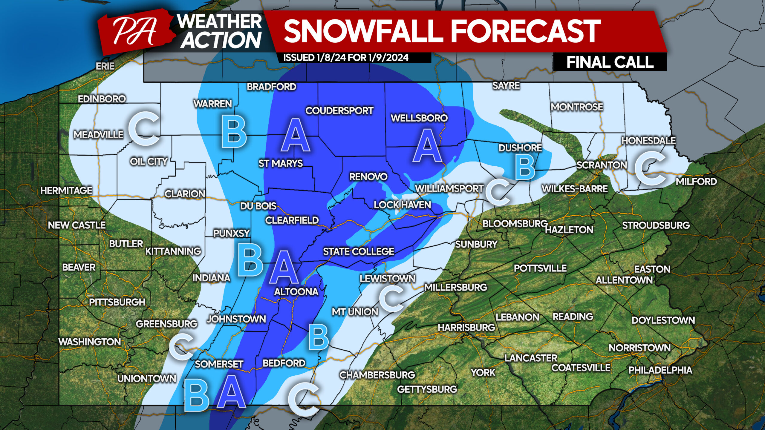
Area A: Snowfall accumulation of 2 – 4″ expected, with highest accumulations above 2000′ elevation. Slushy roads expected during snowfall.
Area B: Snowfall accumulation of 1 – 2″ expected. Slushy roads possible during snowfall.
Area C: Snowfall accumulation of a coating to 1″ expected.
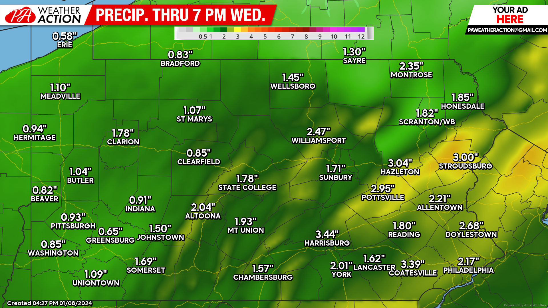
RAINFALL FORECAST THROUGH WEDNESDAY 1/11/24
Scattered power outages are possible especially in higher elevations as a result of the wind. Watch for downed powerlines when driving.
Share this info with friends and family below!
You must be logged in to post a comment.