
Severe thunderstorms are likely Wednesday in much of the state ahead of a cold front that will bring all this warmth to an end. Damaging winds up to 70mph and isolated tornadoes are the main concern.
While models vary widely on timing, these sort of events usually follow a similar progression with Western PA seeing activity around lunchtime, Central PA in the afternoon, and Eastern PA by evening.
This is shown by the RFRS model, which has a line of strong storms in Northwest PA by noon Wednesday. Meanwhile in Southwest PA, some cells may fire up ahead of the line.
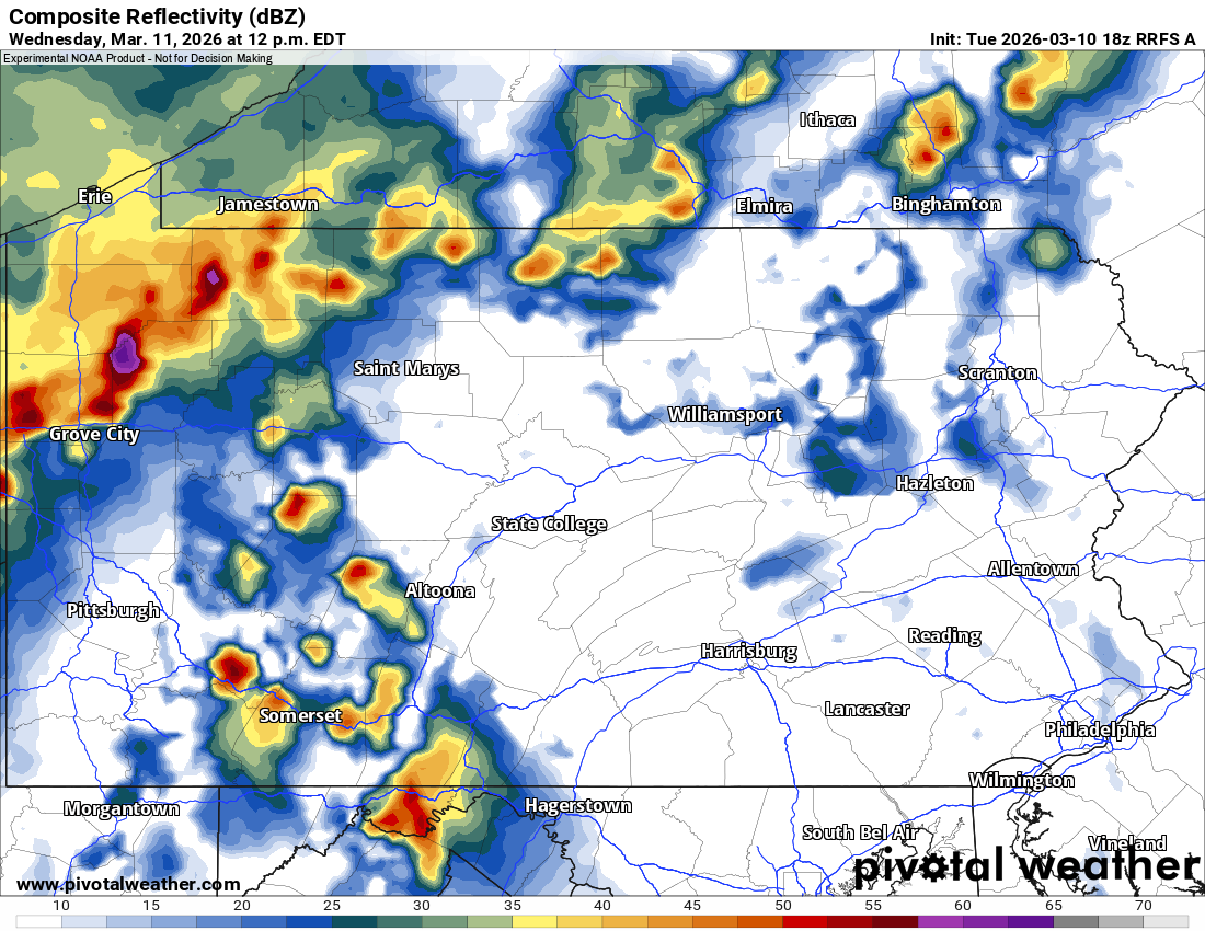
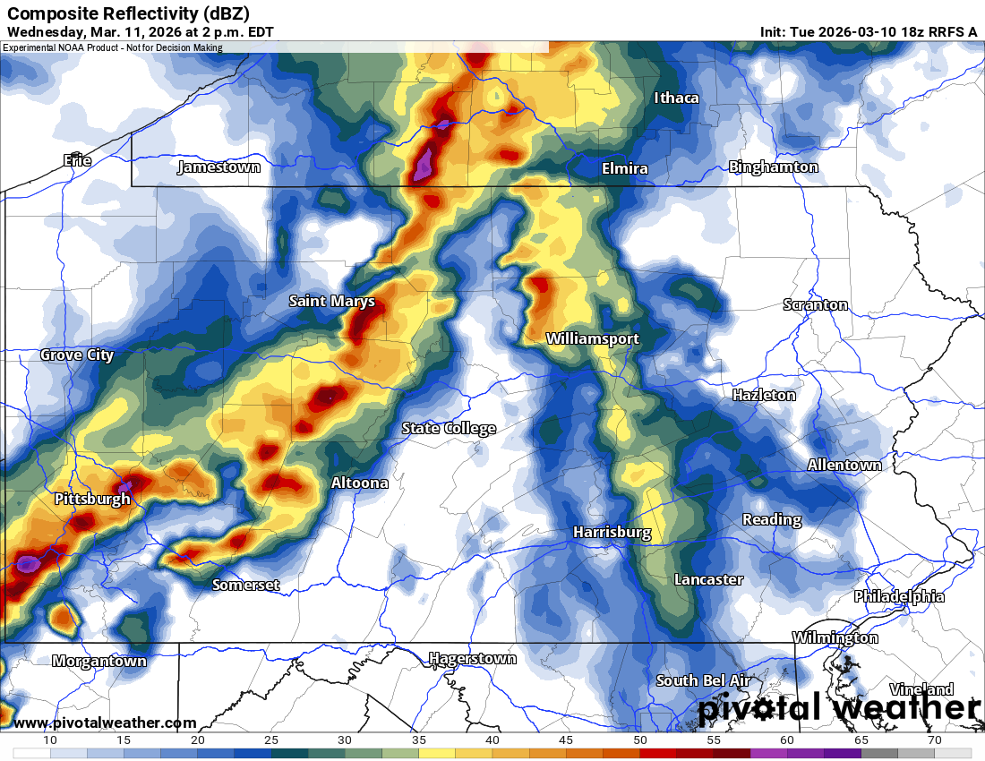
Severe weather is modeled to move into Southwest PA and the Allegheny Highlands around 2 PM Wednesday. This is when the highest tornado risk will be active across Western PA, which the SPC currently lists at 5%. Below is the RFRS model for 2:00 PM Wednesday.
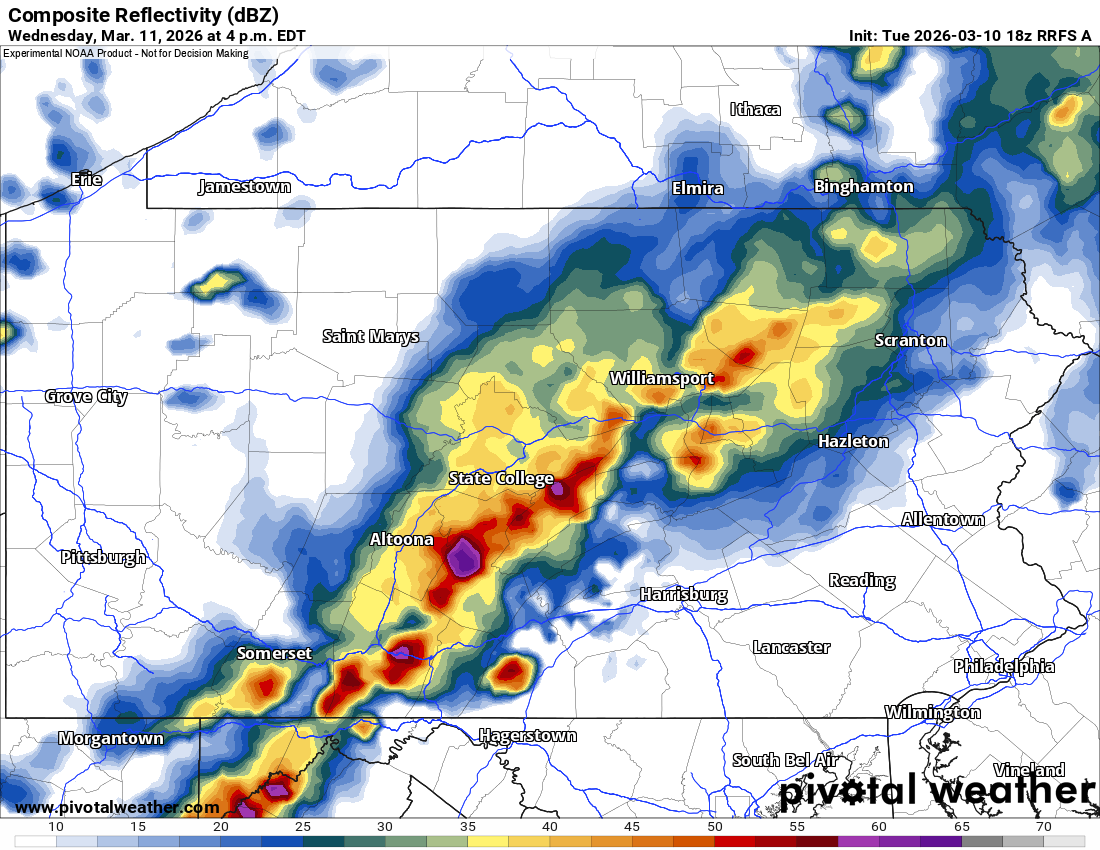
South Central PA will be next in line for the most intense part of the line of thunderstorms as it pushes east. Frequent lightning, damaging winds, small hail, and an isolated tornado are all possibilities. Here’s the RFRS for 4:00 PM Wednesday.
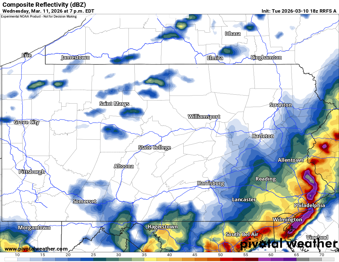
Eastern PA is where models disagree most on. The RFRS is very aggressive with a severe line of storms crashing into the area by dinnertime, almost certainly bringing scattered damaging winds in this outcome.
Other models have timing being later and as a result, the storms are weaker. Severe weather is always more of a nowcast situation than winter weather. Here is the RFRS for 6:00 PM Wednesday.
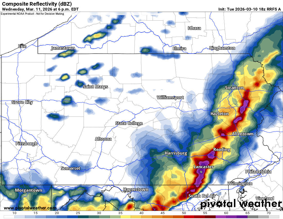
It then carries that line right into Southeast PA around sunset as many people will likely be outside. Safe to say, keep close tabs on the radar tomorrow!
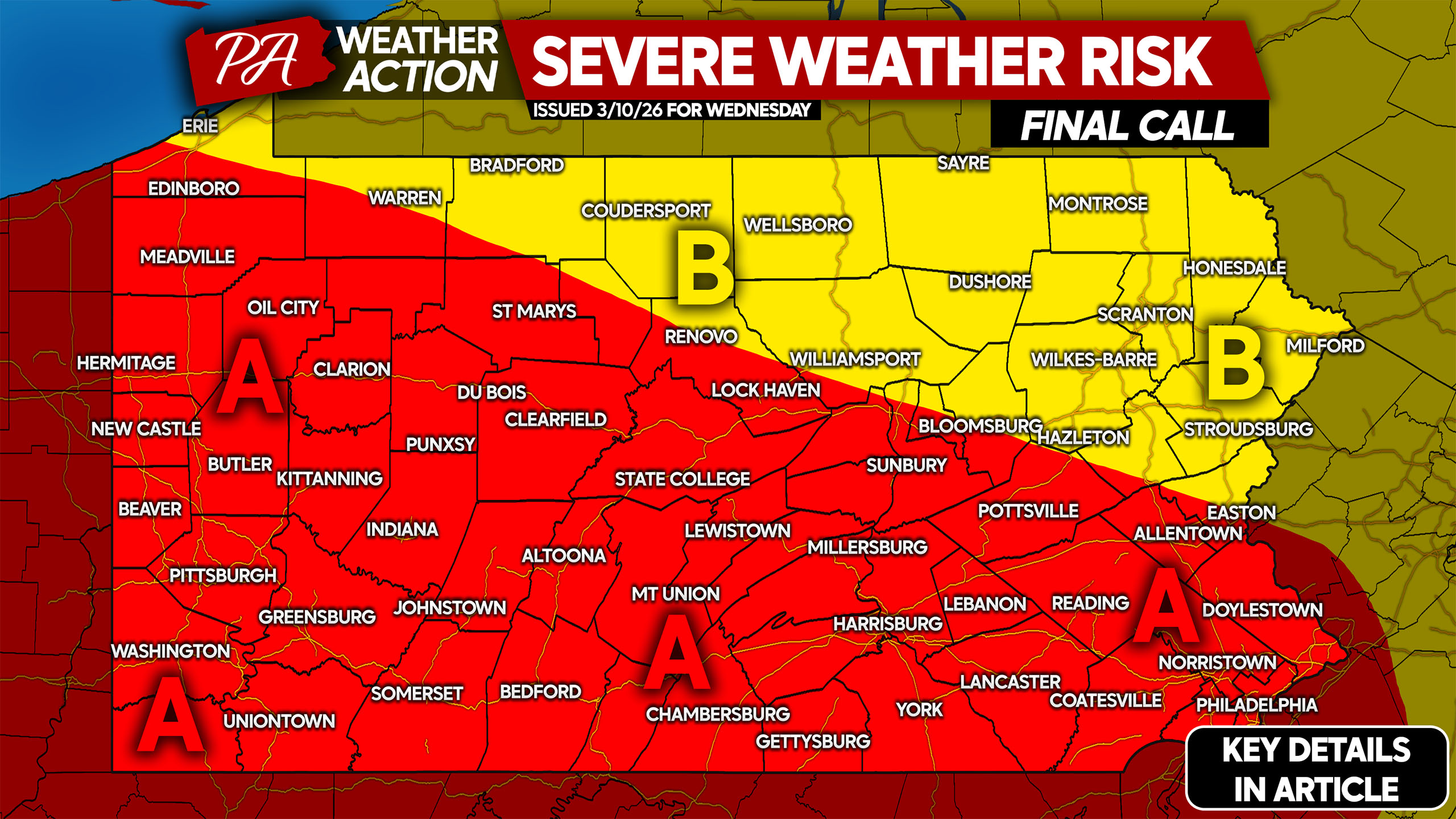
FINAL CALL SEVERE THUNDERSTORM RISK MAP FOR WEDNESDAY
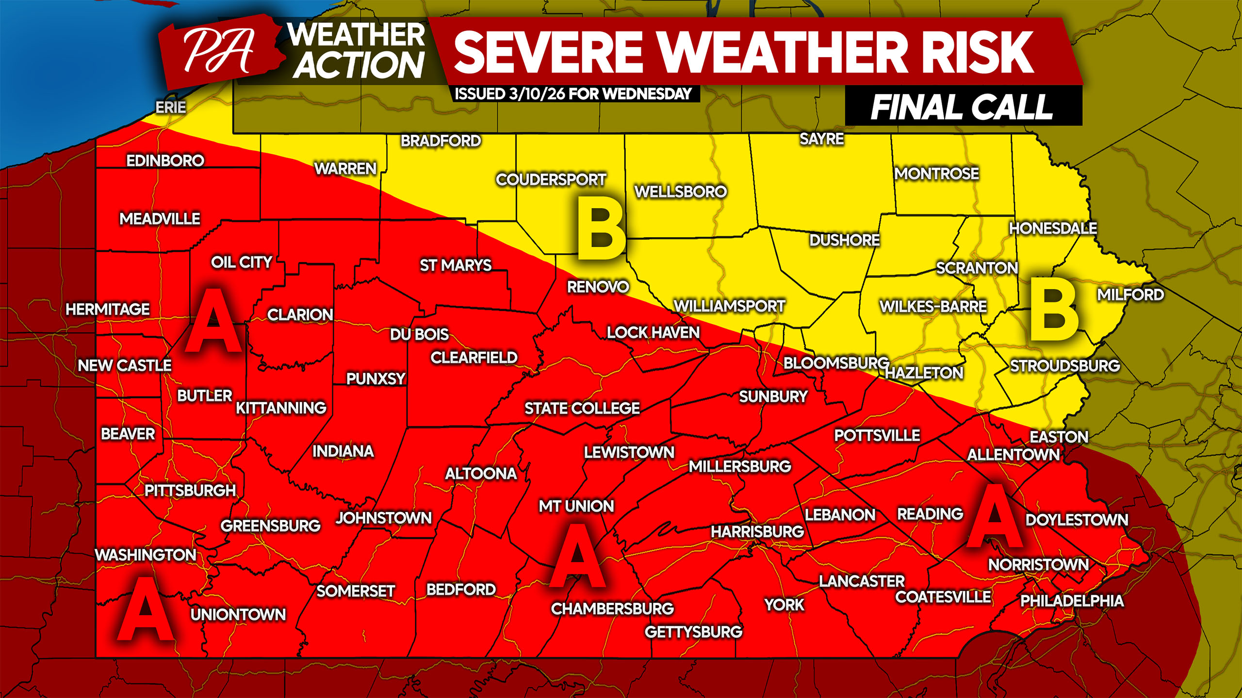
Area A: Scattered severe thunderstorms are expected Wednesday. Please check above for timing. Damaging winds up to 70mph and isolated tornadoes are main risks. Isolated hail likely in the strongest storms.
Area B: Isolated strong to severe thunderstorms expected, refer to future radar for timing. Damaging winds up to 60mph are the main hazard, with a very isolated tornado possible but highly unlikely at any given location.
Be sure to share this forecast with family and friends who may have plans Wednesday, as it’ll be one last day of warmth!
You must be logged in to post a comment.