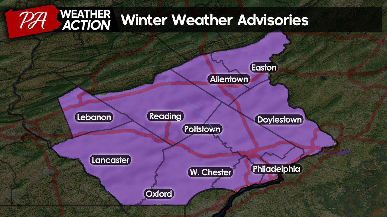
Good Morning Everyone! It is a chilly start to the week, with temperatures in the upper-10s – mid-20s this morning! With the cold air in place, we are tracking a light snow event set to move through the region tonight into tomorrow morning. The National Weather Service has issued Winter Weather Advisories for the entire region until tomorrow afternoon.
 Behind our snowfall, a reinforcing shot of arctic air will infiltrate, keeping temperatures below average through the remainder of the week! Continue reading for details, including snow totals!
Monday
Cloud cover will continue to increase throughout the late morning and into the early afternoon hours. Temperatures will rise into the upper 20s – near 30s by the early afternoon. Winds will be very light today, which is a welcomed relief after all the wind we have received from last week’s storms and over the weekend!
Flurries and light snow showers will move into the southern portion of our region by the mid-afternoon but will be mostly inconsequential at first.
By this evening, steady light-moderate snowfall will spread across the entire region. I expect steady snowfall to begin around 7 pm in southern areas, pushing north from there. By 10 pm, snowfall will be underway across the entire region. Temperatures will hold steady in the mid-upper 20s, meaning snow will accumulate on all surfaces, including roadways, from the onset.
Tuesday
Snowfall rates will increase as we head later into the overnight hours. I expect moderate snowfall to continue into early Tuesday morning.
At this time, temperatures aloft will warm slightly with the passage of our low-pressure system. However, temperatures at the surface will likely remain below freezing. This will cause a period of light icing between 4 am and 6 am across the i-95 corridor, including the Philly metro. This will likely cause slick spots on roadways just ahead of the morning rush hour! Elsewhere, the precipitation should remain as a light snowfall.
After sunrise, snowfall will taper off throughout the remainder of the morning hours. Expect scattered snow and mixed showers to continue into the late morning hours. All locations should be in the clear by noontime.
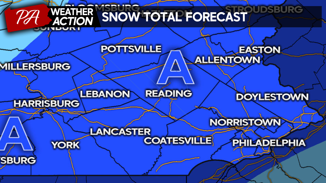
Zone A: 2 – 4″ SNOW, Glaze of Ice – As mentioned, this is not a major winter storm but rather a prolonged light-moderate snowfall. Although snow totals will not be significant, it will be just enough to excite the kids and create headaches for commuters on Tuesday morning. Please use caution if you plan on traveling tonight through tomorrow morning.
Behind our snowfall, temperatures will once again drop, and winds will increase, setting up for a brutal mid-week cold snap. 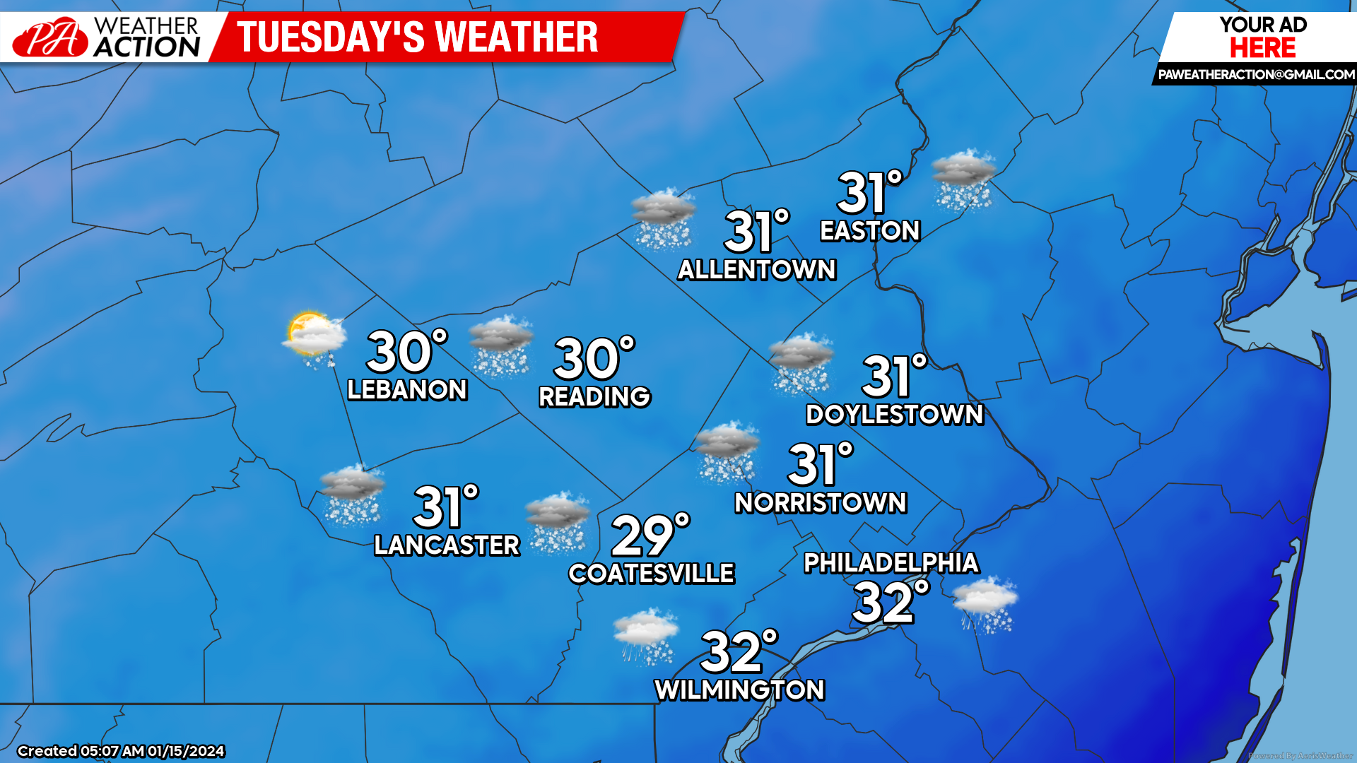
Highs in the upper 20s – low 30s will occur Tuesday morning as preciptation is ending across the region. As we head into the afternoon, temperatures will fall through the 20s and into the 10s after sunset. Expect lingering cloud cover to give way to mostly clear skies by the evening. Winds will increase out of the NW at 10-20mph with gusts to 25mph as our low-pressure exits. Expect wind chills in the 10s and 0s Tuesday afternoon.
Wednesday
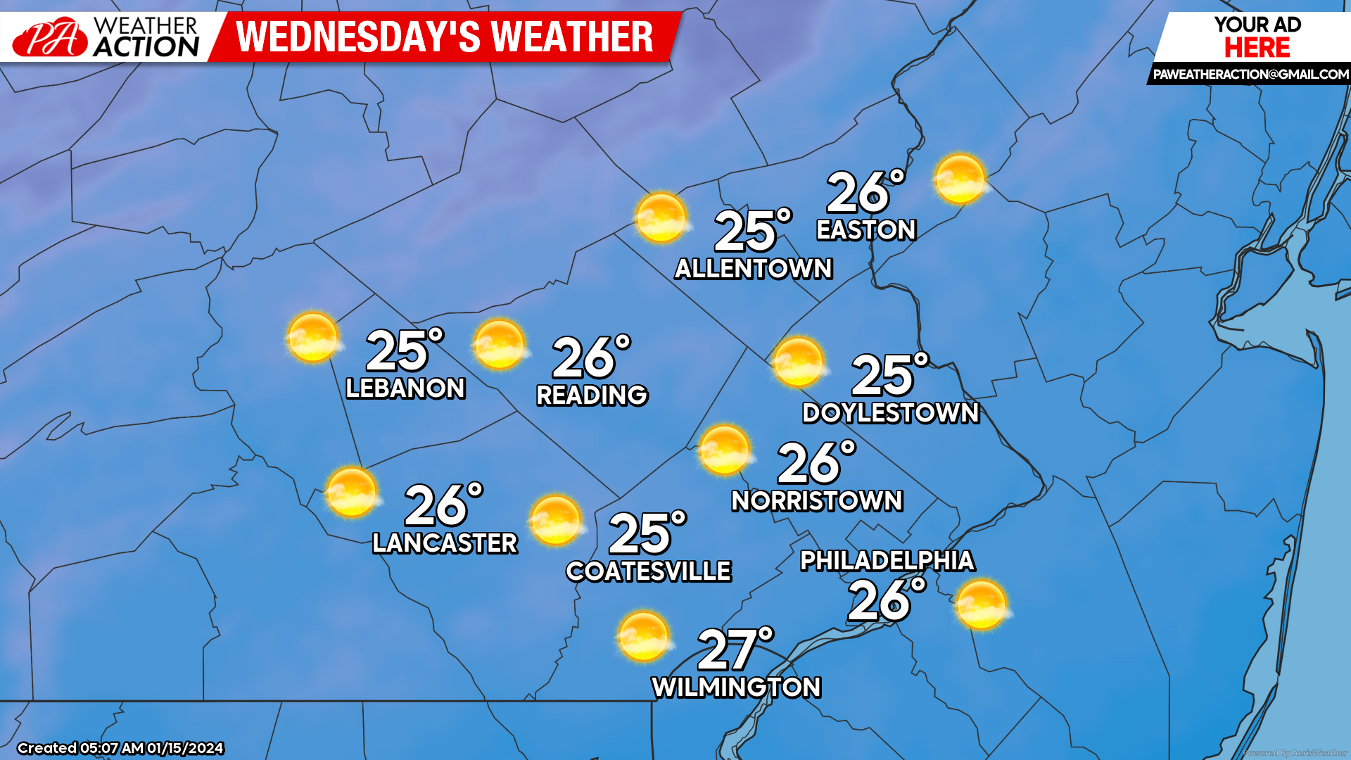
A brutally cold day is on the way for Wednesday. Morning lows will start in the upper 0s to mid-10s. Winds Wednesday morning will make these temperatures feel even colder, with feels-like temperatures ranging from -5F to 5F across the region. Temperatures will warm somewhat as we head into the afternoon under mostly sunny skies, with high temperatures reaching the mid-20s region-wide by the afternoon. However, west winds at 10-15mph will keep temperatures feeling like the single digits and low teens throughout the day!
Thursday
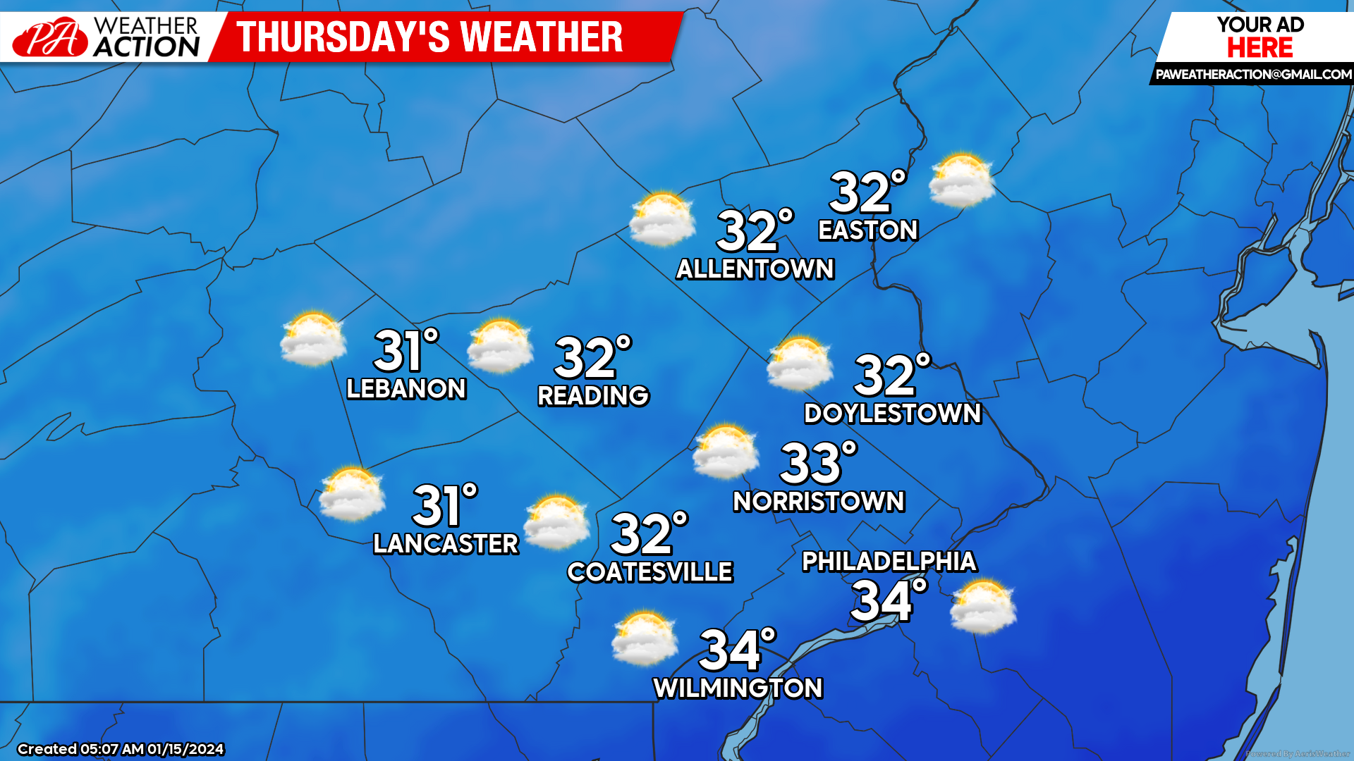
Expect partly cloudy skies to begin your Thursday, with temperatures starting in the upper-10s and low-20s. Cloud cover will increase throughout the day on Thursday, and temperatures will be slightly warmer than Wednesday. Expect highs in the low 30s. Winds out of the SW at 5-10mph will keep feels-like temperatures in the 20s throughout the day. Expect overcast skies to move in by the evening.
Looking Ahead: Another system will push into the region by Friday. As of now, this looks like another modest snowfall event with the cold air in place! This week will feel brutal, especially since we have had such a mild winter thus far. However, next week, the pattern looks to shift to a much milder regime. Have a great day, everyone!
-Michael Woytowiez

You must be logged in to post a comment.