
Good morning! I hope everyone had a chance to enjoy the drier and warmer conditions over the last few days because major changes are coming this afternoon and evening as a strong cold front begins to approach the region from the west, allowing to spark up some showers and thunderstorms. However, the front has slowed down compared to yesterday’s forecast, which may allow temperatures to climb a little bit higher than once expected.
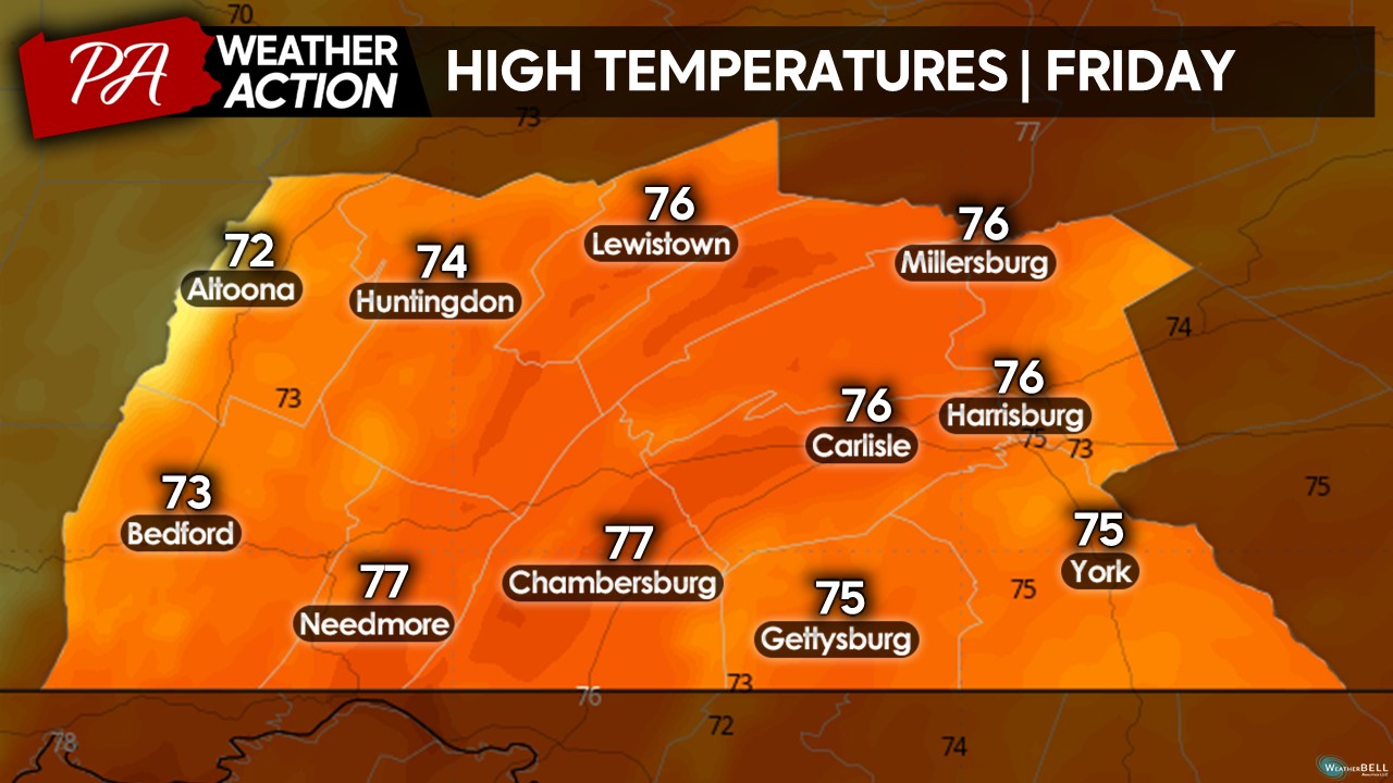
TODAY’S HIGH TEMPERATURES:
Due to a slightly slower forward motion of the cold front, a warm southerly wind will allow temperatures to rise into the mid-70s for many locations despite a thicker cloud cover. Today will be the last day where we will see widespread warmth for potentially quite a while so make sure to soak it in as much as possible! However, with the approaching cold front, there will be the threat for afternoon showers and thunderstorms.
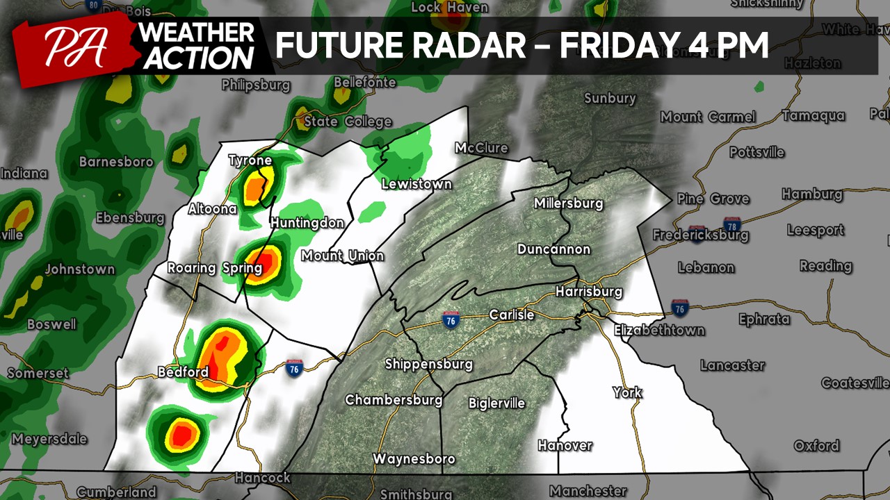
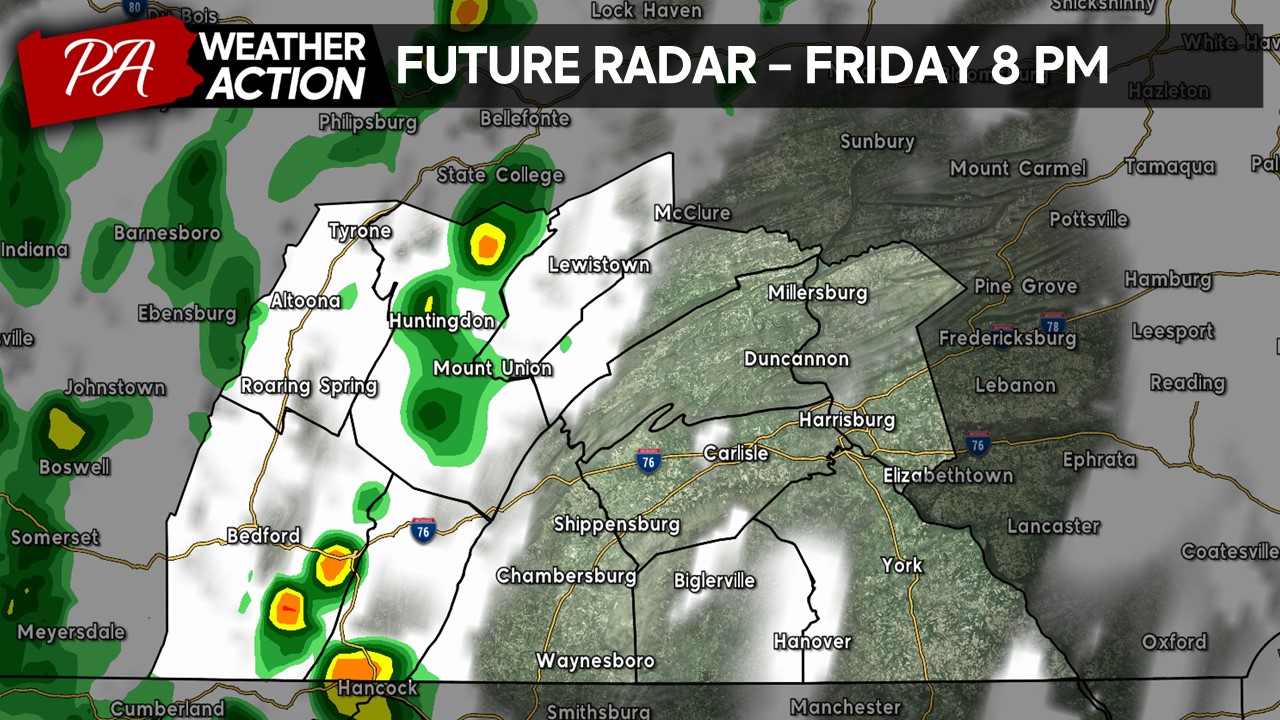
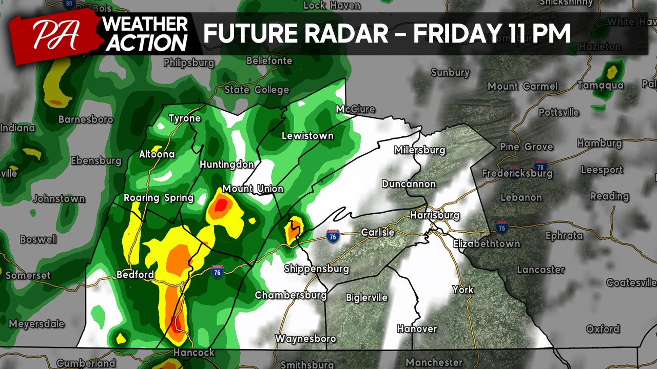
FUTURE RADAR:
Staring off during the mid-afternoon hours, a showers and thunderstorms will fire along the I-99 and along the lower Susquehanna River Valley. Keep in mind, *not everyone* will see precipitation today due to the very scattered natures of these cells. Additionally, severe weather is not anticipated, however, a few stronger isolated cells may produce gusty winds, some lightning, and torrential downpours. 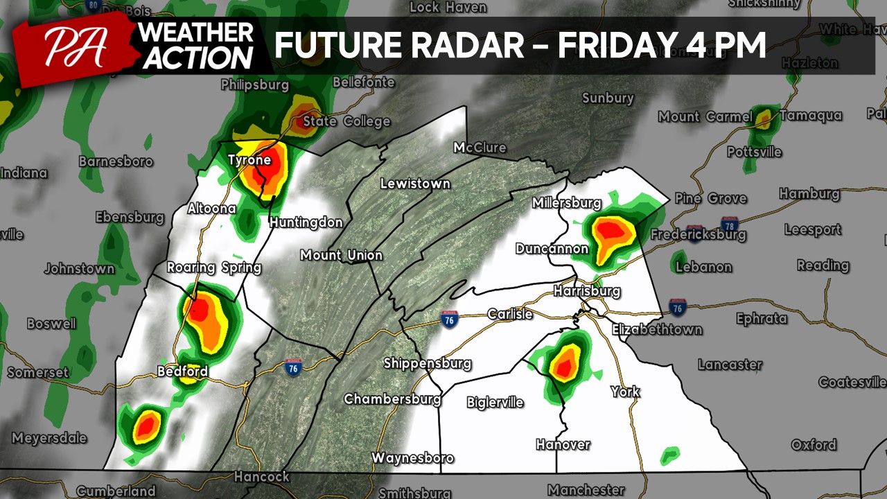
As we head into the evening hours, scattered showers and thunderstorms will continue to fire across the region, primarily the western portions of the region. If you are heading to see a high school football game this evening for Friday Night Lights, make sure to have your rain gear and umbrella handy!

Into the early overnight hours, showers and thunderstorms will continue to push through the area, primarily staying in the western counties.
Heading closer to midnight, we will still see a wide array of showers and isolated thunderstorms, although becoming more widespread across the western areas. If you are planning to be out late this evening, do not forget the rain gear! These showers and isolated thunderstorms will push east into the Harrisburg area later into the overnight hours.
QUICK SUMMARY:
Try to soak in the warmth as much as you can today before the cold front moves through as high temperatures will drop into the 50s & 60s with cold, gusty winds for the rest of the weekend. If you are planning to be outdoors, especially after 3-4PM, make sure to have your rain gear and umbrella at hand. However, **NOT EVERYONE** will see precipitation today since the rain showers and thunderstorms will remain scattered in nature. Severe weather is also not anticipated. Have a great Friday and feel free to reach out with any questions or concerns.
For more updates, make sure to download the PA Weather Action app on your phones!
Denys

You must be logged in to post a comment.