A major cooldown is expected this weekend as a cold front passes over the region Friday and early Saturday morning. Breezy conditions, along with some of the coldest air of the season, serve as a friendly reminder that fall is truly here as we enter the first full weekend of October.
Saturday
Slight chances for rain will linger throughout the region, primarily in the early morning hours. For most areas, temperatures will range between the mid to high 50s. Overnight lows will be in 40s. Some areas may experience wind gusts between 20-30 mph. Factoring in the windy conditions and cooler temperatures some areas could experience windchill values in the mid to upper 30s.

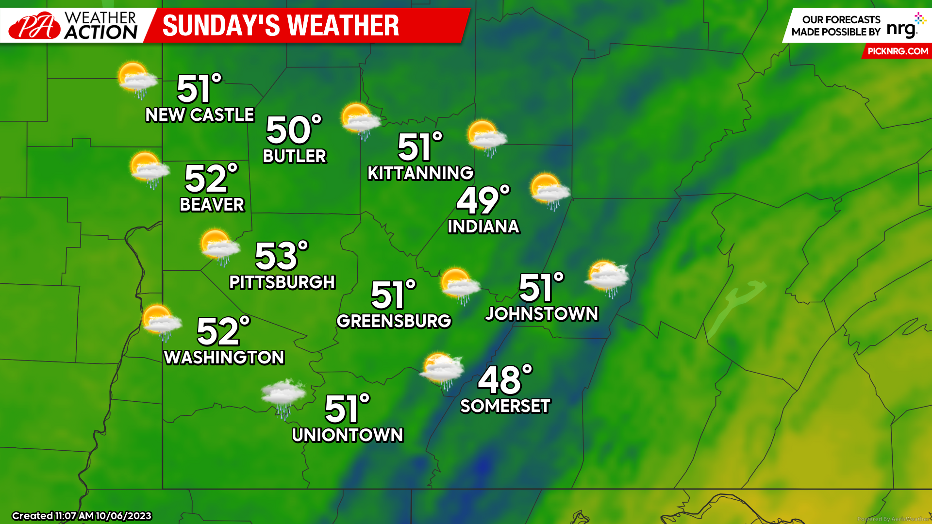
Sunday
Much cooler temperatures are expected throughout the region on Sunday. A slight chance for scattered showers cannot be ruled out. High temperatures will struggle to reach the mid 50s, and overnight lows will be in the 40s.

Monday
Similar conditions and temperatures will continue for the start next week. Temperatures will remain on the cooler side with a slight chance of rain throughout the day. High temperatures will be in the mid 50s with lows in in the 40s.
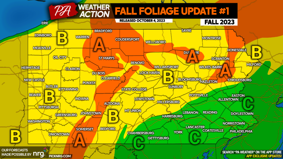
Be sure you continue to follow PA Weather Action to stay informed on the changing weather and statewide foliage conditions as we welcome the fall season.