
Mother nature will be bringing a one-two punch to the state over the course of the next couple of days. The first punch will arrive Wednesday night and continue through Thursday morning. Precipitation will be in the form of sleet, freezing rain, and plain rainfall. The second punch will arrive late Thursday night into Friday morning in the form of snow and rain.
Precipitation with the first system will arrive from the south after 7:00 PM Wednesday night. The precipitation will start off as a sleet and freezing rain mix for most locations, with the exception of southeast and southwest Pennsylvania. Below is a look at 8:00 PM Wednesday night: 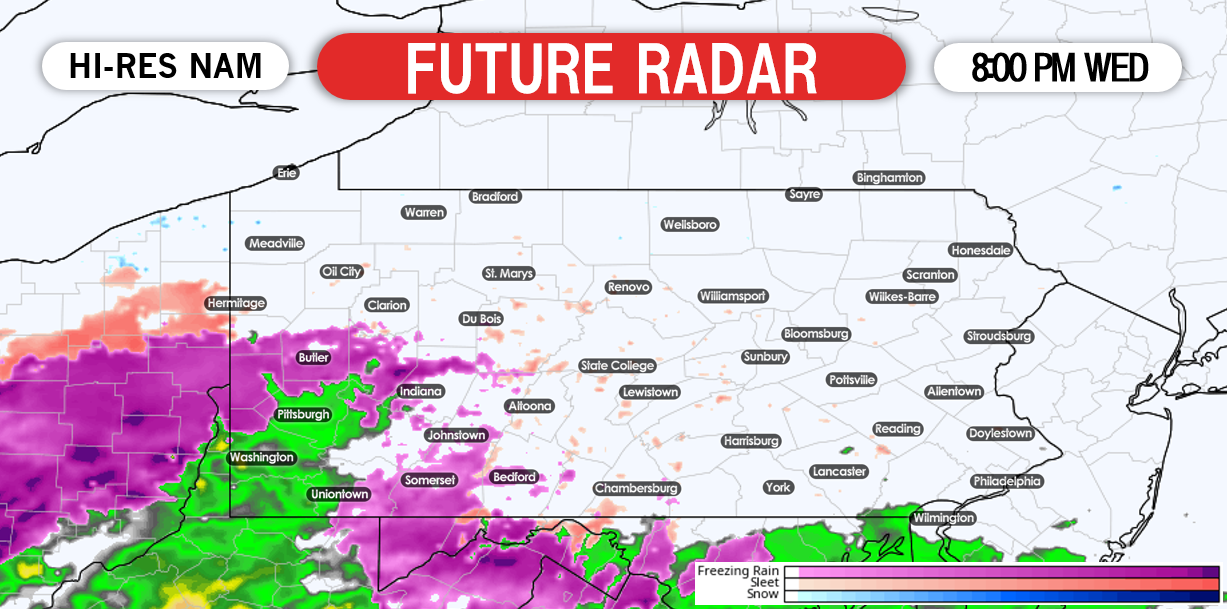

The sleet and freezing rain will linger across the higher elevations in central and northern Pennsylvania the longest going into the early parts of Thursday morning. For the rest of us, a change to plain rain is expected to last through the rest of the morning hours Thursday. Below is a look at 2:00 AM Thursday Morning: 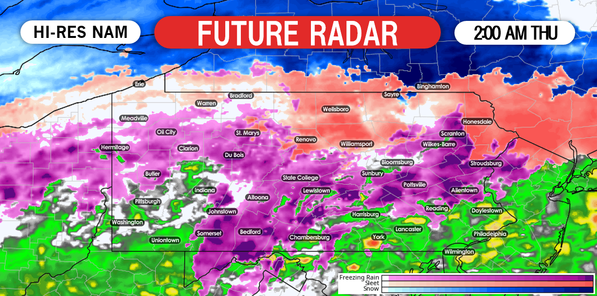
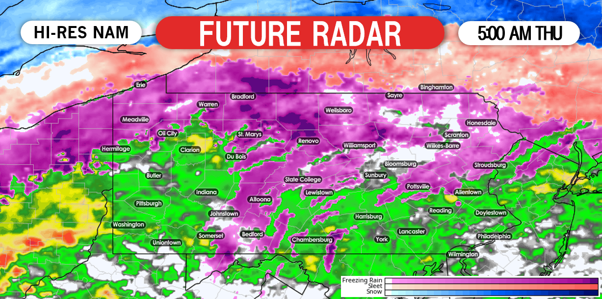
As we progress later into the morning hours Thursday, most areas will change to plain rainfall. It is possible that the rain falls heavy at times. Below is a look at 8:00 AM Thursday: 
The precipitation will clear out of the region by lunchtime. There will be a lull period that will last all the way until late Thursday night. Then round two will begin in the form of snow and rain.
It is likely central and western Pennsylvania experience a period of snow late Thursday night into Friday morning, while eastern Pennsylvania receives mainly rain from the second round. Travel impacts will once again be likely heading to work and school Friday morning.
Below is a look at 7:00 AM Friday Morning: 
Going forward, the pattern looks to remain active. This does not necessarily mean snow, but plenty of storm chances to track over the next couple of weeks. The next storm system will arrive late Saturday night into Sunday morning. That system looks to be in the form of ALL SNOW believe it or not. However, the track of the system will determine whether our area sees anything in the way of accumulations.
FREEZING RAIN FORECAST MAP
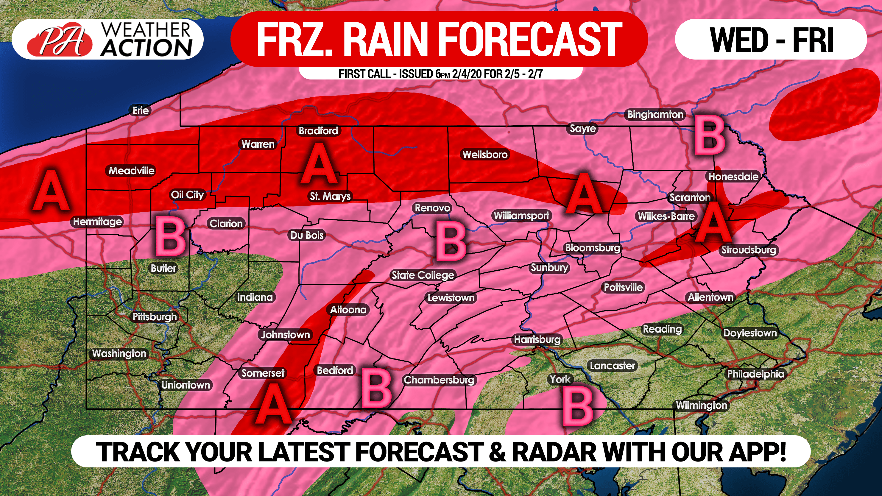
Area A: Ice accretion of .10 – .20″ expected, likely causing slick travel Wednesday Night into Thursday Morning.
Area B: Ice accretion of .01 – .10″ anticipated. Due to warm surface temperatures, locations south of State College and Pottsville are only likely to see slick bridges and overpasses, whereas north of those locations are more likely to see ice on all surfaces.
SNOWFALL FORECAST MAP
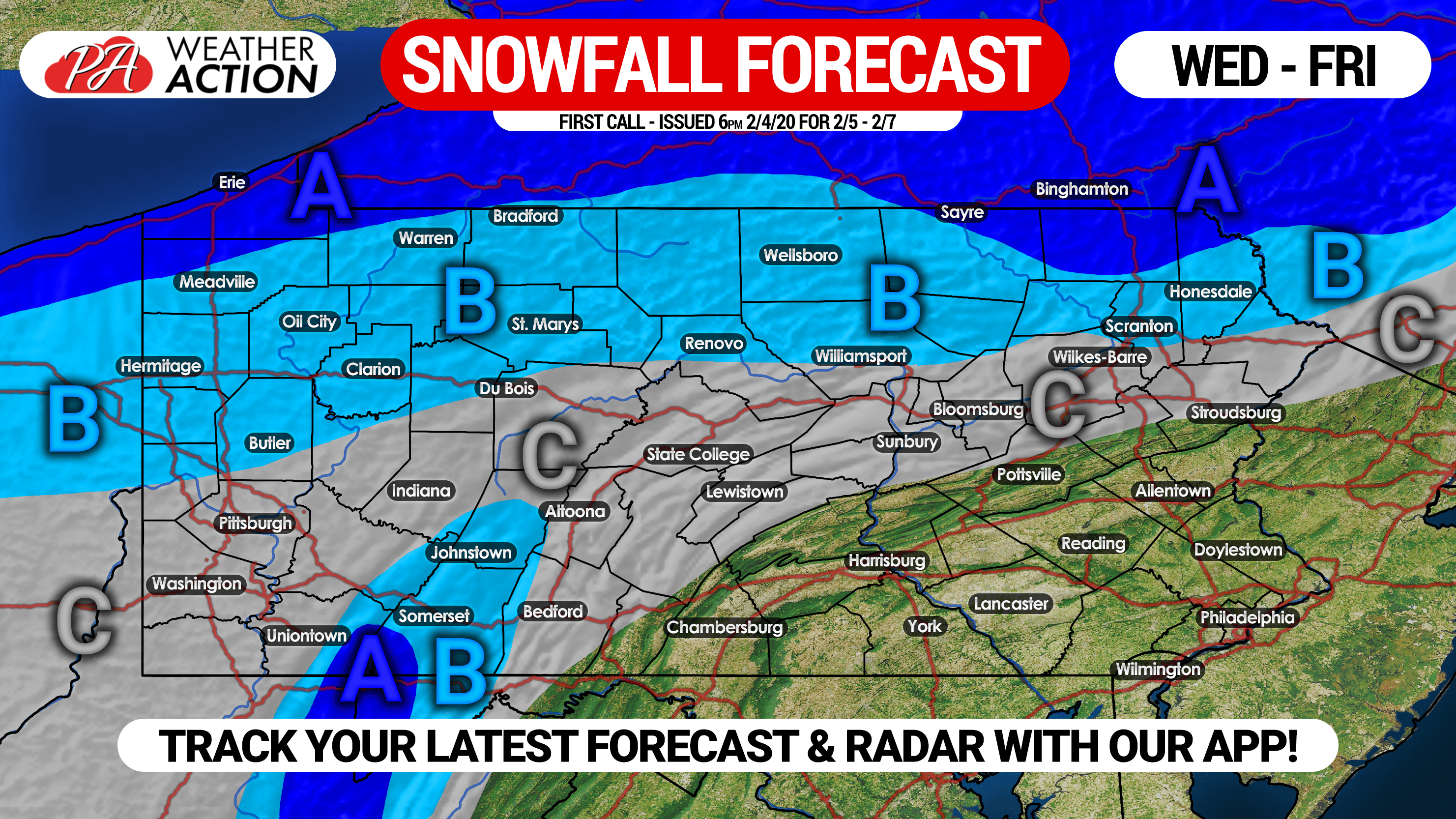
Area A: Snow accumulation of 3 – 5″ expected, mainly during Friday AM.
Area B: Snow accumulation of 1 – 3″ anticipated Friday AM.
Area C: A coating to 1″ of snow possible Friday AM. There is the potential for a little more if precipitation sticks around longer after the cold air turns rain to snow.
Don’t forget to share this icy forecast with your friends and family using the button below! Stay tuned for our final call forecast for this storm, plus our snowfall forecast for the weekend which will be coming in a few days if model guidance holds.
Stay ahead of the wintry weather by downloading our free app! It features detailed hourly and daily forecasts, interactive radar, weather alerts, and more! Tap its icon below to download!
![]()
You must be logged in to post a comment.