
A major severe weather outbreak is ongoing this Wednesday evening across the Mississippi River Valley into parts of the Midwest. Unfortunately an extremely conducive environment for tornadoes combined with discreet supercells has resulted in many violent tornadoes.
Storms will move east on Thursday, and fortunately we will have nowhere near the extent of the dynamics in PA that are in place currently to our west. Still, some strong to severe thunderstorms are possible.
Damaging winds, hail, and an isolated tornado will be possible in parts of Pennsylvania on Thursday.
THUNDERSTORM TIMING IN PA
Some thunderstorm activity is expected to develop late Thursday afternoon south of I-80, however models are keeping things isolated.
Strongest dynamics for severe storms will be in South Central and Southeast PA, so keep an eye on storms in the Lower Susquehanna Valley between 3-6 PM.
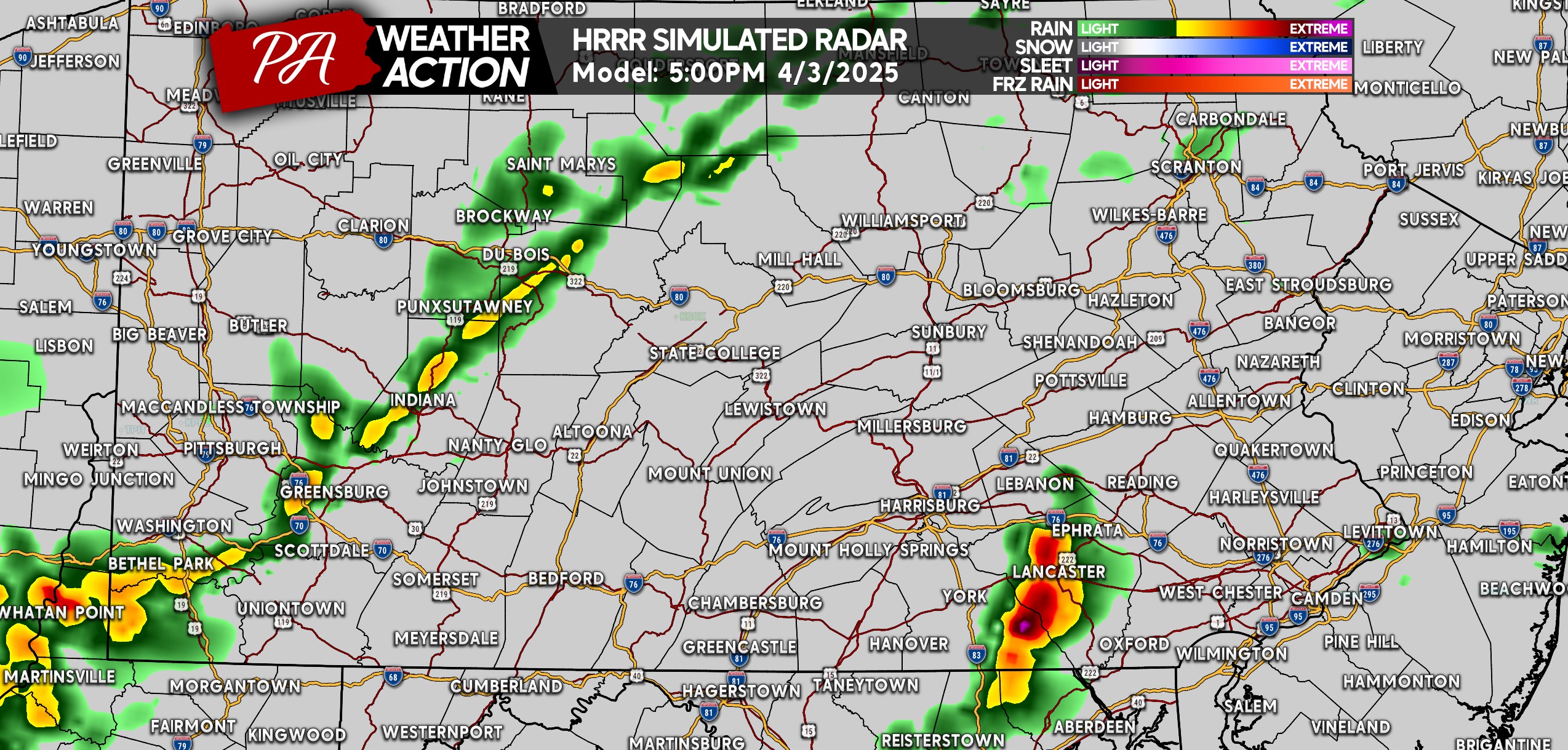
As we head into the dinner time period, strong to severe thunderstorms are projected to push into Southeast PA. Some areas will miss out while others will be hit, remember how severe season works.
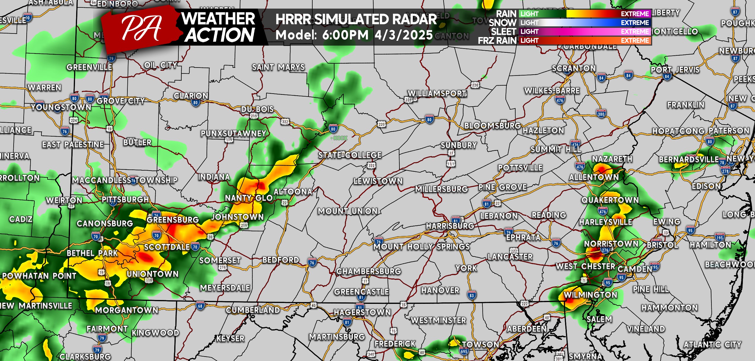
A few ordinary to strong storms are possible around this time in Southwest PA and the Laurel Highlands as well. Below is HRRR Model Future Radar for 6:00 PM Thursday.
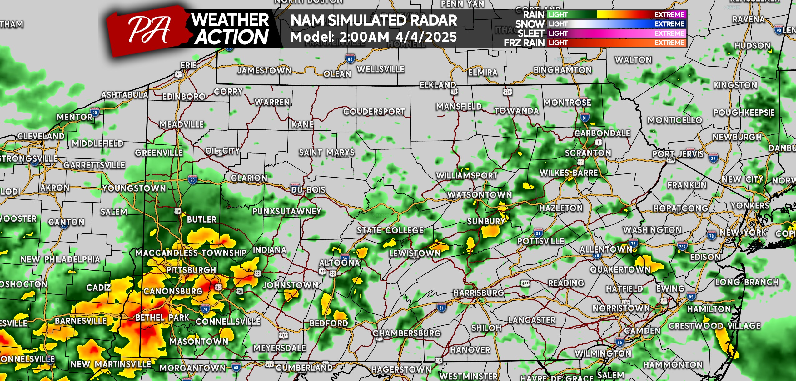
Fast-forward several hours and some thunderstorms are still possible within the heavy rain early Friday morning, especially in Southwest PA. As seen below on future radar for 2:00 AM Friday.
THURSDAY’S SEVERE THUNDERSTORM THREAT FORECAST
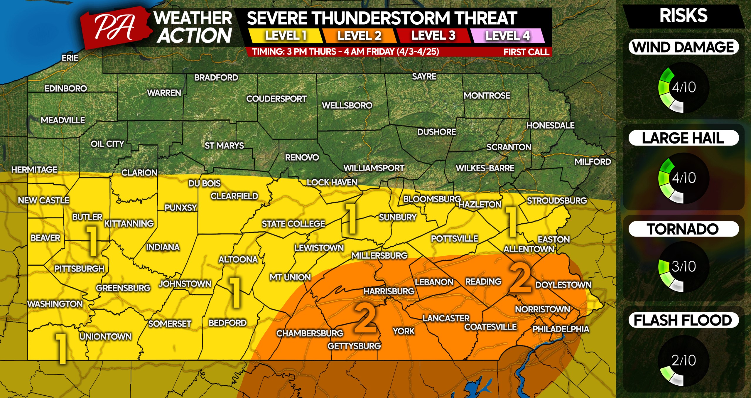
Level 2 Risk Area: Scattered strong to severe thunderstorms possible, with damaging winds of 50-70 MPH the primary concern. A brief spin-up tornado is possible. The strongest storms may contain hail up to 1″ in diameter.
Level 1 Risk Area: Isolated strong to severe thunderstorms are possible, with gusty winds of 40-60 MPH a potential within strongest storms. Strongest cells may contain some hail, with a very low tornado risk.
Be sure to sure to share this forecast with friends and family in affected areas. Have a way to be notified of alerts for your town!

You must be logged in to post a comment.