
An extremely powerful storm will strengthen over the central Plains tonight and move along the Saint Lawrence River Tuesday night into Wednesday.
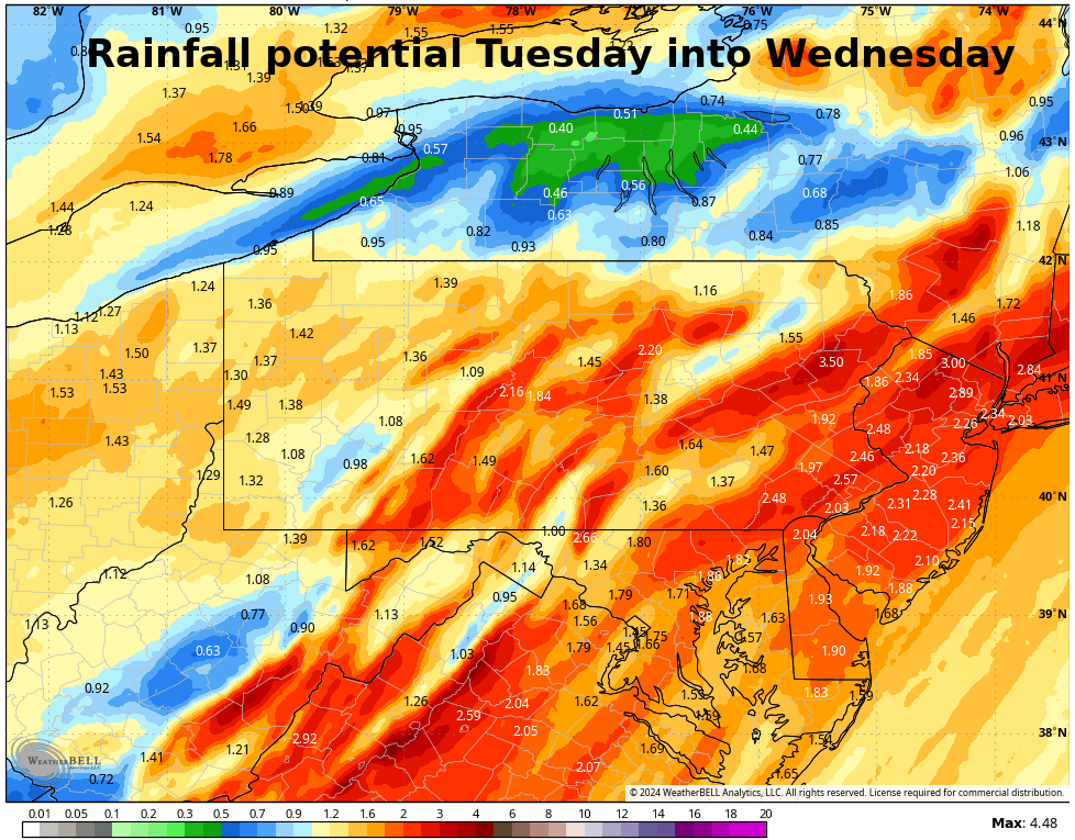
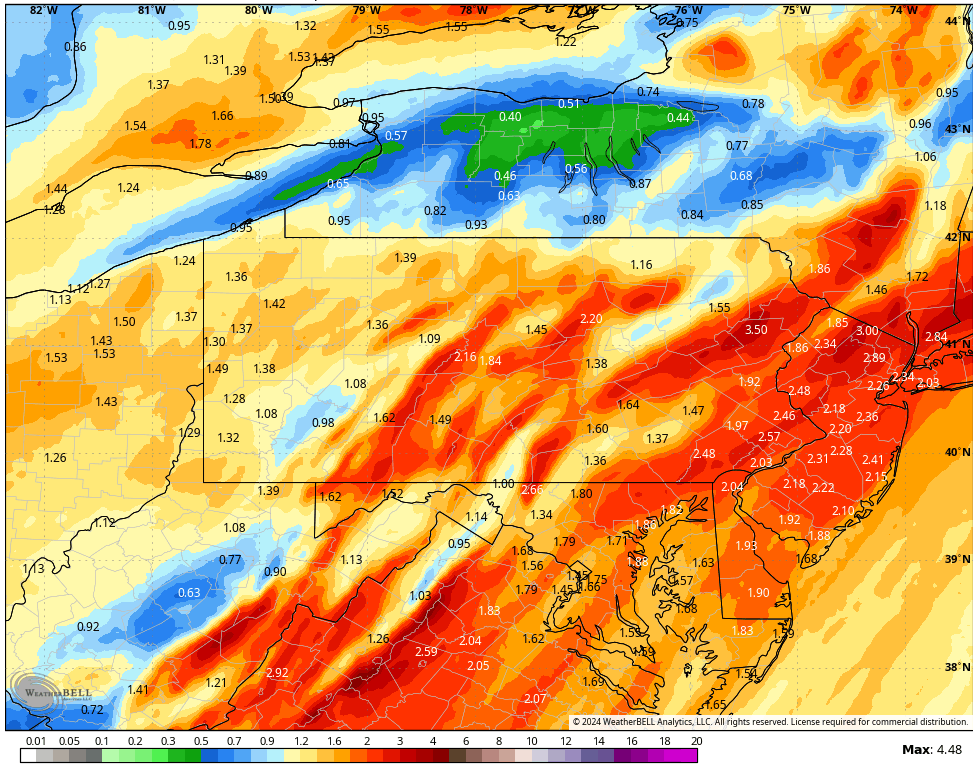
This system will draw copious moisture from the tropics straight into our area upon strong low-level wind from the south, resulting in widespread 1-3″ rain. This will also drive temperatures into the 50s by Tuesday night, melting much of the snow. That snowmelt, along with the widespread heavy rain, will result in some flooding issues. The other big component of this system also involves that powerful low-level wind from the south. Wind gusts could be over 50mph in the highest elevations, although the inversion, especially with the snowpack, will offer protection for the valleys. However, there are indications that a line of thunderstorms could develop just ahead of the cold front Tuesday night. If that happens, the storms could mix away the inversion and push that strong wind down to the surface. The National Weather Service has thus issued a wind advisory and a flood watch for our area for tomorrow and tomorrow night.
That storm will exit Wednesday, with breezy conditions, cooler weather, and gusts to 40 mph.
Another powerful system with heavy rain and potential wind will impact our area Friday night into Saturday morning.
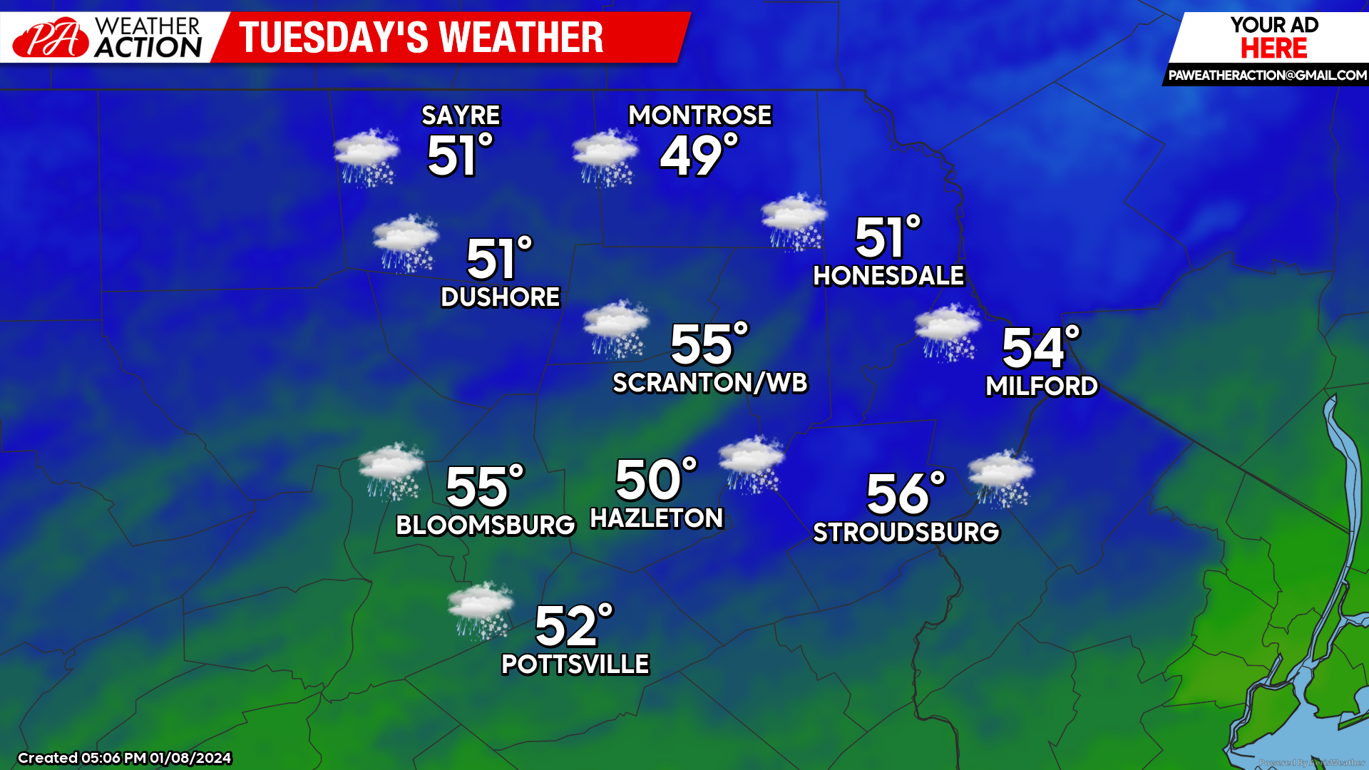
TUESDAY
Snow will arrive during the morning, quickly changing to rain. Before changeover, some of the higher elevations and more-northern locations will enjoy a coating to 2″ snow, which will be quickly washed away by heavy rain. Southerly wind gusts will increase throughout the day, especially over the higher terrain and areas exposed to the south. Valley locations will be more-protected from this wind. However, watch for a potential line of thunderstorms Tuesday night between 10pm and 2am which could mix strong gusts down into the valleys as well. Temperatures will climb from the 30s at sunrise, into the 40s by sunset, and into the 50s overnight until the cold front crosses around midnight, then fall back into the 30s by sunrise Wednesday.
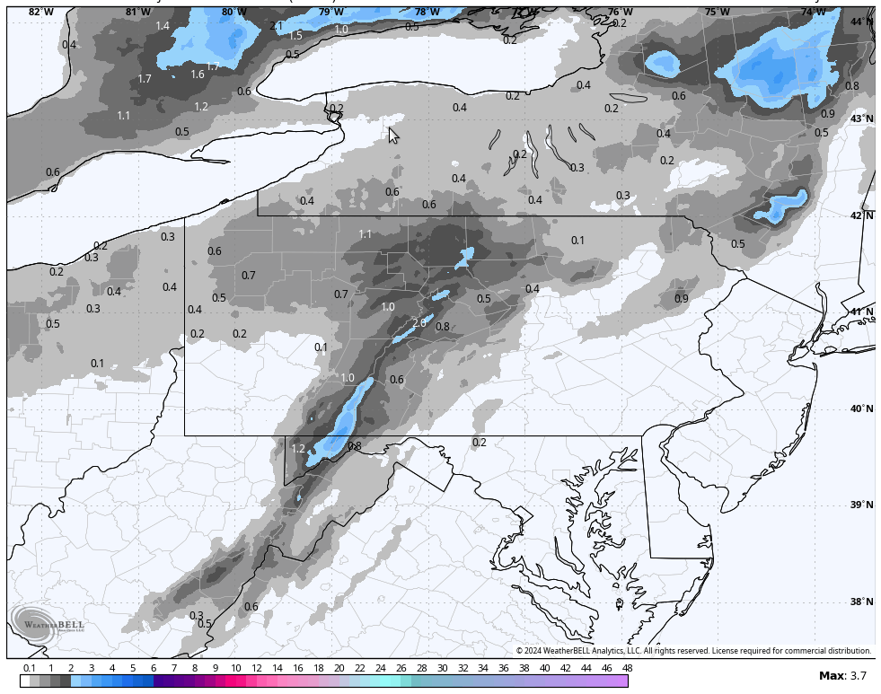
Snowfall Tuesday before changing to heavy rain:
Precipitation Tuesday and Tuesday night:
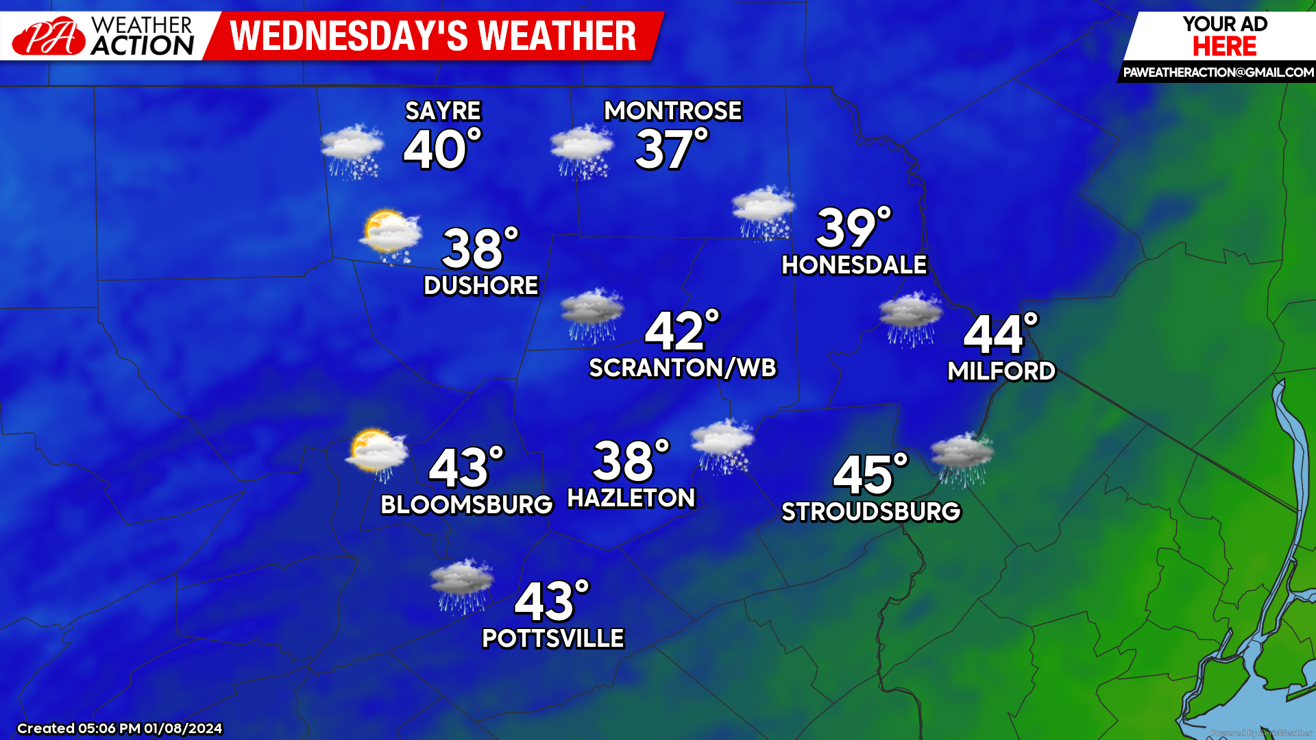
WEDNESDAY
As that powerful system departs, breezy west wind gusting to 40mph will deliver more-normal temperatures to our area, with temperatures remaining steady in the mid-upper 30s. There could be a few scattered snow showers, but most of the day will be dry.
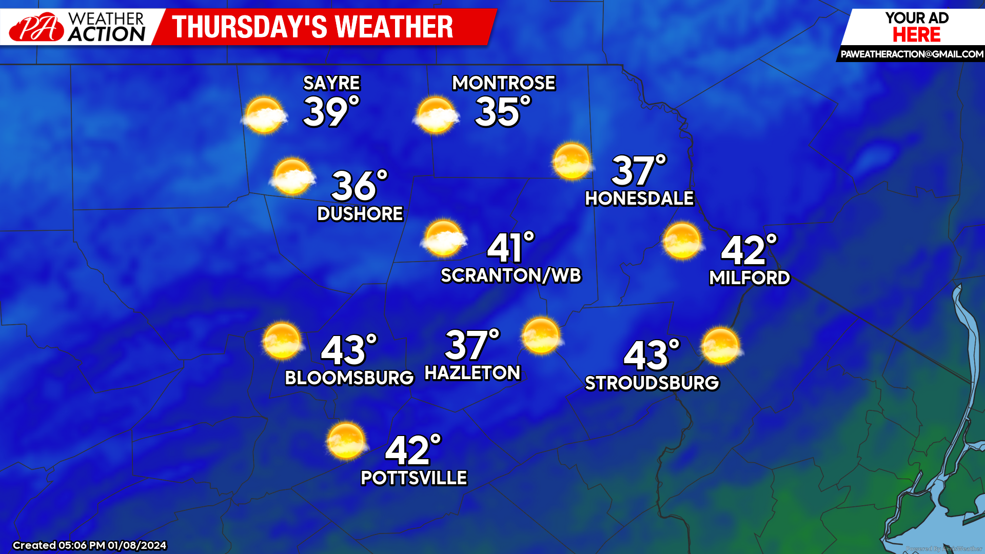
THURSDAY
High pressure will deliver calm wind and partly cloudy skies. Temperatures will be warmer than normal, with widespread upper 30s to lower 40s.
BEYOND THURSDAY
Another powerful storm will deliver wind and potential flooding to our area Friday night into Saturday. Precipitation will also begin as a brief period of snow Friday evening. This system will be able to tap some arctic air for later this weekend into the first half of next week.
You must be logged in to post a comment.