

The endless parade of storms will continue this week, with a storm system tracking into the Great Lakes Tuesday into Wednesday. Meanwhile, a strong coastal low will ignite off the Mid-Atlantic Coast Tuesday into Wednesday, inducing a strong raw wind off the ocean and heavy rainfall. Widespread rainfall totals of 2-3″ are likely. As the system departs Thursday, it will draw colder air into the region, possibly concluding with accumulating snow Thursday!
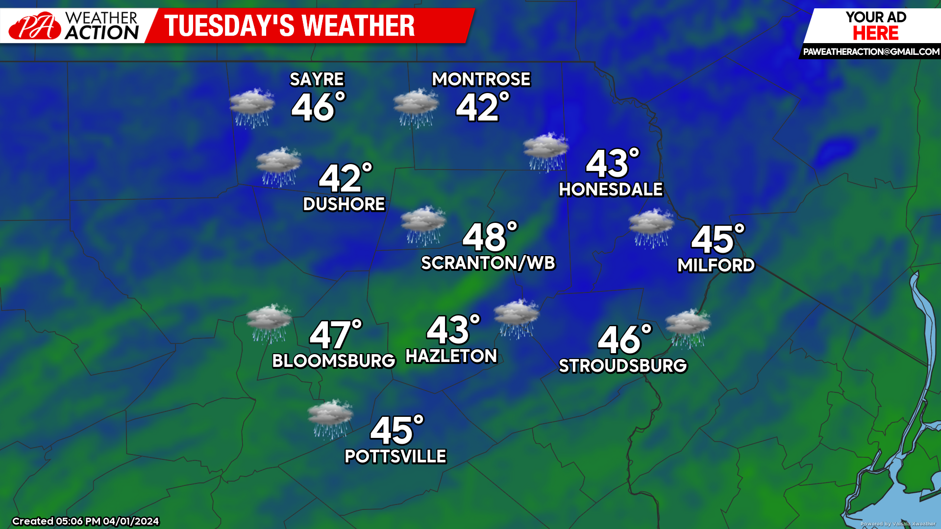
TUESDAY:
Tuesday will feature rain with a chill east wind off the ocean. That wind will increase Tuesday night, with gusts to 30mph in the valleys and possibly over 40 mph in the higher elevations.
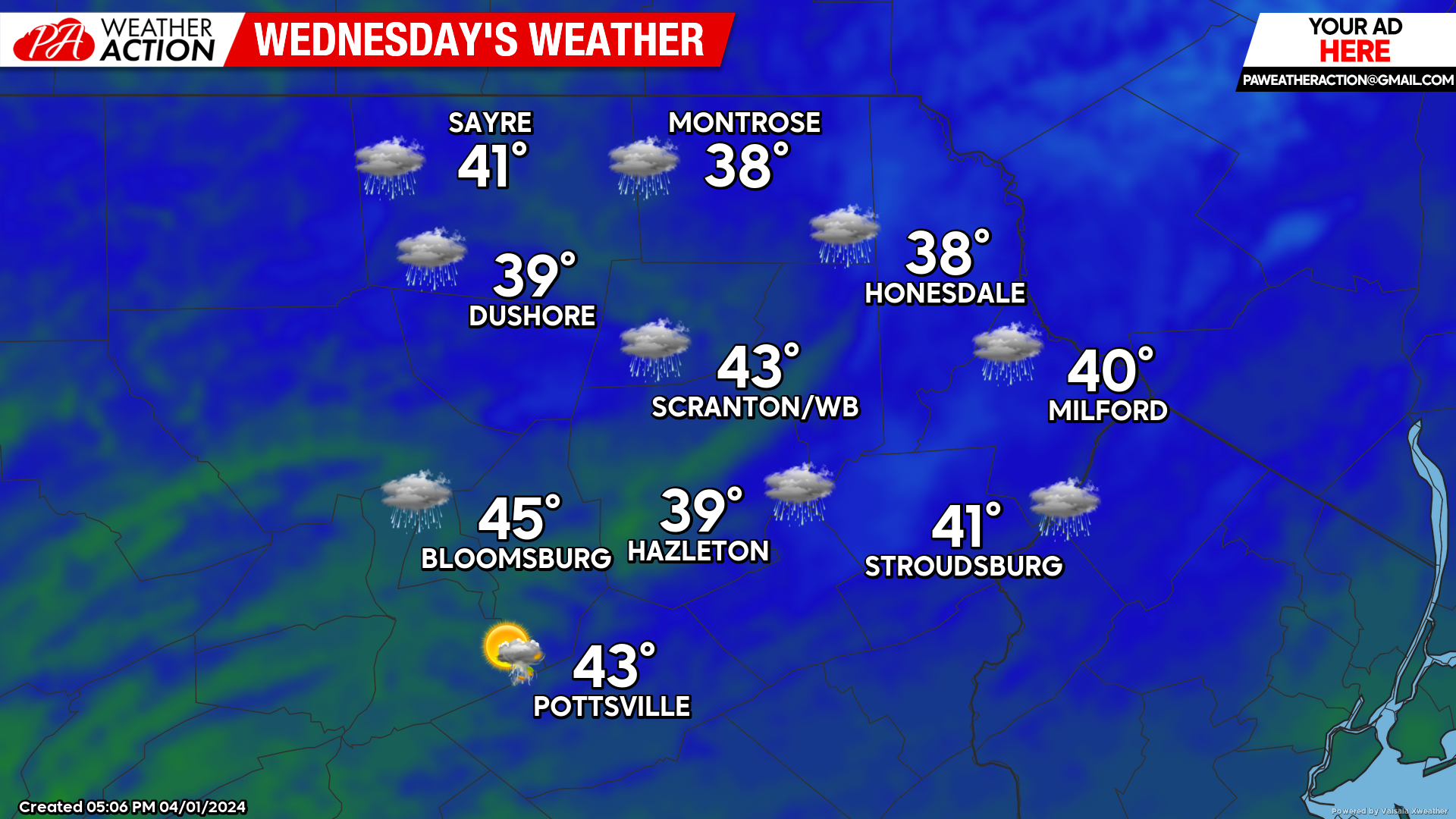
WEDNESDAY:
As the coastal low rapidly intensifies, Wednesday will feature a raw blustery wind off the ocean gusting over 30 mph in the valleys and over 40 mph in the higher elevations, along with heavy rain. As that system pulls away overnight, the wind will start to gust from the NW after midnight Wednesday night, ushering in colder air aloft and changing the rain to snow for parts of the area.
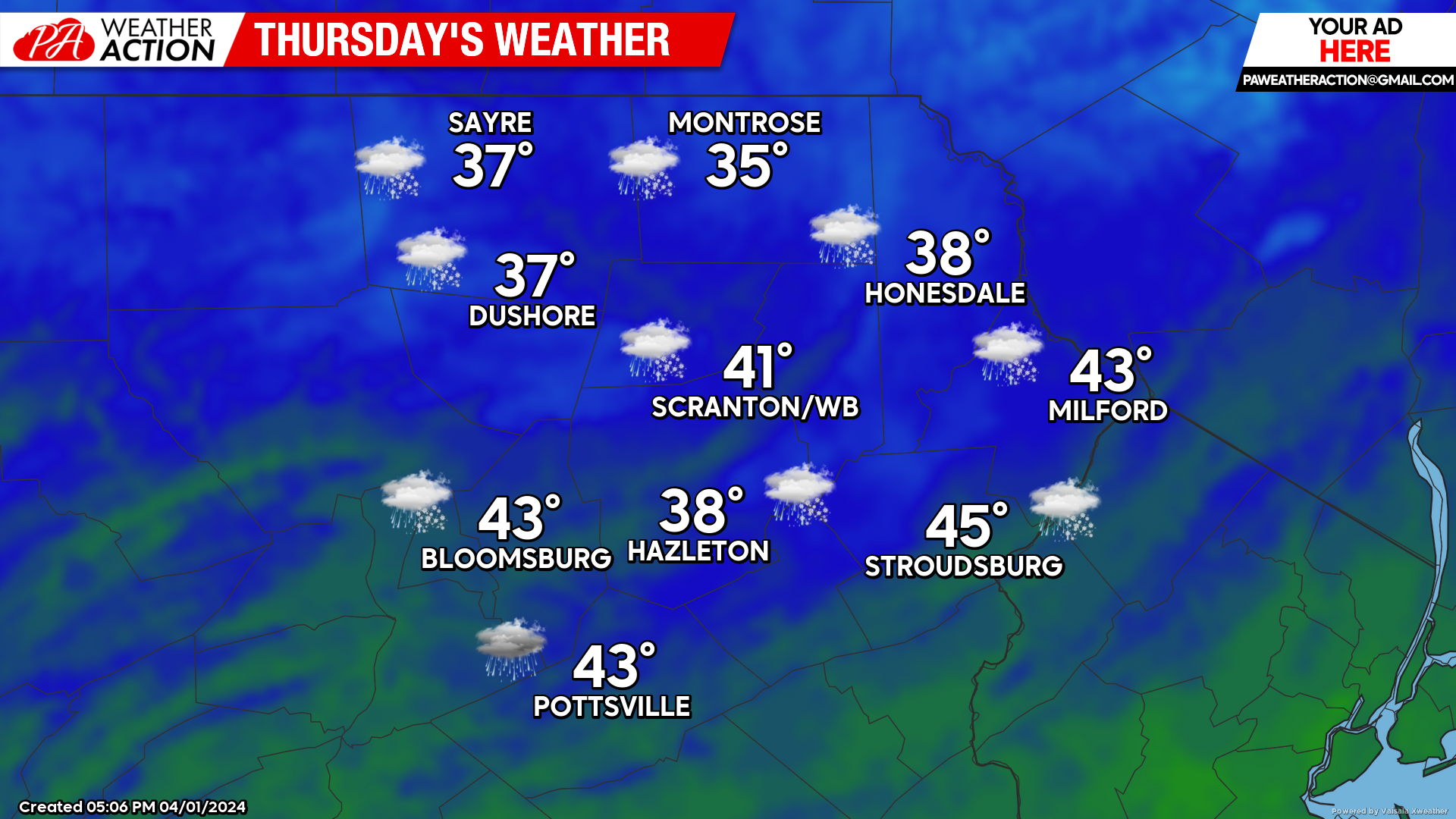
THURSDAY:
Rain and snow will continue, with measurable accumulations possible, especially for the higher elevations! As to be expected this time of year, conditions will be marginal, but that only adds to the excitement. Enjoy!
DON’T FORGET – SOLAR ECLIPSE MONDAY EARLY AFTERNOON!

You must be logged in to post a comment.