
The first tornado outbreak of the year is looking probable Tuesday across much of Ohio, Kentucky, and Tennessee. Also included is far Western Pennsylvania, including the Pittsburgh Metro. Long-track tornadoes are a risk for all those areas, as well as large hail and damaging winds.
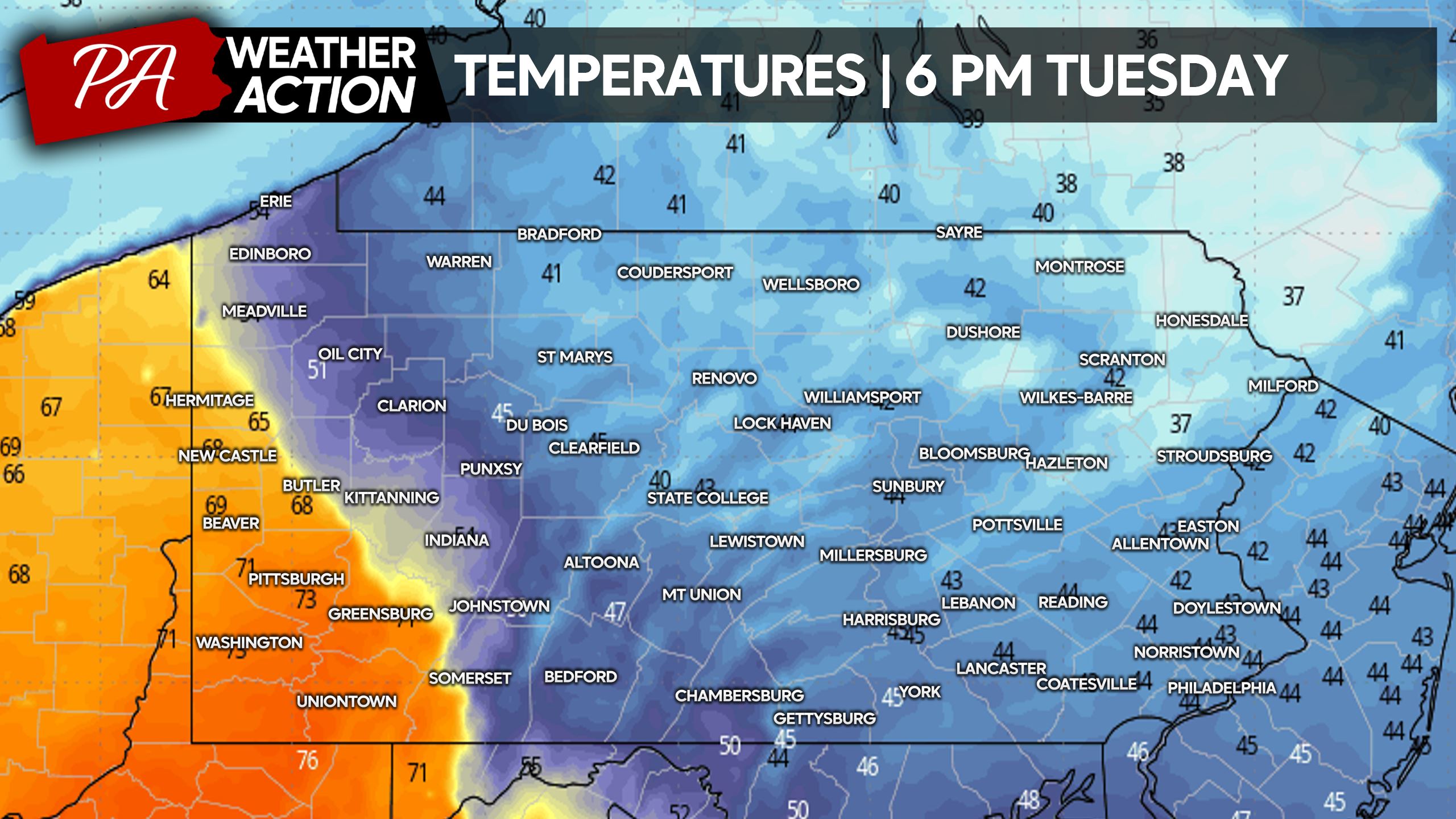
Where the warm sector sets up in Western PA will determine how far these storms will go before they will hit a wall. Cold air damming in and east of the Appalachians will keep much of Pennsylvania cloudy and much cooler, with practically 0 dynamics in place for severe storms. However in Southwest PA, the door will be wide open for severe thunderstorms – likely Tuesday evening. Below is a good display of exactly where the cold air damming and the warm sector to the west will setup.
A major severe thunderstorm risk is up for most of Ohio, which is exceptionally rare for early April. If you have family in Ohio, be sure to warn them of this threat. The will need to be watching the radar Tuesday afternoon and evening. As for Western PA, numerous severe thunderstorms are possible along the I-79 corridor. This will include a heightened risk for tornadoes, large hail, and damaging winds.
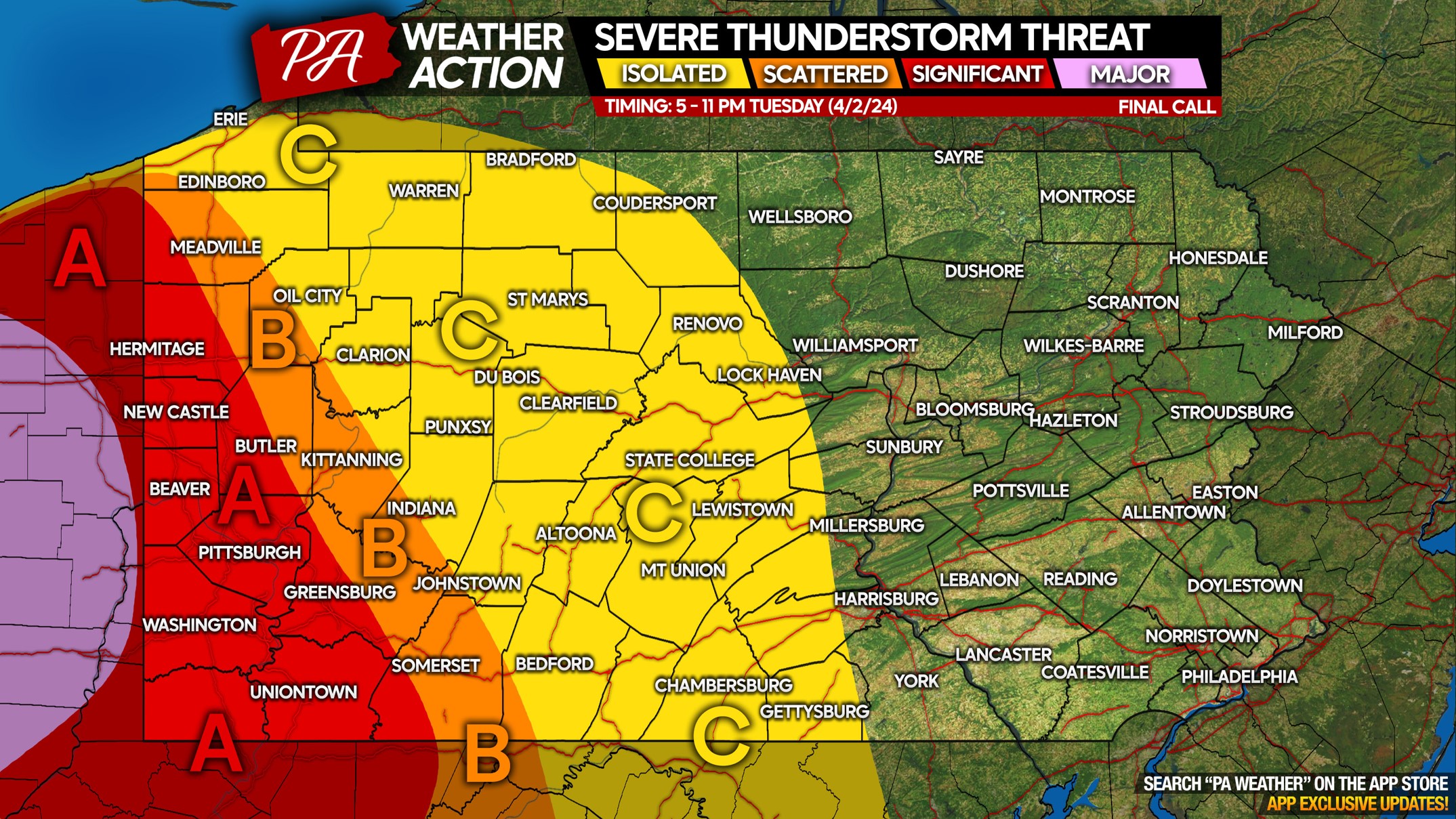
TUESDAY 4/2 SEVERE THUNDERSTORM THREAT FORECAST

Area A: A significant threat for severe thunderstorms, with a tornado threat mainly west of I-79 in this region. Long-track tornadoes may be coming in from Ohio around sunset or just after. Large hail and damaging winds are also risks.
Area B: Scattered strong to severe thunderstorms expected, however the tornado threat here will begin to lower. If this area is in the warm sector, tornadoes are possible. If not, then the main risk will be damaging winds. You will know if you’re in the warm sector, as it’ll either be in the 70s or in the 40s and 50s.
Area C: Isolated strong to severe thunderstorms possible, with the main risk being damaging winds. This area will be very stable, causing storms to quickly weaken.
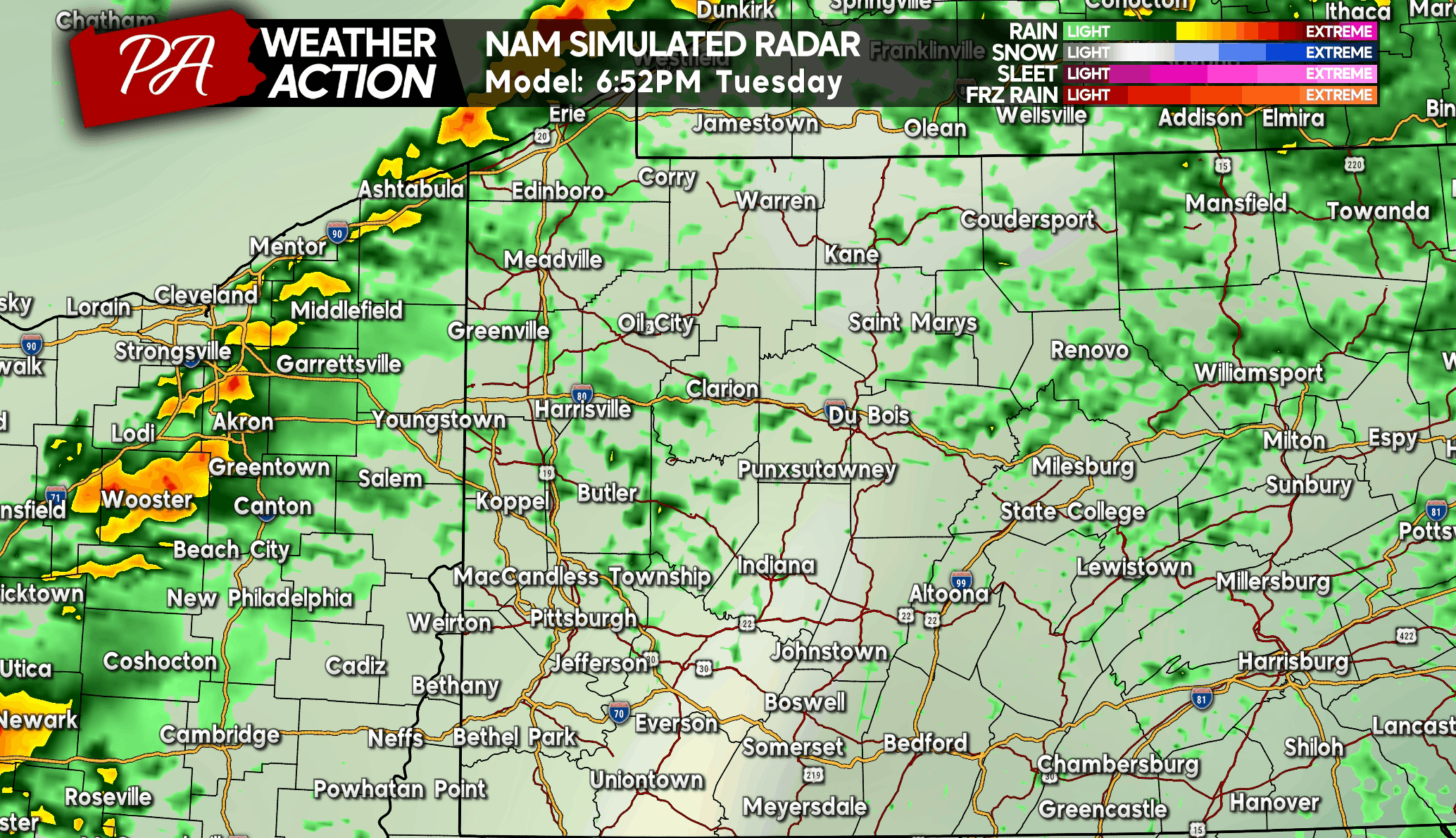
Timing for severe thunderstorms in Western PA will be Tuesday evening between 6:30 PM and 11:30 PM. Storms will move in from northwest to southeast, beginning in Northwest PA and then into Southwest PA. Below is Hi-Res NAM Future Radar for Tuesday evening.
Going into Wednesday, non-severe thunderstorms are possible in South Central and Southeast PA Wednesday afternoon and evening. There may be a few strong storms along the Maryland border, with most of the strong activity staying south. Even to our south, Wednesday’s severe thunderstorm risk will be scattered at most, with damaging winds being the only minor concern.
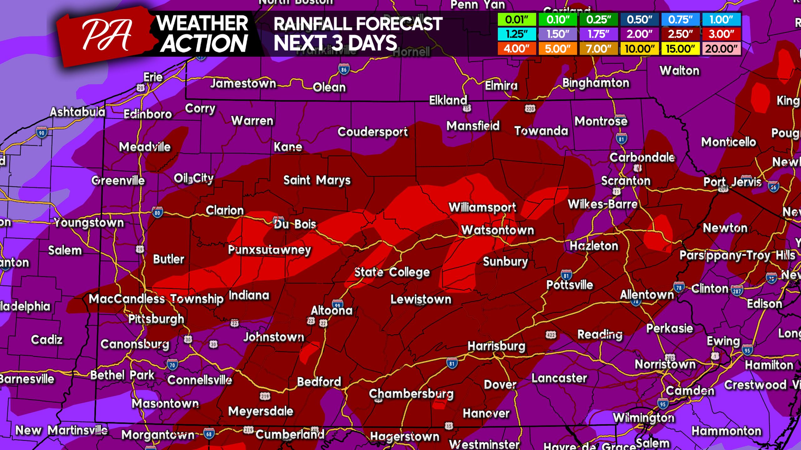
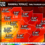
There is a Slight Risk for flooding, as a few more inches of rain will fall by midweek across much of Pennsylvania. Below is the rainfall forecast through Thursday.
Finally, we mentioned the potential for snow in Northern PA on Thursday in a previous article. The jury is still out on that opportunity, but right now significant impacts appear unlikely. There may still be some snow especially in the high elevations as cold air rushes in on the backside of the coastal low, but we aren’t overly enthusiastic about that.
Better weather should be here by next week with much warmer temperatures!
For now, our focus is Tuesday! Be sure to share this article with family and friends in Ohio and Western PA!
Also consider following PA Weather Action to see more of our updates!

You must be logged in to post a comment.