
UPDATE 4:30 PM SUNDAY: Our Final Call has been posted, please view that article here:
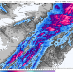
A strong storm will move up the East Coast on Sunday, bringing 1 – 2″ of rainfall to the eastern half of Pennsylvania, and 0.5 – 1″ of rain to the western half of PA. However, that’s not where the story ends. Rain will change to snow Sunday evening into early Monday morning from west to east, but changeover times and snowfall accumulations will be highly elevation-dependent.
Temperatures will crash from the 50s and even low 60s in parts of PA, all the way to the 30s in the span of 10 hours. Generally, temperatures decrease by about 3.3°F for every 1,000 feet you go up in elevation when precipitation is falling. And that can make all the difference in Pennsylvania’s dozens of 1-2k feet deep valleys where much of the population lives.
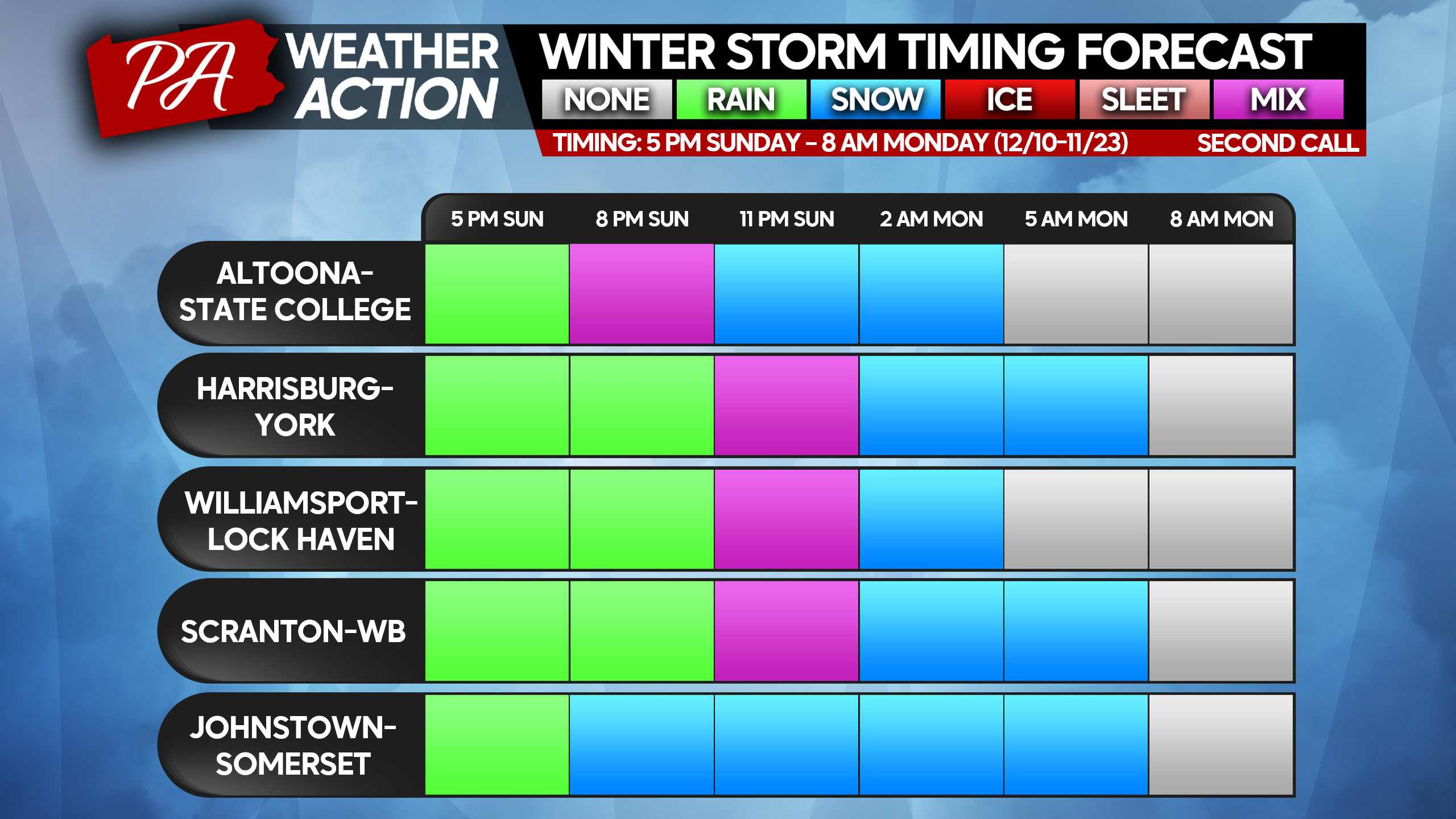
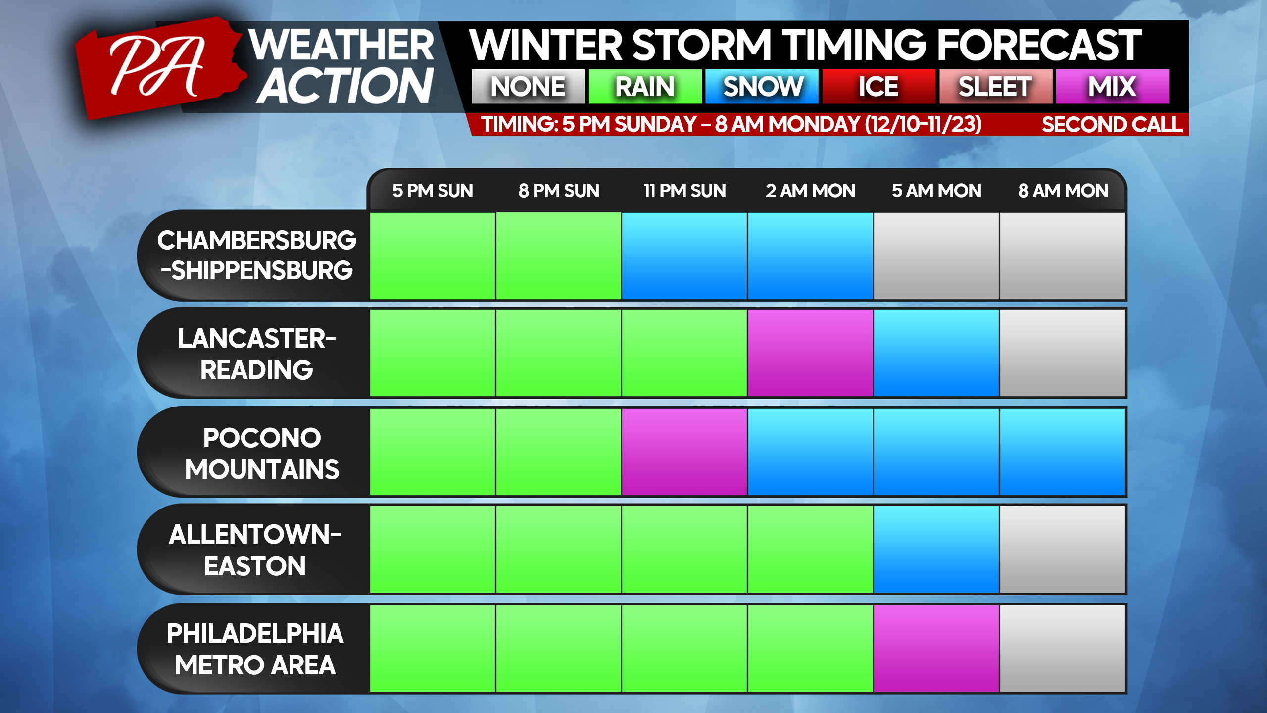
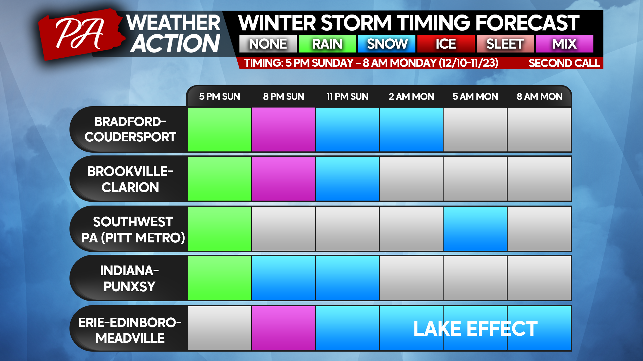
RAIN-TO-SNOW STORM TIMING
Our timing forecast looks a bit different this time, and we plan on doing it this way in the future! Below are three winter storm forecast timing tables. Cities on the table will change in the future, but they’re meant to group areas that will see very similar impacts. If you live in a small town, try to find a bigger town nearby on the tables below!
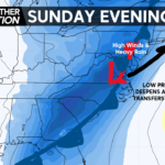
TRAVEL IMPACTS
Travel impacts will mostly be felt when snow is falling in your area and about 3-4 hours afterwards if your area receives over an inch of snow, especially in the eastern half of PA and the Laurel Highlands. This is due to the moderate to heavy snowfall expected, despite surface temperatures being above freezing in the valleys. Because the snow will be falling at a half inch to an inch per hour, and it will be night, snow will have an easier time accumulating on everything. Snow-covered or slushy roads, especially local streets, are possible Monday morning even after the snow has finished, if more than an inch falls. So keep that in mind for the Monday morning commute!
SECOND CALL SNOWFALL FORECAST FOR SUNDAY EVENING – MONDAY MORNING
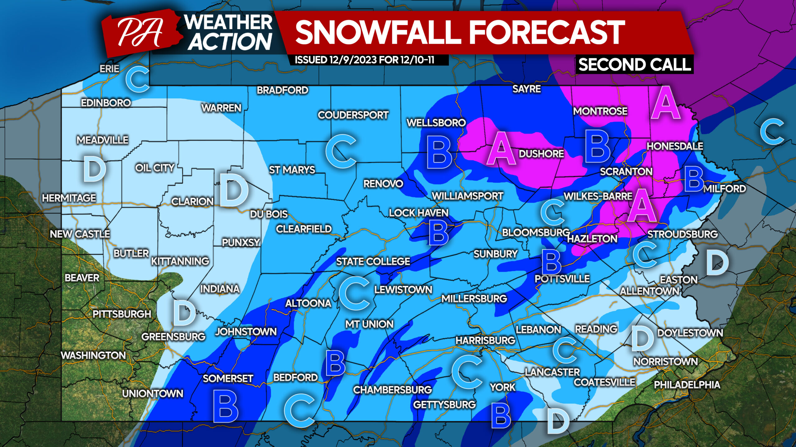
Area A: Snow accumulation of 4 – 7″ expected, with highest amounts above 2000′ elevation. Snow-covered roads expected during and after the storm.
Area B: Snow accumulation of 2 – 4″ expected, with highest amounts above 2000′ elevation. Slushy road conditions expected during and shortly after the storm.
Area C: Snow accumulation of 1 – 2″ expected. Slippery travel conditions possible when snow is falling and shortly after the event.
Area D: Snow accumulation less than 1″ expected. Eastern portions of this area may experience slippery travel for a short time when snow is falling.
Don’t forget to share this article with family and friends, as many areas will have a slow Monday morning commute!
Catch all the trends on the models leading up to the storm, view an early first call forecast ahead of all other weather outlets, and ask us questions about your area in interactive live streams! All for just 99 cents the first month, then $2.99 after, cancel anytime!
Subscribe below, and you will be emailed all our updates and live streams! We are going live at 8:30 PM this evening (Saturday) to answer any questions you have!
Ignore this text.
[dt_divider style=”thick” /]
[dt_divider style=”thick” /]
You must be logged in to post a comment.