
Friday Evening Update: Our First Call Snowfall Forecast has been posted, click here to view our updated forecast >>>
FIRST CALL SNOWFALL FORECAST FOR SUNDAY INTO MONDAY MORNING’S MAJOR WINTER STORM
While we continue to track the overnight snowfall into early parts of tomorrow morning, we are also focused on a potential significant winter storm Sunday afternoon into Morning morning. We are still several days out, but this storm does have the potential to bring some areas their largest snow of the season. There are multiple scenarios on the table right now, we will discuss those scenarios below.
Unlike our past several storms, this will be a rather large storm, allowing for a longer duration period of wintry precipitation. Instead of a 3 to 6 hour period of snow, we will be looking at an 8 to 12 hour period of snow for the areas that do receive snow. For our future radar, we are going to the American Model (GFS) because right now it is pretty close to our middle ground solution.
The storm will gather strength over the south and will push northeastward heading into the day Sunday. By early Sunday afternoon, precipitation, mostly in the form of snow, will be moving into the state across much of the state: 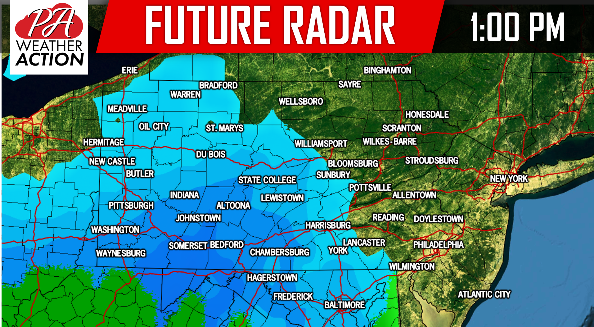
While all models vary on exactly how this storm plays out, they are all on agreement that the worst part of the storm will be Sunday evening regardless if it is snow or rain. By 1:00 AM Monday morning, the precipitation begins to weaken and push northeastward: 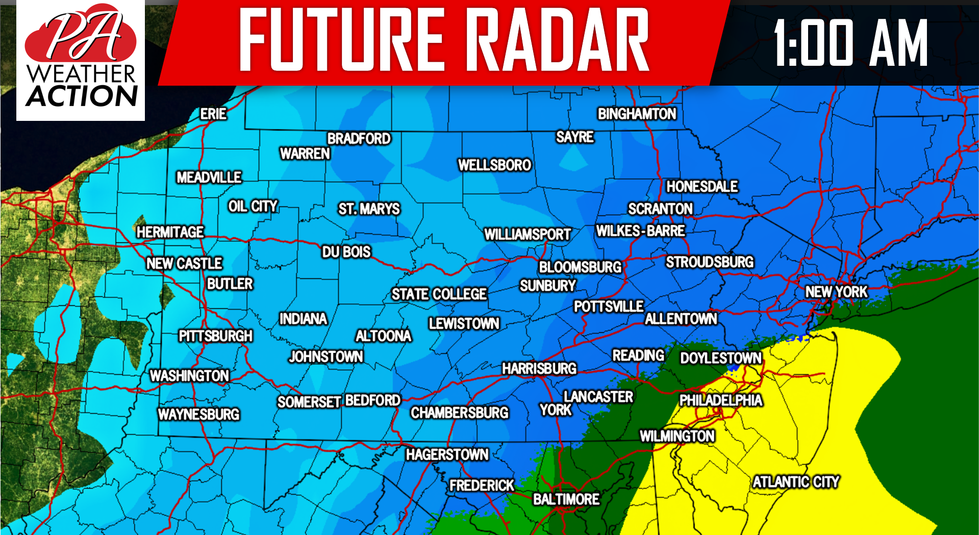
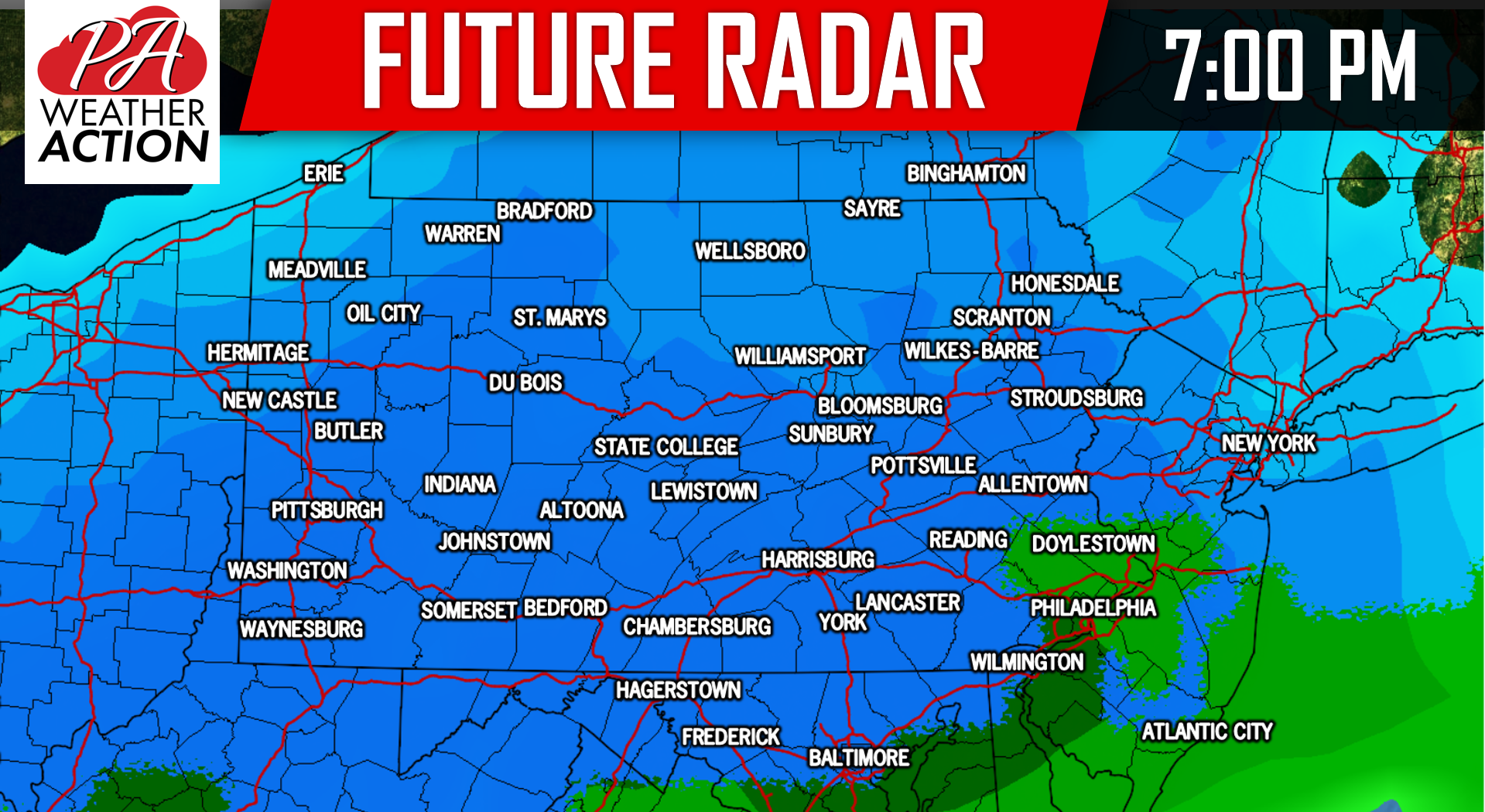
We do anticipate that most of the precipitation will be tapered off by 7:00 AM Monday Morning. Below is a look at three scenarios for the Sunday Afternoon into Monday Morning time frame.
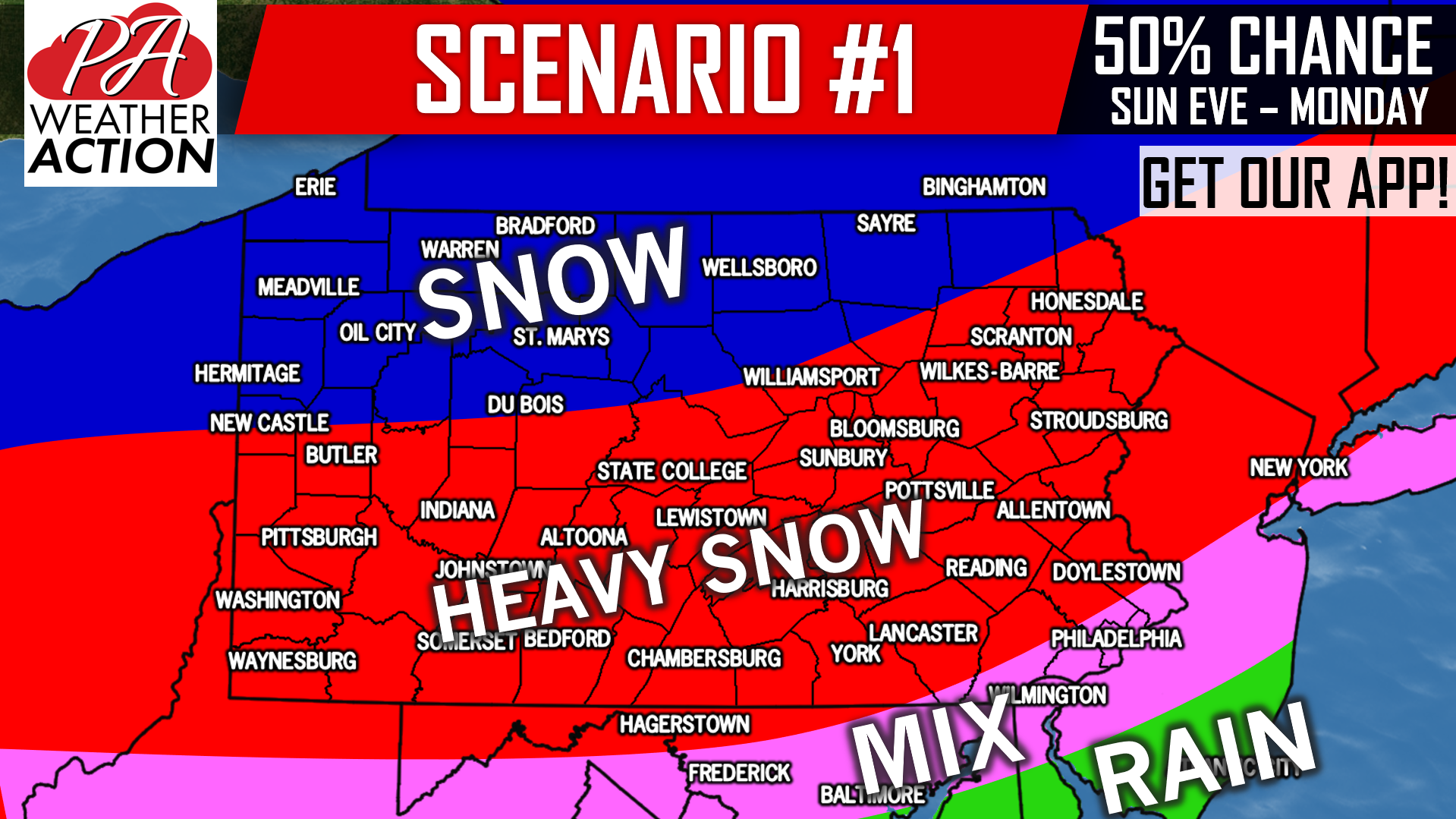
SCENARIO MAPS FOR SUNDAY AFTERNOON INTO MONDAY MORNING’S POTENTIAL SIGNIFICANT WINTER STORM:
The scenario above is currently our most likely scenario at 50%. An area of a half foot of snow or more looks possible in Southwest PA, through Central PA south of i-80, and into the Lehigh Valley and Poconos. Lighter amounts possible in Northern PA and in Philadelphia where mixing with rain is possible. There is no ice concern this time around.
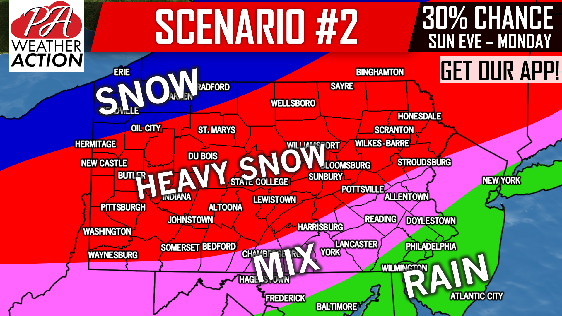
This scenario will play out if the low pressure moves north and west, causing mixing in much of Southern PA, with heaviest snow of once again a half foot or more throughout the i-80 corridor.
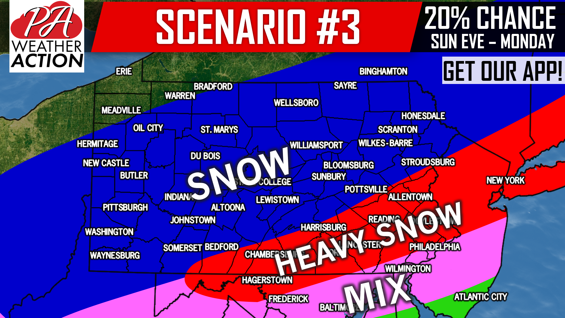
This is our least likely scenario, and will require the low to stay south and weaker. A thin area of significant snow accumulations would still be possible, but much less expansive than the previous two scenarios.
This is a very fluid situation, like our Facebook for the latest information, click here: Pennsylvania Weather Action’s Facebook Page
Download our free app today to keep you ahead of the latest weather alerts and traffic conditions, click here: Pennsylvania Weather Action’s App
Share this article by using our icon below!
You must be logged in to post a comment.