
A slight chance for rain and snow showers is possible late Tuesday into Wednesday before a prolonged period of average temperatures and dry weather sets in for the majority of the region.
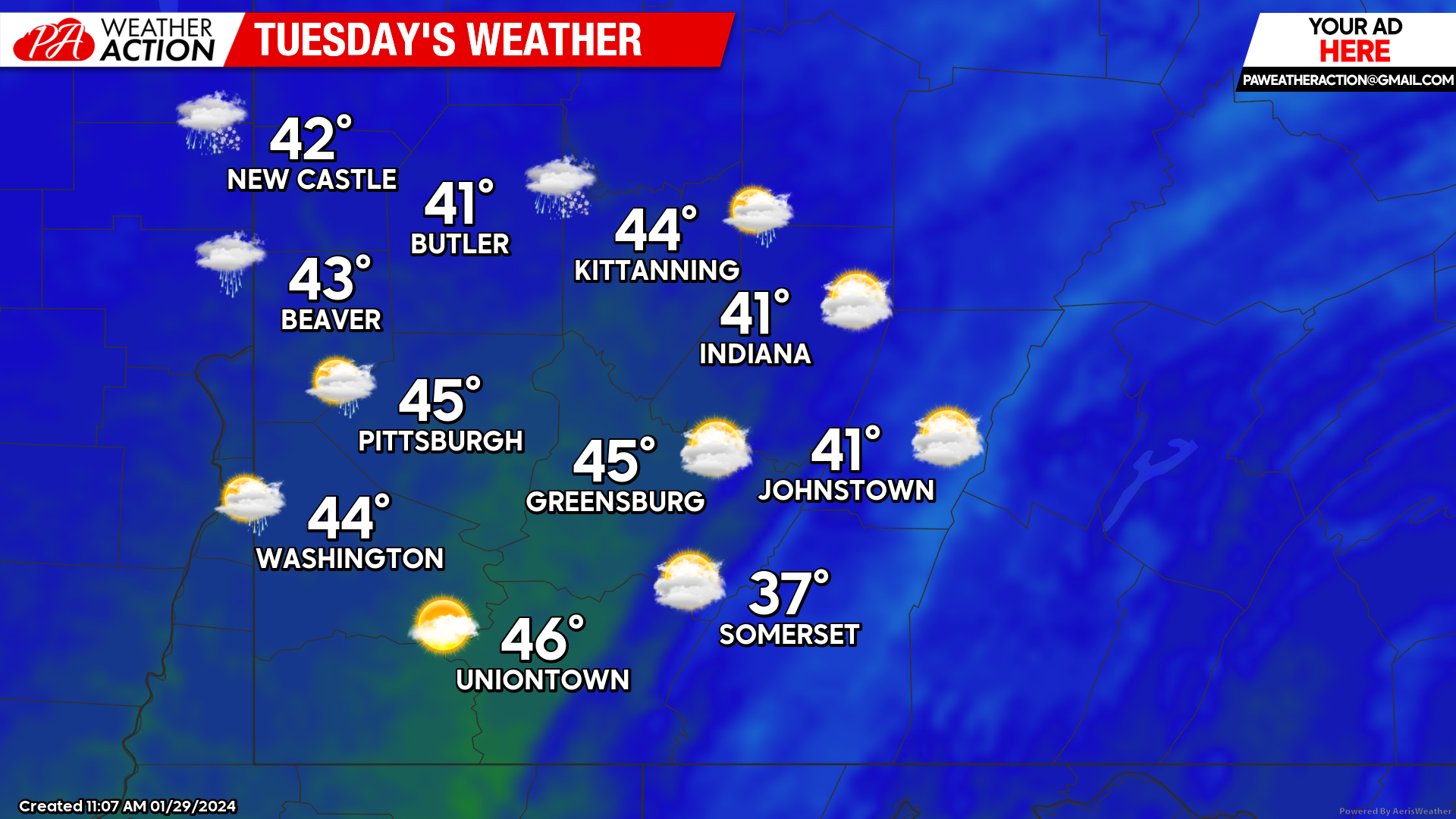
Tuesday
Mostly cloudy conditions for the majority of the day will begin to transition to a rain/snow mix in the overnight and early morning hours on Wednesday. Highs range between the mid-40s to mid-30s throughout the region. Winds will be out of the south at 8 to 15 mph. Gusty winds could be expected in the higher elevations with wind gusts approaching 20 mph. Lows will be mid to low 30s.
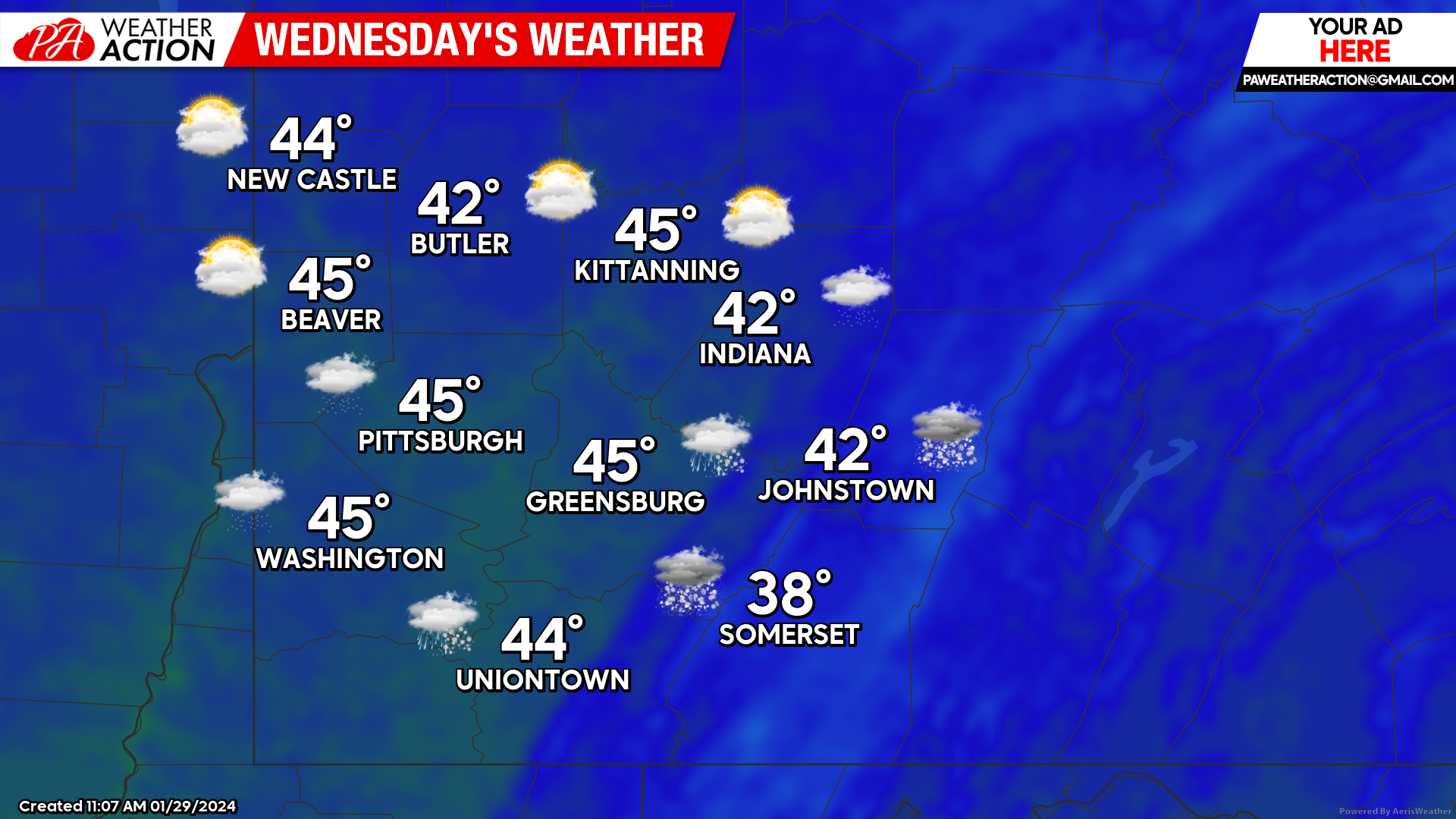
Wednesday
Lingering rain and snow can be expected in some portions of the region to start the day. Mostly cloudy conditions will follow. Highs will be in the mid to low 40s. Winds will be out of the southeast at 5 to 10 mph. Lows will be mid to low 30s.
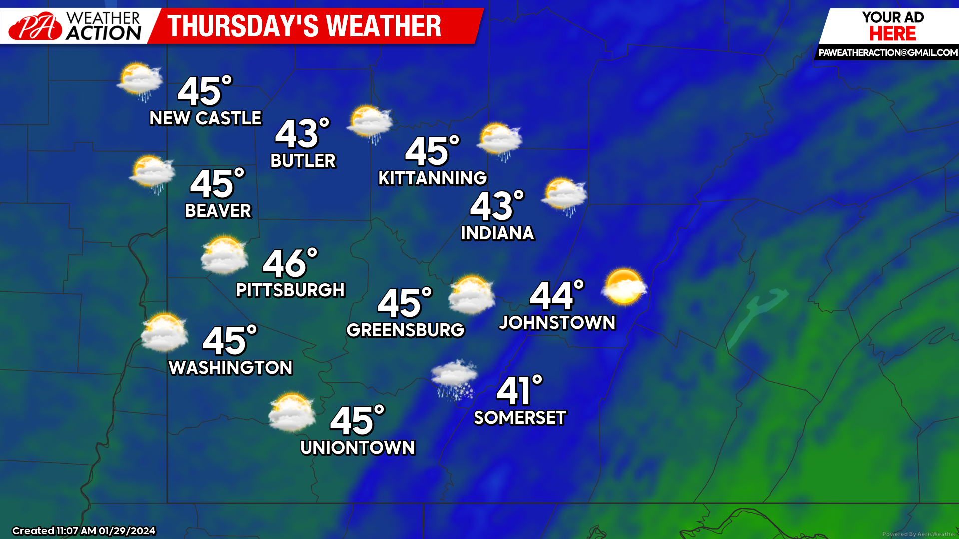
Thursday
Partly sunny conditions will lead to a chance for overnight showers. Gusty conditions can be expected in the higher elevations. Highs will be mid to low 40s. Winds will be out of the southwest at 8 to 15 mph. Wind gusts will range between 20 to 30 mph in the higher elevations. Lows will be in the mid to low 30s.

You must be logged in to post a comment.