
The passing of a cold front overnight Thursday will bring a slight chance of rain to the region with higher elevations having a chance for a rain/snow mix to start the weekend. Temperatures are expected to increase as the weekend goes on.
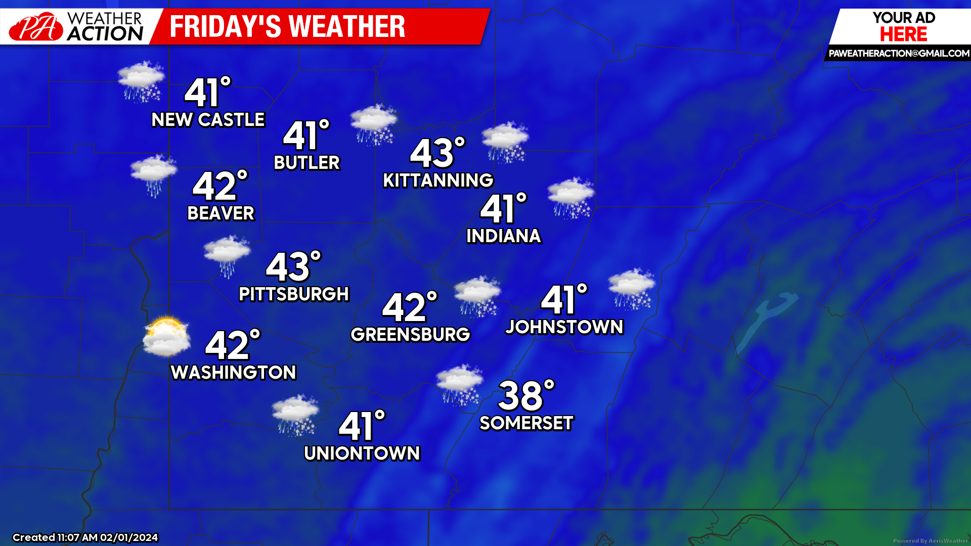
Friday
A slight chance for rain is expected in the early morning hours throughout the region. Higher elevations could see more precipitation with some snowflakes mixed in throughout the day, however little to no accumulation is expected. Highs will be in the low 40s to mid-30s. Winds will be out of the north-northwest at 10 to 13 mph, wind gusts approaching 20 mph can be experienced in the higher elevations. Lows will be in the mid-20s.
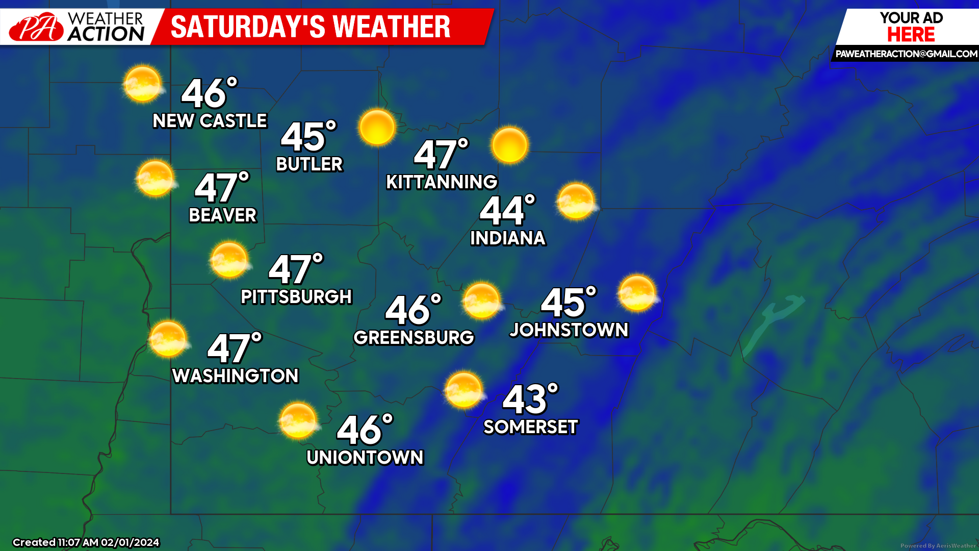
Saturday
Clear, sunny conditions are expected throughout the region. Highs will be in the mid to low 40s. Winds will be out of the north at 6 to 8 mph. Lows will be in the upper 20s.
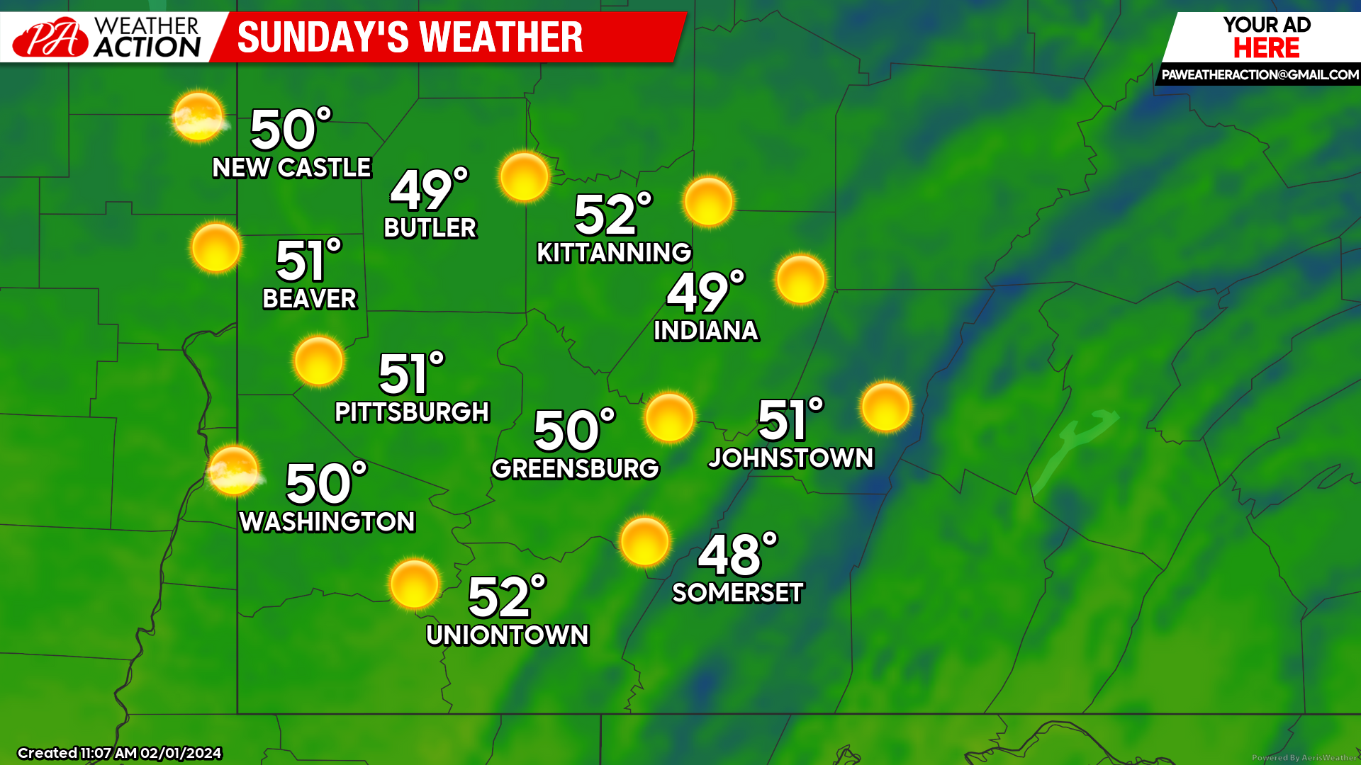
Sunday
Sunny skies and increasing temperatures can be expected on Sunday. Highs will be in the low 50s to upper 40s. Lows will be in the low 30s to upper 20s.
Sunny conditions look to be sticking around to start the week. Be sure to follow PA Weather Action for updated weekly weather forecasts.

You must be logged in to post a comment.