
It has been a while since we last discussed a widespread severe thunderstorm risk here in Pennsylvania. For the most part, severe activity will be concentrated in the Great Plains and Midwest for the next few weeks. Meanwhile, we will continue our unusually dry and sunny weather. Let’s just get Sunday out of the way first.
The Storm Prediction Center has labeled the entire state besides the Philadelphia area in a level two (slight) risk, with Philadelphia being in a level one (marginal) risk. However, short range mesoscale models keep most of the thunderstorm activity along and east of the mountains. Neither timing or instability looks conducive for much severe activity in western PA. If any, it would be in the late morning or very early afternoon there.
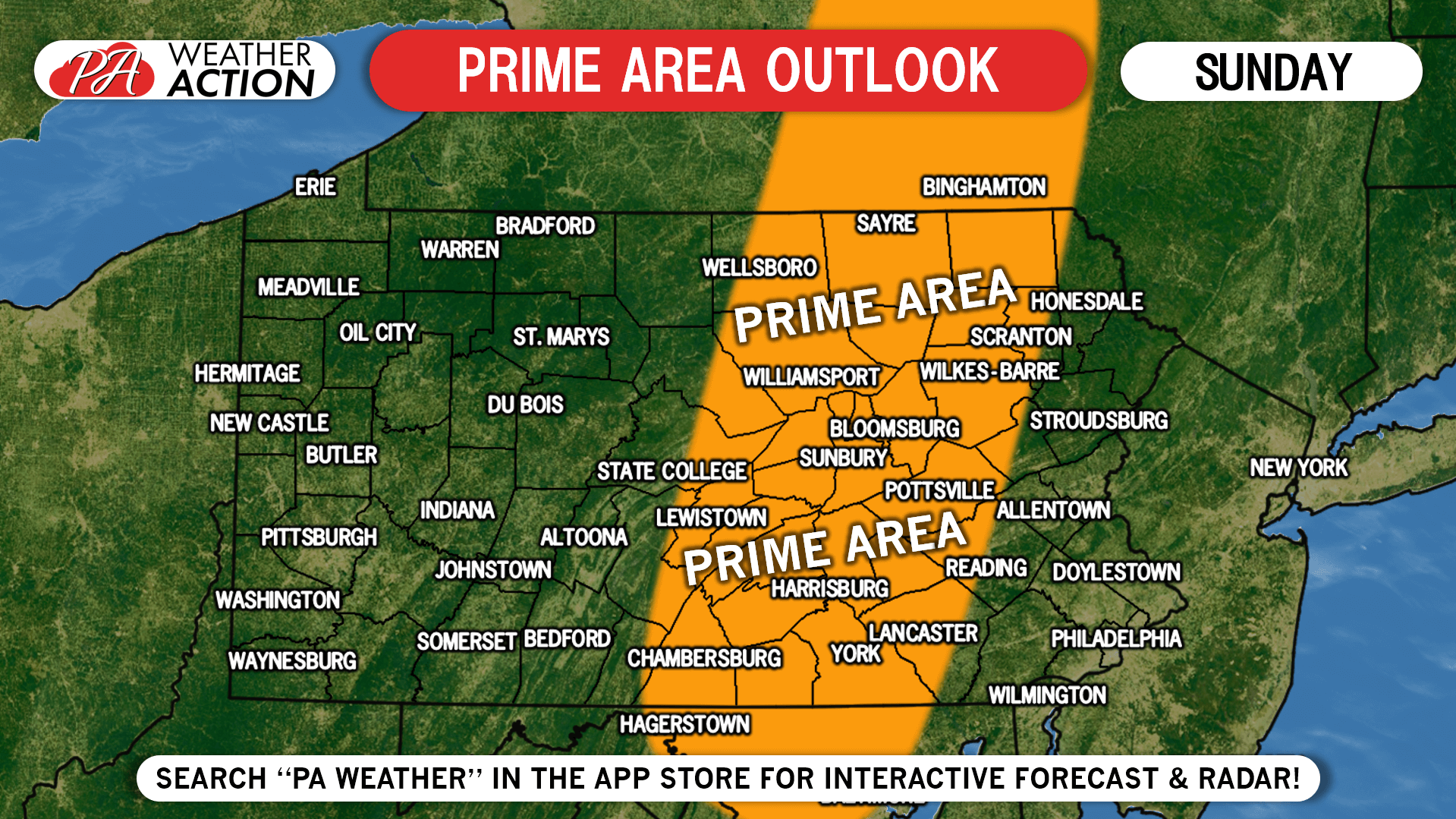
PRIME AREA FORECAST
The “prime” area for strong to severe thunderstorm development and strengthening looks to be in the entire Susquehanna Valley.
TIMING FORECAST
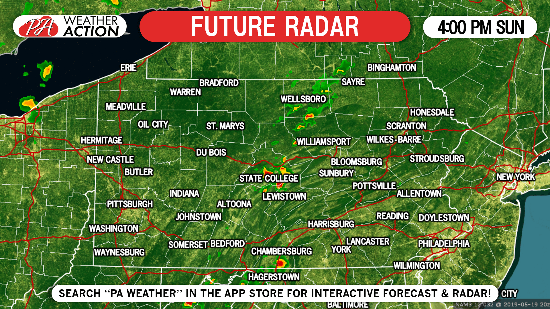
Let’s get into timing for central and eastern PA. Scattered storms will begin to pop-up in the mid-afternoon central PA. They are expected to strengthen as they move east-northeast, with a few likely hitting severe criteria. Below is future radar (Hi-Res NAM) for 4:00 PM Sunday.
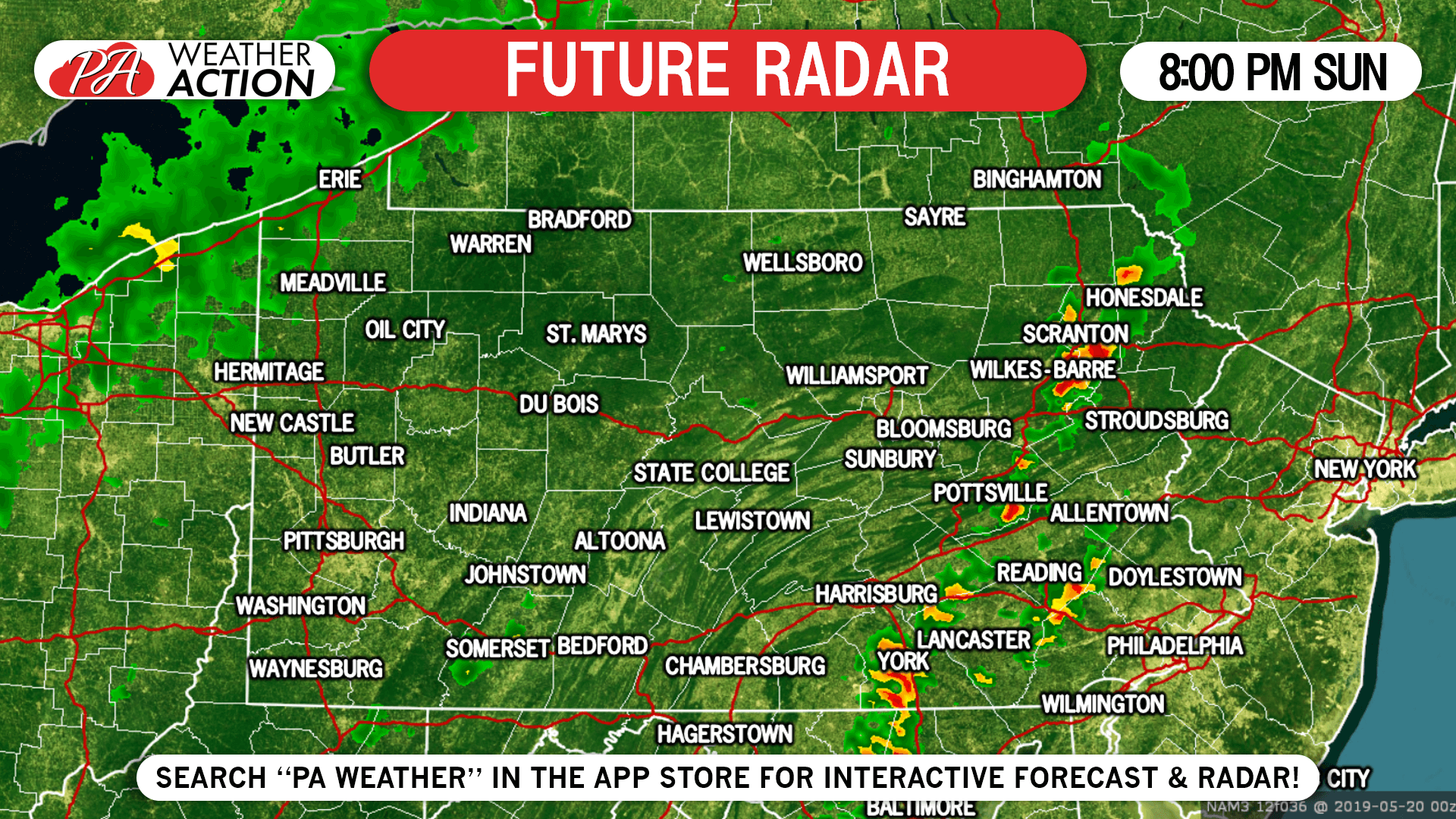
A broken line of strong to severe storms will organize and move east-northeast through the Susquehanna Valley and into the eastern third of the state by Sunday Evening. Here is future radar for 8:00 PM Sunday.
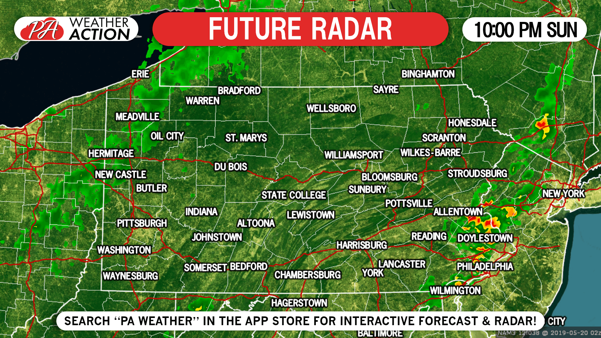
Instability will lower as the sun sets, likely causing thunderstorms to weaken as they push into southeast PA between 8-10 PM. Future radar for 10:00 PM Sunday is below.
SPC SEVERE THUNDERSTORM OUTLOOK
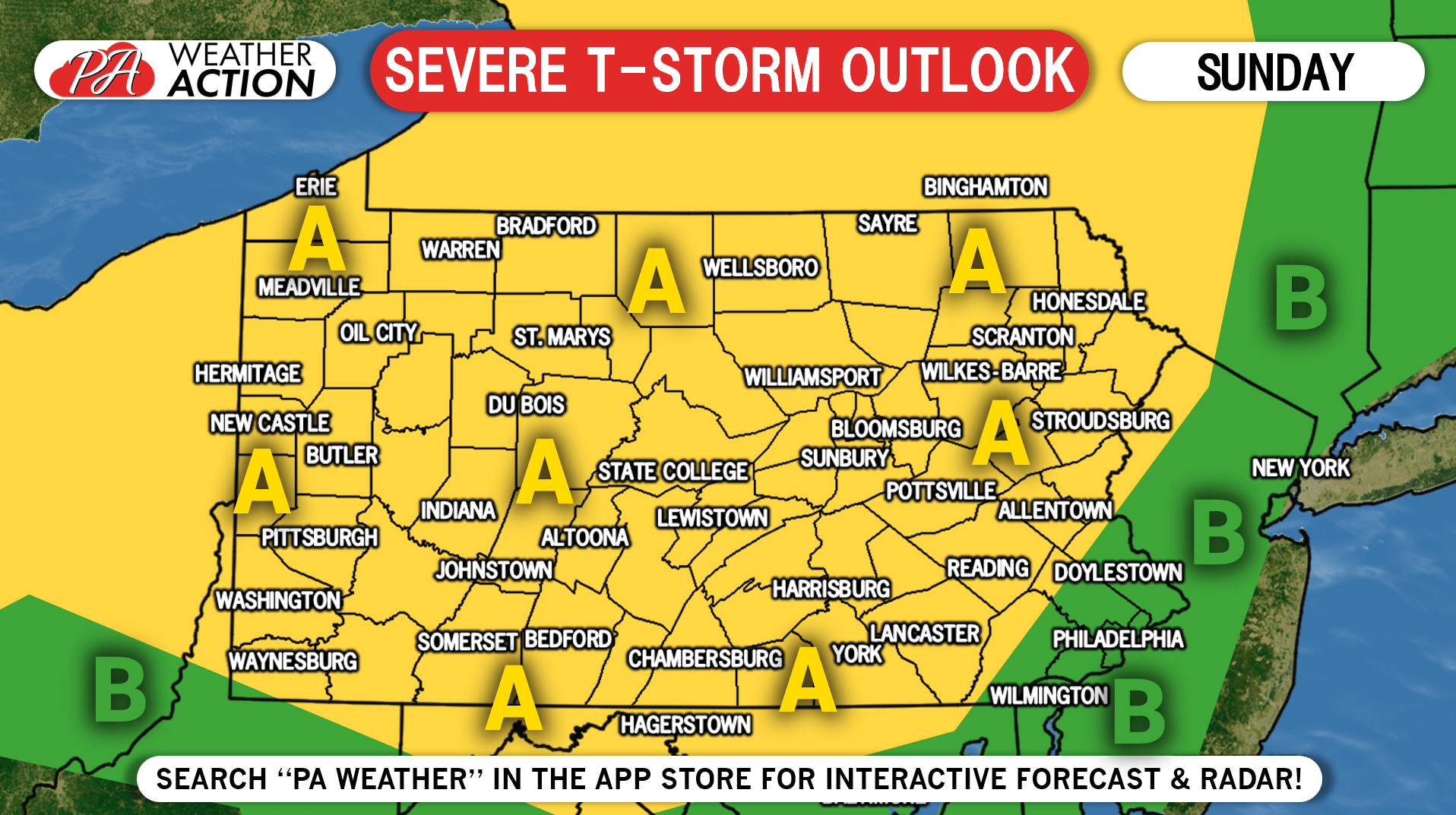
Area A: Strong to severe storms possible mainly in central and eastern PA in the mid-afternoon to mid-evening. Damaging winds and hail are the primary threats, but we’re not ruling out the chance of an isolated tornado.
Area B: Strong storms are possible late Sunday evening around Philadelphia. An isolated damaging wind or hail threat exists mainly near area a.
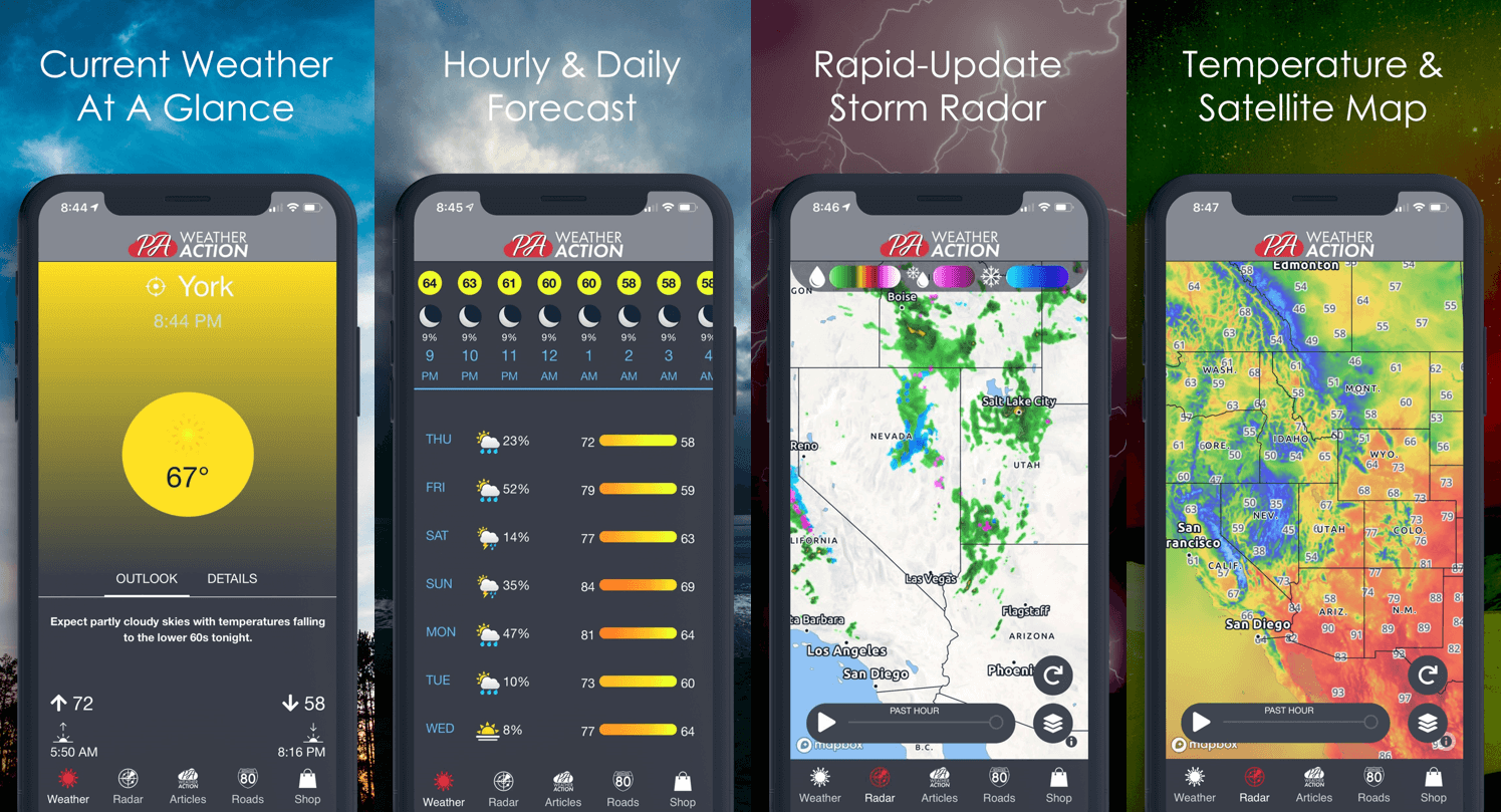
Track the latest forecast, radar, and alerts for your location with our free app! Download it by tapping the image below:
Share this forecast with your friends and family by simply hitting the blue button below, stay safe!
You must be logged in to post a comment.