
March has been more about severe weather than snow here in Pennsylvania. That will continue to be the case, with a strong low pressure over Northern Michigan giving us a perfect setup for significant severe weather this early in the year.
While the Upper Midwest will be buried with feet of snow, we will be on the warm side of the system with a considerable threat of severe thunderstorms. Damaging winds will be the main risk, followed by a few tornadoes possible as well.
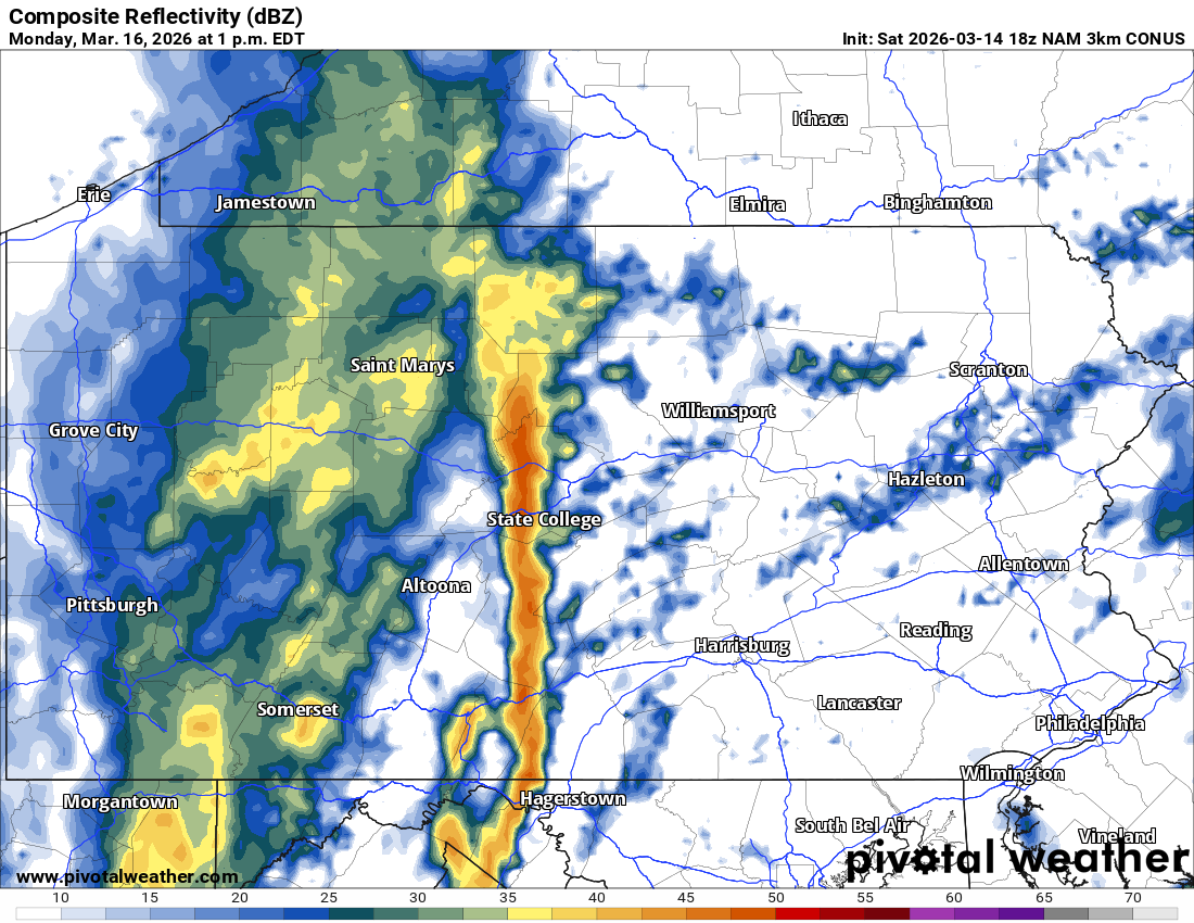
Starting early Monday afternoon, we’re likely to see a line of severe storms form in Central PA. Immediately, the threat of damaging winds of 55-75mph will exist. Below is the late afternoon run of the Hi-Res NAM model for 1:00 PM Monday.
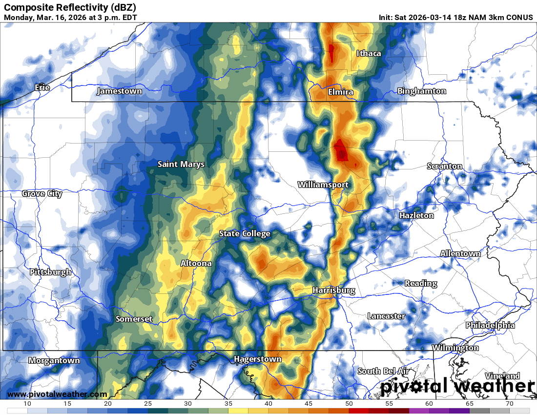
This line will move east quickly, potentially near the Susquehanna River in Central PA by mid-Monday afternoon. There may also be some cells that pop up ahead of the line in the eastern half of PA, and they’d likely bring more of a tornado risk. Here is future radar for 3:00 PM Monday.
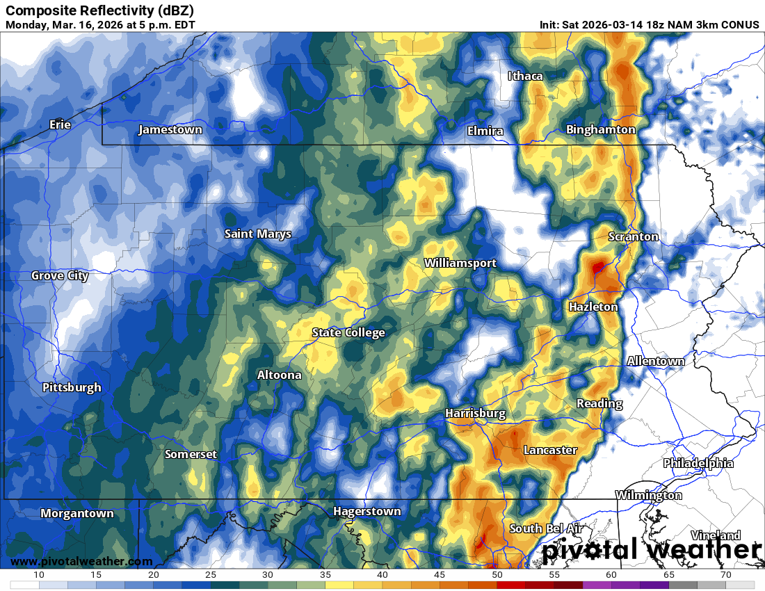
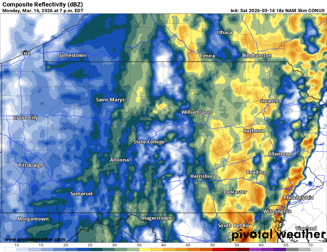
This line will waste no time getting into Eastern PA by the afternoon rush hour. Places like the Wyoming Valley down through the Coal Region and Amish country should be on the lookout around 4-6pm Monday. Below is the Hi-Res NAM for 5:00 PM Monday.
The Philadelphia Metro and Southeast PA is looking at timing around 5-8 PM Monday. Damaging winds are most likely during that period, so be very careful of downed trees/branches and power lines during the evening commute.
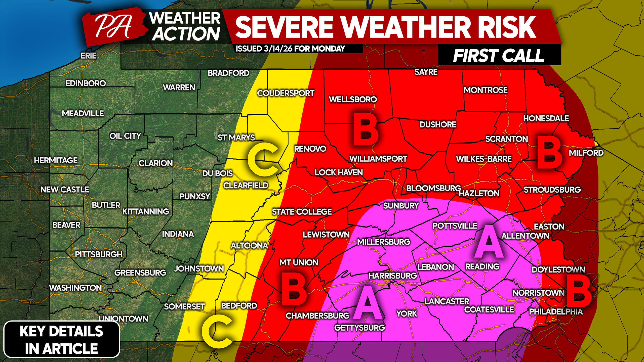
MONDAY’S SEVERE THUNDERSTORM RISK FORECAST
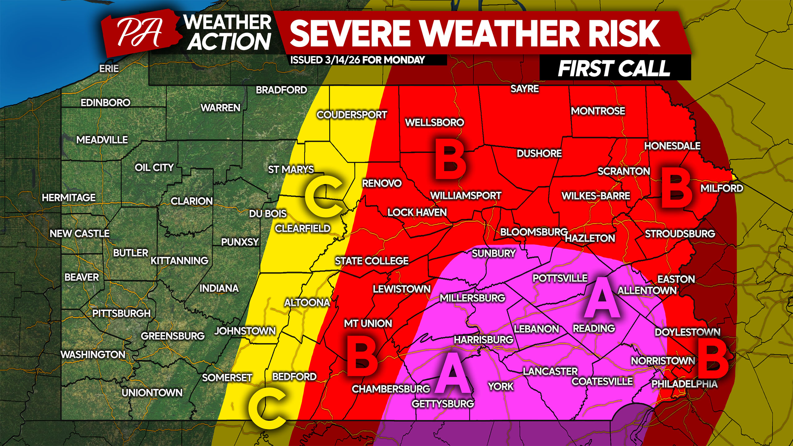
Area A: Widespread severe thunderstorms are expected. Wind gusts of 55-75mph will cause scattered downed trees/branches and power lines. Be careful when driving during and after the storms, as there will likely be objects on roadways.
Area B: Scattered severe thunderstorms are expected. Wind gusts of 50-70mph will cause scattered downed branches isolated downed trees and power lines. Be cautious when driving during and after the storms, as there may be objects on roadways.
Area C: Isolated severe thunderstorms are expected. Wind gusts of 40-60mph may cause scattered downed trees/branches. Be on the lookout for objects in the roadway during and after the storms move through.
Confidence in this forecast is high. Be sure to share this with friends and family!
You must be logged in to post a comment.