
The Storm Prediction Center has highlighted much of the eastern half of the state under a level 2 Slight Risk for the potential for a line of strong to severe storms packing damaging winds and hail Saturday Evening.
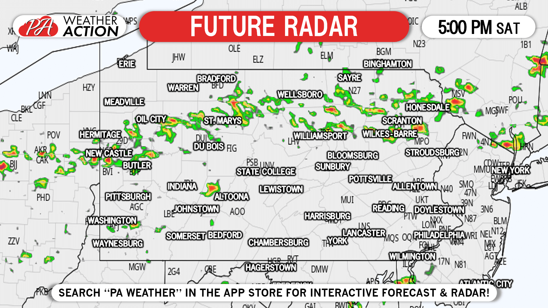
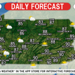
Storms are expected to fire around or just north of I-80 in the late afternoon. An organized line will then likely develop as they move southeast in the early evening. Parts of the line may become severe. Below is the Hi-Res NAM model for 5:00 PM Saturday.
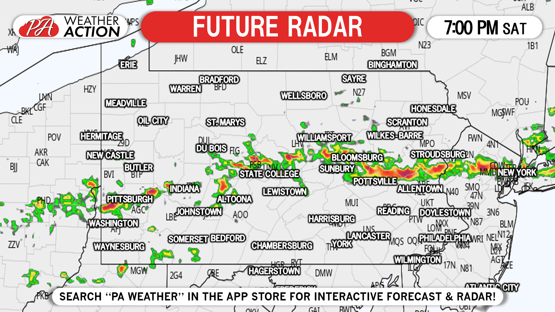
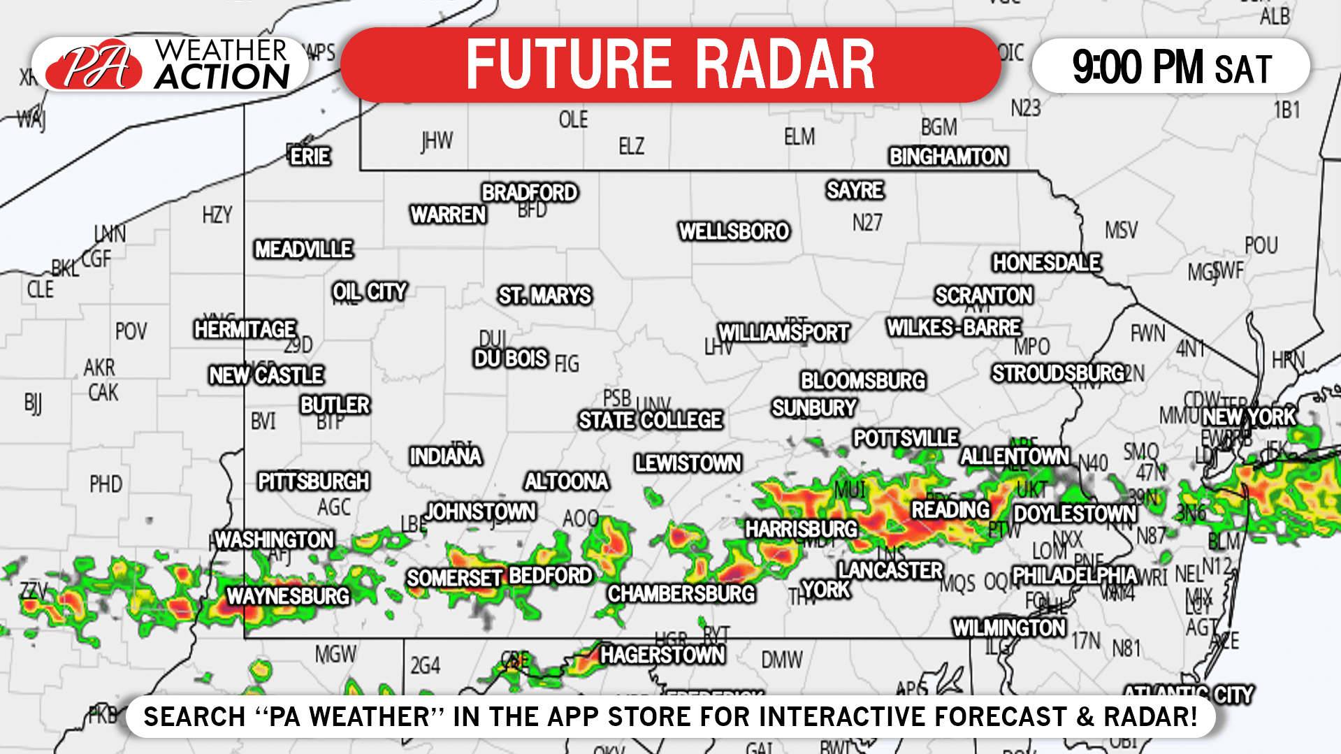
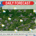
By sunset, the line will move into the Delaware Valley and the Lower Susquehanna Valley. Storms will likely be strongest in this region. Here is future radar for 9:00 PM Saturday.
SPC THUNDERSTORM OUTLOOK
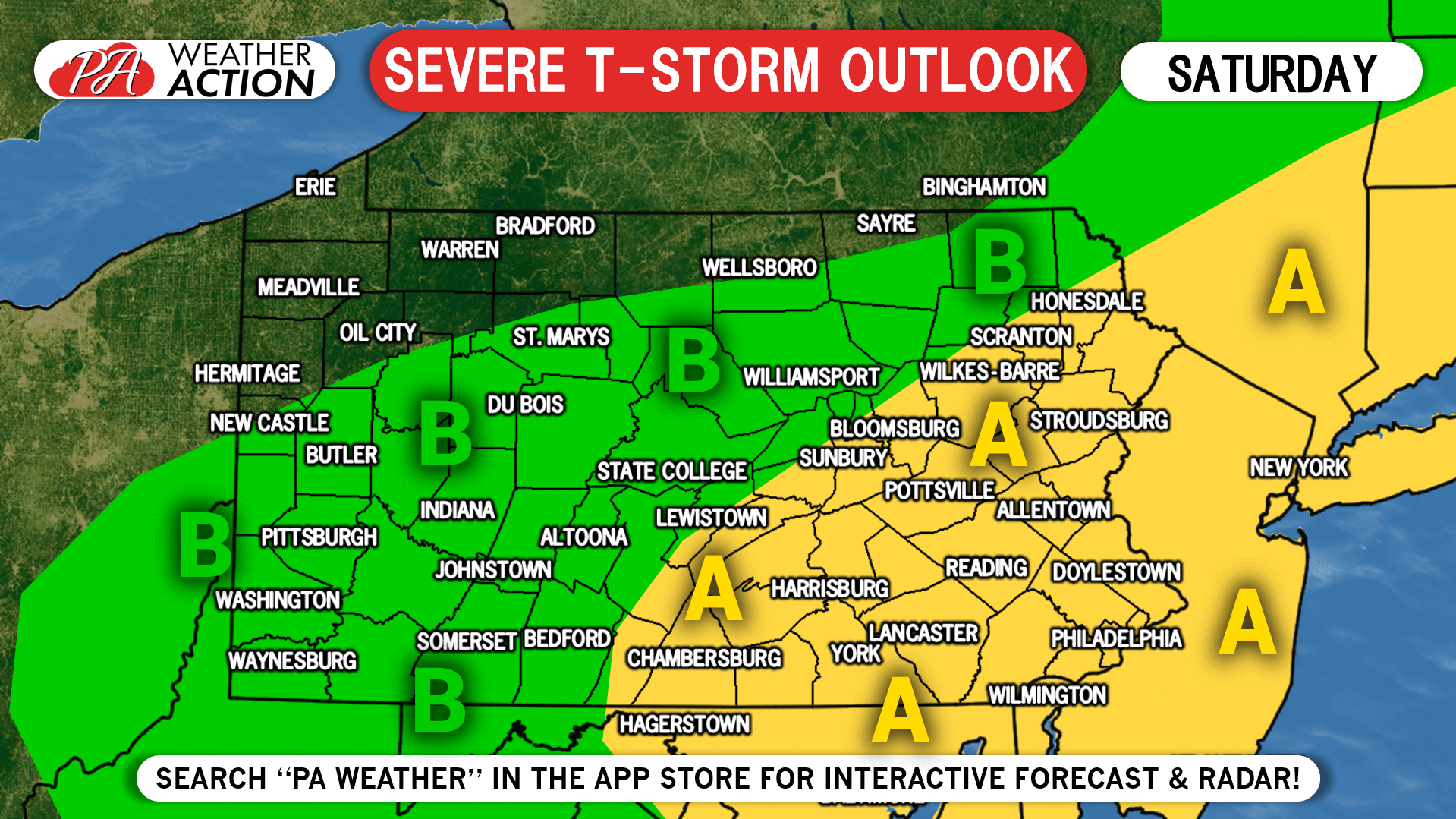
Area A: Strong to severe storms are likely in this region, however not everyone will be impacted equally. Keep an eye on the latest radar and alerts for your area Saturday afternoon and evening.
Area B: Scattered strong to severe are possible in this region. Keep an eye on the latest radar and alerts for your area Saturday afternoon and evening.
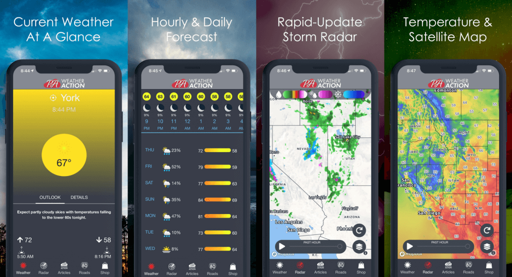
Tap the banner below to monitor the latest short-term forecast, radar, and severe weather alerts with our app!
You must be logged in to post a comment.