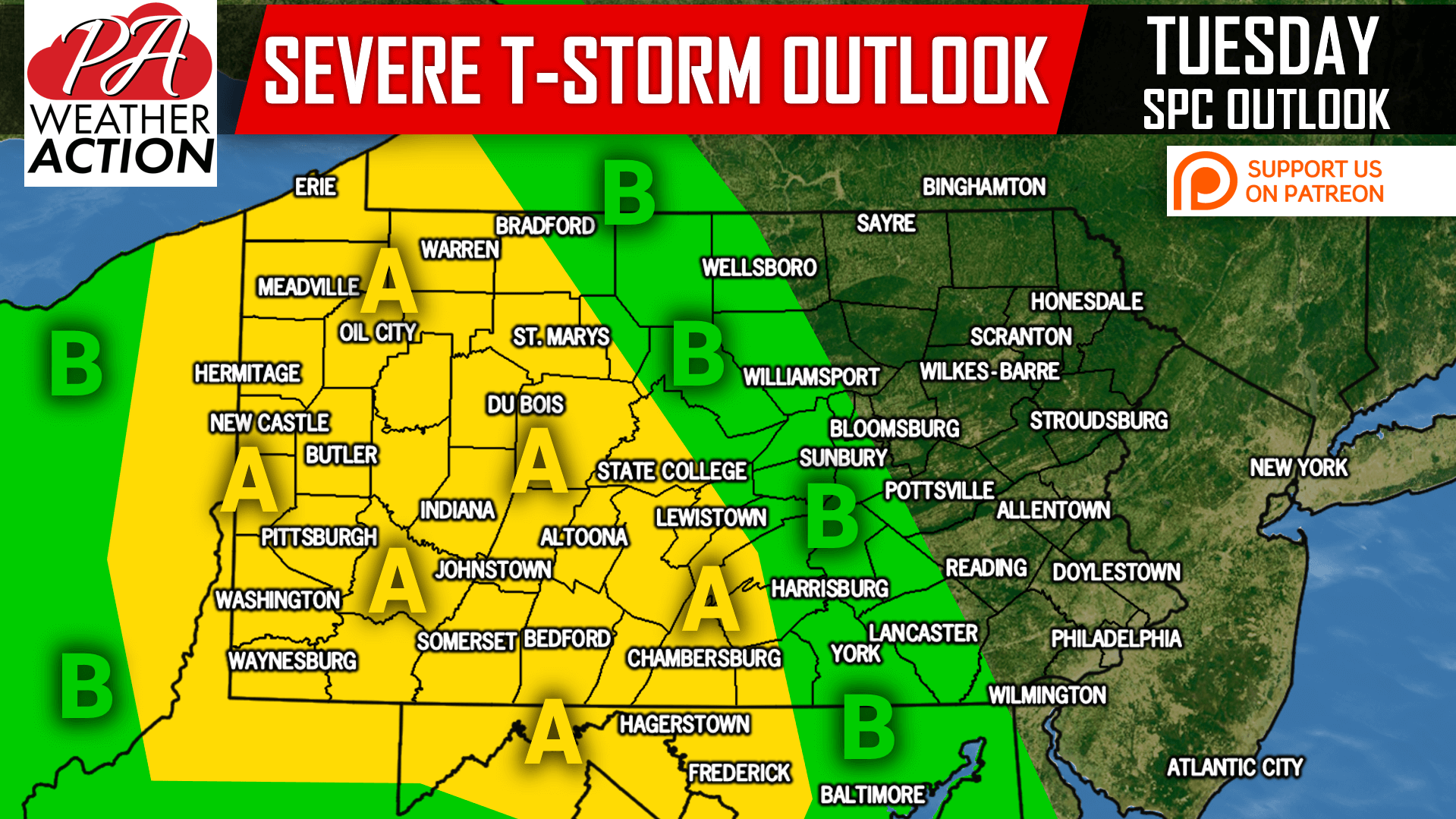
Another round of severe weather is on the way Tuesday. This time around, our focus is on Western and Central PA for the possibility of severe storms accompanied by damaging winds, hail, and a few tornadoes. Conditions will be favorable for individual supercell thunderstorms, along with clusters of strong to severe storms.
Thunderstorms will begin to pop-up mid-afternoon (Tuesday) in Western PA. These storms will strengthen quickly, and by late Tuesday Afternoon scattered severe storms are likely anywhere in Western PA, mainly west of Johnstown and Bradford.
Here is a look at the Hi-Res NAM for 4:00 PM Tuesday:
As you may notice above, storm cells are modeled to be scattered, but potent. The tornado threat is somewhat higher than usual, and a few tornadoes are possible anywhere in Western PA. Below is the Hi-Res NAM for 8:00 PM Tuesday:
By this time Tuesday Evening, it is possible that a line of strong to severe storms could be moving east through the Laurel Highlands and Northwest PA mountains. The line will be weakening as it heads east and looses daytime heating. Keep in-mind storm positioning and timing could still change, but the threat looks to fall off in Central PA.
If you are interested in seeing the full model loop for Tuesday, play the video below.
SPC RISK MAP
Area A: Potent storms in Western PA late afternoon and early evening, followed by a line of strong to severe storms in the Laurel Highlands and possibly Central PA mid-late evening. Damaging winds, hail, and a few tornadoes possible in Western PA (Slight Risk).
Area B: A line of strong to severe storms may move through this area Tuesday Evening (Marginal Risk). Isolated damaging winds are the main threat (Marginal Risk).
Flash flooding will also be possible in areas that receive substantial rainfall.
If you appreciate our work, please consider supporting us on Patreon to receive some great rewards, click here>>>Support PA Weather Action on Patreon!
Remember to download our free app for your latest forecast, interactive radar, alert push notifications, and more >>> Download Our App Here!
Share this important update with your family and friends using the button below!


You must be logged in to post a comment.