
Severe thunderstorm season is beginning to ramp up across the I-80 corridor and even all the way to I-90 as a very warm pattern continues. Today’s outbreak is just getting going across the Upper Midwest and Plains, and the action shifts east Tuesday.
A low pressure way to our north will bring gulf moisture with high dewpoints and instability. In classic East Coast fashion, the storms will mostly come in the form of a line as a cold front pushes through. Although the front will only bring us down from the 80s to the 70s for highs.
Timing is very difficult to nail down to be transparent. Models are absolutely all over the place. There is some consistency in that we may see scattered thunderstorms develop in Western and North Central PA Tuesday afternoon.
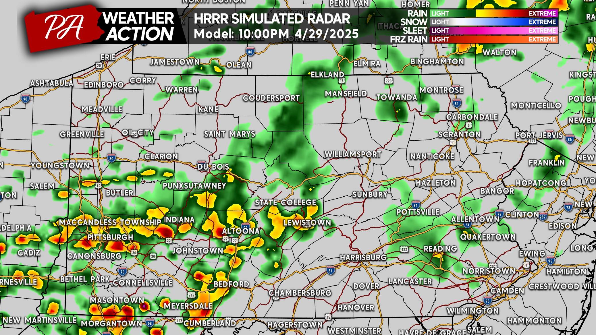
That would then be followed by a line of storms that will run NE to SW, pushing ESE, Tuesday evening. Some models have that line pushing into Western PA around 6-7PM, others like the Hi-Res NAM don’t have the line in Western PA until 9PM.
Below is the HRRR model showing those scattered storms in Northwest PA late Tuesday afternoon. It looks like a line, but we think it’ll be more like a few clusters of storms.
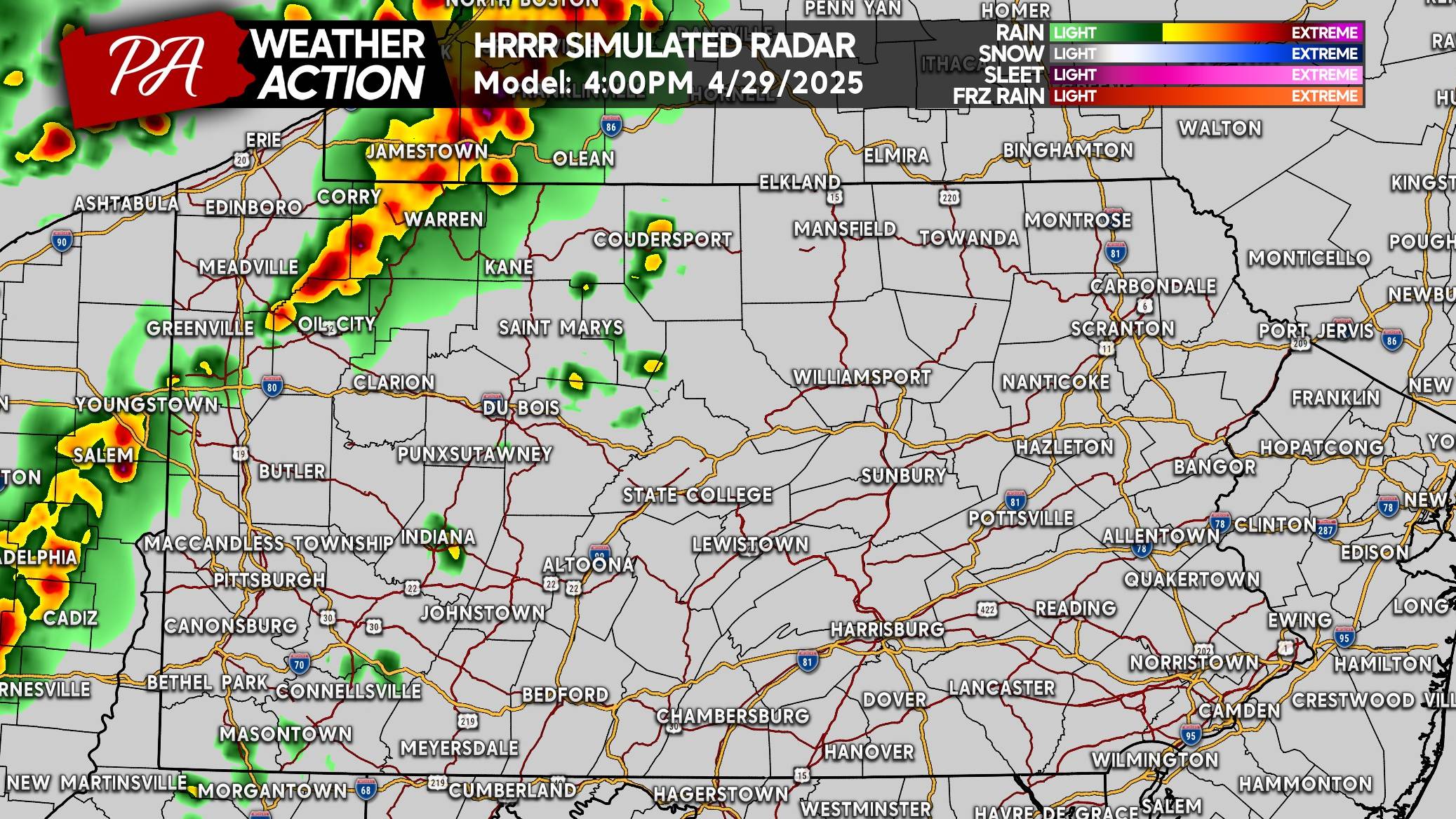
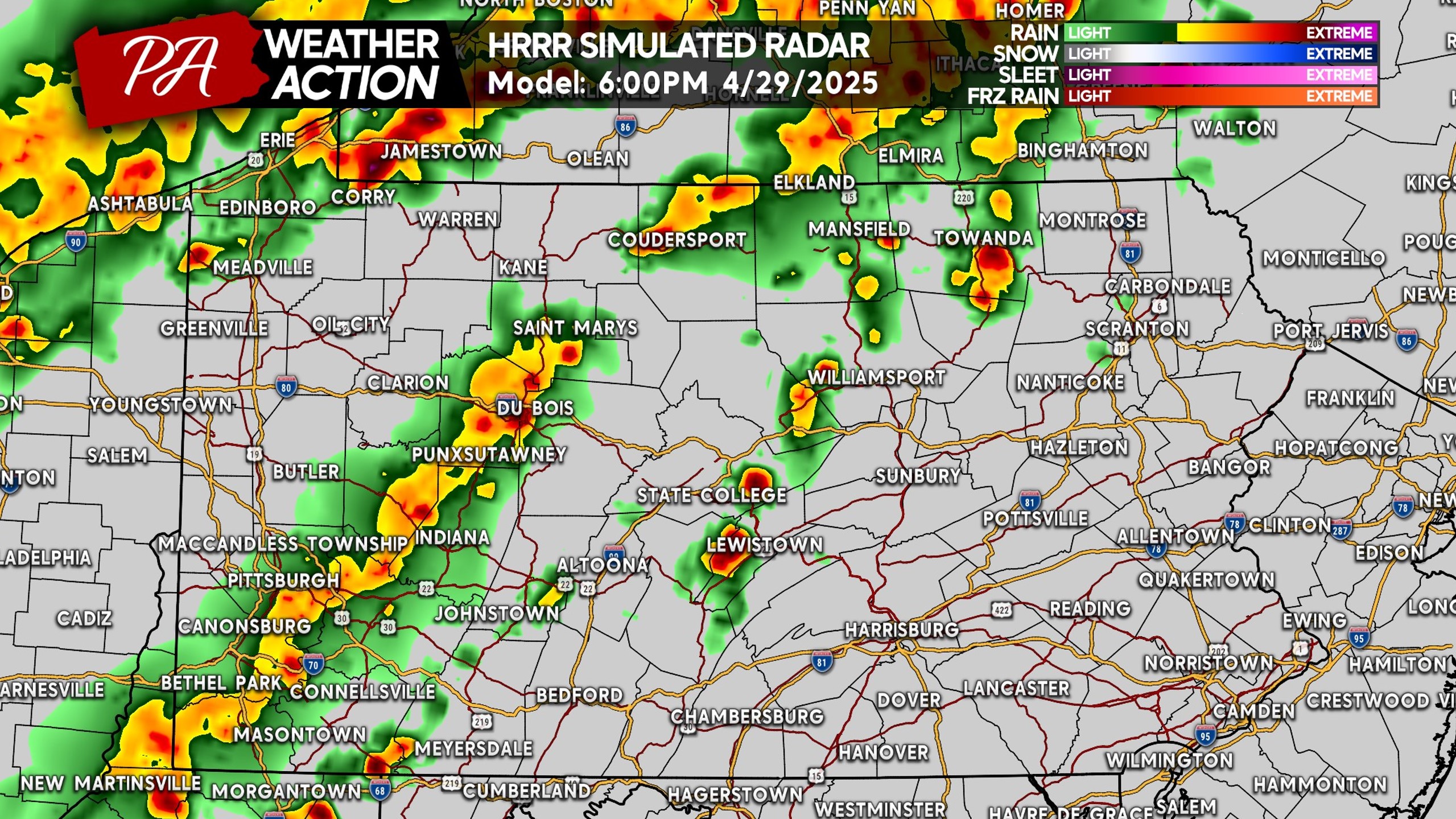
Scattered thunderstorms will then push east into the Alleghenies and Central PA by around dinnertime Tuesday. At the same time, we expect the actual line of storms related to the cold front to begin pushing into NW PA around Erie.
By around 8 PM Tuesday, the line of strong to severe thunderstorms capable of producing damaging winds of 55-75MPH will be nearing the Pittsburgh Metro. It will extend into North Central PA as well.
The activity you see in Eastern PA below is less likely to be severe due to much less conducive dynamics for severe weather in the eastern half of the state tomorrow.
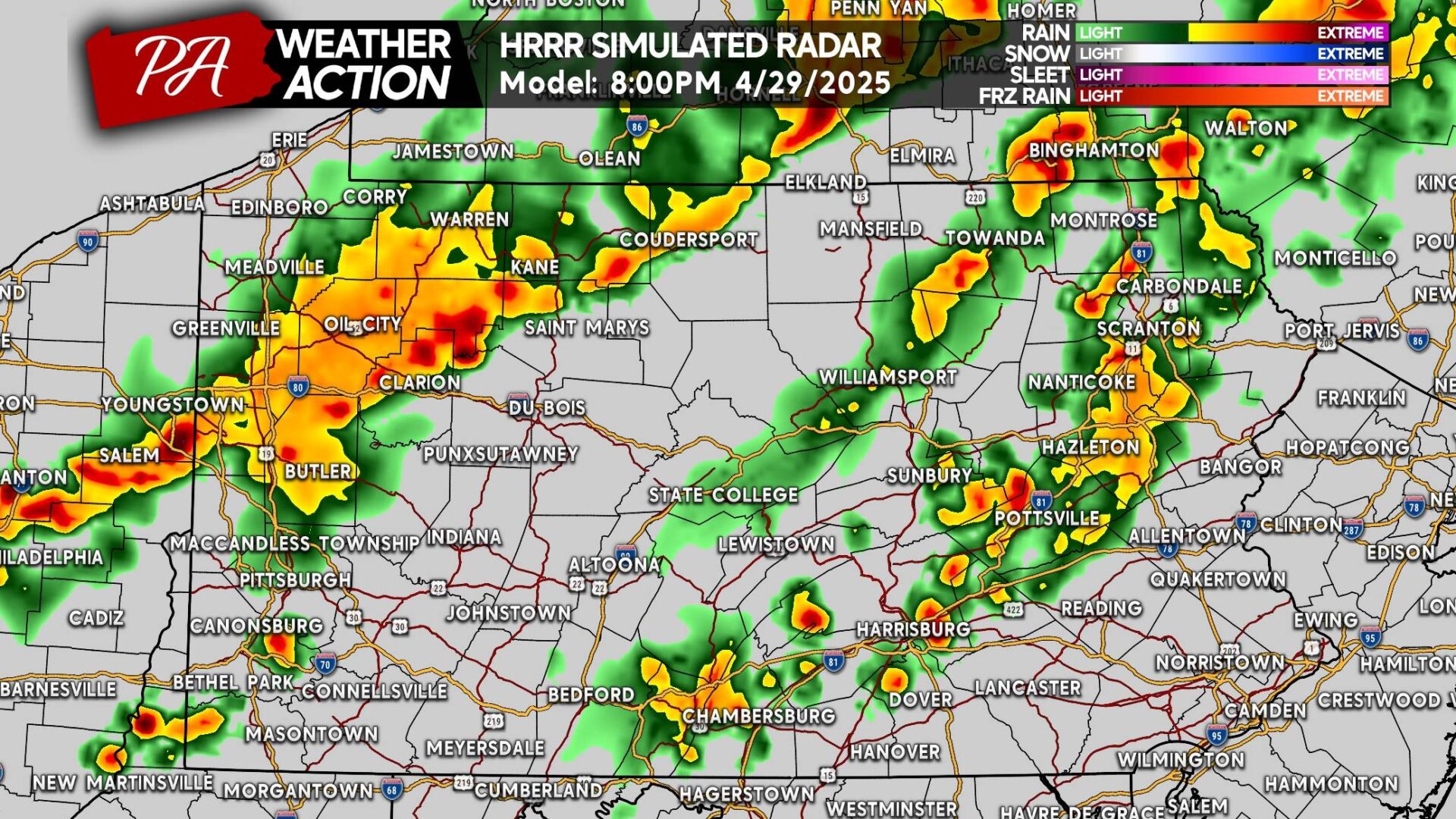
Much of the severe threat late Tuesday evening will be in Southwest PA, but we also think there is a limited threat all the way to near I-81. The model doesn’t show the line extending to I-81, but we think it will. However it probably won’t be severe that far east.
TUESDAY’S SEVERE THUNDERSTORM THREAT MAP
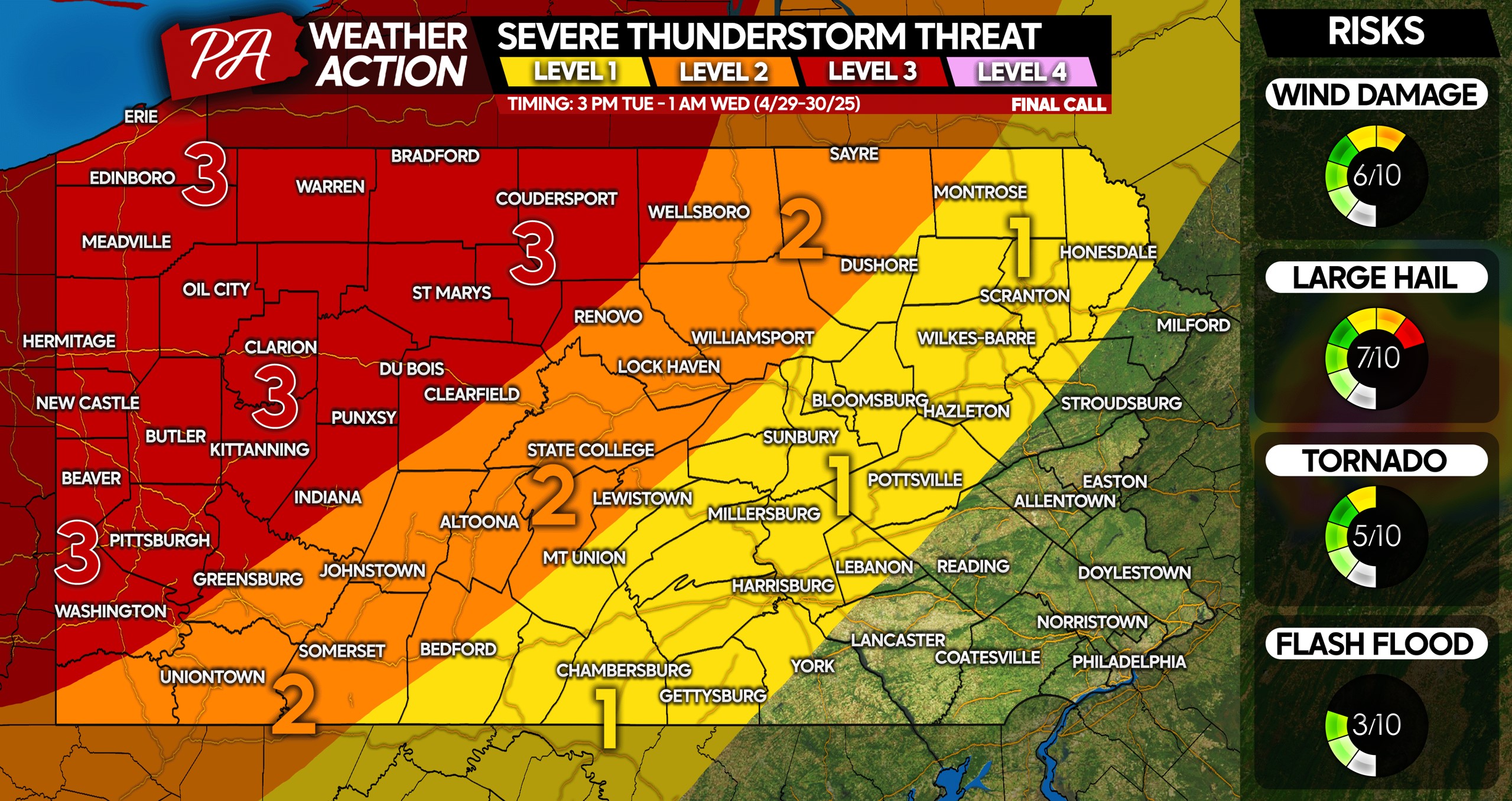
Level 3 Area: Widespread strong to severe thunderstorms are likely. Scattered damaging winds of 55-75mph along with large hail, and isolated tornadoes possible.
Level 2 Area: Scattered strong to severe thunderstorms are likely. Isolated damaging winds up to 70mph are possible, along with hail and a very isolated tornado.
Level 1 Area: Scattered strong storms with a few severe storms possible. Activity will be weakening as it enters this area, but gusty winds of 40-60mph are still possible.
Be sure to pass this forecast along to friends and family in affected areas!


You must be logged in to post a comment.