
Saturday didn’t turn out too bad in terms of severe weather, and it brought plenty of beneficial rain to a lot of areas. However not everyone was so fortunate, and those who miss the storms today will have to wait until late this week for their next opportunity!
The severe threat pushes east today as the cold front approaches the Atlantic Coast, but it’s still situated far enough west to fire off some storms. Of course with the help of hot, humid, and unstable conditions that will exist for one final day – today. Main threat includes damaging winds and maybe an isolated tornado.
SUNDAY THUNDERSTORM TIMING
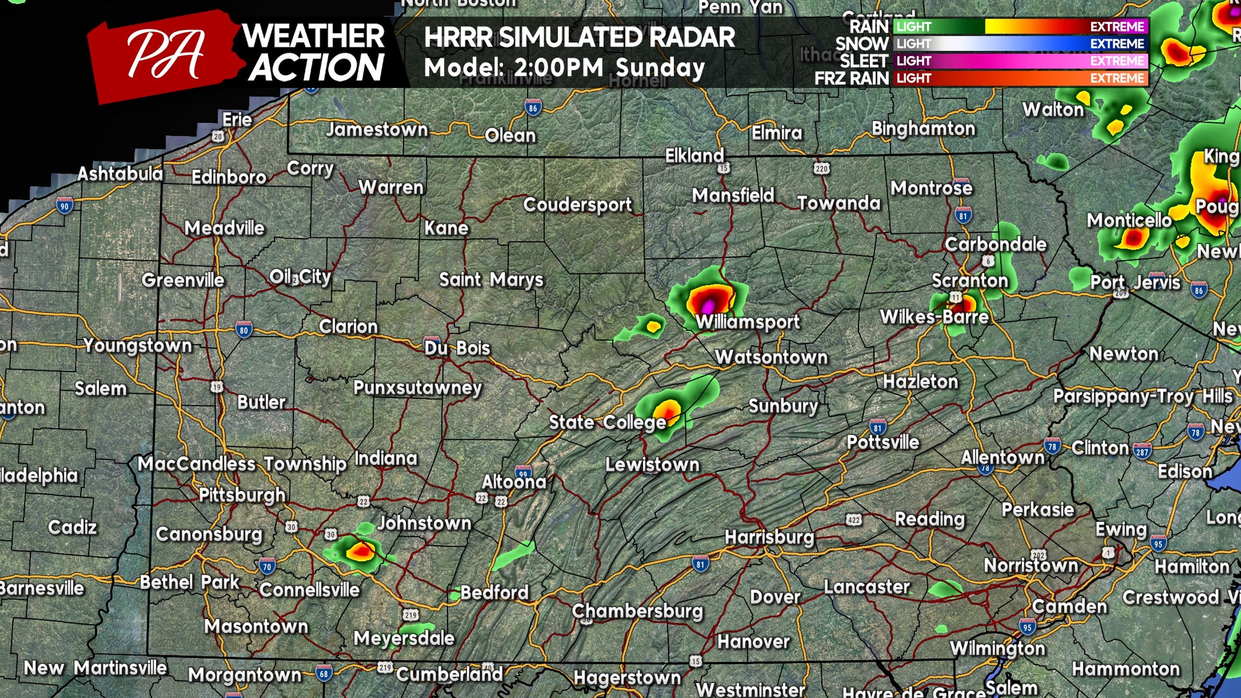
Isolated thunderstorms are expected to fire off near the NY border in Northeast PA around lunchtime today, before more storms develop just south of there across Northeast PA by 2-3 PM, and move into places like the Scranton-WB Area. Keep in mind these will be hit or miss! Below is HRRR Model future radar for 2:00 PM Sunday.
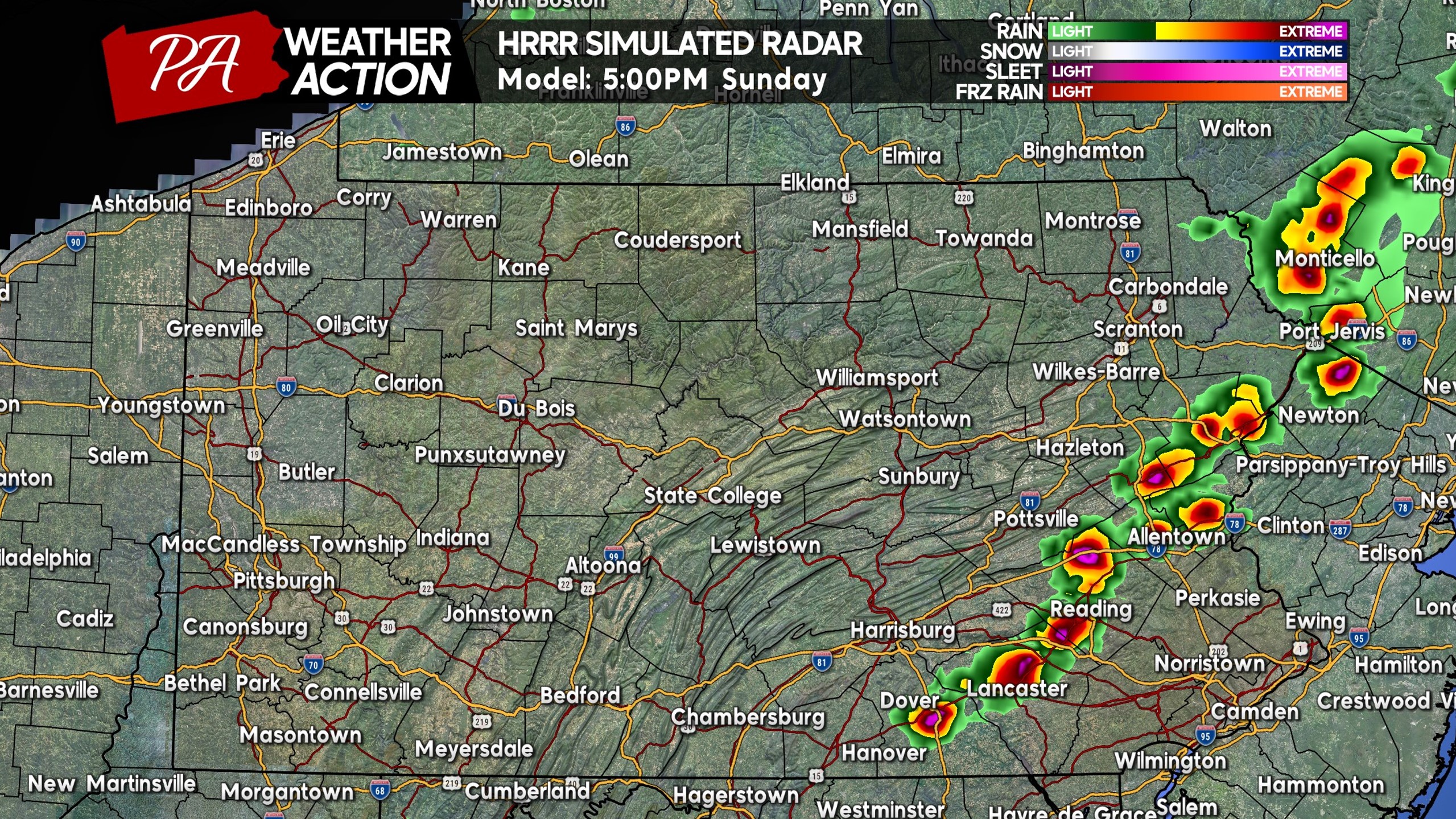
By 4-5 PM, thunderstorms should increase in coverage across Eastern PA as a broken line begins to develop. This is when the highest severe threat will begin, with isolated hail in strongest cells, along with gusty winds of 40-60 MPH, and perhaps even a tornado. As you can see below by 5:00 PM Sunday, widespread thunderstorms are expected from the Poconos to the Lehigh Valley and down through Reading and Lancaster.
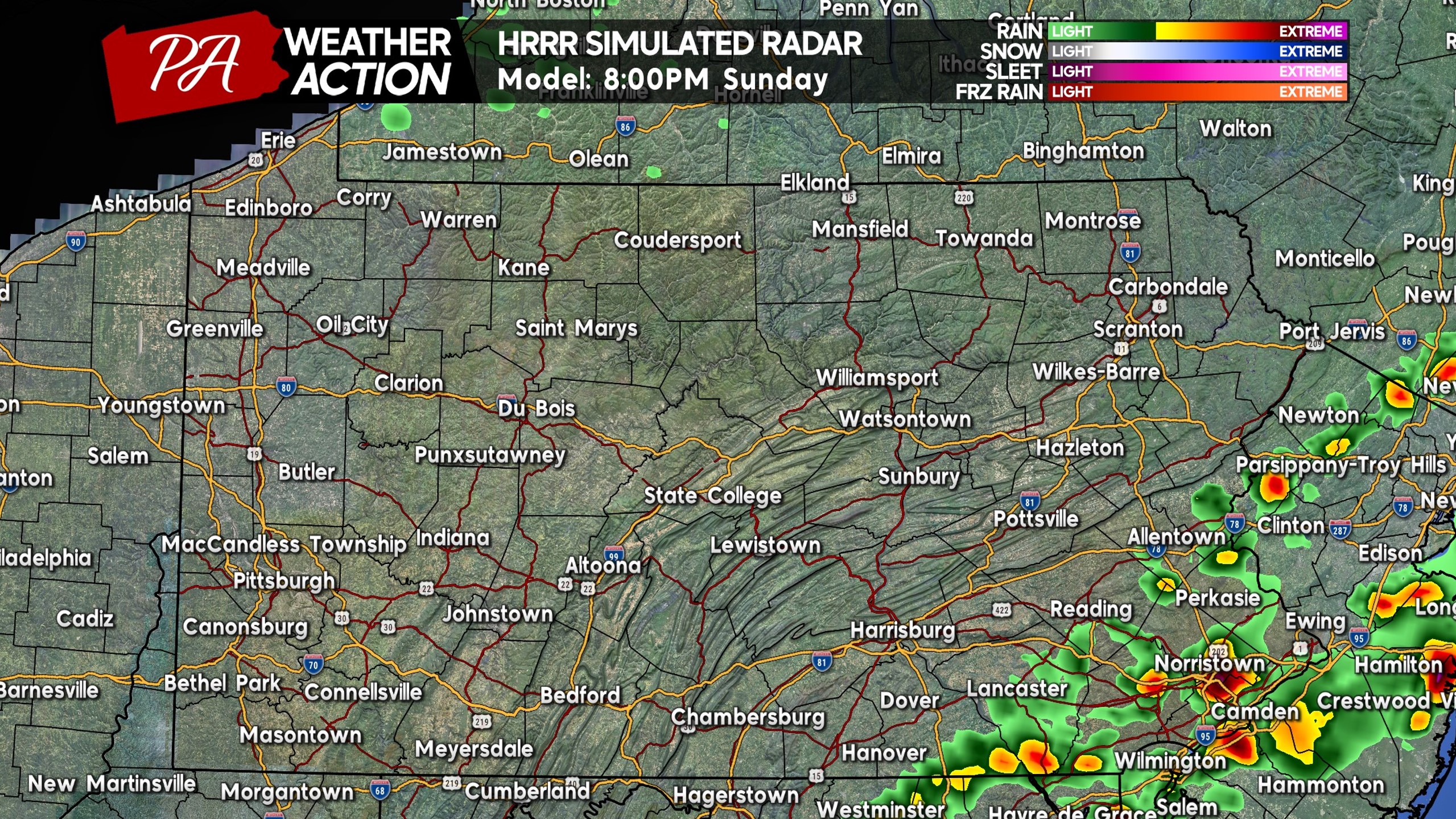
The storms will push east into Southeast PA between 5-8 PM this evening, reaching the Philadelphia Metro by around 8 PM. The severe threat will continue through sunset, so definitely keep a close eye on the radar if you have outdoor plans! Here is future radar for 8:00 PM Sunday.
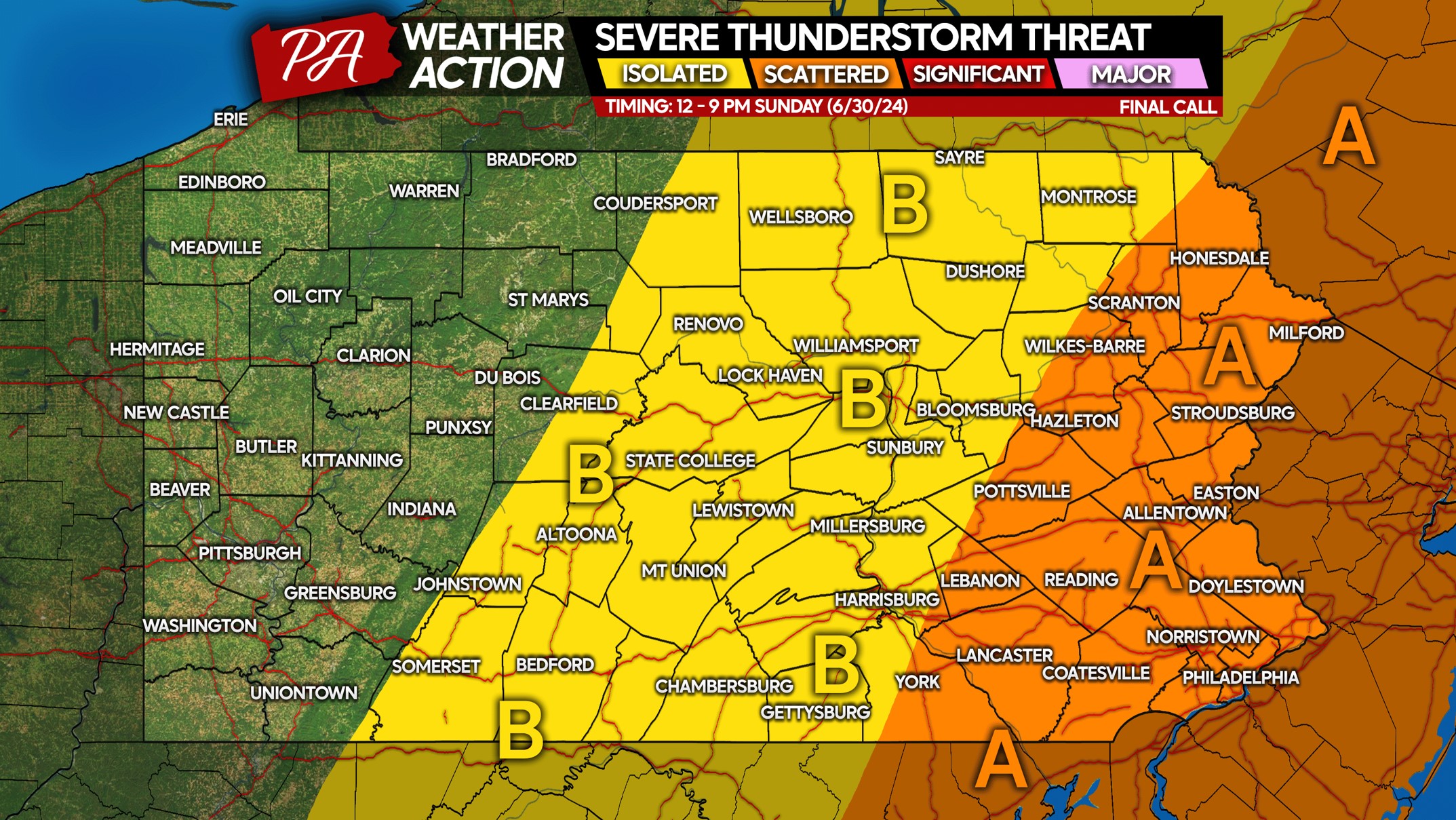
SUNDAY 6/30 SEVERE THUNDERSTORM RISK MAP
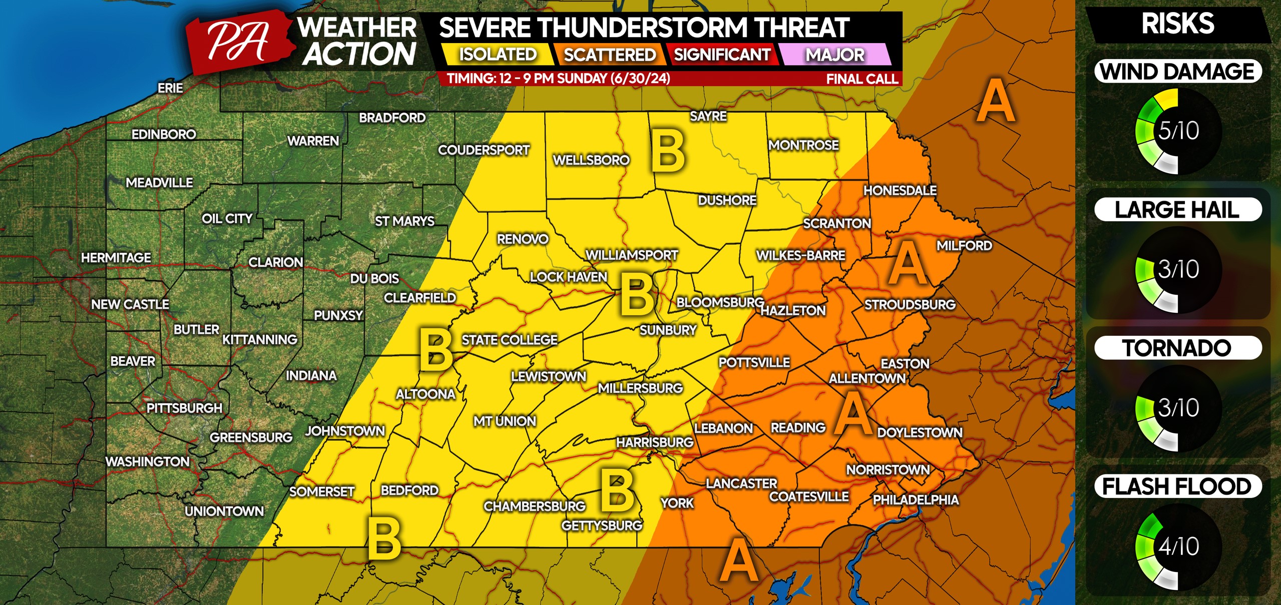
Area A: Scattered strong to severe thunderstorms expected mid-afternoon through mid-evening Sunday. Isolated damaging winds up to 60 MPH are possible. Frequent lightning expected within these storms. Very isolated hail and a tornado possible in the strongest supercells, although the tornado threat is low.
Area B: Isolated strong to severe thunderstorms possible Sunday afternoon, with gusty winds and frequent lightning possible.
A lot of people having Sunday outdoor plans, so please consider sharing this article with them if in the threat area!
Seeing our forecasts on NewsBreak or Google and want to follow us? You can do so on Facebook below!

You must be logged in to post a comment.