
Today was everything so many of us were waiting for since November. Bright blue skies, temperatures around 70, sunset after 7pm. A feeling that we made it through yet another northern winter, especially after this one. We have two more days of this before it’s back to typical March weather, and that transition will involve some severe weather.
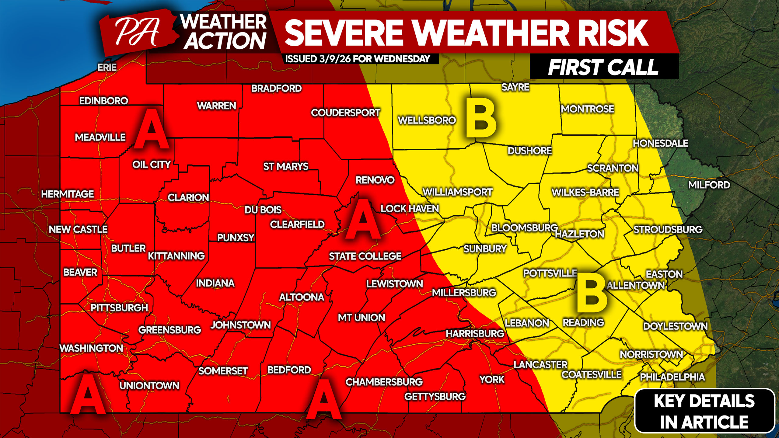
Damaging winds, hail, and tornadoes are all on the table Wednesday. Damaging winds will be the primary risk as is the case almost always here in PA.
SEVERE WEATHER TIMING
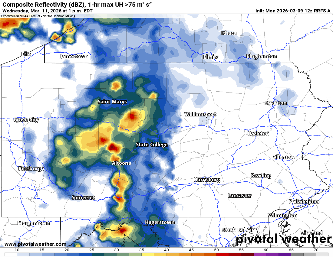
Models are not in agreement with timing and severe weather coverage, but we think reality will look something like the RFRS model. Strong storms will begin to be a possibility in the western half of PA around lunchtime Wednesday, as shown below.
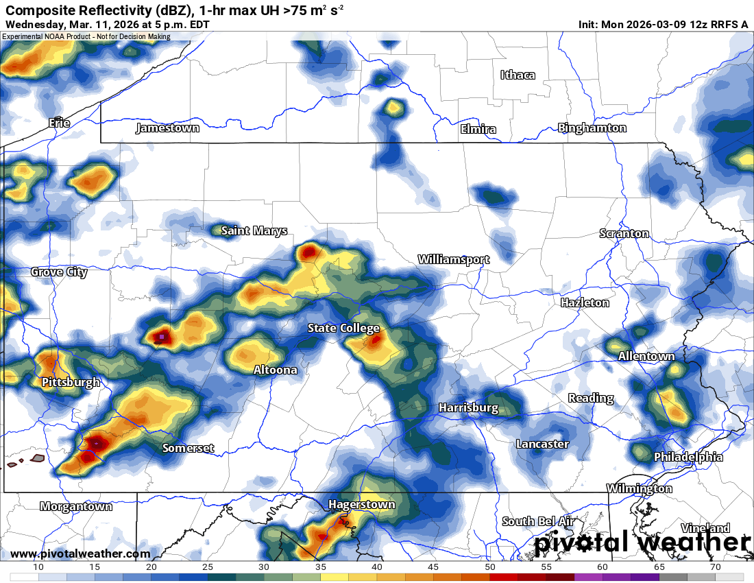
As the afternoon progresses, strong to severe thunderstorms with isolated supercells will be focused in mainly the southwest quarter of the state as shown below. However, north of I-80 is just as much in the game. Below is a look at the RFRS model for 5 PM Wednesday.
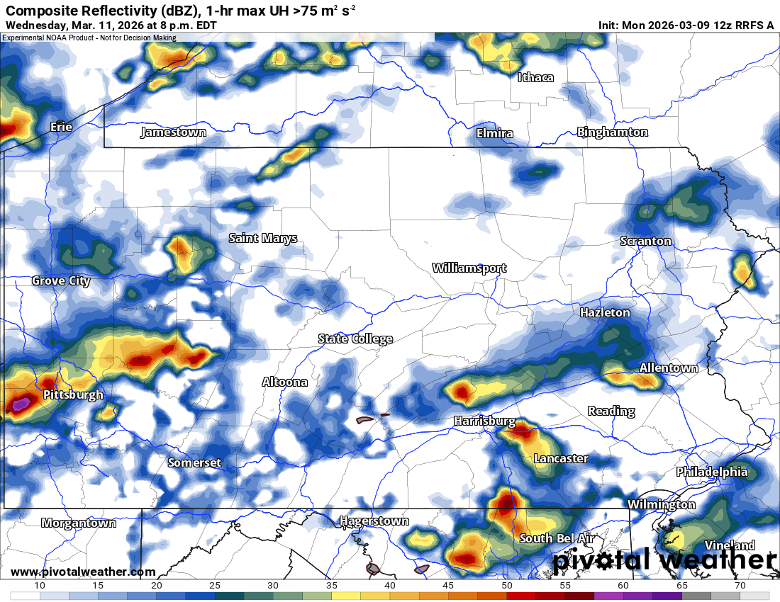
By sunset, storms will continue to be scattered around Western and Central PA, with a few storms making it into Eastern PA. Roughly between 4-9 PM is when the highest severe thunderstorm risk will be.
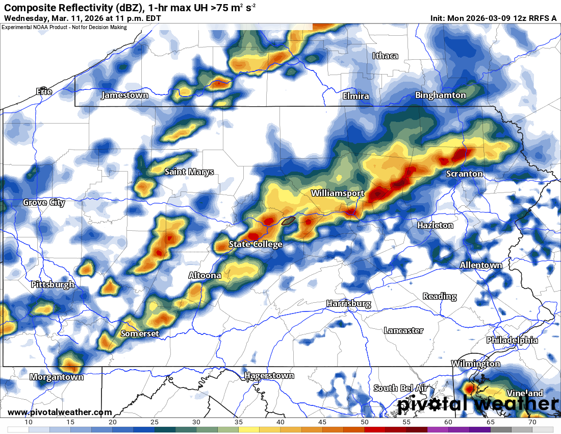
Finally by the very late evening, we’ll see perhaps a line of thunderstorms just ahead of the actual cold front assemble from southwest to northeast. By then, damaging winds will be the prevailing risk.
WEDNESDAY’S SEVERE THUNDERSTORM RISK IN PA
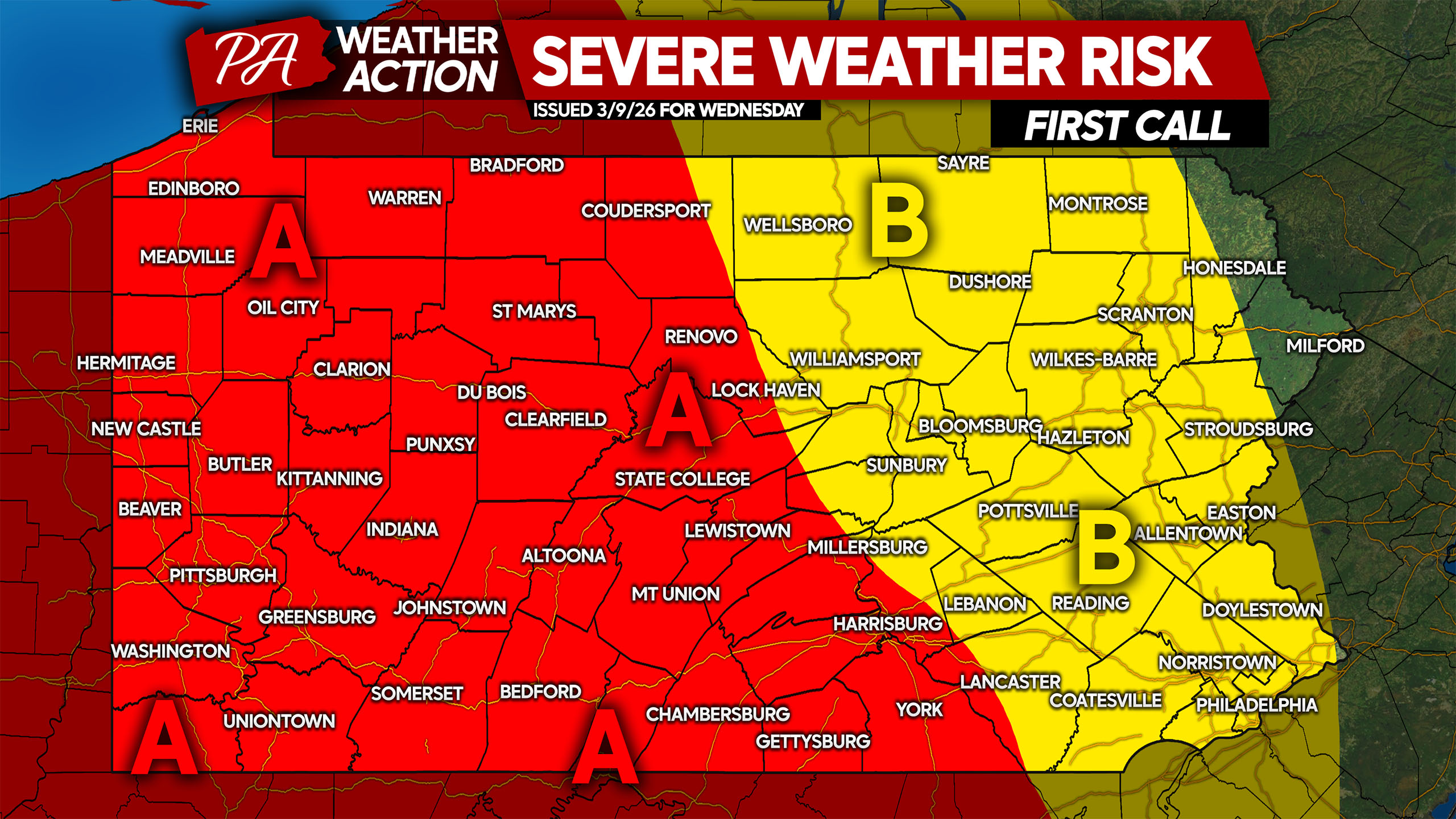
Area A: Scattered severe thunderstorms are expected Wednesday afternoon and evening. Damaging winds up to 70mph are the main hazard, with isolated tornadoes possible.
Area B: Isolated strong to severe thunderstorms expected late Wednesday afternoon into the evening. Damaging winds up to 70mph are the main hazard, with a very isolated tornado possible.
We will have another update to this forecast on Tuesday.
Don’t forget to share this forecast with family and friends who may have plans Wednesday!
You must be logged in to post a comment.