
After this evening’s and tomorrow’s on and off rainfall, our attention turns to Wednesday for severe weather. A warm front will lift northward overnight Tuesday into early Wednesday morning, allowing for a cold front to pass through the state from west to east Wednesday afternoon. This cold front has the potential of producing scattered severe thunderstorms capable of producing winds in excess of 60 MPH.
Below is a look at the future radar for 3:00 PM Wednesday afternoon showing the cold front entering Western Pennsylvania with plenty of severe thunderstorms along the front: 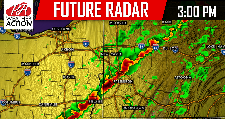
There is still a question as to how well the line of severe weather will maintain its strength as it continues to head eastward Wednesday afternoon. However, the conditions are favorable enough to put most of the area under a SLIGHT RISK for severe weather.
SEVERE THUNDERSTORM OUTLOOK FOR WEDNESDAY ISSUED BY THE STORM
PREDICTION CENTER:
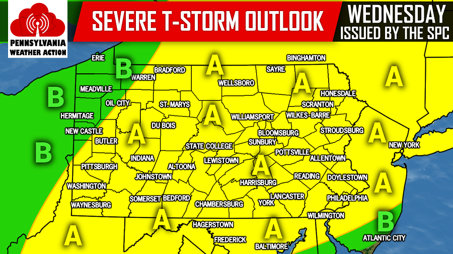
Area A: These are placed under a SLIGHT RISK for severe weather. Scattered severe thunderstorms will be capable of producing damaging winds in excess of 60 MPH, frequent lightning, and heavy downpours. The hail and tornado threat will be rather limited this go around.
Area B: These locations are under a MARGINAL RISK for severe weather. Isolated severe thunderstorms are capable of producing damaging winds in excess of 60 MPH, frequent lightning, and heavy downpours. The hail and tornado threat will be rather limited this go around.
For the latest updates, like our Facebook page by clicking here>>>Pennsylvania Weather Action’s Facebook page
To stay ahead of the severe weather and much more, download our free app today! Click here>>>Pennsylvania Weather Action’s App
You must be logged in to post a comment.