
A surface low is currently located off the New Jersey coast, with a nose of high pressure stretching from New England southwestward into our area. This is inducing a wind blowing westward off the cold Atlantic Ocean, resulting in the cool damp conditions we are experiencing today. Meanwhile, just west of our area, temperatures have soared well into the 50s and even the 60s in central and western Pennsylvania.
FRIDAY:
Meanwhile, another surface low will track northwestward through the eastern Great Lakes tonight and along the St Lawrence seaway Friday. That system will drag a cold front eastward across Pennsylvania Friday afternoon, reaching our area Friday evening, resulting in shower arriving Friday afternoon. Showers will linger into sunrise Saturday. Total rainfall will generally be a third of an inch or less.

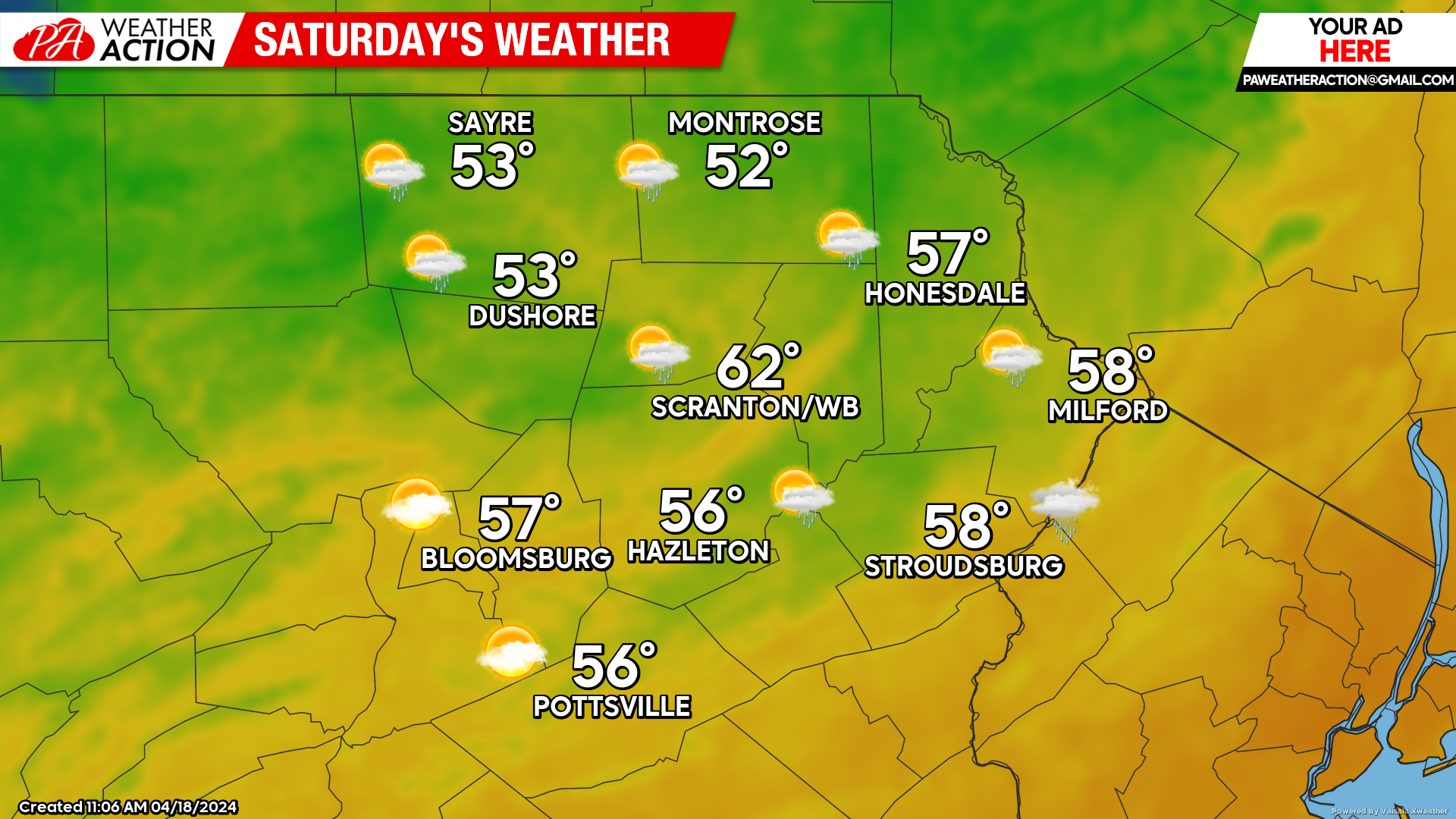
SATURDAY:
After lingering showers around sunrise, Saturday will feature partly cloudy skies and breezy conditions.
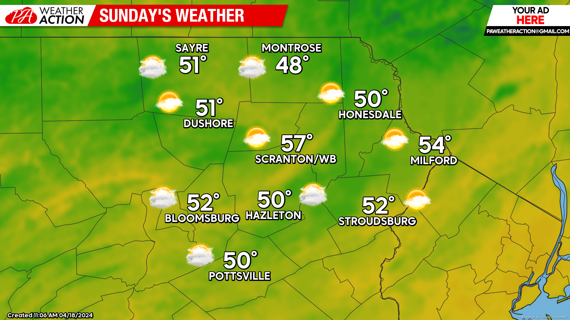
SUNDAY:
Partly cloudy conditions will continue through Sunday, with less breezy conditions.
BEYOND SUNDAY (Mon-Fri April 22-26)
This weekend’s dry weather will continue through Tuesday, along with near-normal temperatures. The next chance for rain will be Wednesday morning when a cold front will cross our area to deliver below-normal temperatures for the end of the week.

You must be logged in to post a comment.