
A line of strong to severe thunderstorms will push into Western PA this evening (Sunday evening), bringing a damaging wind threat with it. However with how this year has gone so far, we can’t rule out a brief spin-up tornado.
STORM TIMING
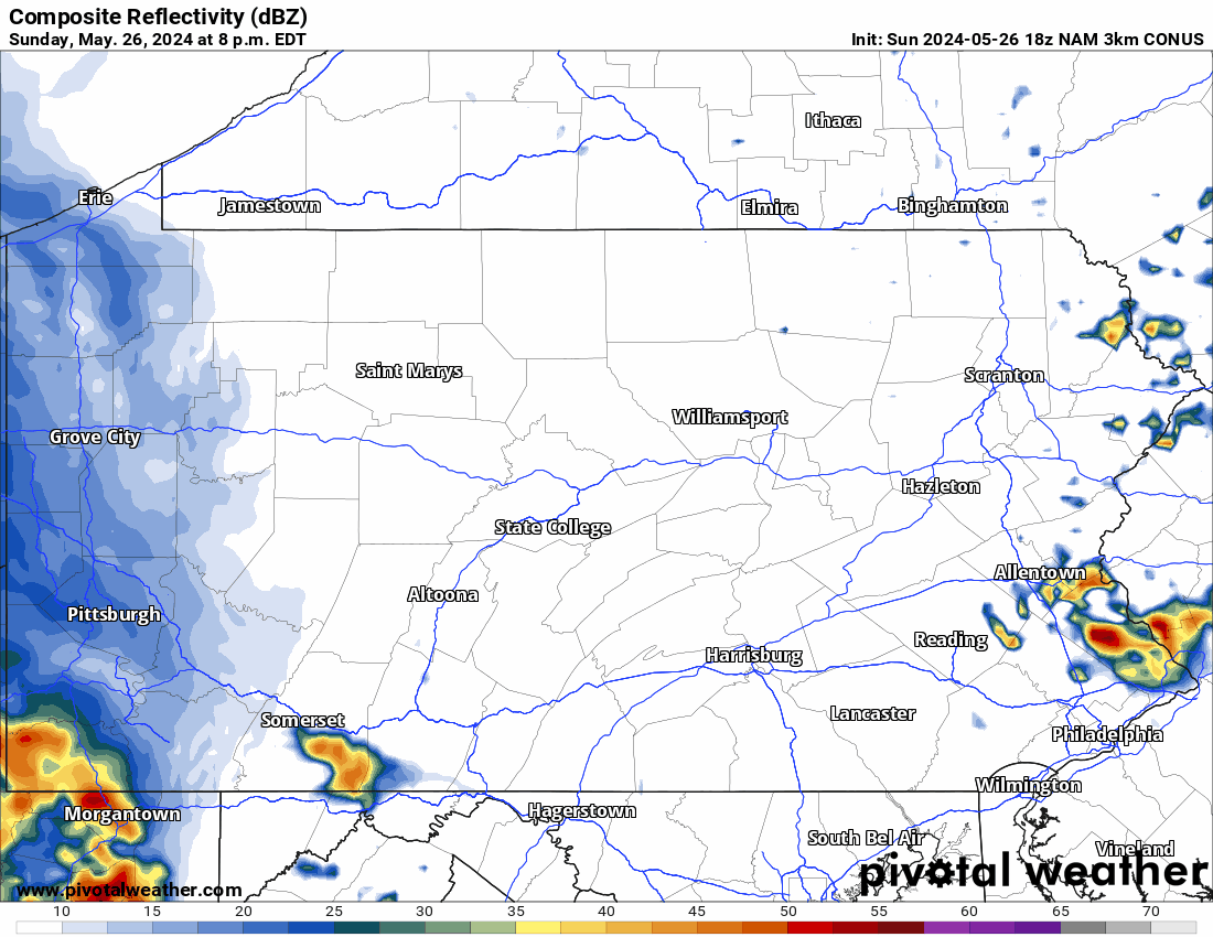
The line will weaken as it approaches the Susquehanna Valley early Monday morning, and will bring showers and rumbles of thunder to Eastern PA by 3-5 AM Monday. Below is an animation from the Hi-Res NAM Future Radar.
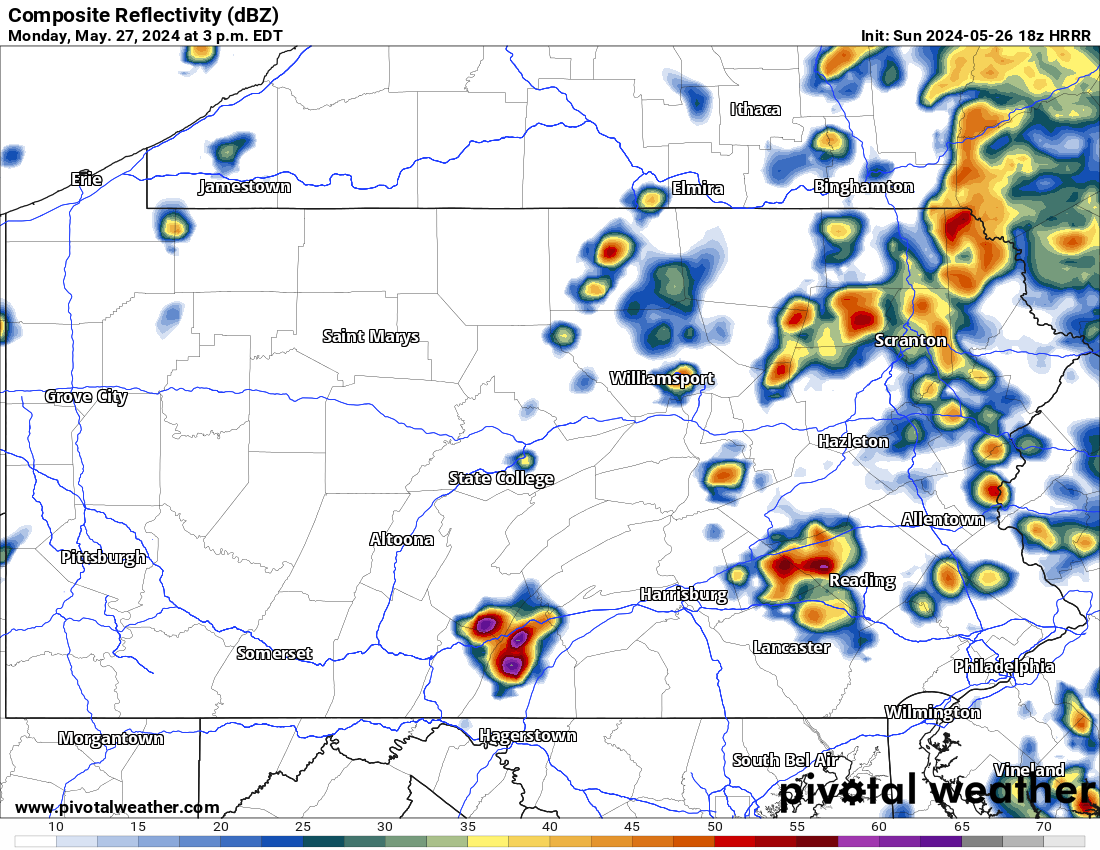
Fast forward to early Monday afternoon when showers and thunderstorms will push through Eastern PA, and clear out shortly after. The real severe threat will then begin around 2-4 PM Monday in Central PA, with storms projected to fire up near Chambersburg up to State College by that time.
Here is future radar for 3:00 PM Monday, showing those storms as very scattered. Storms won’t become widespread until the Susquehanna Valley, which will be a few hours later.
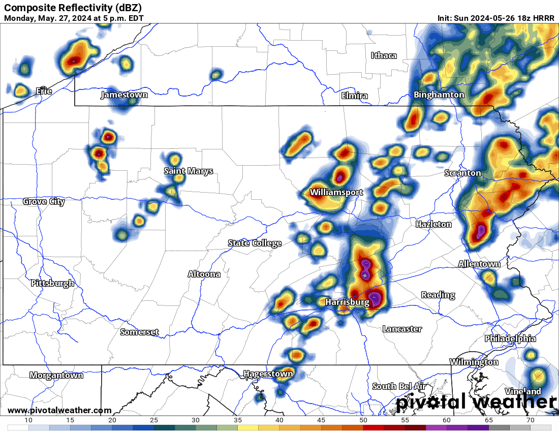
By 5:00 PM Monday, strong to severe thunderstorms will become more numerous in the Susquehanna Valley. With that said, many areas will not see severe-criteria storms.
It’s important to remember that severe season is the opposite of winter, and severe season will always be hit or miss, with a lot of misses. It’s the luck of the draw on days like this, and no forecaster will ever be able to tell you 24 hours in advance that your town will be hit hard but the next town over will see very little.
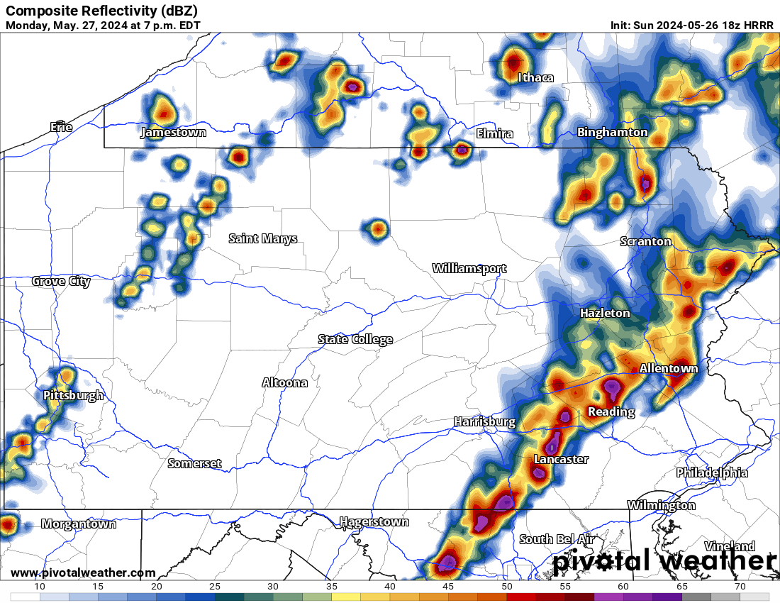
Around 7:00 PM is when we expect storms to be most numerous, from the York-Lancaster area and up into Berks County and the Western Poconos. Early Monday evening is also when the tornado and hail threat will be highest.
Below is future radar from the latest HRRR model for 7:00 PM Monday. While the placement of storms may not be perfect, the general area looks to be accurate.
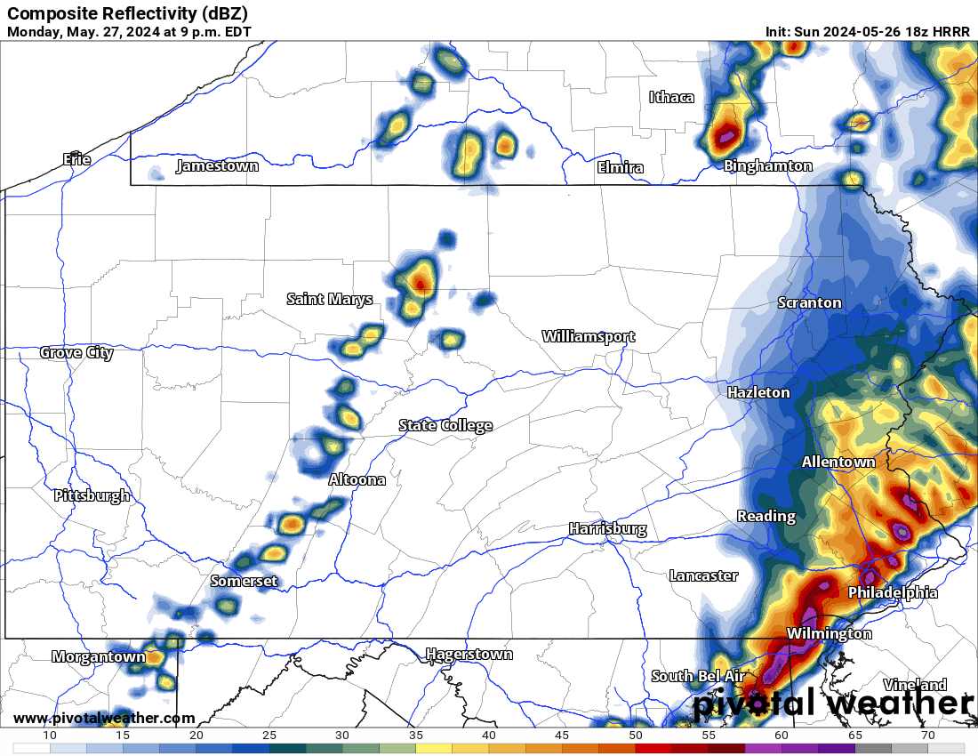
As the storms move into the Philadelphia Metro, they are expected to weaken slightly. However, they will be more widespread in nature as we will go from supercell mode to linear mode, or simply a line of storms by late Monday evening.
Below is future radar for 9:00 PM Monday, showing that line of strong to potentially severe thunderstorms in the north Philadelphia suburbs.
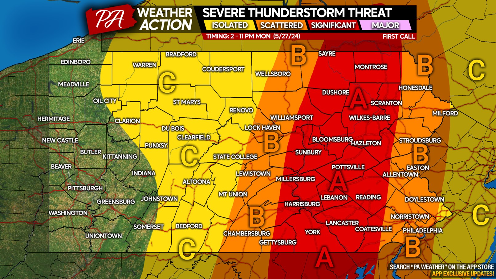
SEVERE THUNDERSTORM THREAT MAP FOR MONDAY 5/27/24
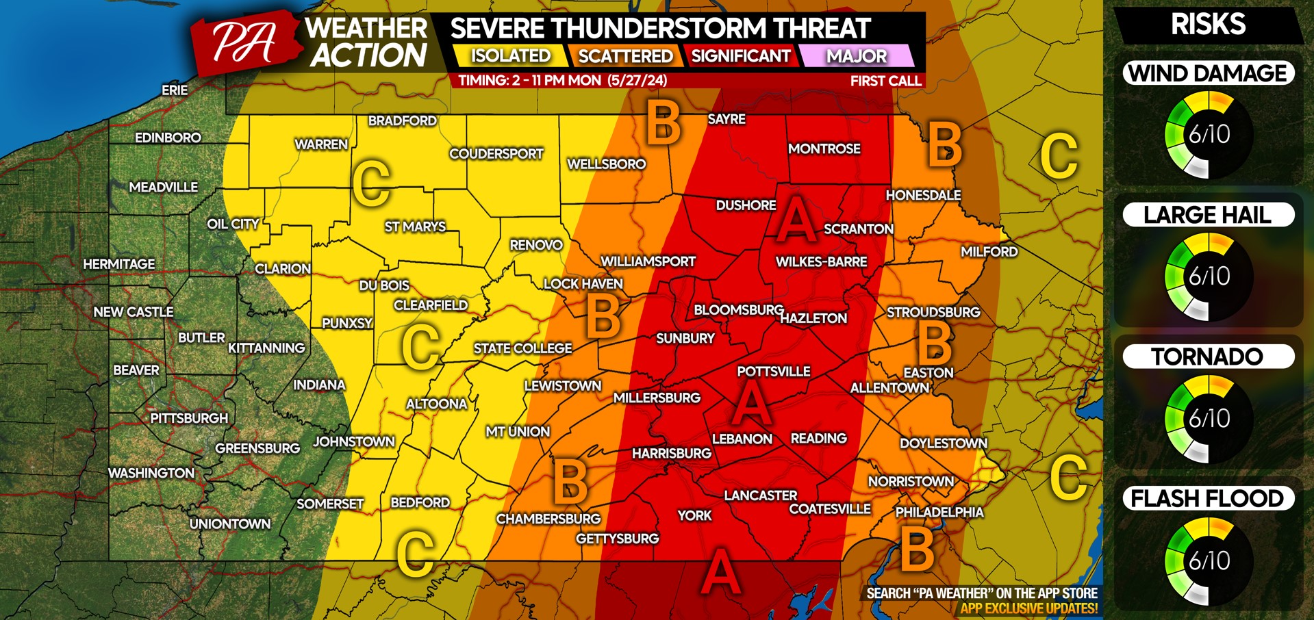
Area A: Numerous severe thunderstorms are likely, view timing details above. Damaging winds up to 70MPH, scattered large hail, and an isolated tornado or two are the risks.
Area B: Scattered severe thunderstorms are likely, see timing details above. Damaging winds up to 60MPH, scattered large hail and a very isolated tornado are the concerns.
Area C: Isolated severe thunderstorms are likely, see timing details above. Wind gusts will mainly be 30-50MPH, with isolated hail possible. A very low tornado threat in this area. Note in Western PA, this map is for Monday PM, not Sunday evening.
Don’t forget to share this forecast with family and friends who have outdoor plans this Memorial Day!
[social_warfare buttons=”Facebook”]

You must be logged in to post a comment.