
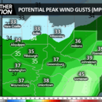
A clipper system will pass to our north tonight, accompanied by snow showers that will deposit a up to an inch of snow this evening. The clipper’s cold front will cross our area from west to east between 9pm and midnight, driving strong wind gusts to 40 mph behind the front that will last into Friday morning. Gusts could exceed 50 mph in the higher elevations. For this reason, the NWS has issued a wind advisory effective tonight through midday Friday.
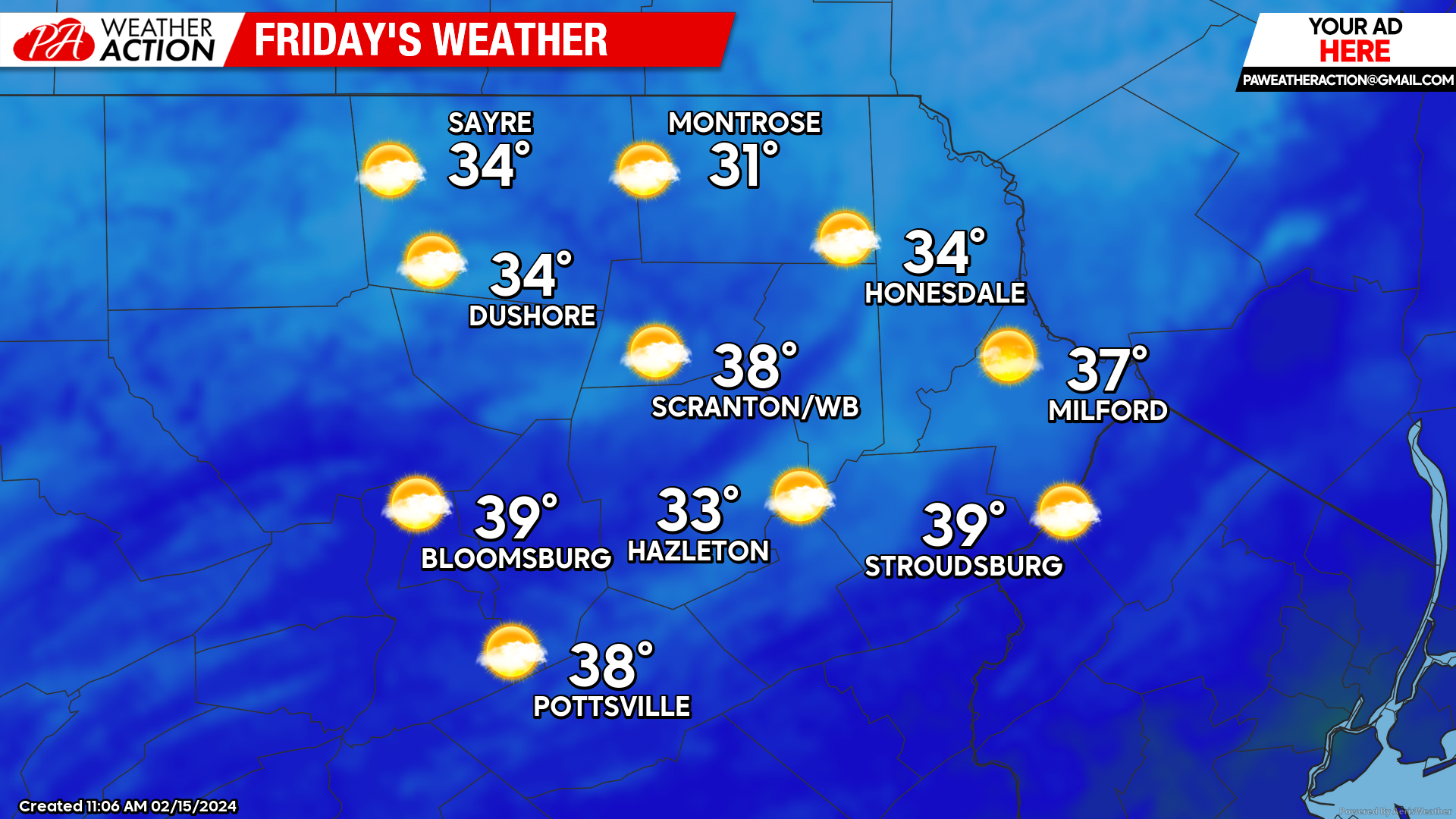
FRIDAY
The strong wind gusts will continue during the morning, subsiding during the afternoon. Skies will be partly to mostly sunny.
FRIDAY NIGHT LIGHT SNOW POTENTIAL
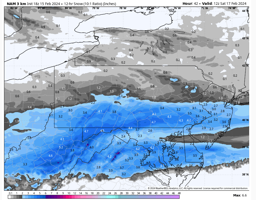
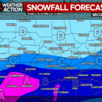
Another clipper system will pass to our south Friday night into early Saturday, delivering a swath of several inches accumulation to southern PA. The northern edge of that snow will reach into our area. Accumulations from this system will range from near nothing near the NY border to an inch or two in the southern half of our area.
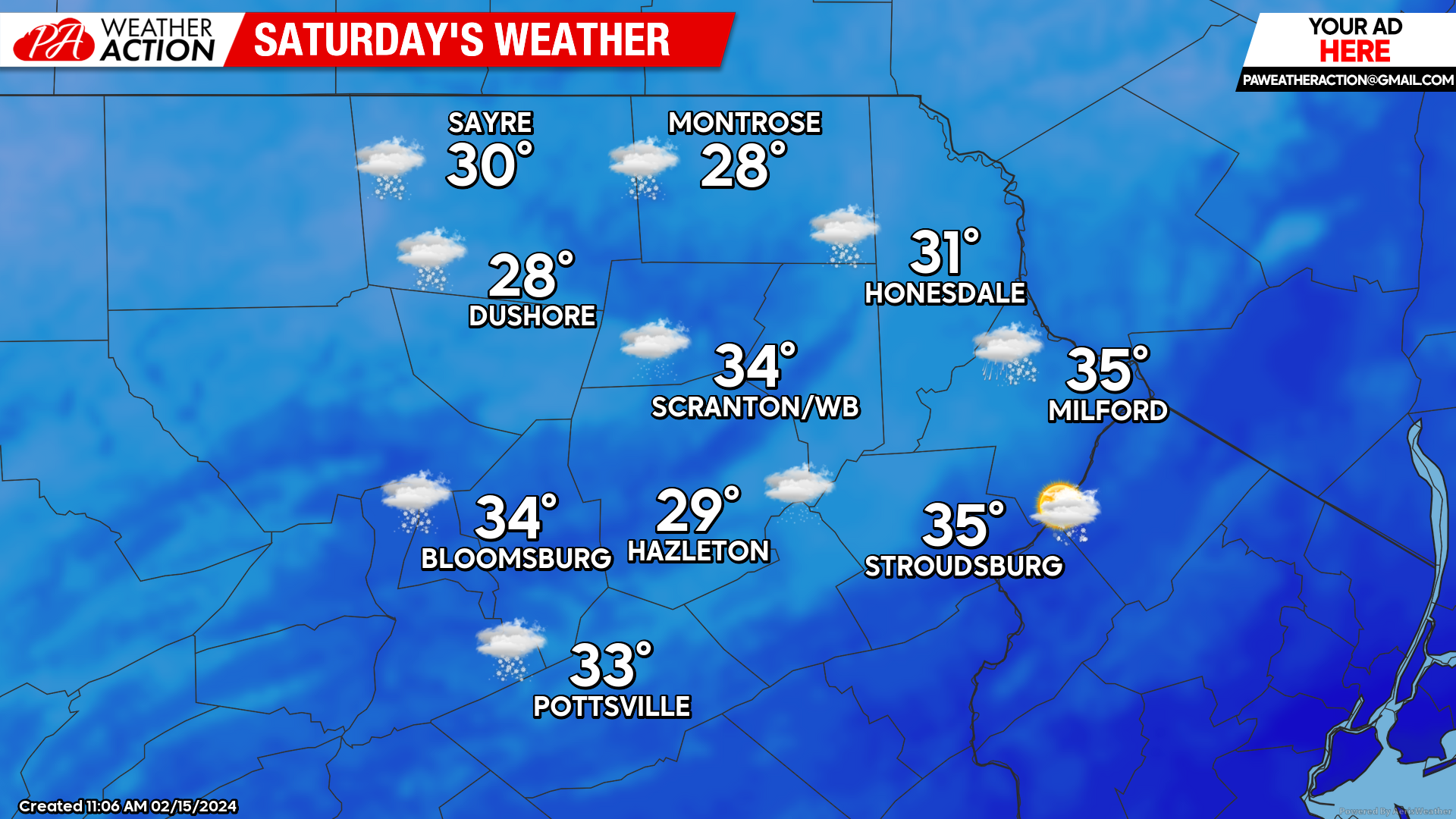
SATURDAY
That departing clipper will draw below-normal temperatures into our area along with snow showers. It will also be breezy with gusts to 25 mph.
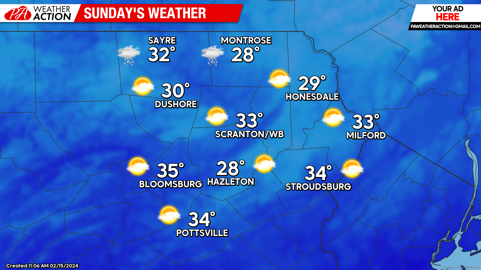
SUNDAY
Breezy conditions and below-normal temperatures will persist into Sunday, with partly cloudy skies.
NEXT WEEK (Feb 19-23)
Most of next week will feature dry conditions. Temperatures will start near normal on Monday (with sunny skies) and climb to above normal levels for the latter half of the week. A system passing to our north could bring some rain near the end of the week.
You must be logged in to post a comment.