
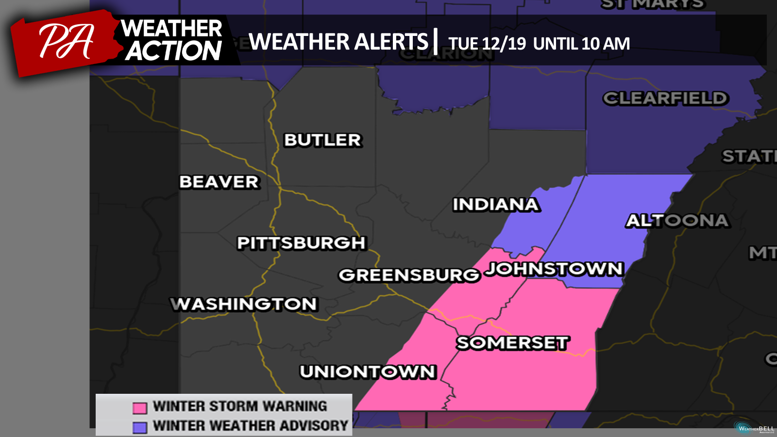
A Winter Storm Warning is in effect for Southeastern portions of the region until 10 am on Tuesday, December 19th. Snow, and blowing snow, is expected. Total accumulations of 2-5 inches are expected in the valleys, higher elevations could see accumulations of up to 6-8 inches. Wind gusts may approach 45 mph.
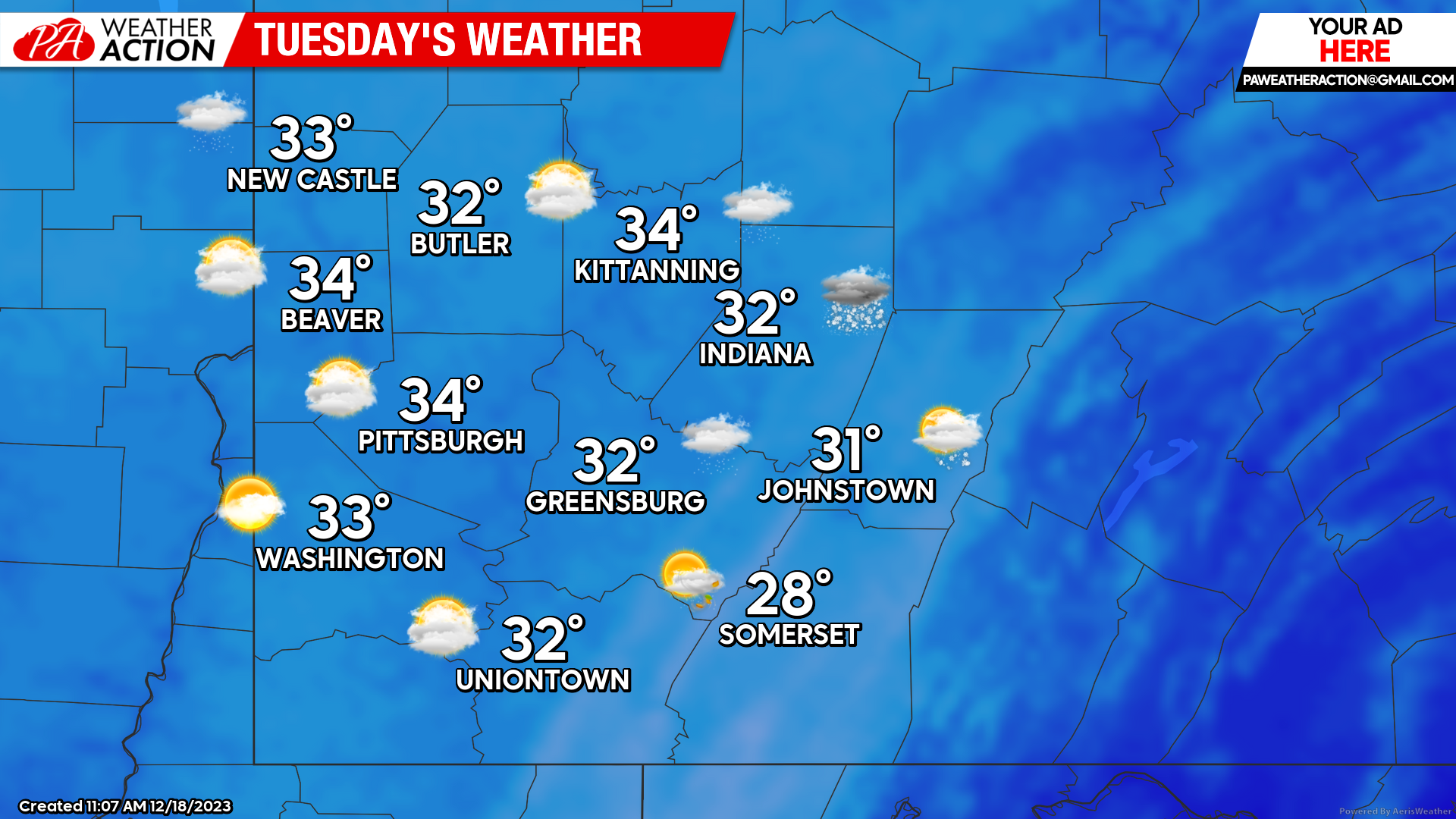
Tuesday
Snow showers can be expected throughout the morning hours across the region, possibly impacting morning travel. Chances for snow will diminish from west to east start as the day goes on. Mostly cloudy conditions will follow. Highs will range in mid 30s to high 20s. Breezy conditions will extend throughout the region, wind speeds will be out of the west at 15-25 mph, wind gusts up to 25 mph can be expected, especially in the higher elevations. Lows will be in the low 20s to mid-teens.
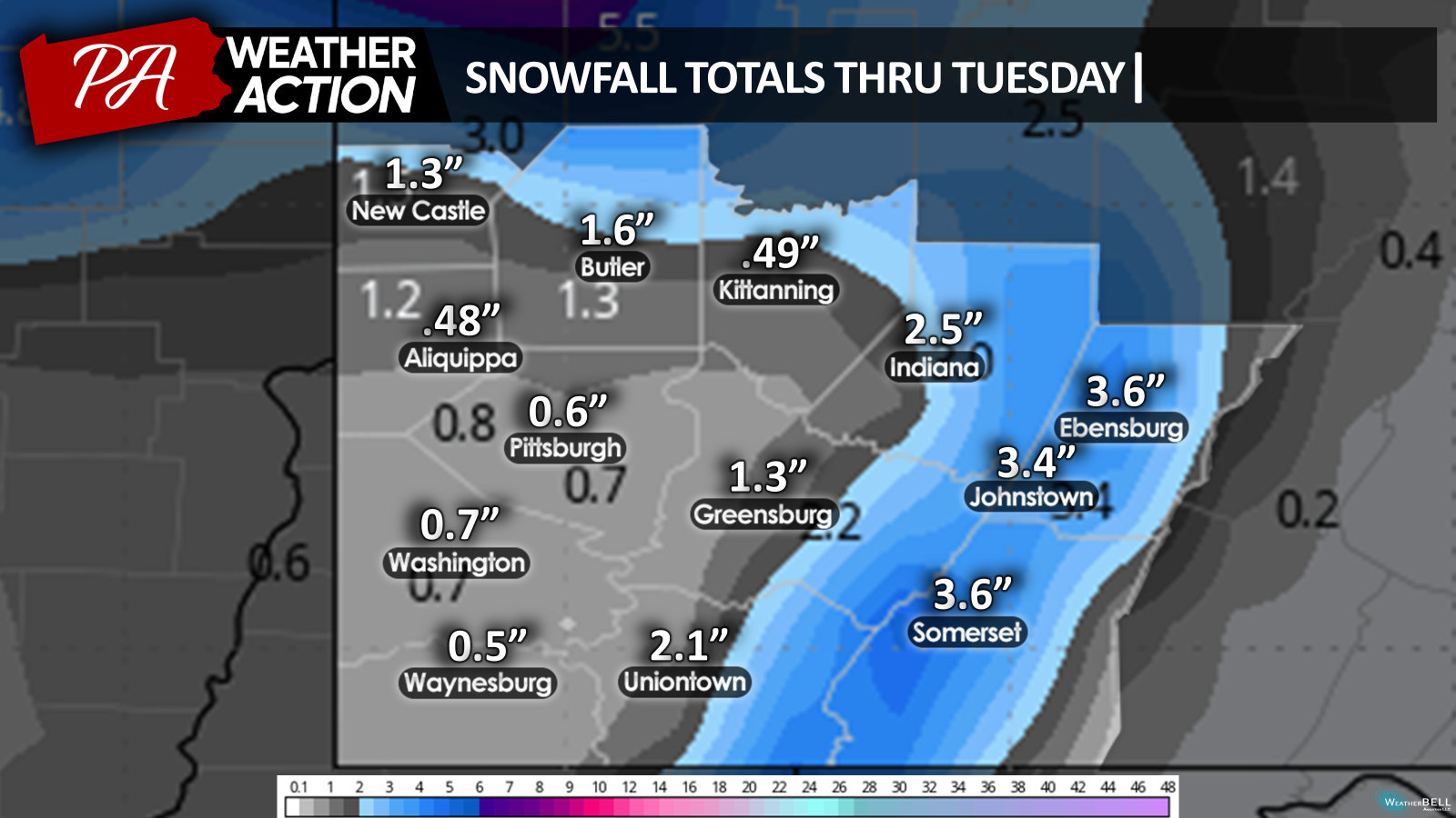
Greater snowfall totals can be expected in the higher elevations compared to the rest of the region. Some areas to the north could also see higher snowfall totals.
Wednesday
Sunny conditions will return on Wednesday. Highs will be in the low 40s to high 30s. Winds will be out of the west-southwest at 5 to 10 mph. Lows will be in the mid 20s.

Thursday
Mostly cloudy to partly sunny skies. Highs will be in the mid to low 40s. Lows will be in the high to mid 20s.


You must be logged in to post a comment.