

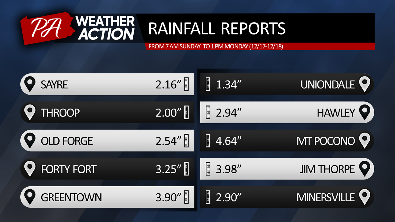
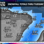
A powerful storm churned northward along the Atlantic coast, unleashing torrents of rain upon our area. Widespread 1-3″ drenched the region, with 4-5″ inundating the Poconos and eastern counties. Minor flooding of small streams and poor drainage areas resulted. Meanwhile, along the coast, wind gusts reached 50-60mph. Logan International Airport in Boston experienced a 68mph gust! The deep tropical feed that provided the moisture also delivered mild temperatures that soared well into the 50s across our entire region last night and this morning! Normal max temperatures for this time of year are in the low 30s for the higher elevations, and near 40 for the valleys.
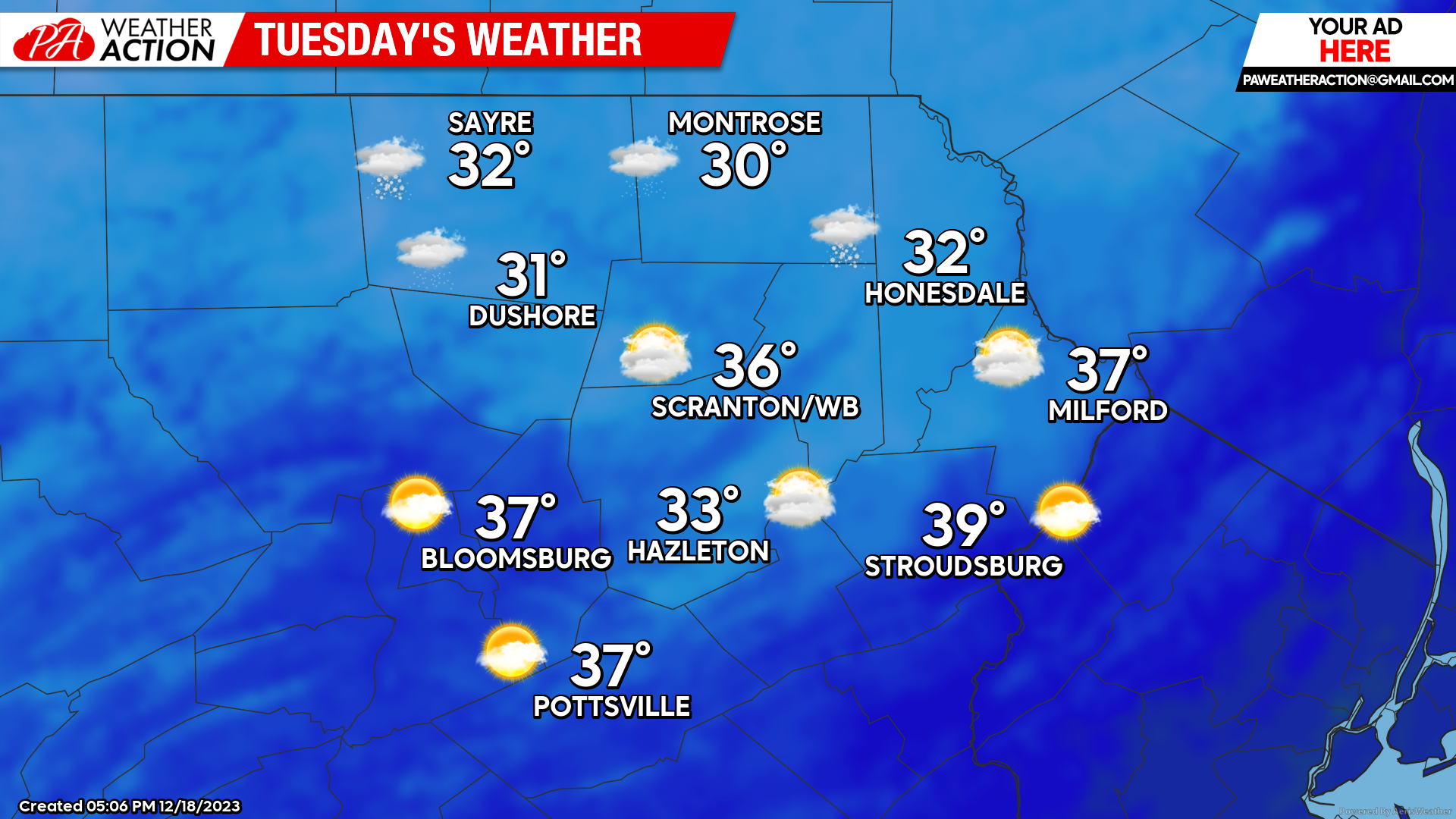
TUESDAY:
For tonight and Tuesday, a brisk NW wind gusting 20-30 mph will usher more-normal temperatures into our area, along with scattered snow showers tonight through Tuesday morning for the northern areas and higher elevations that could whiten the ground, with some of the luckier higher-elevation locations enjoying an inch or two (mainly before dawn Tuesday). The lower elevations will not be so fortunate. This is likely the final opportunity for snow before Christmas, and with persistent above-normal temperatures later this week lasting through the holiday weekend, even the higher elevations will enjoy a patchy white Christmas at best.
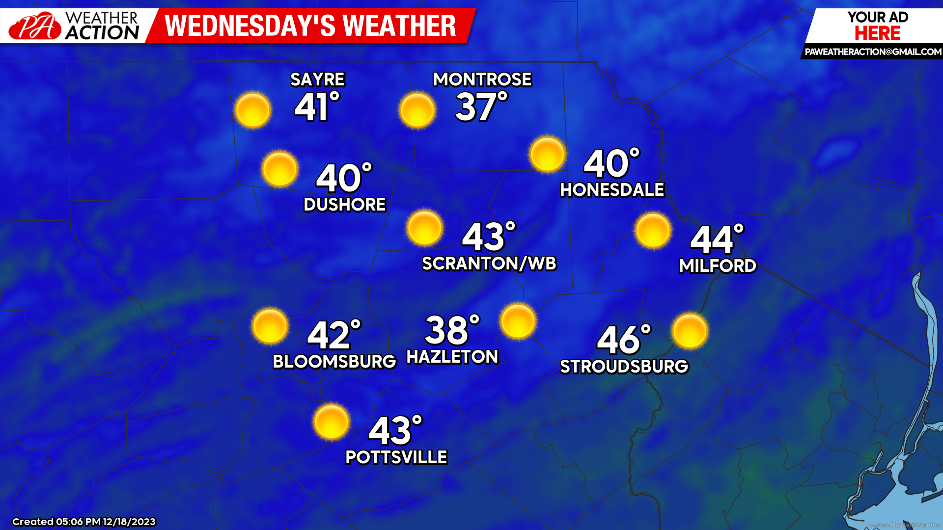
WEDNESDAY
The brisk wind will subside, dry and sunny conditions with temperatures warming to slightly above-normal levels.
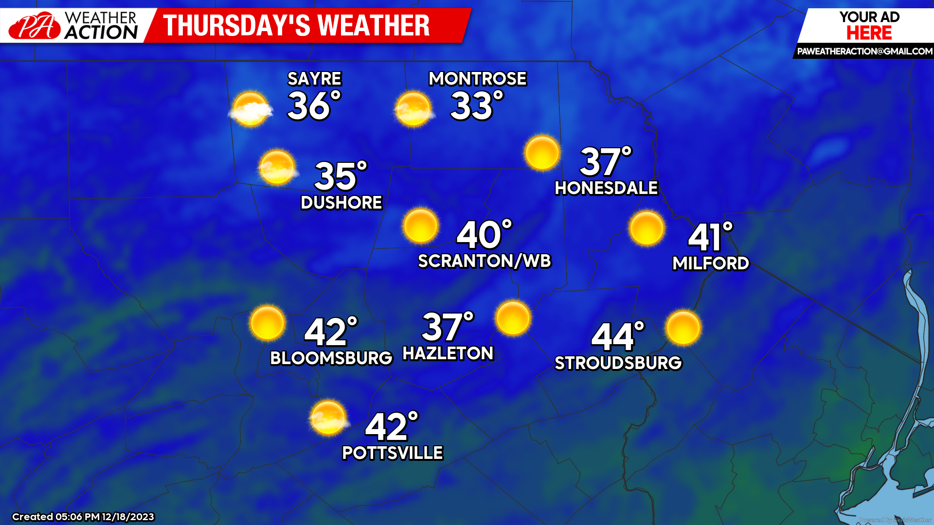
THURSDAY
Dry conditions will continue, along with slightly above normal temperatures and light wind. There could be some clouds during the morning.
BEYOND THURSDAY:
Mostly-dry and warmer-than-normal weather will continue through Christmas Day. There is the slight chance of some light wintry precipitation this weekend from a weak moisture-starved disturbance, but the probability is low.
The next decent chance of precipitation (likely in the form of rain) looks to be Tuesday or Wednesday of next week.

You must be logged in to post a comment.