
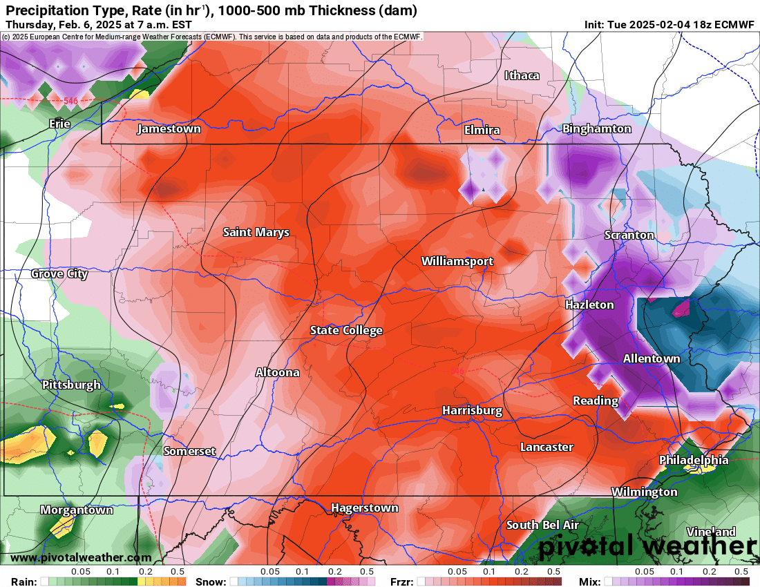
The start of a very active weather pattern begins tonight as a storm system will deliver a mix of snow, sleet, and freezing rain heading into Thursday morning. Below is a look at the current radar:
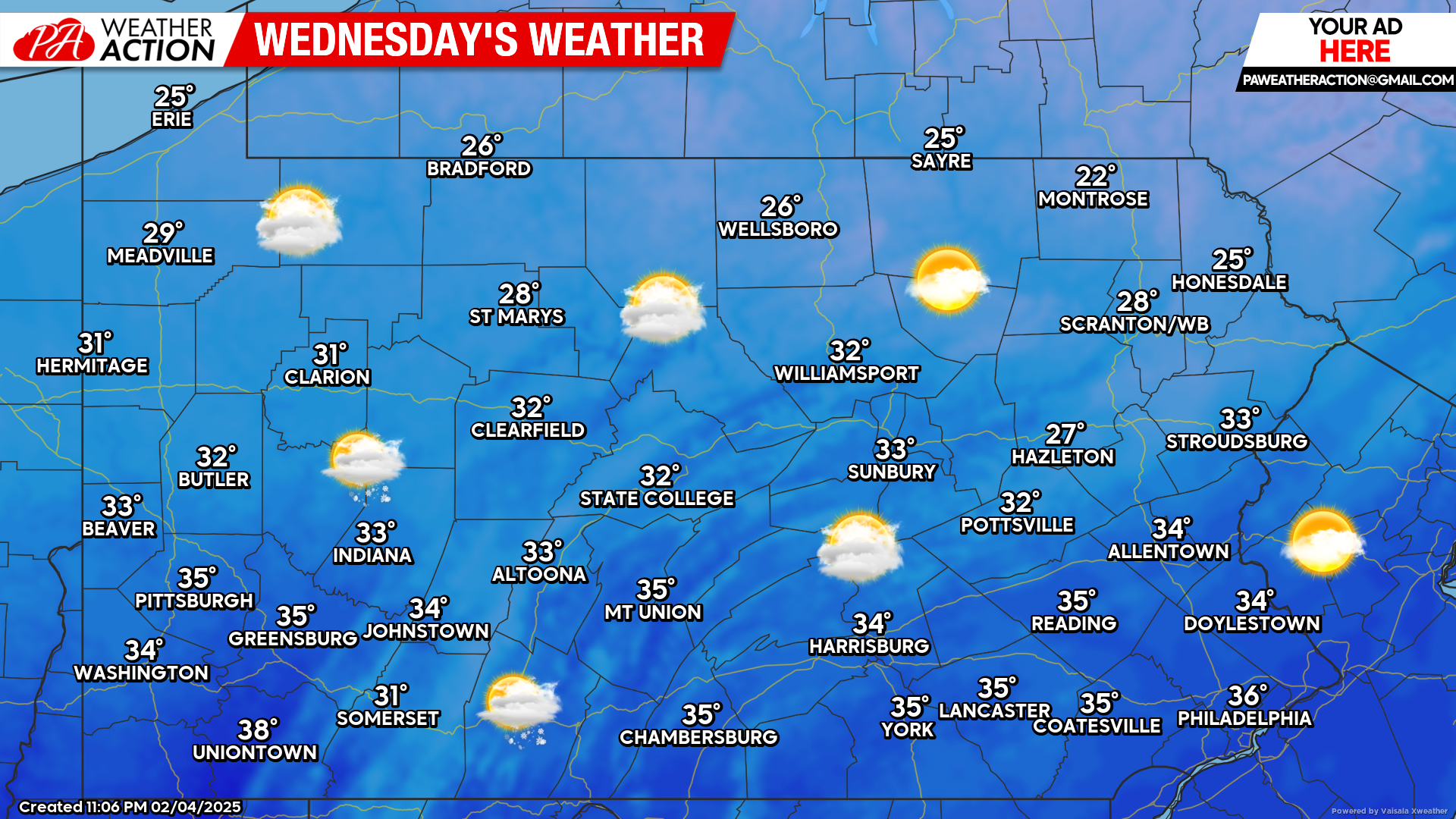
Today’s Weather Forecast: 5/10
Most of today will be dry with temperatures in the 30s. Precipitation will be on the increase heading into the late nighttime hours tonight.
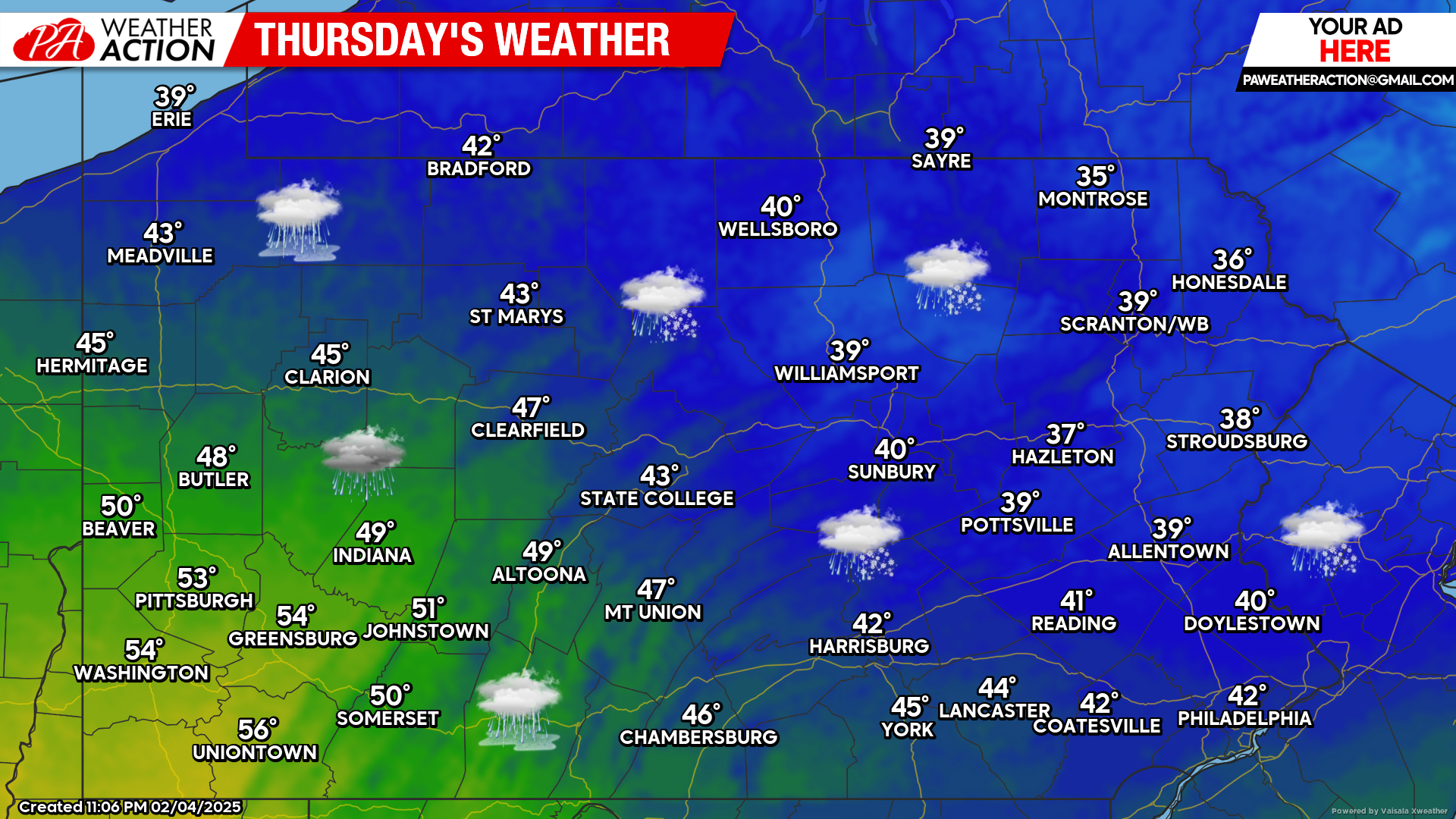
Thursday’s Weather Forecast: 1/10
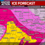
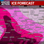
Brief snow will change to heavy sleet and freezing rain is across much of the state Thursday morning. It is strongly recommended to hold off on any travel plans Thursday until closer to the lunchtime hours when temperatures will warm above freezing.
European Model Future Radar Valid for 7:00 AM Thursday Morning:
The heaviest of the sleet and freezing rain will occur after midnight through the mid-morning hours Thursday. Travel conditions will be treacherous for most of Thursday morning.
Again, if you have travel plans Thursday, please hold off until the lunchtime hours if you can. Temperatures will warm up well above freezing by the afternoon hours. See our second call forecast at the bottom of this article.
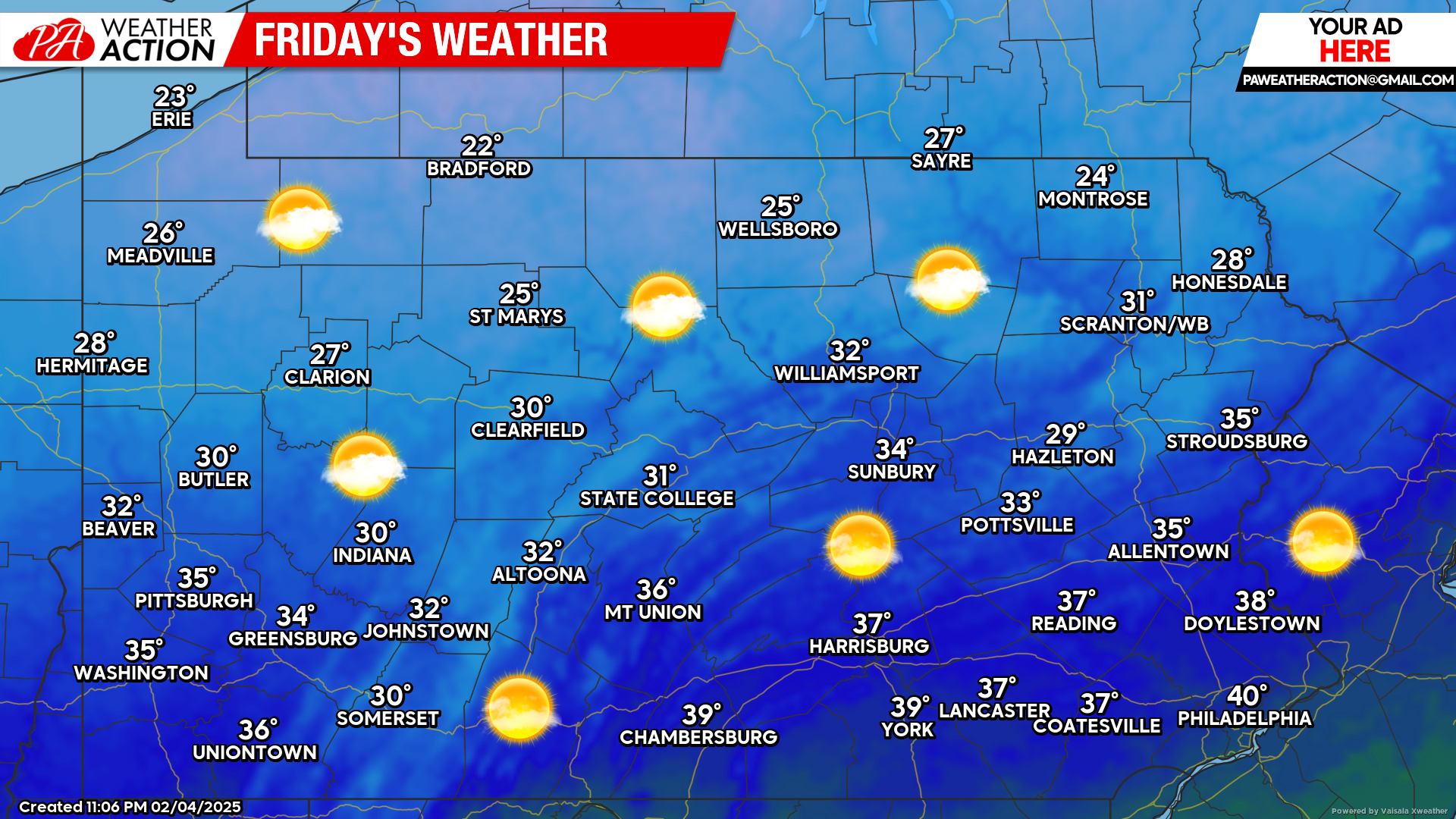
Friday’s Weather Forecast: 9/10
Friday will be beautiful across the state with temperatures in the 20s and 30s.
If you missed our second call forecast for the upcoming winter storm, click the link below:
Second Call Ice & Snow/Sleet Forecast for Messy Winter Storm Hitting PA on Thursday
You must be logged in to post a comment.