
The past few days in the weather world have relatively been quiet. Tomorrow that will change as a widespread severe weather threat is expected. The Storm Prediction Center has placed about half of our state in Slight Risk or greater.
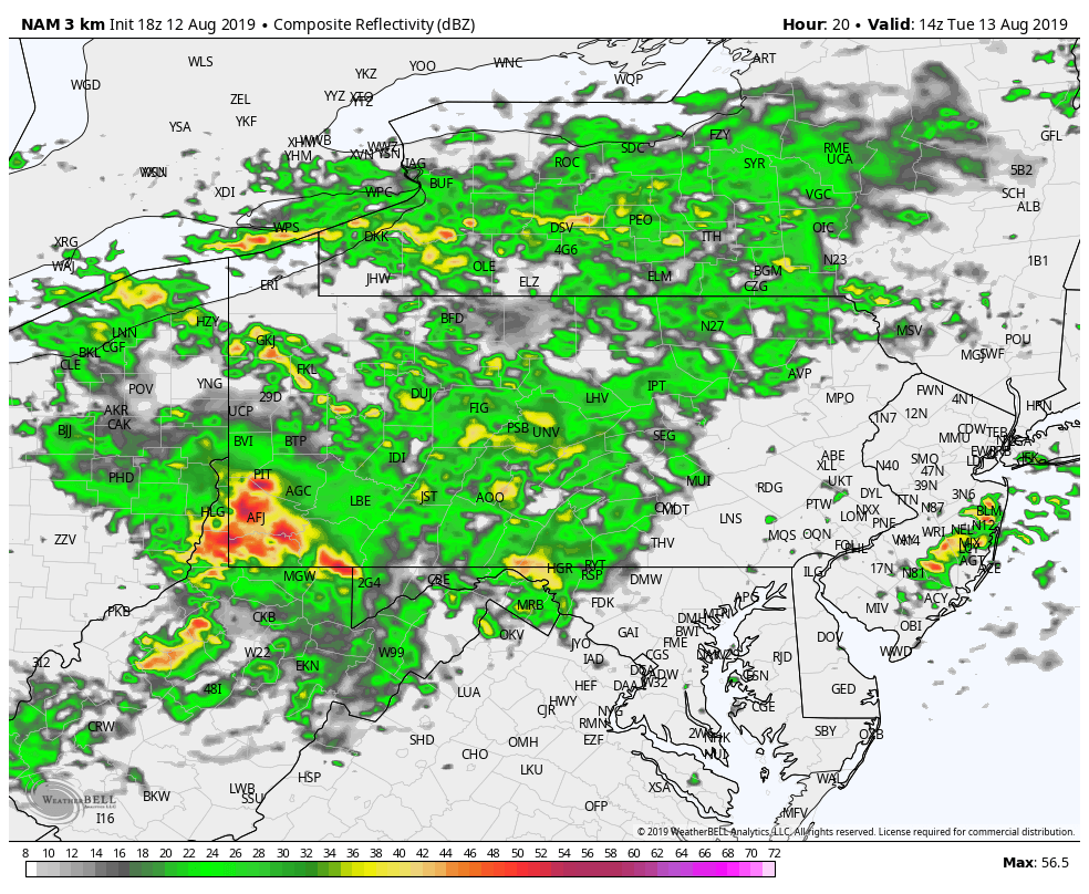
A period of rain and severe thunderstorms is expected across western and central Pennsylvania tomorrow morning. Below is a look at 10:00 AM tomorrow morning:
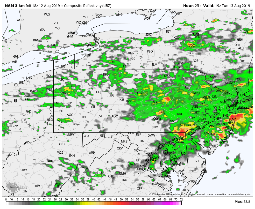
 This batch of rain and thunderstorms will move into eastern Pennsylvania by the afternoon hours. Below is a look at 3:00 PM tomorrow afternoon:
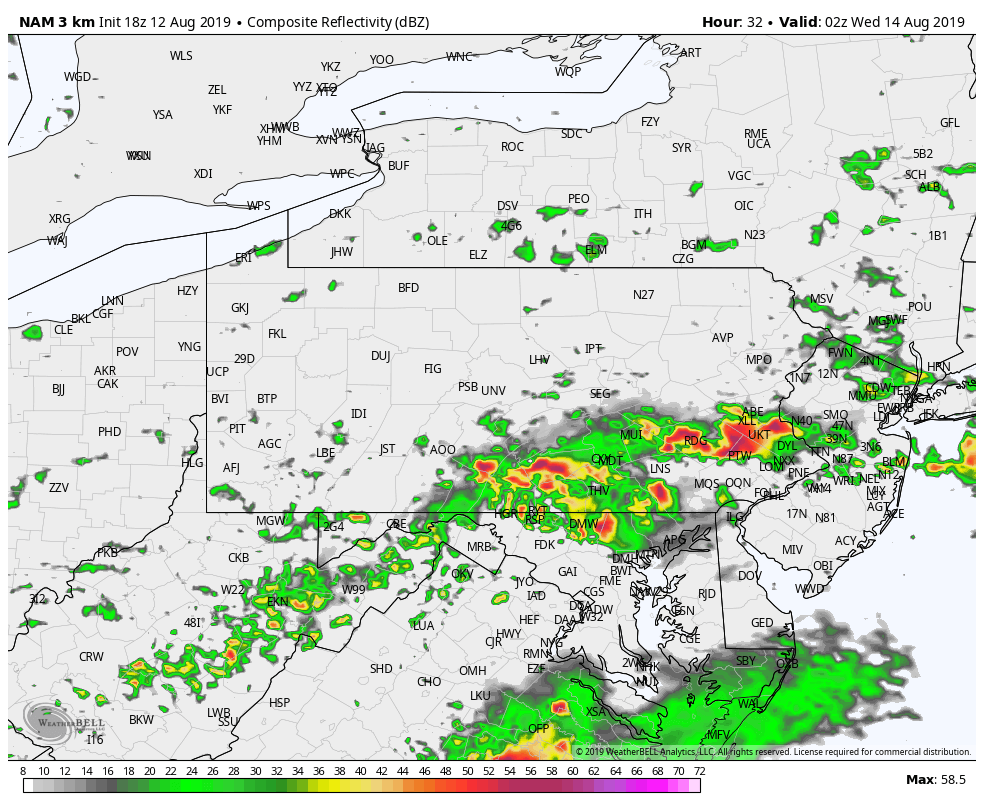
 A second line of severe thunderstorms will develop behind the first round of precipitation. This second line has the best chance of producing severe weather, especially across our southeastern counties. This second line will develop closer to the evening hours tomorrow and will continue to push eastward throughout the nighttime hours. Below is a look at 10:00 PM tomorrow night:
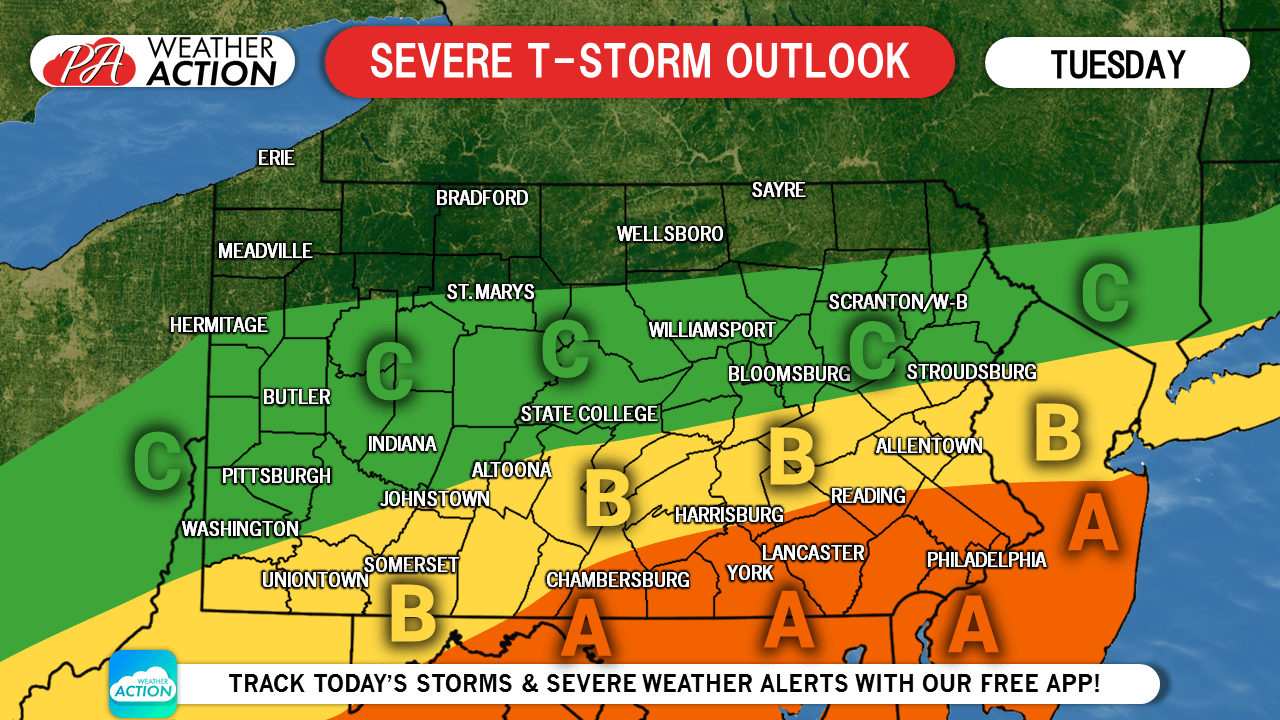
 STORM PREDICTION CENTER FORECAST FOR TUESDAY 8/13/19:
Area A: The Storm Prediction Center has placed these locations under an ENHANCED RISK for severe weather tomorrow. This area has the greatest chance to experience damaging winds in excess of 60 mph, large hail, and an isolated tornado or two.
Area B: The Storm Prediction Center has placed these locations under a SLIGHT RISK for severe weather tomorrow. This area has the chance to experience damaging winds in excess of 60 mph, large hail, and an isolated tornado.
Area C: The Storm Prediction Center has placed these locations under a MARGINAL RISK for severe weather tomorrow. This area still has a chance to experience damaging winds in excess of 60 mph, large hail, and an isolated tornado, but the odds are much less than the locations in area A and B.
Stay tuned for future updates on our Facebook page and be sure to download our free app now to keep you ahead of the severe weather. Click here: Weather Action App
Share this article with your family and friends by using the icon below to keep them ahead of the action!
You must be logged in to post a comment.