Strong to Severe Thunderstorms With Damaging Wind & Hail Threat Possible in Eastern Half of PA Wednesday + Wildfire Smoke Exiting

Strong to Severe Thunderstorms With Damaging Wind & Hail Threat Possible in Eastern Half of PA Wednesday + Wildfire Smoke Exiting

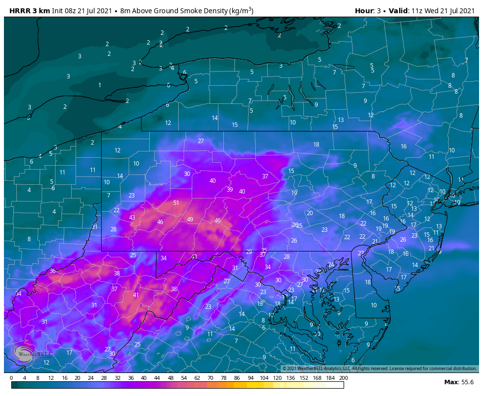
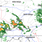
Thunderstorms are expected to pop-up early this afternoon over the northern PA mountains and push southeast in the mid to late afternoon. At the same time, the wildfire smoke will also be pushing southeast, as illustrated in the map at the bottom of the post.

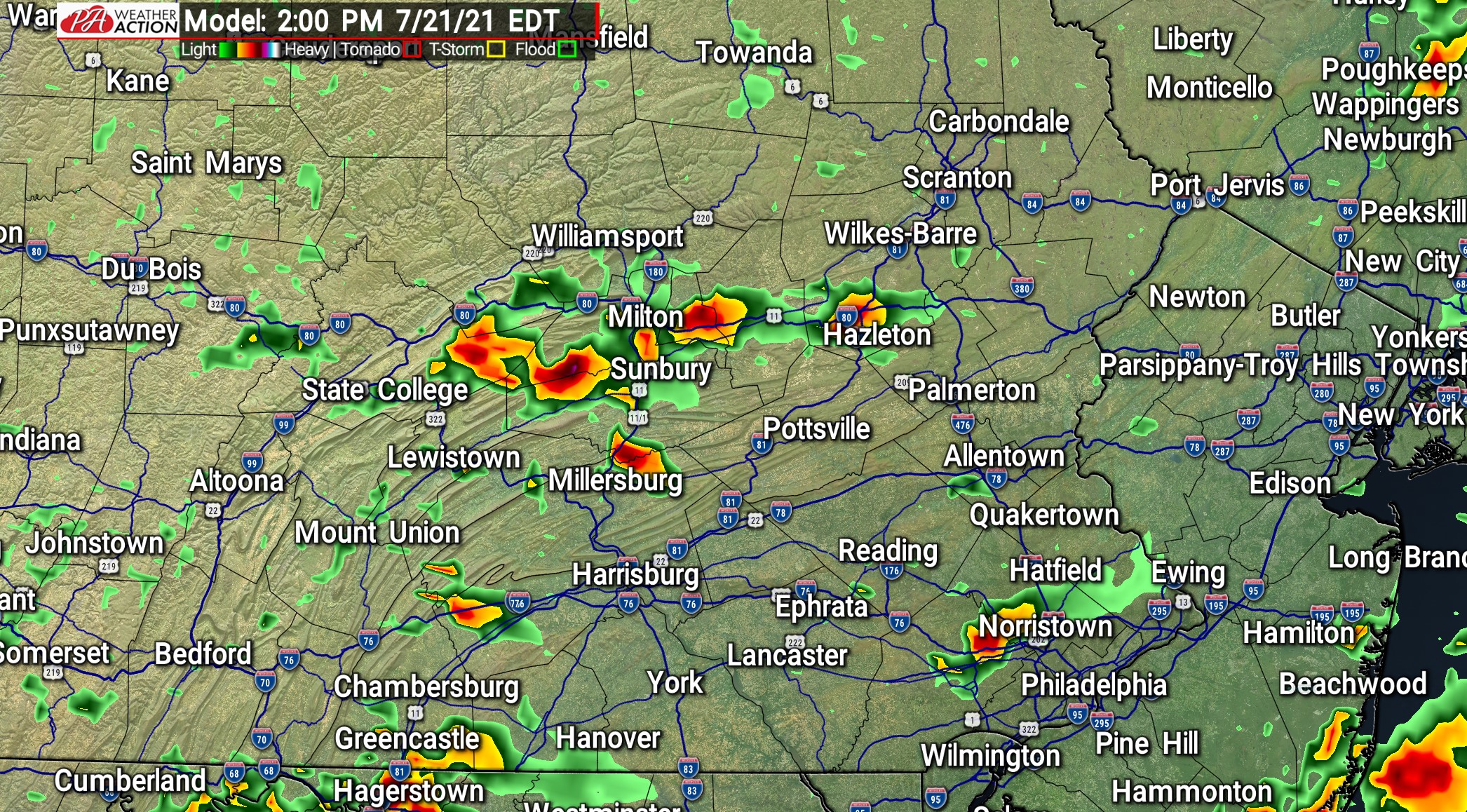
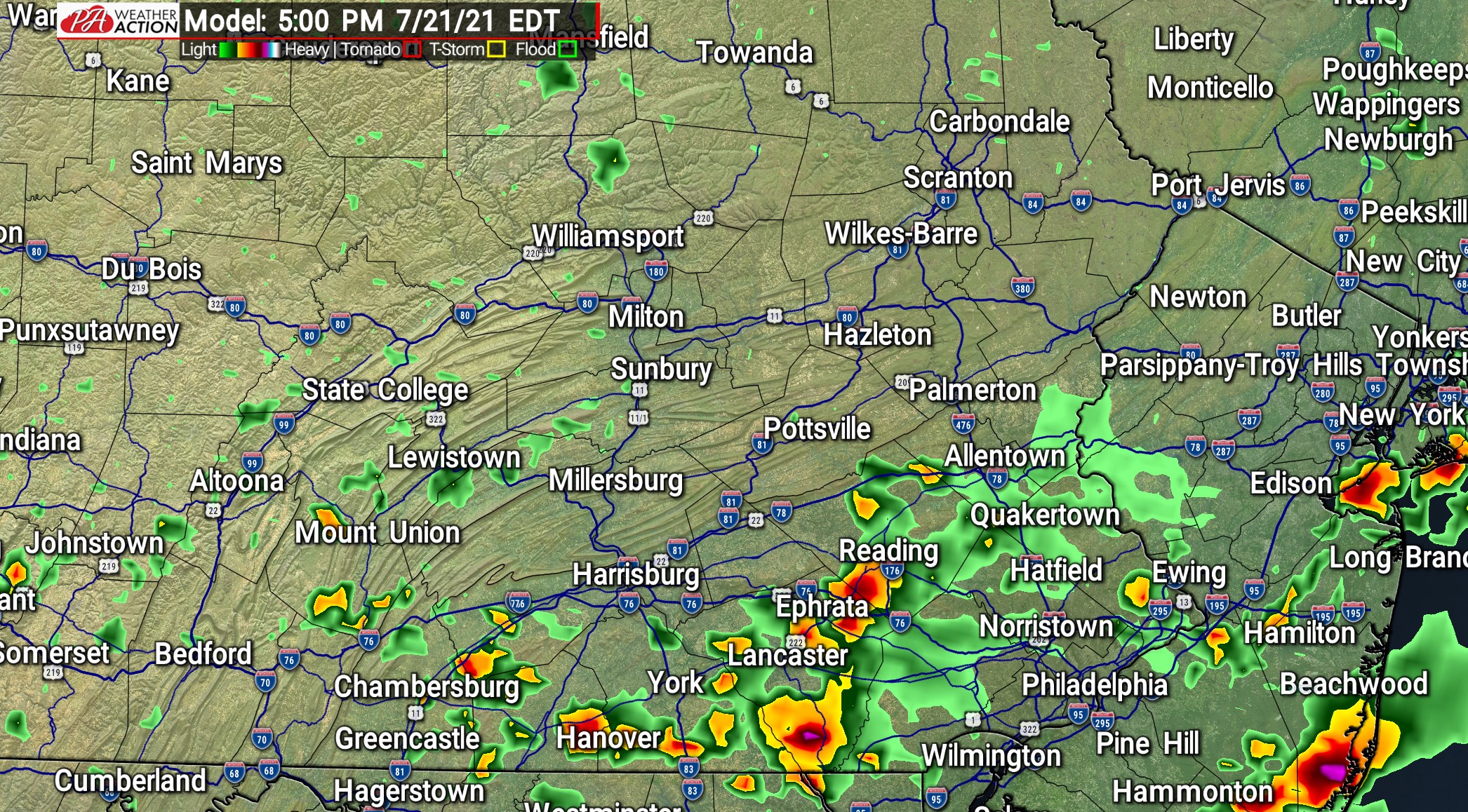
The Philadelphia Area has the greatest risk of scattered severe thunderstorms by late afternoon to early evening. Places like the Lehigh Valley and Lower Susq. Valley may see strong storms in the mid to late afternoon. See future radar frames below.

2 PM WEDNESDAY


5 PM WEDNESDAY

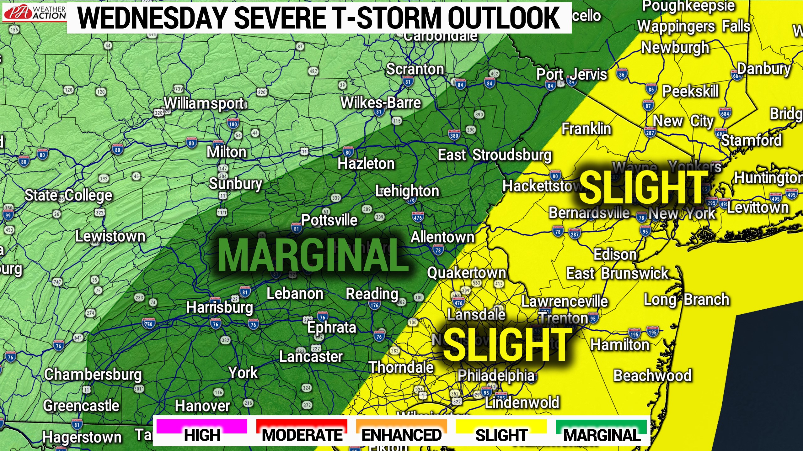
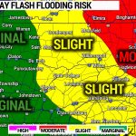
Wind and hail are the main concerns. Here is today’s SPC Severe Outlook map.

WILDFIRE SMOKE FORECAST

Josh Adams is the founder and lead forecaster of Pennsylvania Weather Action, a regional forecasting site he launched in 2015. With over a decade of experience analyzing weather patterns across Pennsylvania, his forecasts have reached millions of readers throughout the state. Josh specializes in Pennsylvania’s complex microclimates and terrain-driven weather patterns, providing detailed coverage of severe thunderstorms, winter storms, and flooding events. His forecasting focuses on delivering precise, timely information to help Pennsylvanians stay informed and prepared during impactful weather. Last Updated: March 10, 2026