A surface high pressure off the Southeast Coast circulated very warm and somewhat humid air into our region today. With the lack of photosynthesis (the leaves have yet to emerge), temperatures soared well into the 80s in the valleys, with upper 80s in some of the deeper valleys!
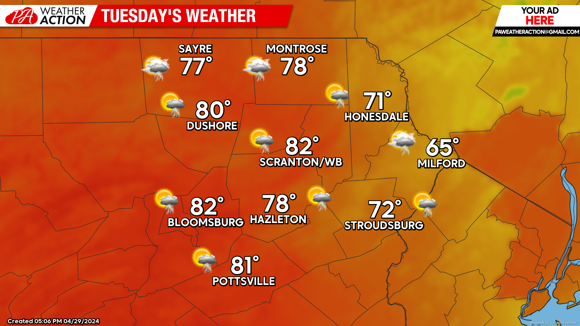
TUESDAY
Tuesday will feature onshore flow on the back side of that surface high, pushing westward into much of our area tonight into Tuesday. This will hold temperatures down in our eastern counties compared to the rest of Pennsylvania. An approaching cold front will spawn thunderstorms, especially near the westward boundary of that onshore flow. Those storms could affect our eastern counties later tonight, and the western counties of our area tomorrow afternoon. Those thunderstorms will then propagate southeastward and possibly weaken as they choke on the cooler maritime air.
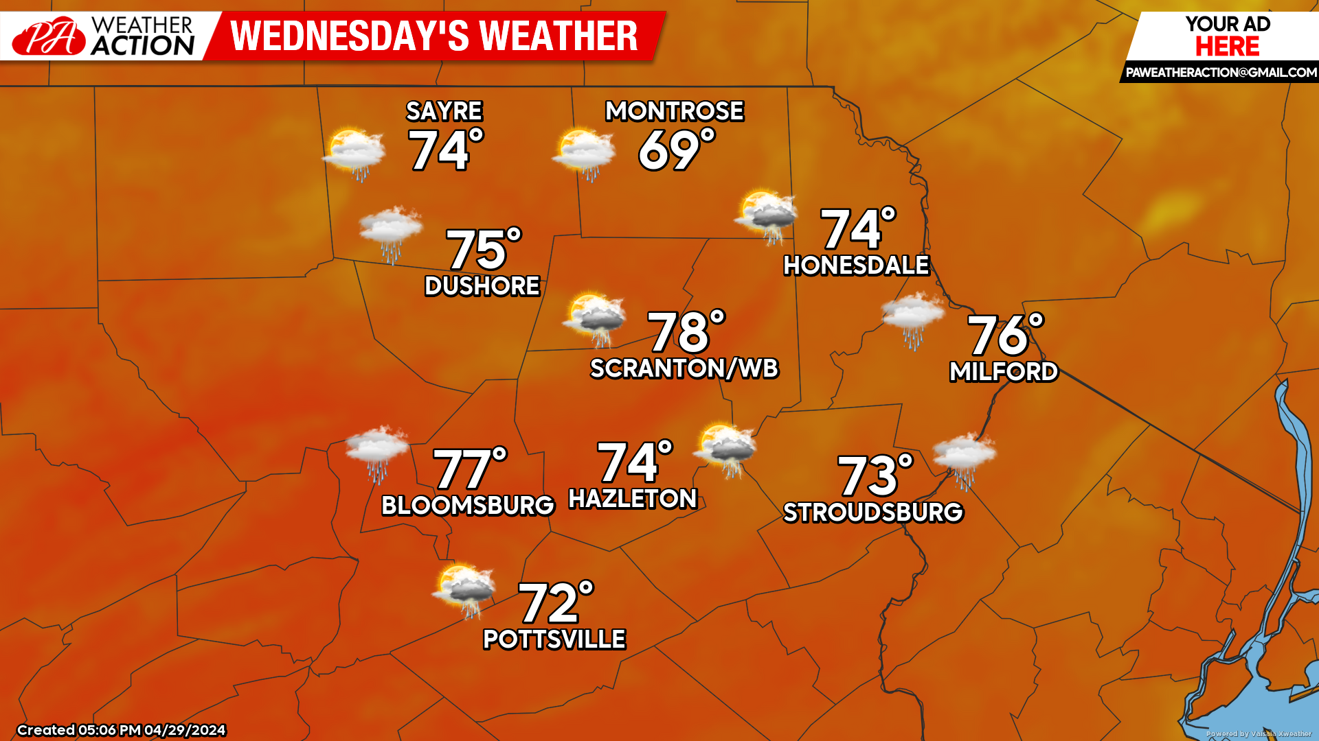
WEDNESDAY
Temperatures will remain warmer than normal, with the opportunity for a few lingering light showers.
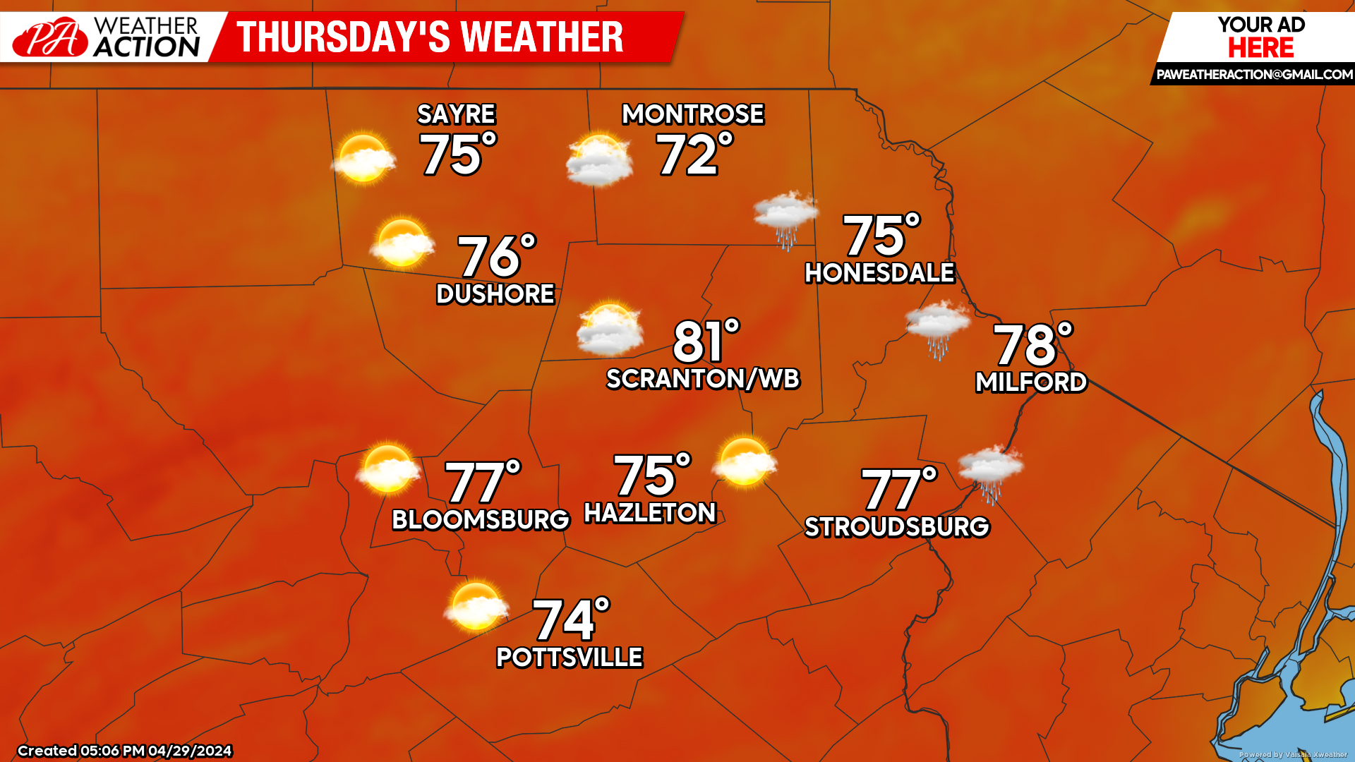
THURSDAY
While there might be a stray shower in the eastern counties, high pressure will move into the area and the day will be largely dry, with temperatures continuing to be above normal.


You must be logged in to post a comment.