
Safe to say Mother Nature got ahead of herself this time, as temperatures Monday reached 90° in many areas of Southern PA. But with the heat often comes opportunities for thunderstorms, and Tuesday will bring that chance. We are not expecting many of these storms to be severe, but some storms may pack small hail and gusty winds, along with of course cloud-to-ground lightning.
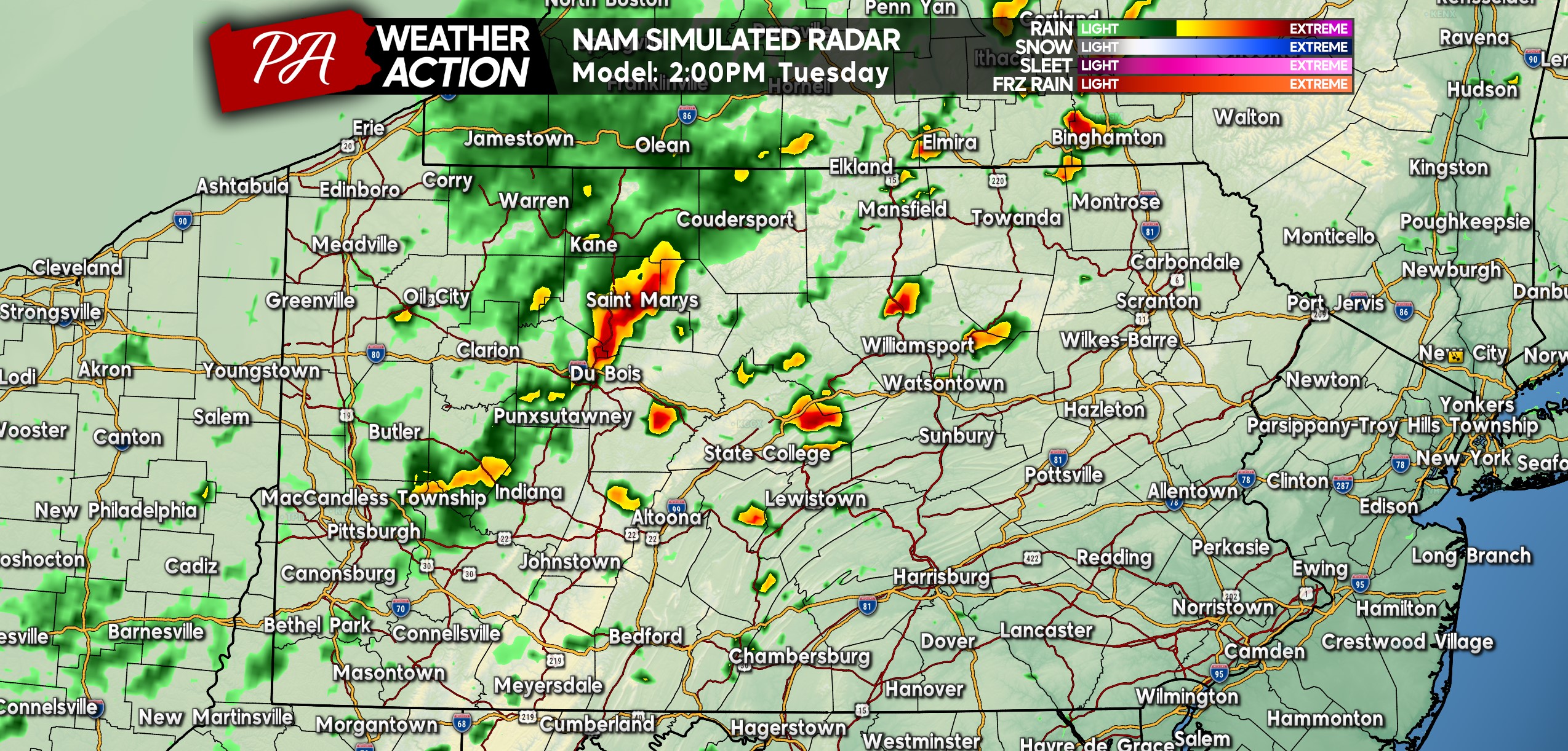
Thunderstorms will fire up across Central PA in the early afternoon hours of Tuesday, between around 1-3 PM, mainly across the higher Appalachians. Below is Hi-Res NAM Future Simulated Radar for 2:00 PM Tuesday.
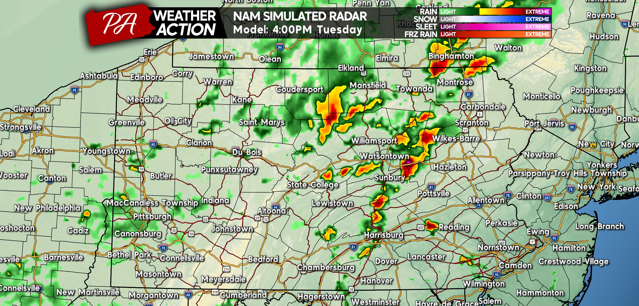
As these storms push east, they will likely strengthen somewhat. The main limiting factor Tuesday will be the significant lack of wind shear, which allows thunderstorms to become severe and start to rotate. Here is Hi-Res NAM Future Radar for 4:00 PM Tuesday, showing those storms become more organized and a bit more widespread as they enter the Susquehanna Valley late Tuesday afternoon!
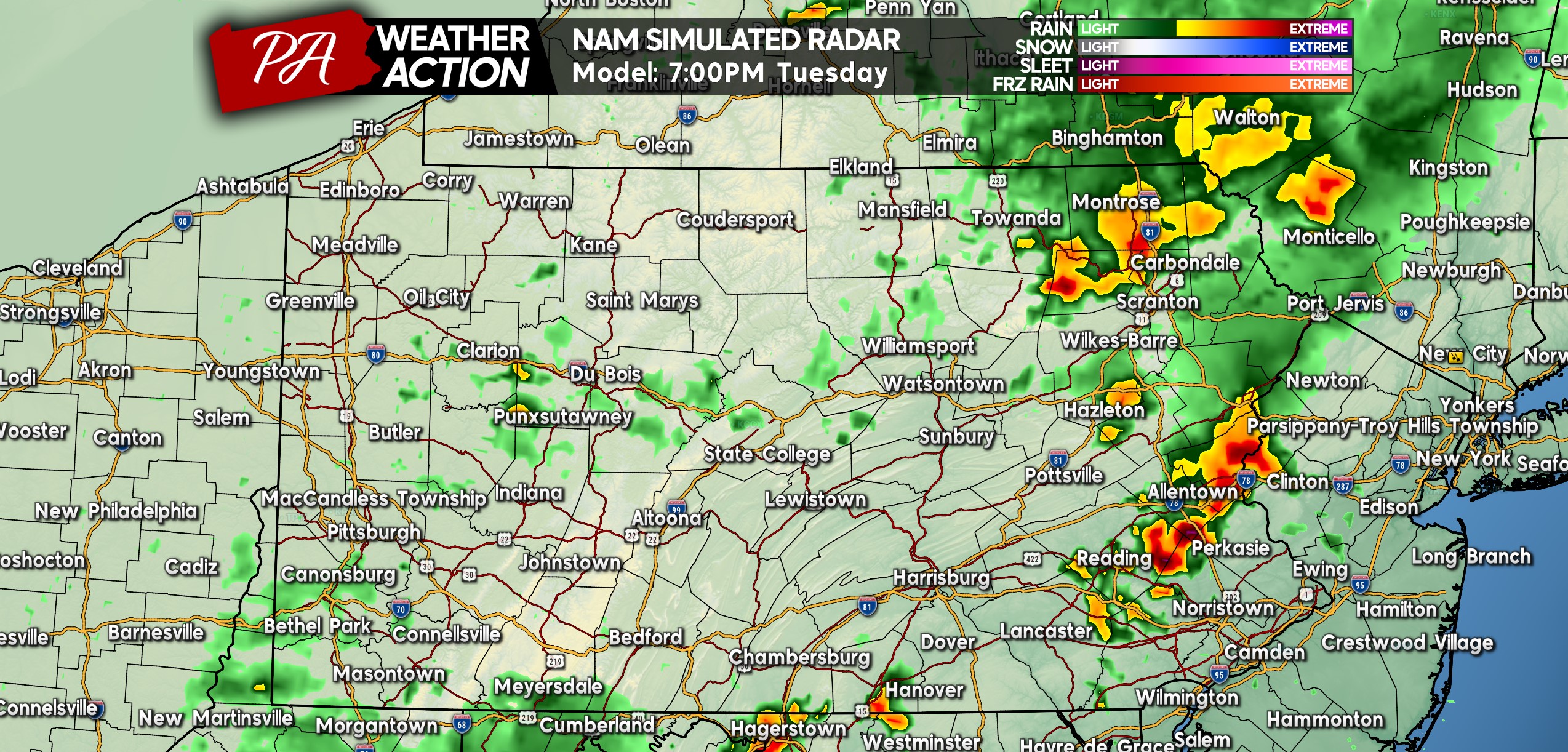
Because of a backdoor cold front in New England, instability will be greatly limited near the Delaware River. As a result, we do not expect storms to continue to strengthen as they move into Eastern PA, but rather begin to weaken. There may be a couple of thunderstorms in South Central PA around dinnertime Tuesday as well. Below is Hi-Res NAM Future Radar for 7:00 PM Tuesday.
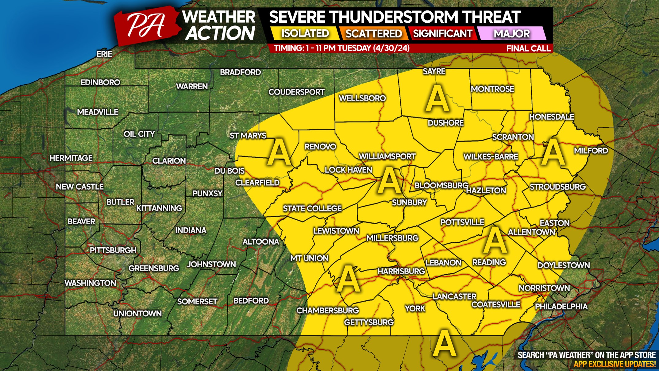
TUESDAY SEVERE THUNDERSTORM THREAT MAP
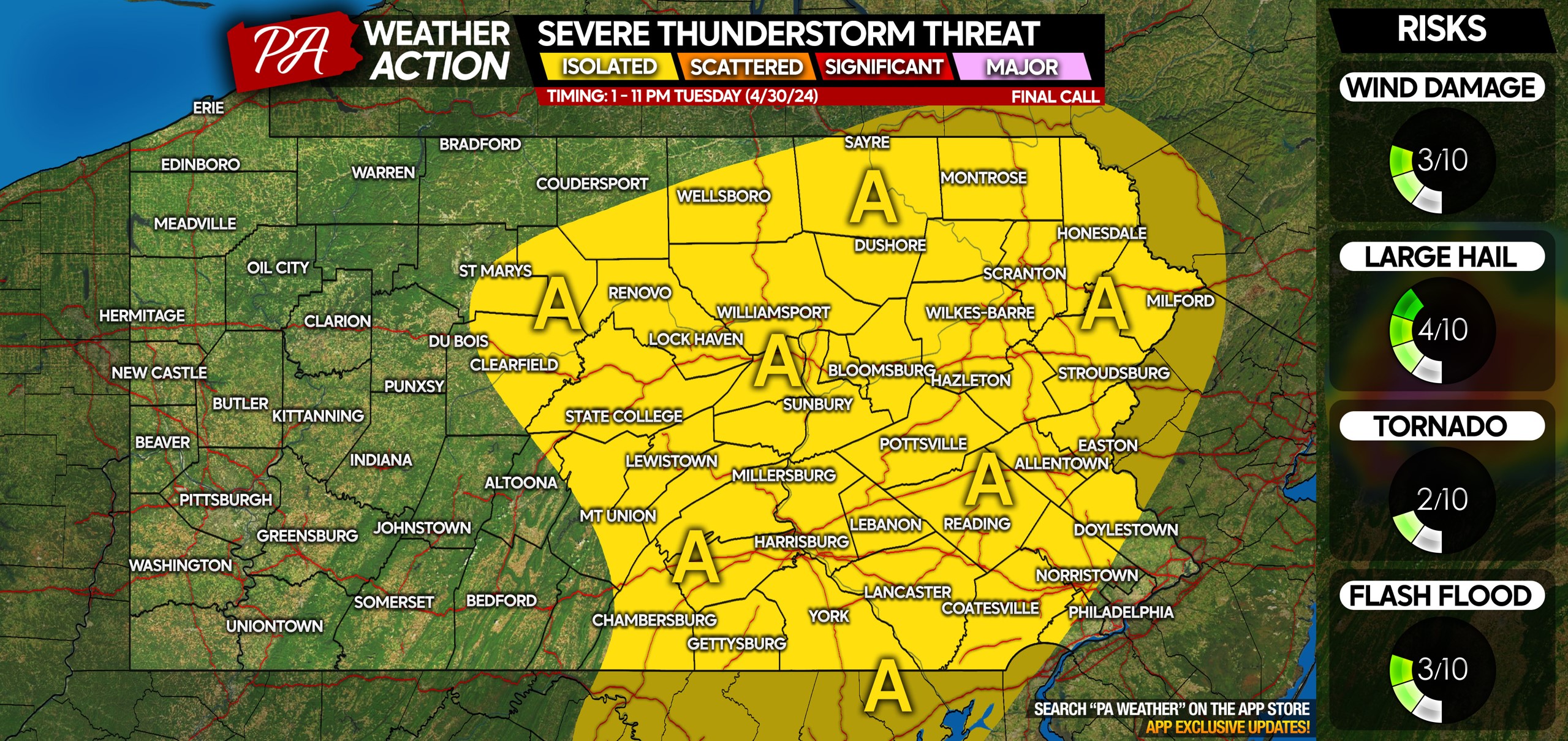
Area A: Isolated severe thunderstorms are possible Tuesday afternoon and evening. Most storms will stay below severe limits, but may still bring dime to quarter-size hail, frequent lightning, and gusty winds up to 50 mph.
This may throw a wrench in the Tuesday afternoon commute for some of you, and complicate Tuesday evening outdoor plans! Don’t forget to share this article with friends and family who may be impacted.

You must be logged in to post a comment.