
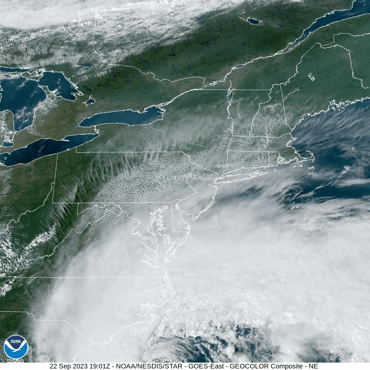
The disturbance off the Southeast Coast officially strengthened into Tropical Storm Ophelia today, currently with 60mph wind. Ophelia will make landfall in North Carolina tonight and drift through the Mid-Atlantic and across southern New Jersey this weekend, delivering gusty wind and soaking rainfall to our area for the entire weekend.
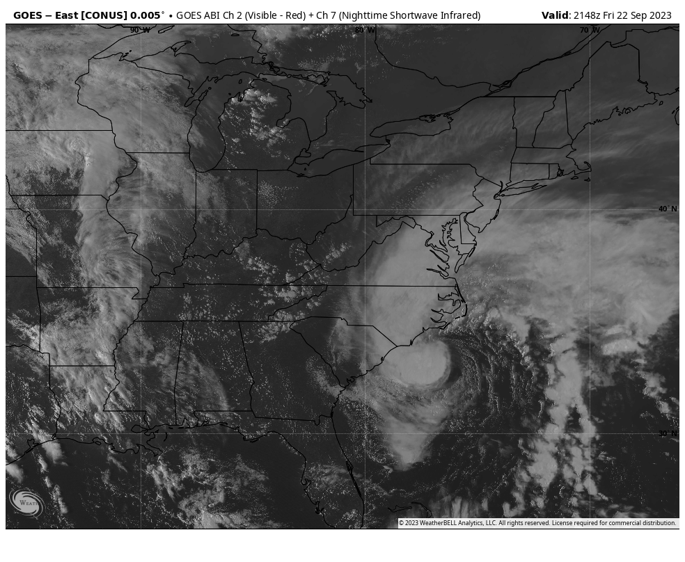
For reference of Ophelia’s current position as of 5:48 PM, please enjoy this satellite image:
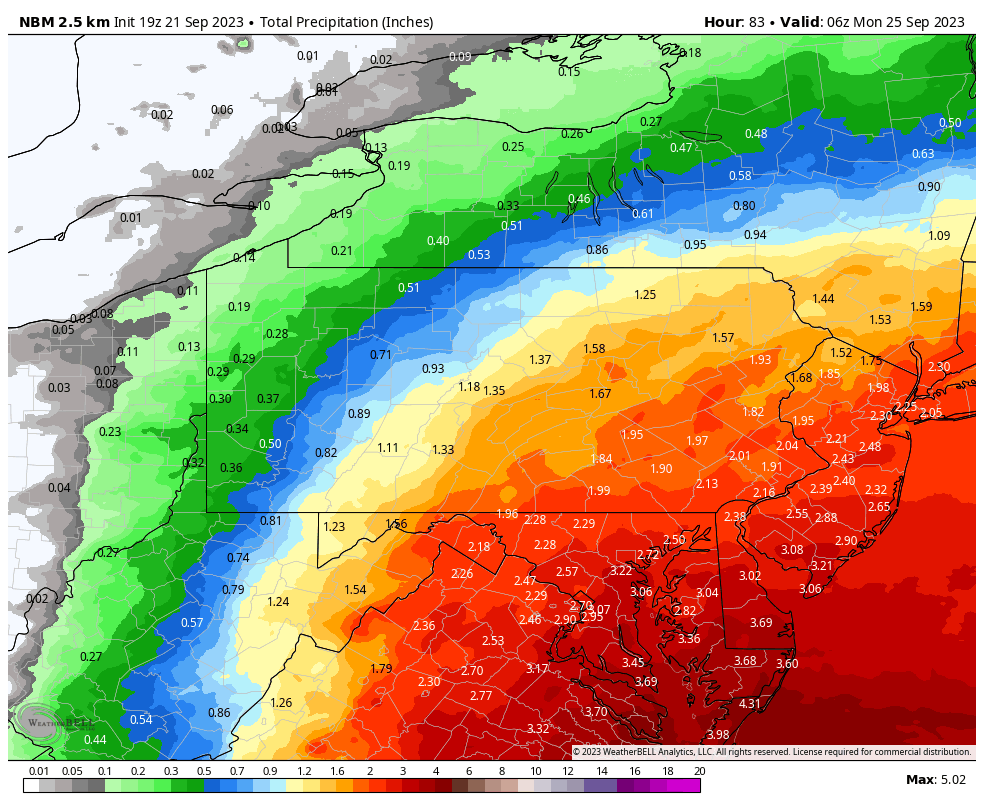
Here are the anticipated rainfall amounts through 2AM Monday:
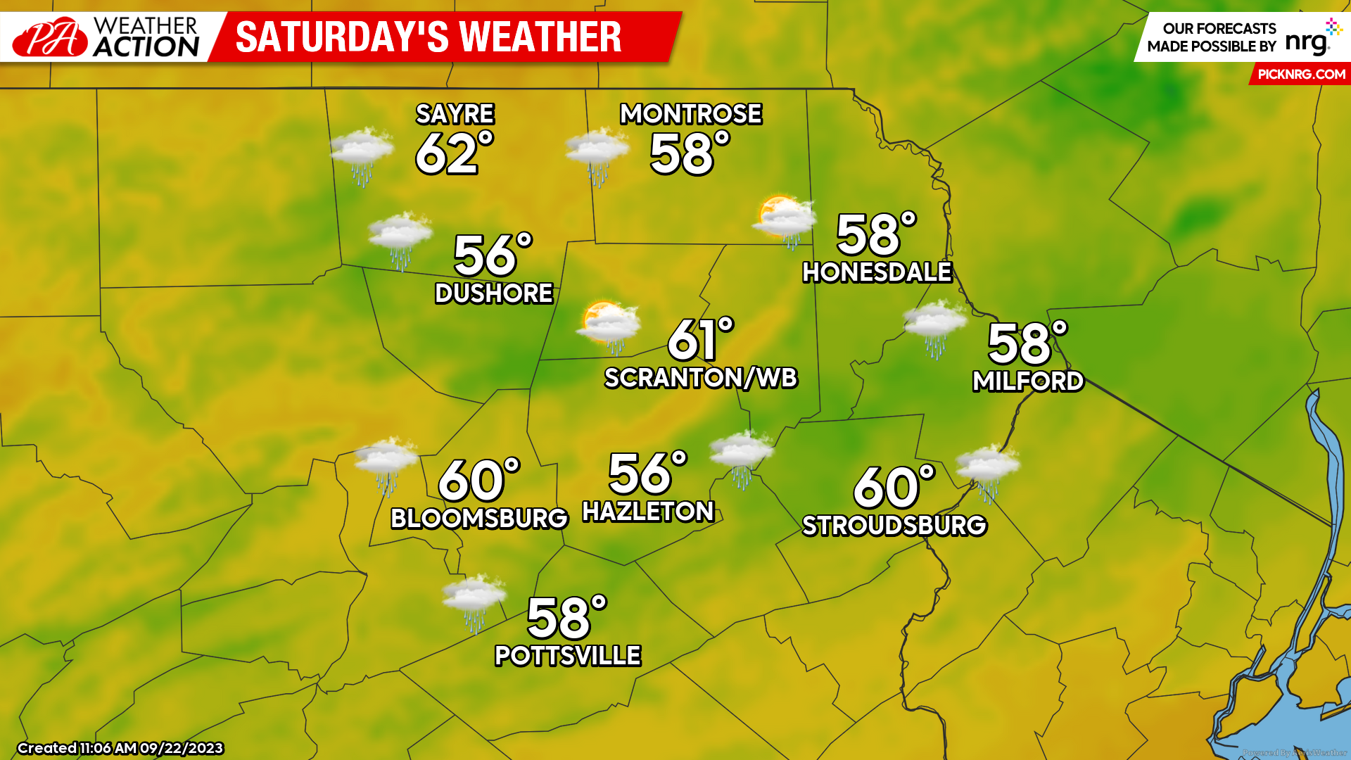
SATURDAY
The Autumn Equinox will occur at 2:50 AM and, as if on queue, will be greeted with wind and rain from a hybrid nor’easter. Precipitation will arrive in the Southern Poconos shortly before sunrise, spreading northward to the PA/NY border mid-late morning. Steady soaking rain will last into the early afternoon, becoming somewhat intermittent mid-late afternoon. ENE wind will increase during the afternoon with gusts reaching 30-40 mph in the exposed areas, and possibly over 40 mph in the higher elevations. Peak gusts will be lower over the northern areas closer to the New York border.
While the rainfall will be intermittent overnight Saturday night, the gusty ENE wind will continue, with gusts over 40 mph possible in the highest elevations of the Pocono Plateau area.
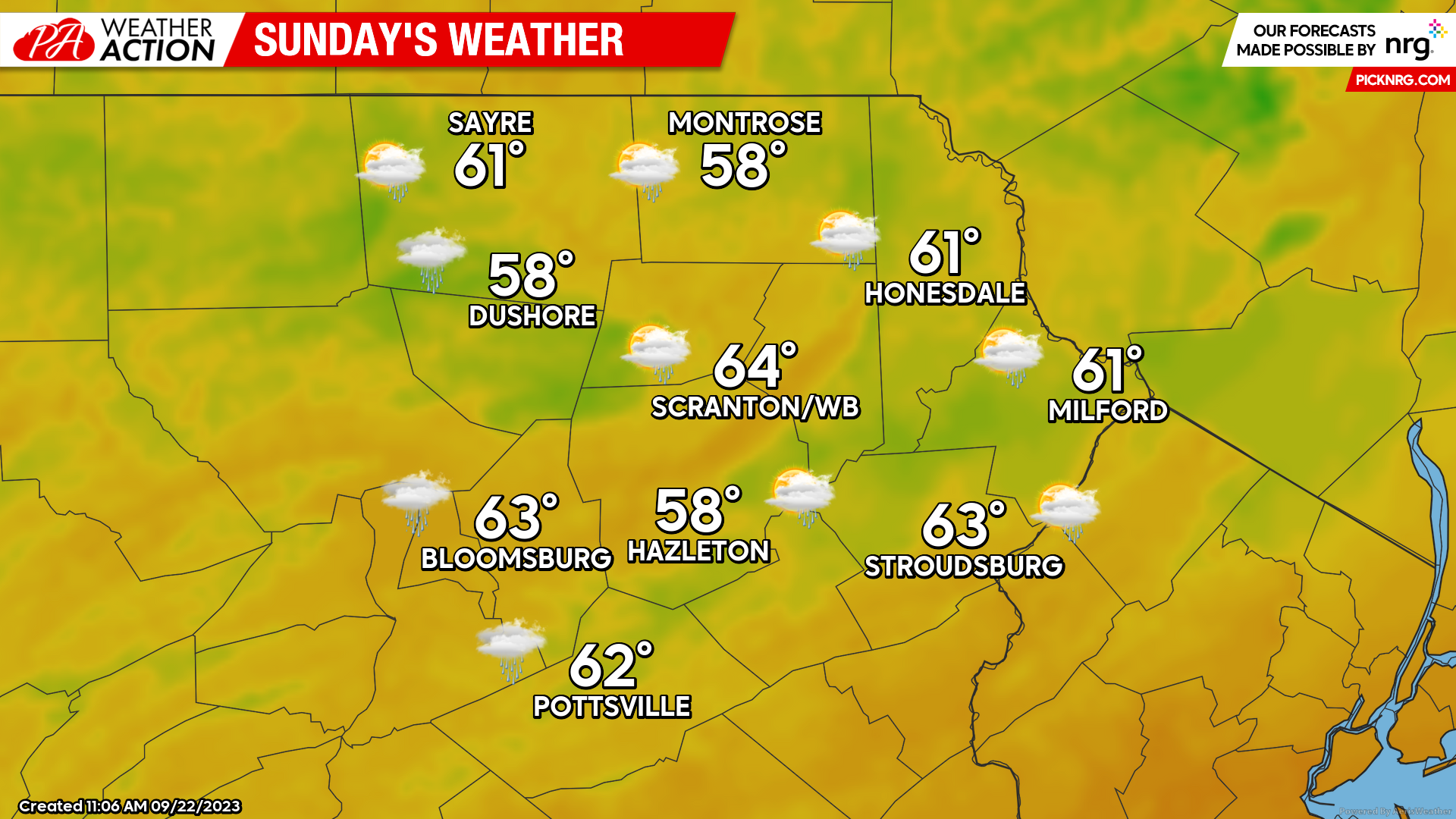
SUNDAY
Ophelia’s center of circulation will crawl through the Philadelphia area and across New Jersey, spreading another band of soaking rain northward through northeastern Pennsylvania during the morning, becoming lighter during the afternoon. Gusty wind will continue from the north, subsiding over the course of the day.
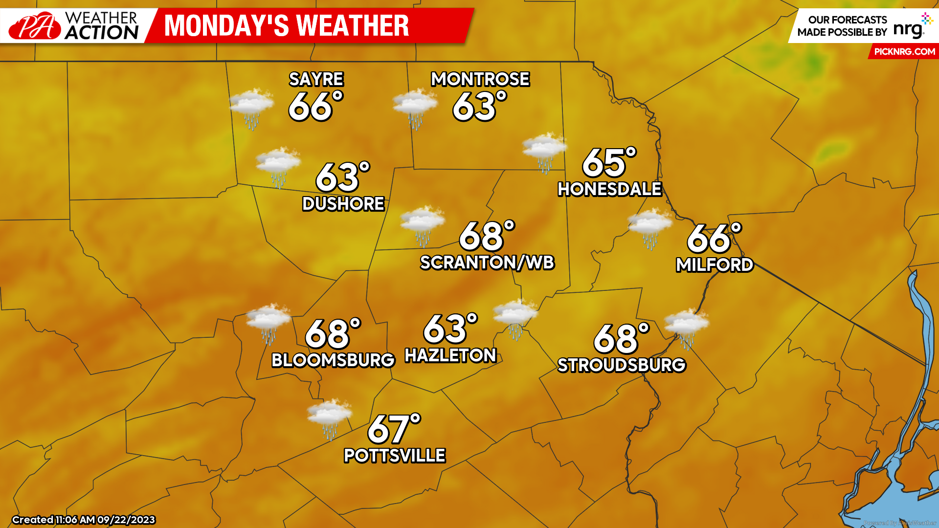
MONDAY
Leftover showers from Ophelia could linger into the morning hours, but any precipitation will be light, with a clearing trend during the afternoon.


You must be logged in to post a comment.