
When the calendar flipped from October to November, the summer-like warmth of last week became a distant memory as snow squalls whitened the higher elevations of Northeastern Pennsylvania on Wednesday. Binghamton airport enjoy 0.7” accumulation! Those of you in the lower elevations of the southern counties endured partly cloudy skies and dry conditions as the strong NW wind downsloped off the higher elevations.
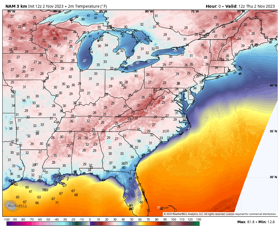
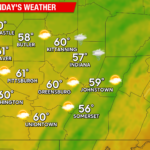
The surface high settled over the region last night and provided clear skies and light wind, resulting in the widespread low-mid 20s we experienced Thursday morning.
To illustrate the widespread extent of this morning’s freeze, here are the surface temperatures initialized in this morning’s model run:
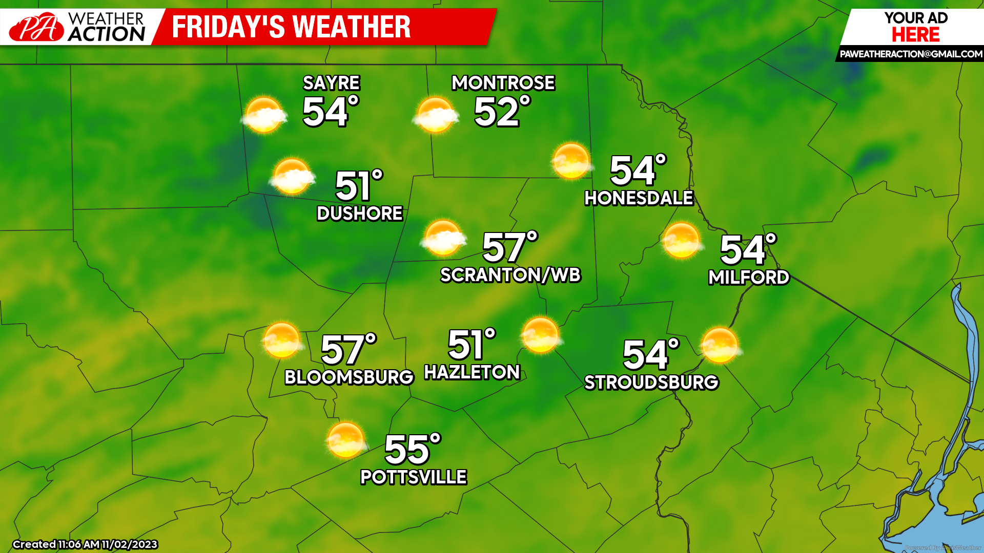
After one more frosty morning on Friday, that surface high will slide to our east, circulating warmer-than-normal weather into our region for the weekend. The slowly-approaching cold front will provide us with the very slight chance of a sprinkle on Sunday but most locations will remain dry.
FRIDAY
After another frosty morning, temperatures will climb into the 50s with ample sunshine.
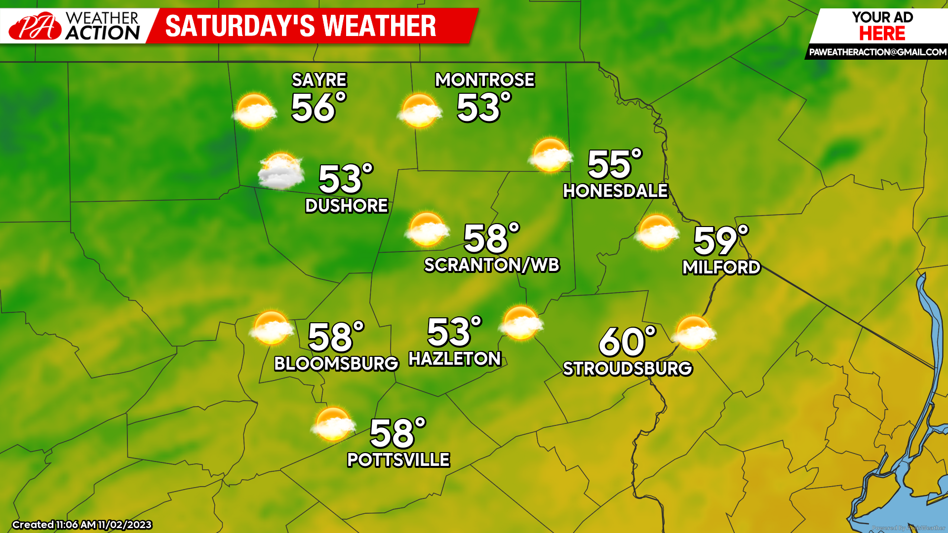
SATURDAY
Saturday will be another mild day with partly cloudy skies.
SUNDAY
REMEMBER TO TURN CLOCKS BACK ONE HOUR!
The slow-moving cold front will be close enough to our area to provide partly cloudy skies, and maybe an isolated shower… although most (if not all) locations will be dry. Warmer-than-normal temperatures will continue along with mild above-freezing overnight temperatures. Enjoy!

You must be logged in to post a comment.