
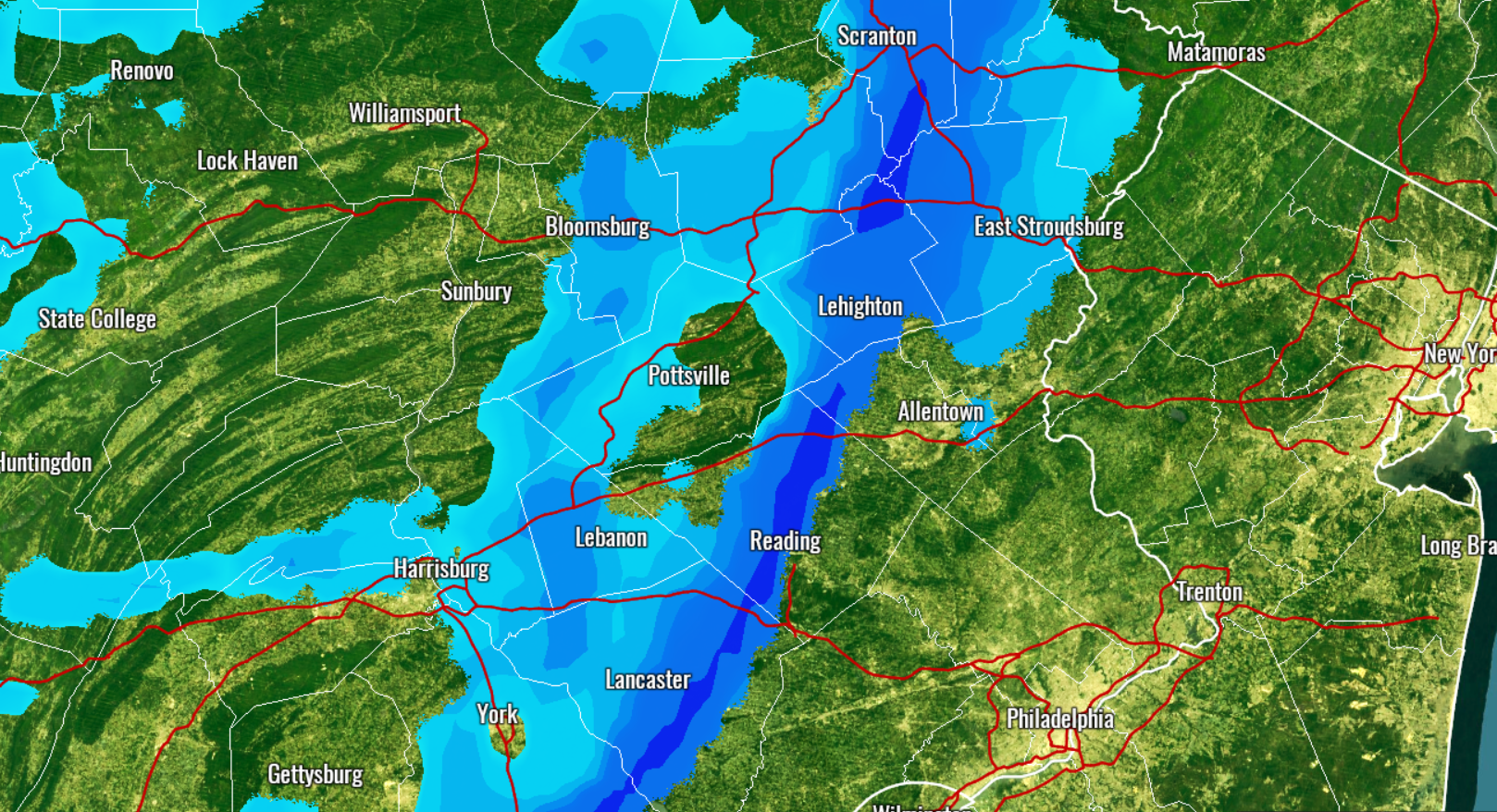
An intense snow squall is expected to move across the state from west to east Wednesday Morning and early afternoon. Sudden deteriorations in road conditions and visibility will be possible with these dangerous snow squalls. Snow accumulations will be under an inch, but every flake will stick to the roads due to frigid temperatures. Use our future radar slideshow below to determine when the squall will impact your area!
If on the roads when a snow squall hits, be sure to safely decrease speed and make sure your head lights are on.
Check your latest hourly forecast for precise timing for your location with our free app >>> PA Weather App Link
Be sure to share this important update with your friends and family using the button below, stay safe!
You must be logged in to post a comment.