
An Arctic Front is in the process of making its way into the area, and will come in the form of a line of dangerous snow squalls Sunday morning. Immediately following the line, temperatures will drop about 15 degrees, leaving us in the teens and low twenties by sunset Sunday.
Indications are that the line will begin to form in Western PA around sunrise, and intensify at it heads into Allegheny Mountains around 8:00 AM Sunday. The squall will continue across Central PA through mid morning and into Eastern PA around lunchtime.
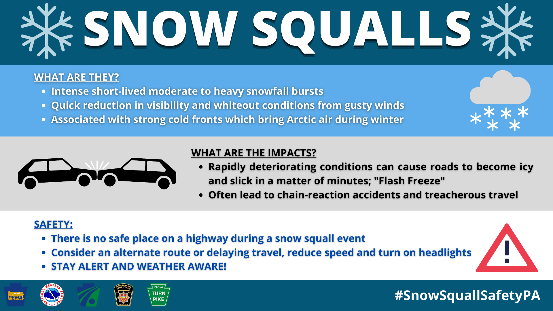
The main concern will be highways such as I-80 and I-76, among others, but even if you’re on surface streets, gradually reduce speeds as visibility decreases in the snow squall. Here is a graphic courtesy of the NWS on snow squalls.
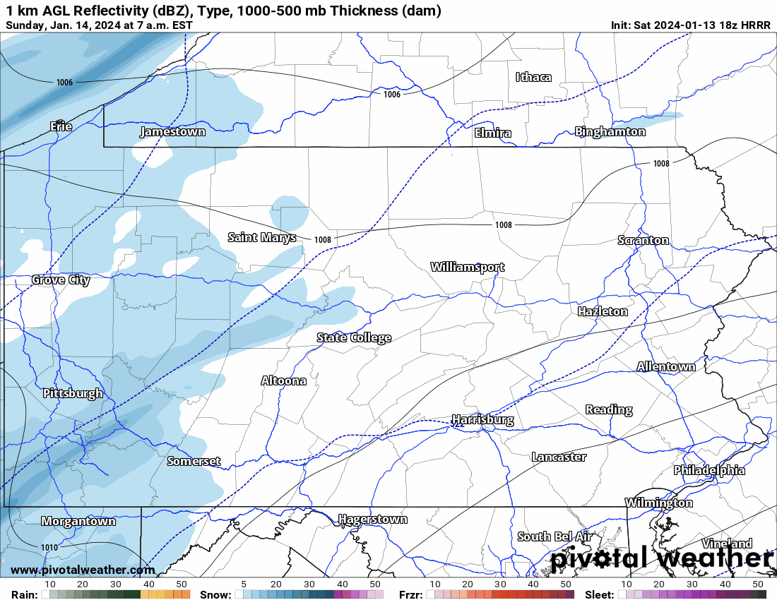
Below is HRRR Future Radar illustrating the strengthening of the snow squall as it pushes into Central PA. Also note that it may briefly begin as rain in Southern PA, which may form a layer of ice beneath the thin layer of snow that follows.
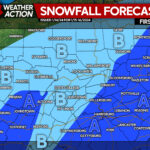
SNOW SQUALL TIMING FORECAST FOR SUNDAY
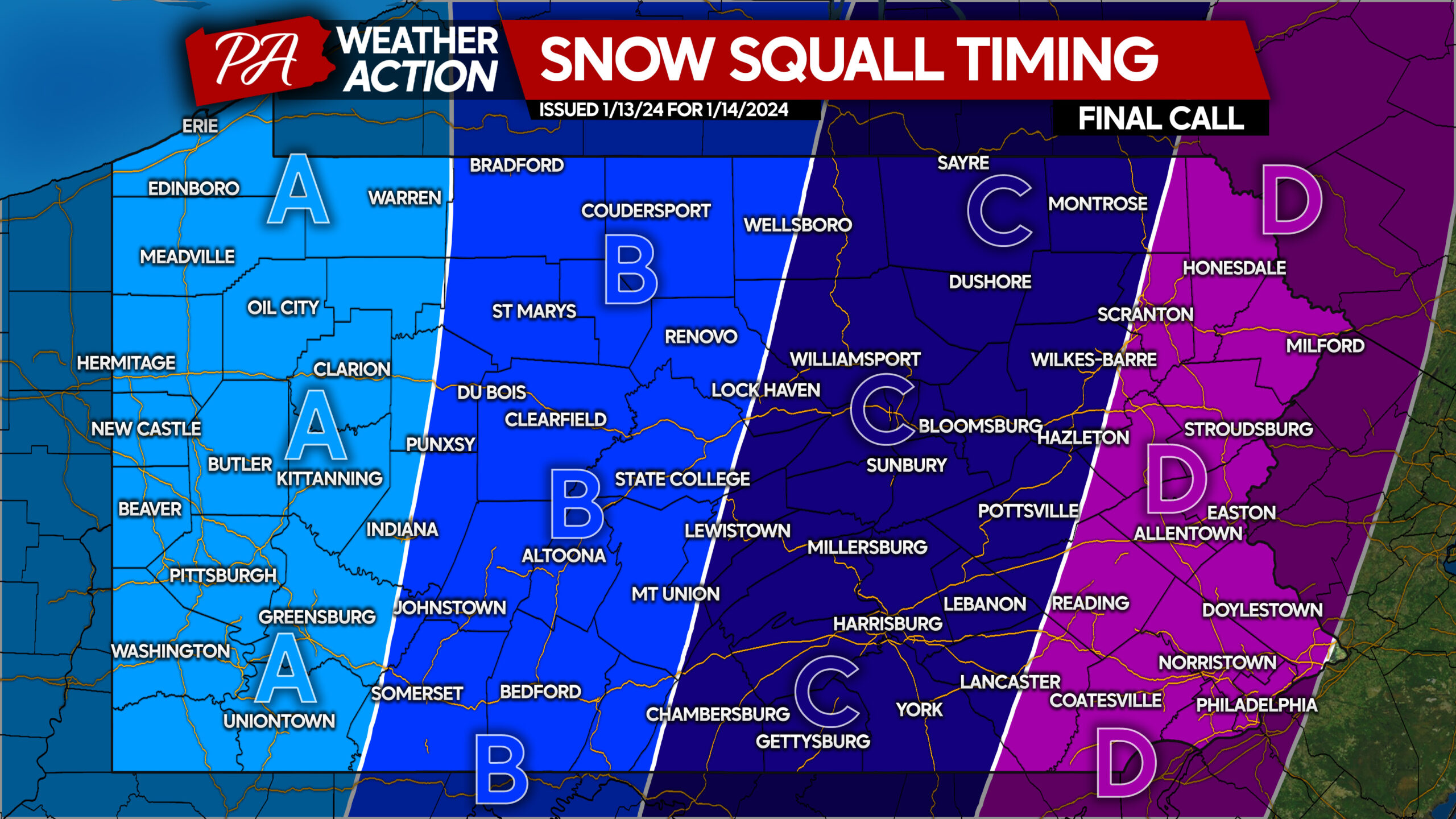
Area A: Snow squalls possible, mainly between 6:00 – 8:00 AM Sunday. A coating to an inch of snow possible, along with slick roadways and reduced visibilities.
Area B: Snow squalls possible, mainly between 8:00 – 10:00 AM Sunday. A coating to an inch of snow possible, along with slick roadways and reduced visibilities.
Area C: Snow squalls possible, mainly between 10:00 AM – 12:00 PM Sunday. A coating to an inch of snow possible, along with slick roadways and reduced visibilities.
Area D: Scattered snow squalls possible, mainly between 12:00 – 2:00 PM Sunday. A coating to an inch of snow possible, along with slick roadways and reduced visibilities.
Again, if possible, we advise you to stay off highways during the time period when snow squalls are possible in your area!
You must be logged in to post a comment.